Important Riparian/Wetland Systems of Peninsular Baja California
An Overview[1]
Norman C. Roberts[2]
Abstract.—The peninsula of Baja California, Mexico, and its phytogeography are described. Climatological factors and their historical and present impact on the land and its inhabitants are noted. An inventory of peninsular wetlands and some of the dominant plants are provided. Some conclusions concerning the future of the peninsula are presented.
Introduction
Riparian/wetland systems, for the purposes of this paper, are defined as being periodically, seasonally, or continually submerged lands populated by species and/or life forms different from those of the immediately adjacent vegetation, maintained and dependent upon conditions more mesic than those provided by the immediate precipitation (Brown 1978).
While the original Latin usage of the term "riparian" apparently related to freshwater, the term has occasionally been applied to tidewaterand estuarine-adjusted zones (Warner 1979). Tidelands have been included in this study because of their critical importance to the future of both the peninsula and the adjacent seas of Baja California, Mexico.
Geography
Baja California is a jagged finger of land extending from the southern border of California to south of the Tropic of Cancer. It wanders irregularly south and east from latitude 32°30'N and longitude 117°W at the northern International Boundary and Tijuana, to terminate in the Pacific Ocean 1,300 km. further south at Cabo San Lucas (22°50'N, 110°W) after penetrating well past the Tropic of Cancer.
The peninsula is separated from mainland Mexico by a 160-km. wide body of water usually known as the Gulf of California or the Sea of Cortez. To the west and south lies the Pacific Ocean. Baja California varies in width from 250 km. at the International Border in the north to 135 km. at the Bahía de La Paz, 155 km. above its southernmost tip. Baja California comprises an area of 143,790 km2 , and has 3,240 km. of shoreline. Figure 1 illustrates the geography of the region and indicates locations of sites referred to in the following discussions.
Geology
The peninsula split off the mainland 25 million years ago and began moving northwest. It has continued to do so at the rate of 1.5–3 cm. per year ever since, widening the Gulf as it moves (Anderson 1971). In addition, most of the peninsula, with the exception of the northern mountains, those at the Cape, and a few peaks in between, underwent submergence during the Miocene period (ibid .; Murphy 1975).
The relatively recent geologic separation of the peninsula from the mainland has been a somewhat limiting factor in the development of endemic species of plants (Wiggins 1980). There is, however, a high degree of endemism, or nearendemism, of both floral and faunal elements on the peninsula (ibid .; Savage 1959).
Climate
The climate is generally hot and dry over most of the peninsula. Average annual rainfall ranges from 250 mm. at Tijuana, 200 mm. at Ensenada, 125 mm. at San Quintín, 100 mm. at El Rosario, to 50 mm. mid-peninsula. The highest mountain ranges of both the north and south, however, each receive approximately 750 mm. of annual precipitation.
Most of the peninsula has a two-season rainfall pattern. In the northern mountains, 70% of the precipitation occurs in winter—some in the form of snow (particularly in the Sierra de San Pedro Mártir)—and 30% occurs in the summer. The Sierras de la Giganta and de la Laguna in the
[1] Paper presented at the California Riparian Systems Conference. [University of California, Davis, September 17–19, 1981].
[2] Norman C. Roberts is Staff Assistant, U.S. Department of Interior, Washington, D.C.
[
Figure l.
Map of Baja California (northern portion).
Figure 1 (cont.)
Map of Bajaj California (southern portion).
Cape Region receive 70% of their rainfall during the summer months (Hastings and Humphrey 1969). Both the Desert Region and the lower elevations of the Cape Region receive 50% or more of their precipitation in the summer.
Three general types of storms occur on the peninsula. Winter cyclonic storms moving south from the Gulf of Alaska bring rain to the north. These weaken as they move south, seldom reaching beyond the northern mountains. During the summer and fall, monsoon storms, also known as "Sonora storms", come across the Gulf of Baja California from the Mexican mainland. These are sometimes called "aquaceras" or "equipatas;" the former bring more rain to larger areas than the latter.
Tropical cyclonic storms that originate off Acapulco in the southeastern Pacific are known as "chubascos" by the natives of Baja California. Due to the violent nature of these storms and the winds accompanying them, the potential benefit of
the rainfall is more than offset by the damage done as water rushes down the arroyos to the sea.
Normally chubascos do not make it as far north as California. However, on 10 September 1976, "Kathleen" reached the head of the Gulf and slammed into Southern California with winds of up to 160 km. per hr.[3] The storm caused at least 10 deaths and damage in excess of $10 million in San Diego and Imperial Counties. The northern peninsula was unaffected by "Liza" which followed "Kathleen" on 28 September 1976. The same cannot be said for La Paz; winds of up to 208 km. per hour and torrential rains burst a dam near the town and buried between 2,000 and 3,000 inhabitants.[4]
The San Diego Union reported the final chubasco of the season on 12 October 1972, "El Cardonoza de San Francisco", the shiplash of St. Francis. It dumped 250 mm. of rain on San Felipe in two days.[5] The average annual rainfall in San Felipe is only 55 mm. (Humphrey 1974).
In September, 1939, four chubascos struck Bahía de Magdalena, dumping a total of 570 mm. of rain. Between 1939 and 1962, the same area received an additional 750 mm., equal to 57 mm. annually.[6]
During the fall of 1978, in Arroyo de la Pasión, north of La Paz, one goat rancher measured 6 m. of water rushing past his house in what had been a dry stream bed the previous week.[7]
But there have been times when peninsula natives prayed for a chubasco. There have been periods of up to four years when not one drop of rain fell in some areas. During one dry period, or "seca," Antero Dias of Bahía de Los Angeles fed viznaga (barrel cactus) (Ferocactus spp.) and cardóns (Pachycereuspringlei ) to his livestock. The cacti were made more palatable by dousing them with kerosene and then lighting them to burn the spines.[8] During these dry years untold damage is done to the vegetation by overgrazing.
Phytogeographic Regions
There is considerable variation in the vegetative elements within the 1,300-km. peninsula. Additionally, the altitude goes from sea level to 3,096 m., and annual precipitation varies between 50 and 750 mm. The phytogeography of the peninsula is best characterized as three more or less distinct vegetative zones: the California Region, the Desert Region, and the Cape Region (Wiggins 1959).
The California Region can be considered an extension of the southwestern California mountain ranges and their Pacific slopes. The Desert Region includes the eastern scarps of the northern mountain ranges, the central one-third of the peninsula, with the exception of the Sierra de la Giganta and the Cape Region. The Desert Region is generally divided into four subregions. The Cape Region includes the Sierras de la Laguna and de la Giganta ranges in addition to their drainages, and the southern mangrove forests on the seacoasts.
The California Region
The California Region includes the mountains and their western drainages to the Pacific Ocean from the International Border to the southern terminus of the Sierra de San Pedro Mártir. The transition to desert vegetative elements is gradual, becoming increasingly xeric from north to south coinciding with decreasing rainfall. On the Pacific slopes, this transition is well advanced at El Socorro (30°17'N), a few kilometers below Bahía San Quintín.[9]
There are two principal mountain ranges in the California Region. They are considered extensions of the peninsular ranges of Southern California and San Diego County. The northern-most, the Sierra Juárez, extends from the International Border south to Valle Trinidad, and has the highest representation of Southern California flora. Vegetation at the higher elevations consists of yellow pine forest and Jeffrey pine (Pinusjeffreyi ), with a more or less typical chaparral group below, replaced by coastal sage scrub to the west as the elevation declines. The Sierra Juárez range average elevation is 1,400 m.
The Sierra San Pedro Mártir is the highest range in Baja California with an average elevation of 2,700 m. The forests are generally more open than those of the Sierra Juárez. Jeffrey pine is dominant, with sugar pine (P . lambertiana ) occurring on the ridges. Lodgepole pine (P . murrayana ) and quaking aspen (Populus tremuloides ) are also found there, but not in the Sierra Juárez or in San Diego County. This range is a climatic island with the closest comparable plant community being the Santa Rosa Mountains 250 km. to the north.[10] The Sierra San Pedro Mártir lies at the southern
[3] San Diego Union, September 12, 1976.
[4] San Diego Union, October 3 and 4, 1976.
[5] San Diego Union, October 12, 1972.
[6] Schwenkmeyer, Richard. 1977. Baja California seminar, San Diego Natural History Museum, San Diego, California.
[7] Rancher at El Paso, in Arroyo de la Pasion, Baja California Sur. 1978. Personal communication.
[8] Dias, Antero. 1973. Personal communication, Bahía de Los Angeles.
[9] Moran, Reid. 1975. Plant life of Baja California, Baja California Seminar, San Diego Natural History Museum, San Diego, California.
[10] Moran, Reid. 1977. Plant geography of Baja California. Presented at Biogeography of Baja California Symposium, California State University, Fullerton.
extreme of the north temperate zone, influenced by both the Pacific and Gulf climates (Hastings and Turner 1965). This climatic interaction with the regional topography creates the greatest diversity of speciation and habitat to be found on the peninsula (Wiggins 1980).
The vegetation of the riverine corridors in the California Region is generally characteristic of comparable undisturbed riparian systems in Southern California. Riparian systems on the Pacific slopes of the peninsula all share many characteristics. At higher elevations and in the numerous deeper canyons, characteristic willow (Salix spp.), cottonwood (Populusfremontii ), oak (Quercus spp.), and sycamore (Platanusracemosa ) bosques remain with minimal disturbance. The streams are semi-perennial at lower elevations because of agriculture in the lower valleys and floodplains. None reach the sea except during heavy rains and flooding. With the exception of Río de Tia Juana, no major dams or water projects obstruct the arroyos of the peninsula.
Flooding during cyclonic storms from the north or south continues to discourage extensive human invasion in the canyons. In the valleys and on the coast, however, bridges, dikes, and flood channels are now being built to protect agricultural projects. When first constructed in 1973, trans-peninsular Highway 1 had few bridges along the 1,600+ km. stretch from the northern border to the tip of the peninsula. Truck and passenger traffic is increasing, and bridges are reconstructed after the roads are washed out during storms.
Although each riparian system exhibits individual characteristics, certain species are common in systems that have remained relatively pristine. The overstory may be open or closed, with willow the dominant tree comprising most of the overstory, along with sycamore, cottonwood, and oak. The understory is composed of Ceanothus spp., coffeeberry (Rhamnus californica ), scrub oak (Quercusdumosa ), chamise (Adenostomafasciculatum ), rose (Rosa minutifolia ), arrowweed (Pluchea spp.) and Baccharis spp., as well as willow.
The Río de Tia Juana is the northernmost, and one of the more extensive riparian systems in the California Region. It is formed by the confluence of two major drainage systems, one on either side of the International Boundary. The mouth of the river is 135 km. from the most distant source. One of the two tributaries joining to form the Río de Tia Juana is the Río de las Palmas. A Baja California semi-perennial stream, during periods of drought it is dry over much of its course. Along the river where agriculture is not extensive, there are numerous stands of willow and sycamore. Farther east, cottonwoods and oaks join the riparian corridor. At lower elevations or in disturbed areas, Baccharis and arrowweed are found.
The second tributary of Río de Tia Juana is Cottonwood Creek. It drains a considerable area in southern San Diego County, becoming Arroyo del Alamar as it crosses into Baja California 9 km. east of the Pacific Ocean. It joins Río de las Palmas, then becomes Río de Tia Juana just east of the town of Tijuana. The river is being channelized through the city of Tijuana.
The sole major dam on the peninsula is Presa Rodriquez located 11 km. east of Tijuana. Constructed in 1937, it impounds water from Río de las Palmas. There are seven major dams in San Diego County alone draining a much smaller area of comparable mountain ranges. The lake impounded by the dam is now 7 km. long. The spillway was in use all during the spring of 1981. Five years ago however, the lake bed in its entirety was farmed. It was also a dry lake bed in the early 1960's.
Valle de las Palmas, 30 km. above the dam, has extensive olive and other fruit orchards in addition to variegated crops. The valley is so named because of a generous stand of California fan palms (Washingtoniafilifera ) that existed in previous years. Although common in the peninsular deserts, this was the only grove on the Pacific slopes of northern Baja Califorfornia. Most of the trees fell to the machete long ago.
The Tia Juana River estuary is located on the American side of the International Border, its southern bank adjacent to the International Boundary marker at the Pacific Ocean.
"The Tia Juana Estuary of San Diego is recognized by ecologists as a model ecosystem, to be used in determining how to restore many modified coastal wetlands in the San Diego region. Its structure and function have been examined in detail and compared with other local wetlands, as well as more disturbed parts of Tia Juana Estuary itself, in order to establish how activities such as reduced tidal exchange, altered elevation, reduced species diversity, and altered channel morphology have changed southern California coastal wetlands."[11]
Río Guadalupe is the next important stream to the south. It flows west from its origin in the Sierra Juárez (32°5'N). Río Guadalupe is fed by springs and contains the only lake in the Sierra Juárez range, Laguna Hansen. Both the Río Guadalupe and Laguna Hansen sometimes go dry during long secas. The estuary at the mouth of the river is located at La Misión. This formerly rather extensive estuarine system has been drastically changed by the presence of several wells pumping water north 55 km. to the city of Tijuana. The estuary is now a salt water lagoon.
[11] Zedler, Joy. 1981. Personal communication.
Throughout most of its 100-km. course the river has been altered by heavy demands on the water table in the valleys through which it flows. Only at the higher elevations in the coniferous and chaparral zones of the mountains and in few steep canyons has the ecosystem remained relatively pristine.
Río San Carlos (31°45'N), another semi-perennial stream similar to Río Guadalupe, originates 30 km. to the south of Río Guadalupe. Its arroyo reaches the ocean at Estero Beach below Ensenada. There are at least three geothermal seeps along the river. The Río San Carlos corridor runs through chaparral for much of its course. Extensive dryland farming is practiced in the Ojos Negros Valley through which the river flows. For several kilometers at lower elevations, the river passes through an oak woodland with only subsistence farming to disturb the riparian system. The riparian corridors of this drainage include Tecate cypress (Cupressus forbesii ) in some arroyos at lower elevations. A small population of western pond turtles (Clemmysmarmorata ), and introduced bullfrogs (Ranacatesbeiana ) occur above the resort of San Carlos, inland from Ensenada.
Río Santo Tomás (31°35'N), the next semi-perennial stream to the south, crosses Highway 1 approximately 40 km. south of Ensenada. Originating from a seep in the chaparral zone below the almost abandoned mining town of El Álamo, the riparian vegetation has remained relatively undisturbed for the first half of the corridor to the sea. For 25 km. the stream courses through one of the most beautiful arroyos in the northern peninsula.
Evidence of increasing xerification becomes apparent in this arroyo as northern riparian elements are joined by stands of cholla (Opuntiacylindropuntia ), Our Lord's candle (Yuccawhipplei ), and "pitaya agria" (Machaerocereusgummosus ), which nears the northernmost extension of its range in this arroyo. Western pond turtles and red-legged frogs (Ranaaurora ) are found in the river east of Highway 1.
Río San Vicente (31°30'N) (fig. 2) is the southernmost of the western-flowing streams originating in the Sierra Juárez drainage system. Like the others in this northern mountain chain, it remains relatively unaltered by humans wherever it passes thorough steep canyons. At lower elevations, or where subsistence farming is practiced, the native vegetation is substantially altered. Río San Vicente disappears into the sand during secas, leaving a dry stream bed with a few pools remaining. From its origin to the sea, it has one of the longest courses of any stream in the Sierra Juárez, nearly 100 km. Populations of Tecate cypress occur in the foothills and arroyos of this area.
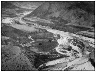
Figure 2.
Arroyo San Vicente above the town.
Río San Rafael (31°07'N) is the northernmost drainage system of the Pacific slopes of the Sierra de San Pedro Mártir. It has few entering tributaries, and until recent years was little disturbed over much of its course. Considerable water flows down this arroyo during storms (Welsh 1976). Arroyo San Rafael has a more direct corridor than other drainages to the north and is usually a permanent stream until it reaches the floodplain. Heavy willow bosques are dominant in the upper portion of Arroyo San Rafael. There is considerable agriculture for the final 20 km. of the river as the canyon opens into the floodplain and water sinks into the streambed.
The next large drainage system to the south is Arroyo San Telmo. It crosses Highway 1 in a broad valley at 30°55'N, 11 km. below Arroyo San Rafael. There is substantial agriculture along much of its course. The stream disappears in the upper San Telmo Valley 40 km. from the ocean. At higher elevations however, considerable undisturbed native woodland remains.
Continuing southward, Arroyo Santo Domingo (30°55'N) is located 15 to 25 km. south of Valle San Telmo. This stream has considerable pristine vegetation with few ranches because of the inaccessibility of the riparian corridor. At Mission Santo Domingo, the arroyo widens into a floodplain. For the remainder of its course to the sea, about 11 km., the arroyo intermittently carries water. Like most other streams of the California Region, it is characterized by heavy willow bosques along the streambed, joined by arrowweed and Baccharis at lower elevations and in agricultural areas.
In the arroyos of the California Region, the vegetation of the transition zones (upland to riparian) may include junco (Juncusacutus ), oak, mountain mahogany (Cercocarpusbetuloides ), toyon (Heteromelesarbutifolia ), Rhus spp., Ceanothus spp., and in some areas Tecate cypress.
Bahía de San Quintín (fig. 3) is the first salt water lagoon of major significance south of the International Boundary. The average annual
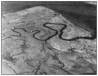
Figure 3.
Estero de San Quintín.
rainfall there is 120 mm. This relatively pristine salt marsh is located 275 km. south of Tijuana at 30°31'N. It is quite similar to the few remaining undisturbed Southern California salt marshes (Neuenschwander etal . 1979).
The bay itself is large, resembling an inverted J with the rounded base pointing towards the sea. From the entrance to the uppermost salt marsh is approximately 11 km. Much of the bay is shallow; the channel is tortuous and difficult to navigate even for small ocean-going fishing vessels.
The littoral marshes have dense stands of eelgrass (Zosteramarina ) in the channel bottoms. The channel banks are lined with cordgrass (Spartinafoliosa ), as well as glasswort (Salicorniabigelovii ) and saltwort (Batismaritima ) (ibid .). Three vegetationtypes dominate the upper, middle, and lower littoral; they are salt cedar (Monanthochloelittoralis ), pickleweed (S . virginica ), and cordgrass, respectively (MacDonald and Barbour 1974).
The Desert Region
The Desert Region includes the eastern escarpment of the northern mountain ranges. The mountains are precipitous, dropping sharply between 1,000 and 2,000 m. to the desert floor. The Sierra de San Pedro Mártir escarpments in particular are spectacular, with the highest peak, Picacho del Diablo, rising abruptly to over 3,096 m. from the San Felipe Desert to the east.
The eastern scarp of the Sierra Juárez has several deep canyons cutting into the mountains. These narrow streambeds have steep gradients and are often relatively straight in their course to the desert, where they fan out sharply into large fans known as "bajadas" by the natives. Several of these canyons have water year-round and some also have geothermal seeps. In the Sierra Juárez all the larger arroyos, except the northernmost, are palm-lined with California fan palm and the endemic blue palm (Braheaarmata ).
The largest and most beautiful of these canyons is called Tajo (Cantilles Canyon to early botanists). It usually carries water thoughout the year. Other picturesque palm canyons in the range are Carrizo, Guadalupe, and Palomar. During the summer and fall however, none have sufficient streamflow to reach their respective bajadas in the desert. These bajadas are littered with trunks of palms and large boulders washed down from higher elevations in the canyons during the often violent storms that occur in this region.
The eastern escarpment of the Sierra San Pedro Mártir also has several steep canyons cutting into its eastern face—Las Canada, del Diablo, Toledo, Oso, San Marcos, and San Luís. None have palms however, possibly because of their steep gradient (Rodriquez 1981). Like those of the Sierra Juárez, they have some water throughout the summer. In recent years, there has been considerable invasion of tamarisk (Tamarix spp.) in many of these arroyos.
The southwestern extension of the Colorado Desert, known as the San Filipe Desert, extends south along the eastern scarps of the northern mountains to join the Central Desert southwest of the town of San Felipe, above 30°N. The San Felipe Desert is considered the driest area on the peninsula—annual rainfall is 50 mm. One weather station in the northeast records 31 mm. of rainfall annually (Hastings and Humphrey 1969). In this region evaporation from a pan occurs at an estimated annual rate of 350 mm. per year during the summer.[12]
East of the Sierra Juárez, in an area formerly known as Laguna Salada, a new freshwater lake is now being formed. It is known as Laguna Maquata and extends from a few kilometers below the International Border south for 30 km. Laguna Maquata is being filled by a canal running north and west from the Río Hardy, a branch of the Río Colorado. It could become an important agricultural and vacation area for Mexicans in the future. The impact this lake will have on the surrounding desert is unknown.
Further east in the Colorado Desert lies the Mexicali Valley and the channelized Lower Colorado River. Both the Imperial and Mexicali Valleys are gradually being filled in by siltation from the Colorado River and peripheral canals. Because of irrigation and the canals involved, the Río Colorado no longer empties directly into the Gulf of California. However, the canals are dumping silt and salts into the upper Gulf, filling both it and the San Andreas
[12] Bloyd, Richard M. 1978. Water Resources talk presented at the California Desert Advisory Comm., USDI Bureau of Land Management public forum, Riverside, California.
Fault running down the middle of the Gulf. Ultimately this silt will raise the floor of the Gulf sufficiently to cause flooding of the entire adjacent low desert region.[13]
A detailed discussion of the Colorado River has been omitted. Originating far to the north, less than 200 km. of its long course to the Gulf of California winds through Mexico; it is not a Baja California river. Previous riparian symposia have adequately discussed the lower Colorado River (Ohmart etal . 1977; Johnson 1978).
Río El Rosario (30°5'N) is the last of the perennial streams with drainage from northern mountain ranges. It is formed by the confluence of two large arroyos, Rosario and Cardonal. The tributaries originate on either side of Cerro El Matomí (30°40'), a 1,500 m. desert peak 30 km. below the southern slope of the Sierra de San Pedro Mártir range, only 30 km. from the Gulf. In this area, the transition to Desert Region vegetation is nearly complete. Chaparral and coastal sage scrub have disappeared.
Both Arroyo El Rosario and Arroyo El Cardonal are pristine over much of their drainages and represent the first streams to be found in a "cardonal", a cardón (Pachycereus pringlei ) forest. Arroyo El Rosario has been particularly subject to flooding during chubascos, and occasionally from northern storms in winter. In recent years, numerous wells have been drilled and crops are being raised where the arroyo widens 30 km. east of the ocean. In times of drought, both Río El Rosario and Río El Cardonal dry up, leaving only a few pools in protected areas. The average annual rainfall at El Rosario is 100 mm.
Laguna Manuela (28°10'N) is a substantial estuarine system. This narrow, shallow lagoon and the much larger adjacent Estero de San José (Guerrero Negro) are extensive and relatively untouched salt water estuarine marshes. They form part of the huge Ojo de Liebre (Scammons Lagoon) complex located in the region of 28°N, the state boundary between Baja California Norte and Baja California Sur. Laguna Ojo de Liebre extends nearly 60 km. into the Vizcaíno desert.
Much of the inland, or eastern, area of Scammons Lagoon is botanically rather sterile and is diked for salt production. These huge salt beds are known as Salina Vizcaíno. It is the largest seawater salt-producing facility in the world. Both Estero de San José and Laguna Manuela have rich biotas, however. Like many of the Pacific saltwater marshes they have beach barrier formations in which fine sandy sediments dominate (MacDonald and Barbour 1974). The species composition and zonal distribution in Estero de San José are apparently quite similar to that of San Quintín with cordgrass, salt wort, glasswort, and salt cedar again succeeding one another as the elevation increases (ibid .).
No gray whales (Eschrichtiusgibbosus ) enter Laguna Manuela, but they winter and calve in adjacent Laguna Ojo de Liebre. Formerly a favorite visiting site for whale watching by boat, Scammons Lagoon has been closed by the Mexican Government to protect the whales. There is, however, a road off Highway 1 where visitors can watch whales from shore.
To the immediate south is the Laguna Abreojos/Estero del Coyote/San Ignacio group of marshes. San Ignacio (27°N) (fig. 4) is the largest of the three lagoons and extends into the Vizcaíno Desert 30 km. It is deep enough for large vessels. The Abreojos and Estero de Coyote lagoons are too shallow and narrow for ships. All three lagoons have extensive salt marshes with scattered mangrove shrubs and estuarine systems.
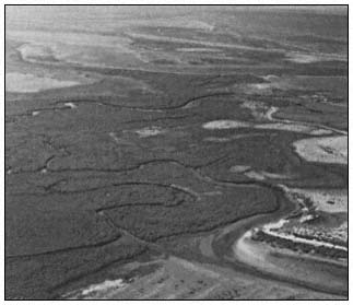
Figure 4.
Laguna San Ignacio, south side.
There are four species of mangrove-like plants occurring in Baja California: black mangrove or "mangle negro" (Avecennia germinans ), white mangrove or "mangle blanco" (Lagunculariaracemosa ), "mangle dulce" (Tricermaphyllanthoides ), and red mangrove or "mangle rojo" (Rhizophoramangle ). Another bush tree in the family Combretaceae that occurs in this region is the button mangrove (Conocarpuserecta ). It is sometimes called "mangle" by the natives.
Laguna Abreojos, also called Pond Lagoon, is the northernmost Pacific extension for white and red mangrove in the low marsh, with saltwort and glasswort dominating the littoral marshes at higher elevations.
[13] Jahns, Richard. 1978. Geological History talk presented at the California Desert Advisory Comm., USDI Bureau of Land Management public forum, Riverside, California.
Laguna San Ignacio has a 25-km. wide opening interrupted by a large, mostly sand barrier island known as Isla Arena, 15 km. long. South of the lagoon and island, shallow tidal lagoons extend for another 35 km., to 26°38'N. Gray whales winter in this lagoon and whale watching trips are popular. Vegetative elements in Laguna San Ignacio include white mangrove, red mangrove, and cordgrass in the low marsh; with glasswort, saltwort and salt cedar occurring in the high marsh.[14] The eastern and southeastern shore of the lagoon is called "La Laguna" locally. It is the largest marsh area of the complex. In the low marsh dominant vegetative elements are red mangrove followed by white mangrove with some cordgrass. The high marsh is dominated by saltwort mixed with glasswort.[15]
Río San Ignacio (fig. 5), located midpeninsula between 27°N and 28°N at 113°W, is the first true river south of the northern mountains. It flows west from a long, narrow, springfed lake at the town of San Ignacio. The elevation is 165 m. at the lake and town. Annual rainfall of the area is slightly under 130 mm. At the river's origin and around the town, native vegetation has been replaced largely by date palms (Phoenixdactylifera ), introduced by the missionaries. Dates are the only important industry of San Ignacio, there being no other agriculture with the exception of family gardens and a few cattle.
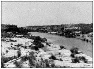
Figure 5.
Arroyo and Río San Ignacio.
The geology of the San Ignacio region is similar to much of the Vizcaíno Desert: an ancient sea bed overlain with volcanic rocks, some of which are of recent geologic origin. Río San Ignacio winds its course west towards Laguna San Ignacio and the Pacific Ocean for approximately 30 km., disappearing into the sand as the shallow arroyo widens into the open Vizcaíno Desert. The river fails to reach Laguna San Ignacio by 20 km.
Río San Ignacio has been little disturbed by man; there are only two ranches located along the riparian corridor. These are both subsistence operations—one raising a few cattle and the other, goats. The riverbed itself is either lava rock, "caliche", or sandstone, affording little nourishment for plants. Below the palm grove and town of San Ignacio, a mesquite (Prosopis spp.) bosque follows the course of the river. There has been a considerable invasion of introduced tamarisk in some areas.
Bullfrogs have been introduced into the lake at the town of San Ignacio but they have not extended their range to the river below the date palm grove. Río San Ignacio is the northernmost extension of the range of pond slider (Chrysemys scripta on the peninsula (Van Denburgh 1922; Roberts[16] ).
Laguna San Gregorio (26°7'N) is a 10-km. long, narrow estuary just east of Punta San Juanico. Prior to 1958, the mouth of the lagoon was open and ships had navigated it for decades. A chubasco in 1958, followed by another in 1959 (a rare occurrence) caused extensive damage and several deaths in the area. The storm also closed the mouth of the laguna with a sand barrier.[16] It has remained shut to seagoing ships since then. The estuary is below the confluence of two of the larger Pacific drainage systems of the Sierra de la Giganta. The northernmost of these, Arroyo San Gregorio, has water over some of its riparian corridor only during wet periods.
Intertidal vegetation of Laguna San Gregorio includes some new elements in addition to the common high marsh species found at Laguna San Ignacio. Sea purslane (Sesuvium portulacastrum ) and iodine bush (Allenrolfea occidentalis ) are both found in the estuary. Other than red mangrove seedlings, there are no mangroves in this marsh. Dominant vegetative elements are saltwort and glasswort.[17]
The Río de la Purísima (fig. 6) is the next drainage system to the south of Río de San Gregorio; it empties into Laguna San Gregorio, flowing from the heart of the Sierra de la Giganta range from the region of 26°20' southwest to the lagoon. This is the largest perennial stream of the southern peninsula. It flows above ground for approximately 32 km. Midway a low dam, El Zacatón, about 300 m. long, blocks the arroyo, creating a shallow lake. There are numerous larger pools along the course of the
[14] Mudie, P.J., A. Johnson, J. Rutherford, and F.H. Wolfson. 1975. Shoreline vegetation of Baja California. Unpublished report prepared for Foundation of Ocean Research, San Diego, Calif.
[15] Mudie, Peta J. 1981. Personal communication.
[16] Roberts, Norman C. 1981. Unpublished manuscript.
[17] Mudie, Peta J. Diversity in the salt marsh floras of Southern California and western Baja California. Unpublished manuscript.
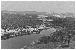
Figure 6.
Río de la Purísima.
river; many have apparently stable populations of pond sliders. Downstream from the dam two small towns, San Isidro and La Purísma, have subsistence agriculture using water from a dam flume. Several kilometers below the towns, the stream flows through limestone caliche and the water sinks into the stream bed.
Willow, "torote" (Bursera spp.), "palo verde" (Cercidium spp.), "palo colorado" (Colubrina viridis ), "palo adan" (Fouquieriadiguete ), "lomboy" (Jatropha spp.), "garambullo" (Lophocereusschottii ), mesquite, and cholla are all found in the riverine corridor.
The Cape Region
The southernmost phytogeographic region of the peninsula includes the Sierra de la Laguna (Cape Mountain Range) and the Sierra de la Giganta, a lesser range that extends northwest along the Gulf of California towards Bahía Concepcion. The Sierra de la Laguna extends nearly due north from 23°N to 24°10'N. This range consists primarily of granitic blocks, while the Sierra de la Giganta is volcanic in origin. Floristic elements of the two ranges are similar; both have semi-deciduous forests that share many species of plants not found in other regions of the peninsula (Carter 1980).
The vegetative elements of the region are widely diversified, generally dry and tropical, but with pine/oak woodland only at the higher elevations of the Sierra de la Laguna. At lower elevations is semi-deciduous forest prominent in leguminous trees and shrubs.
Southern peninsular coastal salt marshes and mangrove swamp forests have been included in the Cape Region flora (Wiggins 1980). These forests are extensive in the larger saltwater lagoons and estuaries. They are found from Laguna Abreojos (26°50') south around the Cape and north in the Gulf to Bahía de Los Angeles (29°N).
Bahía Magdalena (fig. 7, 8) is 960 km. south of San Diego. It is the third and southernmost of the gray whale mating grounds on the peninsula. The bay area covers approximately 260 km2 composed of quiet deep water with a network of uncharted small canals, islets and islands of estuarine character.
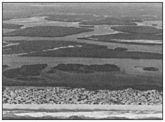
Figure 7.
Boca de las Animas, upper end of Magdalena Bay.
Bahía Magdalena (fig. 8) is the largest and most extensive saltwater lagoon on the peninsula, and contains a most impressive deep water harbor. The bay extends from the town of La Poza Grande (25°45'N) over 200 km. south in a dog-leg that terminates in a narrow shallow lagoon. Much of Bahía Magdalena is separated from the Pacific Ocean by narrow sand barriers that are often submerged during major storms.

Figure 8.
Magdalena Bay, south end.
The sea entrance to Magdalena Bay is protected by two large islands, Isla Magdalena and Isla Santa Margarita. Isla Magdalena, the northern island, is 100 km. long, low, narrow, and mostly sand. It protects the section of Magdalena Bay known as Laguna Santo Domingo and the port of San Carlos, used by ocean-going vessels for commerce. Isla Santa Margarita, to the immediate south, is mountainous and 40 km. long. The principal bay is 40 km. long and 25 km. wide.
The channel running between Puerto San Carlos and Puerto Lopez Mateos 45 km. to the north is known as the Hull Canal. This is a favorite playground for the gray whale. When the tides are favorable, smaller ocean vessels can navigate this canal north to the town of La Poza Grande from Puerto San Carlos.
Ciudad Constitución, located on Highway 1 in Valle Santo Domingo, is 58 km. inland from Puerto San Carlos. The valley, formerly a broad cardonal, has for the past decade been under intensive agricultural development. Hundreds of irrigation wells perforate an underlying fossil aquifer. Within a few years this irreplacable water supply will be depleted and saline. Rainfall in the area is replacing less than 10% of the groundwater being removed at present rates (Palacios 1978).
The wetland vegetative elements of Magdalena Bay include: red mangrove, cordgrass, and white mangrove in the low marshes; saltwort, salt cedar, and black mangrove in the high marshes. In the estuaries are iodine bush, a glasswort (Salicornia subterminalis ) and mangle dulce.[15]
Dense beds of eelgrass occur in most of the lagoons but are absent from the estuaries. Ditchgrass (Ruppia maritima ) is found in shallow open ponds in the salt marshes and mangroves. Red mangrove is the dominant mangrove species from Laguna Santo Domingo south. Black mangrove joins the other mangroves at Laguna Santo Domingo. It is much more common in the Gulf because of the warmer waters (MacDonald and Barbour 1974). Red mangrove increases in height southward from Laguna Abreojos and becomes the dominant mangrove species from the northern end of Laguna Santo Domingo.
Arroyo de la Pasión (fig. 9) is a shallow arroyo located below the 25th parallel. It meanders west for over 80 km., practically crossing the peninsula to terminate in Bahía Almejas at the southern end of Bahía Magdalena. This arroyo, located 250 km. north of La Paz, at 24°55'N and 111°W drains the low southern extension of the Sierra de la Giganta. It is semi-perennial with water remaining in the deeper pools during dry periods. Less than 30 km. of the arroyo has water. Pond slider turtles are found in many of these ponds at La Presa, Las Tinajitas and El Paso. This is the southernmost extension of this species, although they were formerly found in the Sierra de la Laguna drainages at the cape (Van Denburgh 1922, Roberts[16] ).
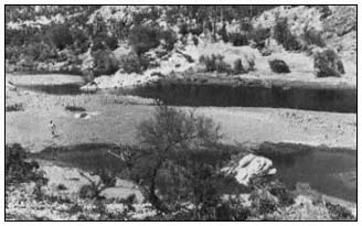
Figure 9.
Río de la Pasíon.
The town of Todos Santos, on the west side of the peninsula south of La Paz, has little marsh, but button mangrove first occurs at Las Piedritas to the south. This appears to be the northernmost extension of its range on the Pacific coast.[15]
The Sierra de la Laguna Range of the Cape Region extends almost north/south in direction, the drainages are east and west. The plant communities are oak/pinyon woodland above and semi-deciduous forest below. The Sierra de la Laguna weather station is in a meadow known as La Laguna. It is at approximately 1,900 m. elevation. Records indicate 350 mm. of rain falls in the summer months and about the same amount during the rest of the year. The average annual rainfall at the La Laguna station is 735 mm. (Hastings and Humphrey 1969).
The Sierra de la Laguna watershed empties into the tropical Pacific by several relatively straight canyons. None of the streams normally reach either the Gulf or the Pacific. The arroyos on the west scarp are precipitous and only carry water after rainfall. The larger and more gradual east-facing arroyos carry water much of the year and have considerable runoff during the summer months. There are subsistence farming or ranching operations on the lower slopes of the mountains, as well as in the arroyos.
Two of the largest arroyos have extensive drainages and pass through the towns of Santiago and Miraflores. Both streams are perennial in the mountains; even during periods of drought deep pools remain at the lower elevations. Both arroyos have bosques of willow (S . taxifolia ) along their courses. The beautiful "zalate", a fig (Ficus sp.), is common here.
The town of San José del Cabo (23°5'N) (fig. 10) at is at the middle of the peninsular tip. It overlooks the estuary and mouth of the broad valley through which the Río San José formerly flowed. The valley extends north for over 50 km. When Nelson visited the area there was extensive agriculture and a well-established town (Nelson 1922). The river no longer flows except during flood periods because of ever increasing agricultural and population demands. The valley has not suffered the damage of other areas because rainfall is sufficient to replenish the aquifers (Palacios 1978).
The Sierra de la Giganta range extends north roughly from Cerro Machado, a peak of 1,025 m. just north of Bahía La Paz (24°35'N) to about 30 km. northwest of Loreto (26°30'N). The

Figure 10.
San José del Cabo.
eastern escarpment of the Giganta range is precipitous and close to the Gulf. The western slopes decline more gradually to the Llano Magdalena.
There are several large mangrove lagoons on the west side of the Gulf between La Paz and Bahía de Los Angeles. Most of these areas have extensive salt marshes whose vegetative species include glasswort and saltwort. Bahía de La Paz (24°10'N) is well inside the Gulf of California and has the largest port on the Gulf side of the peninsula. Several areas in the bay have wetlands. Pichilingue in the outer bay has black, red and white mangrove at the lowest littoral zone. Saltwort dominates at higher elevations. Inside La Paz Bay and on the El Magote peninsula the same three mangroves are present, but glasswort replaces the saltwort at higher littoral zones.[15] The town of Loreto also has some mangrove and salt marsh vegetation.[16]
In the Sierra Giganta west of Loreto is an area known as Las Parras, a beautiful arroyo draining these mountains to the east. "Palma de taco" (Braheabrandegeei ), an endemic palm, is found in abundance here (Coyle and Roberts 1975).
Mulegé and Bahía Concepción to the immediate south are rimmed with mangroves. Río Mulegé, in Arroyo Santa Rosalea (26°05'N) is actually a brackish water lagoon. It exists for only 3 km., running from below a bridge and dam in the town to the Gulf. The river is navigable for small boats. It is surrounded by palms, both native Mexican fan palms (Washingtoniarobusta ) and introduced date palm. The wide valley, Arroyo Santa Rosalea, above Mulegé (fig. 11) has been under intensive cultivation for many years.
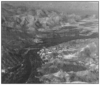
Figure 11.
Mulegé and Arroyo Santa Rosalea.
Río San José de Magdalena is one of the perennial streams in the Gulf drainage system. It is located just above 27°N. There is substantial subsistence farming in much of the arroyo and the willow overstory has been largely replaced by small agricultural plots. The stream disappears where the mouth of the canyon opens into the bajada leading to the Gulf. There is a large stand of the endemic "güéribo trees" (Populusbrandegeei ) in the arroyo above the town of San José de Magdalena. This is the northernmost population of this beautiful cottonwood species (Coyle and Roberts 1975). It is most common in the arroyos of the Cape, but a few trees are also found in the Sierra Giganta.
Farther north, San Lucas (27°30'N) has a relatively small bay, with red mangrove, black mangrove, and glasswort. There is also a Suaeda that resembles Suaeda californica but may be an undescribed species.[15]
Bahía de Los Angeles has a large salt marsh at te head of the bay with some red mangrove, also saltwort and glasswort. To the north, San Luís Gonzaga (29°42'N) has saltwort and glasswort in some areas of the bay.
With the exception of the California Region, the transition zones of vegetation over most of the peninsula are brief or absent in the riparian corridors. Species found in Desert Region transition zones include mesquite, palo verde, ironwood (Olneyatesota ), creoste bush (Larrea tridentata ), and lomboy (Jatropha spp.).
Much of the transition zone along both peninsular coasts is comprised of sand dunes or sea bluffs. The most common dune species in the northern and central sections of the west coast are sand verbena (Abroniamaritima ), ice plant (Mesembryanthemumchilense ) and sea purslane (Sesuviumverrocosum ) (Johnson 1973). Other coastal dune plants include species of Ambrosia , Oenothera , and Verbena . Sea bluff community plants are confined to the Pacific side of the peninsula. They include Dudleya spp., ice plant, marsh-rosemary (Limoniumcalifornicum ), and Eriophyllum spp. (Wiggins 1959, 1980).
From Todo Santos south, sand verbena, ice plant, and sea purslane are replaced by the tropical grasses, dropseed (Sporobolusvirginicus ) and Jouvea pilosa . These grasses continue on the Gulf side of the Cape where sea purslane is absent and sand verbena is only found in scattered patches.
Whither the Peninsula
When the first dozen Europeans arrived at Loreto in 1697, there were probably 40,000 aborigines living a rather precarious existence on the entire peninsula (Aschmann 1967). Baegert, a German Jesuit missionary, returned to Europe after 20 years in Baja California and spent the remaining four years of his life writing an excellent account of the peninsula (Baegert 1772). In Chapter VIII entitled "The Vermin of California" he wrote:
To this group belong the snakes, toads, bats, wasps, ants and locusts. Of the first named there are twenty different kinds in California, and every year thousands of them are buried in the stomachs of the California Indians (ibid .).
The entire peninsula of Baja California could apparently only support 40,000 Indians in bare subsistance. It is difficult to imagine how long this fragile landmass, two-thirds of it desert, will sustain the rapidly expanding population of 2.25 million and the concurrent development. Since 1940, the average rate of population growth for Tijuana alone has been over 9% per year (Navarro 1976).
Last year, Baja California Norte produced nearly 300,000 tons of agricultural crops and shipped 152,000 head of cattle.[18] During the entire missionary period, the southern half of the peninsula never supported more than 1,000 ha. of agricultural crops, most of which were raised adjacent to or in riparian systems (Palacios 1978).
Engineer Raul Palacios has provided the following critique of that situation:
It is estimated that from 1921 to 1930 the Magdalena plain of Baja California Sur did not cultivate more than 5,000 hectares. Cattle raising activity was more extensive. The limiting factor was water. At the present time, approximately 50,000 hectares are annually cultivated; in this same region, 600 wells are being used to furnish water.
Of the water removed by pumping from wells, 90.6% is coming from aquifers and only 9.3% is available from surface water. In all cases except the San José del Cabo region, this extraction is substantially higher than the new charge or recovery.
Due to over-exploitation, the resulting salt water intrusion, and new pumping areas, at least 100 wells will now have to be relocated farther away from the coast. The conception that underground waters are renewable resources must be changed by all means." (ibid .)
This headline appeared in the San Diego Union: NO WATER FOR 500,000 OF TIJUANA'S POOREST.
This city's antiquated water system and a sharp drop in reservoirs have left an estimated 500,000 of Tijuana's poorest residents without running water for two to six weeks. State officials said no water can be pumped to an estimated 80 affected neighborhoods until late 1982. That is when a new aqueduct from the Colorado River in Mexicali to Tijuana is scheduled to be completed.[19]
The California Region in the north has the greatest water resource potential, but it must be developed, and at prohibitive costs. At the present rate of growth in the north, it is doubtful that future water sources, including the new Colorado River aqueduct, will be capable of supplying the needs of the expanding population.
The northern mountain ranges and their riparian corridors have not yet suffered serious damage. Hydrologic development in the north, should it occur, will accelerate deterioration of the remaining riparian systems. The mid-peninsular Desert Region has no water available for development other than that supplied by depleting two fossil aquifers. The Vizcaíno Desert and the Magdalena Region will be forced to transport water from elsewhere or allow present agricultural projects to revert back to desert within a few years when the fossil aquifers are depleted. The Cape Region is growing less rapidly than the north and the government has not aggressively attempted to expand industry there.
[18] Annual Report of the Sec. de Desarrollo, Dir. de Agricultura y Ganaderia, annual report of the state. 1979–1980.
[19] San Diego Union. August 22, 1981.
The Mexican Government is attempting to exploit marine resources at an accelerating pace throughout the peninsula. In most areas, shellfish beds have been so severely depleted that conservation efforts may prove futile. As the ports of Bahía Magdalena are developed, increasing pressures will cause further deterioration of the natural resources of this enormous wetland. The philosophy of the Mexican Government is oriented towards development of resources, not their conservation.
Scientists and others involved in natural resources programs are consequently charged with investigating possibilities for exploitation. Basic research or even long-range research is severely limited in favor of attempts to provide food and shelter for the rapidly expanding population.
Conservation programs, if initiated at all, are generally underfunded and understaffed. In Mexico, as in most Latin American countries, there is a very limited political constituency for the management of natural resources at the present time. However, in recent years both the USDI Fish and Wildlife Service and the Office of Environmental Services of the U.S. State Department have been working with Mexican officials to develop conservation programs applicable to Mexico.
Literature Cited
Anderson, D.L. 1971. The San Andreas Fault. Scientific American 225(5): 52–68.
Aschmann, Homer. 1967. The central desert of Baja California: demography and ecology. p. 145–148. The Central Desert of Baja California: demography and ecology. Manessier Publshing Company, Riverside, Calif. 282 p.
Baegert, Johann Jakob. 1772. Observations in lower California. Second edition. Translated in 1952. University of California Press, Berkeley, California. 218 p.
Brown, David E. 1978. Southwestern wetlands—their classification and characteristics. p. 269–282. In : R.R. Johnson and J.F McCormick (tech. coord.). Strategies for protection and management of floodplain wetlands and other riparian ecosystems: proceedings of the symposium. [Callaway Gardens, Georgia, December 11–13, 1978]. USDA Forest Service GTR-WO-12. 410 p. Washington, D.C.
Carter, Annetta. 1980. The vegetation of the Sierra de la Giganta Baja California Sur: its scientific and potential economic importance. Presented at the eighteenth annual symposium of the Asociacion Cultural de Las Californias. [Loreto, Baja California Sur, Mexico, May, 1980]. 5 p.
Coyle, Jeanette, and Norman C. Roberts. 1975. A field guide to the common and interesting plants of Baja California. 206 p. Natural History Publishing Company, La Jolla, Calif.
Hastings, James R., and Robert R. Humphrey (ed.). 1969. Climatological data and statistics for Baja California. Technical report on meteorology and climatology of arid regions, No. 18. 85 p. University of Arizona, Tucson.
Hastings, J.R., and R.M. Turner. 1965. Seasonal precipitation regimes in Baja California, Mexico. Geografiska Annaler 47:204–223.
Humphrey, Robert R. 1974. The Boojum and its home. 214 p. University of Arizona Press, Tucson.
Johnson, Ann. 1973. A survey of the strand and dune vegetation along the Pacific coast of Baja California. Masters Thesis, University of California, Davis. 126 p.
Johnson, R. Roy. 1978. The lower Colorado River: a western system. p. 41–62. In : R.R. Johnson and J.F McCormick (tech. coord.). Strategies for protection and management of floodplain wetlands and other riparian ecosystems: proceedings of the symposium. [Callaway Gardens, Georgia, December 11–13, 1978]. USDA Forest Service GTR-WO-12. 410 p. Washington, D.C.
MacDonald, K.B., and M.G. Barbour. 1974. Beach and salt marsh vegetation of the North American Pacific coast. p. 175–233. In : R.J. Reimold and W.H. Queen. An ecology of Halophytes. 605 p. Academic Press, New York, N.Y.
Murphy, R.W. 1975. Two blind snakes (Serpentes: Leptotyphilopidae) from Baja California with a contribution to the biogeography of peninsular and insular herpetofauna. Proc. Calif. Acad. of Science series 4, 40:99–103.
Navarro, Gabriel Cuevas. 1976. Acueducto Rio Colorado-Tijuana, Baja California, Mexico. p. 3–22. In : J. Fernandez (ed.). Proceedings of XIV symposium of Baja California. [Tecate, Baja California, Mexico, May 1–2, 1976]. 59 p. Instituto de Investigaciones Esteticas de la U.N.A.M., Mexico.
Nelson, Edward W. 1922. Lower California and its natural resources. 194 p. Manessier Publishing Company, Riverside, Calif.
Neuenschwander, L.F., T.H. Thorsted, Jr., and R.J. Vogl. 1979. The salt marsh and transitional vegetation of Bahía de San Quintín. Bull. So. Calif. Acad. Sci. 78(3): 163–182.
Ohmart, R.D., W.O. Deason, C. Burke. 1977. A riparian case history: the Colorado River. p. 35–77. In : R.R. Johnson and D.A. Jones (ed.). Importance, preservation and management of riparian habitat: a symposium. [Tuscon, Arizona, July 9, 1977]. USDA Forest Service GTR-RM-43. 217 p. Rocky Mountain Range and Experiment Station, Fort Collins, Colorado.
Palacios, Raul Aviles. 1978. Evolution of the agriculture in south Californian desert. In : J.C. Agundez (ed.). Proceedings of the XVI Symposium de la Asociacion Cultural de las Californias. [San José del Cabo, Mexico, May 1978]. 254 p.
Rodriguez, Fernando. 1981. Baja California: its coast and highlands along the Sea of Cortez. p. C8–10. In : Kirchner, W.M. Mathes, D. Kerig, R. McFarlane (ed.). Proceedings of Baja California symposium XIX. [California State University, Los Angeles, May 16–17, 1981]. California State University, Los Angeles.
Savage, Jay M. 1959. Evolution of a peninsular herpetofauna. p. 184–212. In : J.S. Garth (ed.). Biogeography of Baja Califorina and adjacent seas: proceedings of the symposium. Part 3. [San Diego State College, San Diego, Calif., June 16–17, 1959]. 88 p. Society of Systemic Zoology, Washington, D.C.
Van Denburgh, John. 1922. Reptiles of western North America. 980 p. California Academy of Sciences, San Francisco.
Warner, Richard E. 1979. The California riparian study program: background information and proposed study design. 177 p. California Department of Fish and Game, Sacramento.
Welsh, Hartwell H., Jr. 1976. Ecogeographic distribution of herpetofauna of the Sierra de San Pedro Mártir region. Masters Thesis, California State University, Humboldt, Arcata, Calif. Unpublished. 169 p.
Wiggins, Ira L. 1959. The origin and relationships of the land flora. p. 148–165. In : J.S. Garth (ed.). Biogeography of Baja Califorina and adjacent seas: proceedings of the symposium. Part 3. [San Diego State College, San Diego, Calif., June 16–17, 1959]. 88 p. Society of Systemic Zoology, Washington, D.C.
Wiggins, Ira L. 1980. Flora of Baja California. 1025 p. Stanford University Press, Stanford, California.