Maps
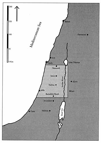
Map 1. Southern Syria
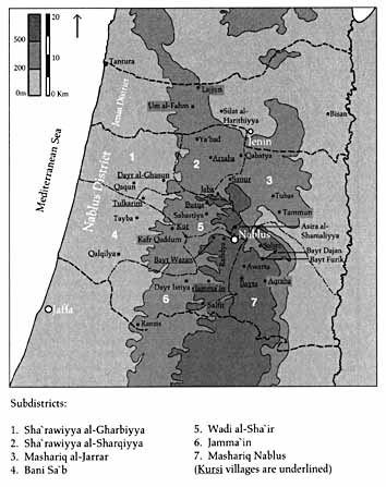
Map 2. Jabal Nablus, circa 1850
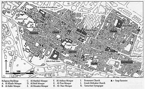
Map 3. Nablus Old City, showing the positions of key buildings in the late nineteenth century (base map, Nablus Principality, 1987)
Preferred Citation: Doumani, Beshara. Rediscovering Palestine: Merchants and Peasants in Jabal Nablus, 1700-1900. Berkeley: University of California Press, c1995 1995. http://ark.cdlib.org/ark:/13030/ft896nb5pc/
| ||||||||||||||||
MapsMap 1. Southern Syria Map 2. Jabal Nablus, circa 1850 Map 3. Nablus Old City, showing the positions of key buildings in the late nineteenth century (base map, Nablus Principality, 1987) |
| ||||||||||||||||
Preferred Citation: Doumani, Beshara. Rediscovering Palestine: Merchants and Peasants in Jabal Nablus, 1700-1900. Berkeley: University of California Press, c1995 1995. http://ark.cdlib.org/ark:/13030/ft896nb5pc/