Maps
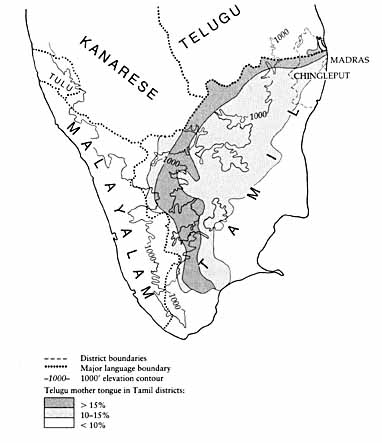
Map 1. Relationship between elevation and distribution of Telugus in Tamil districts, 1931. Based on maps in M. W. M. Yeatts, Madras Report, vol. 14 of Census of India (Madras: Superintendent, Government Press, 1932), opposite 286, and Eugene F. Irschick, Politics and Social Conflict in South India (Berkeley: University of California Press, 1969), 2.
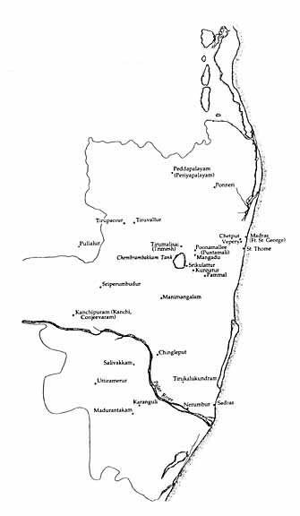
Map 2. Selected villages of the Jagir. Based on an original historical map produced from Thomas Barnard’s survey and published by Alexander Dalrymple in 1778. Boundaries on the original map are indistinct, hence the imprecision here.