Two
Politics and Community in Premodern History
Few areas of Java bear such visible traces of Southeast Asia's complex history as do the Tengger highlands. Drawn into a lowland-based Hindu-Buddhist state a thousand years ago, this is the only region in modern Java to have preserved an indigenous Hindu priesthood. After Hindu Majapahit's fall at the beginning of the sixteenth century, the centers of power on the island moved west to Muslim courts in Central Java, and the influence of lowland powers in the eastern mountain areas waned. For the next two centuries, politics and religion worked to isolate these mountain Javanese from their Muslim neighbors to the west. Indeed, for a time, it looked as if the inhabitants of this upland territory might become a wholly separate ethnic group. Like highlanders in much of Southeast Asia (Keyes 1977, 19; Leach 1954), they preserved a dialect, a religious tradition, and a social order distinct from those of their lowland neighbors. Their mythology spoke of flight from the lowlands and an identity distinct from that of Muslim Javanese.
Ultimately, however, the upland-lowland contrast did not evolve into a full-blown ethnic cleavage, as the mountains were firmly drawn into events in the surrounding society. Isolated from the courtly influences that reshaped Central Javanese culture in the seventeenth and eighteenth centuries, the Tengger highlands awoke in the nineteenth century to find themselves forcibly reincorporated into a new and more powerful entity, the Dutch colonial state. It was this more than any other institution that shaped politics and community in the Tengger mountains at the dawn of the modern era.
The Precolonial Uplands
Prior to the tenth century the most important centers of state power on the island of Java were located around the rich wet-rice terrains of inland central Java. Much of the spectacular architecture of this region—at Buddhist Borobudur and Sivaite Prambanan, among other sites—dates from this period. In the tenth century, however, court power shifted eastward, first to the Kediri region, in the western portion of what is today the province of East Java, and, early in the thirteenth century, to Singosari, a town located at the western edge of the Tengger highlands. The shift east may have been owing to the growing importance of trade with eastern Indonesia's spice islands, for which the eastern Javanese authorities acted as brokers. As Schrieke (1957, 2:301) has speculated, the move may have also been the product of flight from Central Java by peasants seeking to escape the onerous burden of forced labor required for the construction of Central Java's monumental architecture.
Political rivalry among eastern Java's new principalities was intense. Kediri was conquered in 1222 by Singosari, a state founded by a commoner with no prior dynastic genealogy. Seventy years later, Kediri forces returned to avenge their defeat by capturing the Singosari court. Kediri's victory was itself short-lived, however, as Singosari armies returned quickly to rout the invaders. Consistent with Javanese tradition, Singosari's leaders were reluctant to reestablish their capital at a site once seized by their enemies. Hence a new court was built about ninety kilometers (as the crow flies) to the northwest, at a site known as Majapahit. Situated a small distance from the coast in the Brantas River valley, the location was ideally suited for control of the agrarian hinterland and for easy access to the important port of Surabaya at the river's mouth (Robson 1981, 262). The old Singosari court, meanwhile, appears to have remained in use; fourteenth-century chronicles, for example; report that King Hayam Wuruk of Majapahit stayed in its central compound at the end of his tour of the realm in 1359 (Pigeaud 1962, 4:104). For the next two centuries, Singosari-Majapahit was Java's most powerful kingdom; it would be remembered in modern times as the most glorious of the island's pre-Islamic states. It declined in the final decades of the fifteenth century, however, and its eventual conquest in the 1520s by Muslim principalities (Noorduyn 1978; Robson 1981) was an important watershed in premodern Javanese history.
Our knowledge of the Tengger highlands during this pre-Islamic period is fragmentary. Literary and epigraphic evidence indicates that the mountain region played an important role in state-supported religious cults. It was home, for example, to both Sivaite and Buddhist clerical communities, as well as to a smattering of freeholder villages involved in
the worship of mountain spirits (Pigeaud 1962, 4:443-44; Hefner 1985, 25). The most important of these spirits was that associated with the massive volcanic cauldron at the center of the Tengger massif, known as Mount Bromo. Rising some 300 meters from the desolate wastes of a rolling "sand sea" (segoro weds ), this Smoldering crater is itself located at the center of a larger, extinct crater, some ten kilometers in diameter and four hundred meters deep. Historical evidence indicates that in Majapahit times the Bromo complex was the focus of important ritual activity, as it is still today for the upperslope Hindus. Each year, non-Islamic highlanders come together on the slopes to throw offerings into the volcano and to remember the flight of their Hindu ancestors from Muslim armies (Hefner 1985, 46).
Religious texts from the pre-Islamic period make numerous references to this unusual mountain terrain, indicating that at least some of the local population were involved in state cults. Several texts, for example, link the sand sea around the Bromo caldera to sacred territories in classical Hindu cosmology. One text, for example, describes how the souls of the dead must pass through the sand sea's barren wastes on their way to the fiery hell of Bromo (Gonda 1952, 148). The same purgatorial image appears in prayers of ritual purification still used today by Hindu priests in the upperslope highlands (Hefner 1985, 176-82). An important work of the late Majapahit period, the Tantu Panggelaran (see Pigeaud 1924), also mentions this region, identifying Mount Bromo as the spot where the Indic god of fire, Brahma (from whom the volcano's name, Bromo or Brama, is derived), does his smithing.
The most intriguing references to the Tengger highlands, however, occur in the fourteenth-century Nagarakertagama , an account of a "progress" through the countryside by Hayam Wurukr uler of Majapahit at the height of its power (Pigeaud 1962). The king's journey skirted the Tengger highlands, and on several occasions he made forays into its mid-slope regions. For example, the royal procession visited a mandhala religious community in the district of Tongas, Probolinggo (on the northern slopes of the Tengger massif), performed water devotion at a nearby shrine, and received tribute from eleven Buddhist communities, including three located in or near present-day mountain communities.[1] Although today all of these villages lie just below the territory inhabited by upperslope Hindus, ethnographic evidence suggests that several of them remained non-Islamic into the early nineteenth century.
The importance of the Tengger mountains for Majapahit religion raises the question as to the precise relation between this earlier tradition
[1] The three villages are Lumbang, Pancur, and Tenggilis; see Pigeaud 1962, 4:68; de Vries 1931, 1:17.
and that of today's upperslope non-Muslim "Tengger." This issue has long fascinated scholars, who have hoped that modem Tengger traditions might provide clues as to the nature of popular religion in Majapahit times. J. E. Jasper's (1926) influential work on modem Tengger, however, counseled pessimism in this regard. He argued that in earlier times the upperslope population was a tribal enclave that had held itself apart from the rest of Java. This people's conversion to Hinduism occurred so late in Majapahit's history, Jasper speculated, that they were only superficially Indicized. Hence their traditions tell us little about pre-Islamic religion as a whole.
In his brilliant work on fourteenth-century Java, Theodore Pigeaud relied heavily on Jasper's account to reach a similar conclusion. "In fact even in the pre-Islamic period," he wrote, "the Tengger highlanders · seem to have formed a separate community, worshipping the spirit of a volcano who (by outsiders, probably) had been given an Indian name, Brahma" (Pigeaud 1962, 4:244). The ritual texts preserved by Tengger priests, he concluded, are "apparently of relatively recent date," and thus are "disappointing to scholars seeking information on Old Javanese religion" (1967, 1:49). Rather than linking the present-day Tengger tradition to the Sivaite communities discussed in the Nagarakertagama or the Tantu Panggelaran , therefore, he thought it more likely that modem Tengger are related to the "spirit servants" (hulun hyang ) mentioned in the Walandhit charter discovered near Mount Bromo at the turn of the present century (1962, 4:443-44). These people, he speculated, were probably "simple worshippers of local Spirits or tutelary deities residing on mountains or in springs, not wholly identified with the great Indian gods, especially Shiwa" (1962, 4:486).
More recent research, however, refutes these arguments and indicates that the ancestors of today's upperslope Hindus were mountain Javanese whose priests in Majapahit times were members of a Sivaite clergy found throughout East Java and Bali.[2] Even today, there are strong parallels in ritual performance and paraphernalia between Tengger and Bali. Indeed, some Tengger prayers show a word-for-word correspondence to those found in modern Bali, describing a richly detailed Sivaite cosmol-
[2] Jasper's (1926) historical reconstruction reached a different conclusion in part because he, like many scholars in colonial times, regarded the upperslope "Tengger" population as a cultural and racial survival of an earlier proto-Javanese population. Even in Jasper's time, however, there was strong evidence of earlier cultural ties between Tengger and Bali (Scholte 1921), suggesting that the isolation of the upperslope Hindus was the product of political conflict, not of putative racial distinctiveness (Rouffaer 1921; de Vries 1931). The Hindu population, one should note, are physically indistinguishable from people in other areas of East Java, and they certainly think of themselves as Javanese (Hefner 1985).
ogy.[3] This and other evidence indicates that clerics in the Tengger mountains were once associated with a popular Sivaite order known as the resi pujangga , genealogically related to the non-Brahmanic resi bujangga of modern Bali.
For an understanding of politics and community in the premodern Tengger highlands, this apparently obscure information is of critical importance. It shows that from early on the people of the highlands and those of the plains had strong cultural ties. This is in striking contrast with many other areas of Southeast Asia where mountain peoples maintain ethnic and religious identities apart from those of the state-dominated lowlands (Leach 1954; Keyes 1977, 27). That this was not the case in the Tengger highlands testifies to the cultural cohesiveness of the early Javanese state. It also helps to explain why in Java, unlike neighboring areas of Southeast Asia, there was such a remarkable degree of ethnic homogeneity from an early period. Even in Majapahit times the lowland-based state exercised a dominating influence on upland affairs.
After reaching its zenith in the fourteenth century, Majapahit fell into decline just a hundred years later, in part as a result of the rise of Muslim mercantile states in the western and central regions of the Malay archipelago. The court itself was overrun in 1478, apparently by a rival Hindu principality. It was then recaptured by what was probably a legitimate dynastic line in 1486 (Noorduyn 1978, 255). Shortly after its reestablishment, the court was moved inland, away from the increasingly powerful Muslim principality of Surabaya at the mouth of the Brantas river (Robson 1981, 279). The mercantile economy of the now-Muslim coast was slowly becoming ascendant over the inward-looking, rice-growing, and largely feudal interior. Eventually, the alliance of Muslim merchants and potentates proved too strong. In the 1520s Majapahit fell to Muslim forces from north coast principalities, under the spiritual and political leadership of Demak (de Graaf and Pigeaud 1974, 34-71). The process of Islamization that had followed insular trade routes through Northern Sumatra (converted in the late thirteenth century), northeastern Malaya and the southern Philippines (fourteenth century), and Malacca and the Malay peninsula (fifteenth century) had achieved its greatest prize yet.
Majapahit's collapse marked the beginning of a long and uneven process of Islamization in Java's eastern territories, one that would not be
[3] The content of the old prayers says nothing about either priestly or popular understanding of their meaning. Historical evidence shows that this non-Islamic population experienced considerable cultural disorientation as it carne under the influence of its Muslim neighbors (Hefner 1983a). The relationship between the Tengger and Balinese prayers is discussed in greater detail in Smith-Hefner 1983 and Hefner 1985, 163-88. The corresponding liturgy of the Balinese resi bujangga is found in Hooykaas 1974. Other information on these resi is found in Hooykaas 1964 and Pigeaud 1924, 248-49.
completed for another 250 years. In the middle of the sixteenth century, the north coast principality of Demak took the lead in coordinating the campaign against the few remaining Hindu-Buddhist principalities on the island, relying on a shifting alliance of Muslims from Java's north coast. The port of Pasuruan fell to Demak's forces in 1535 (de Graaf and Pigeaud 1974, 180). The victors quickly appointed a Muslim administrator for the region, and in 1546 Pasuruan, now Islamized, played a leading role in the Muslim campaign against the still heathen court of Panarukan, just to the east. Despite these advances, large interior areas to the east and south of Pasuruan remained non-Islamic. The most important center of resistance was the small principality of Blambangan at the far eastern tip of Java. The last of Java's Hindu-Buddhist courts, Blambangan was attacked in the 1540s, 1580s, 1590s, and early 1600s. The population of the Tengger mountains appear to have been drawn repeatedly into this contest. They had the unfortunate distinction of lying smack dab in the middle of the no-man's-land separating Muslim Central Java from Hindu Blambangan to the east (de Graaf and Pigeaud 1974, 193).[4]
The turmoil in this eastern region was soon complicated by a changing balance of power in Muslim Central Java. Beginning in the late sixteenth century, the inland agricultural state of Mataram rose to power, ultimately dominating the trading ports of the north coast. While Mataram was nominally Islamic, and even used Islam as a rallying cry against its Dutch enemies, it greatly restricted the political influence of the once-powerful Muslim clergy. Court literati also revived some of the aesthetic styles of the pre-Islamic period (Ricklefs 1974) and created many of the distinctive ritual forms still associated with "Javanist" Islam.
Like its north-coast predecessors, Mataram looked east after consolidating its power in Central Java. It conquered Pasuruan in 1616, Madura in 1624, and Surabaya, its most powerful coastal rival, in 1625. Still non-Islamic, Blambangan was repeatedly attacked between 1635 and 1640, when Mataram forces finally managed to occupy its court. Like earlier Muslim powers, however, Mataram failed to develop administrative control of the eastern territory, and, with the help of forces from Hindu
[4] Even in the nineteenth century, legends collected in the countryside spoke of the violence of former times and the role of Tengger priests in resisting Islamic armies (de Graaf and Pigeaud 1974, 179; Hefner 1985, 53-57; Rouffaer 1921, 300). Few of these tales are remembered today. Interestingly, the image of Islamization that emerges from these accounts is quite different from the relatively gentle process described in some Central Javanese myths (Geertz 1968, 29). Here in the eastern salient, or Oosthoek, Islam's advance was anything but a quiet process of personal conversion.
southern Bali, the wily Blambangan court eventually resurfaced and again challenged Mataram's authority (Ricklefs 1981, 44).
As a non-Islamic population, the Tengger highlanders were fair game for enslavement by Muslims. Between 1617 and 1650 Mataram forces made repeated forays into the mountain territories around Mount Bromo and nearby Mount Kawi to seize slaves. The prisoners were among the famous gajah mati ("dead elephant") population taken from eastern Java to Central Java to work as royal footmen and forest workers (Rouffaer 1921, 300).
While it could periodically devastate the region, however, Mataram was unable to establish a stable administration, and eastern Java's mountains provided shelter for anti-Mataram rebels. In the 1670s, for example, a Madurese prince by the name of Trunajaya mounted a powerful challenge to the Mataram court. It was suppressed only after the Dutch East Indies Company—which in 1619 had established a fort at the western end of the island—came to the aid of imperiled Mataram (Ricklefs 1981, 75). Once defeated, Trunajaya's forces took refuge in the Tengger mountains, where they were pursued by Dutch forces. This was the first European intervention in the highland area.
Around this same time a Balinese ex-slave by the name of Surapati was involved in several attacks on the Dutch, first in West Java and then in Central Java (Kumar 1976; Ricklefs 1981, 80). After the latter incident, he too fled east, and in 1686 he established a court near the port of Pasuruan at the northern foot of the Tengger mountains. Surapati's Pasuruan quickly became a political force in its own right, providing the organizational momentum for an anti-Mataram alliance linking Pasuruan, Tengger, Blambangan, and the Balinese. This brazen challenge to Mataram's authority could not long go unanswered. In 1706-7 the inland court forged an alliance with the Dutch East Indies Company, and some 60,000 VOC (Vereenighde Oostindische Compagnie), Mataram, and Madurese troops attacked Surapati's stronghold near Pasuruan (de Vries 1931, 1:20). Surapati was killed in the first weeks of battle and the powerful garrison overcome. Pasuruan was seized and turned into a Dutch fort— the first in East Java and just twenty kilometers from the Tengger mountain range. For years Surapati's descendants continued to put up resistance from hideouts in the Tengger mountains and Blambangan. The last rebel leader in Tengger was captured by Dutch forces only in 1764 (Jasper 1926, 11). When Blambangan fell in 1771 (Ricklefs 1981, 96), there followed one of the most peculiar events of Javanese history. So as to split the long-rebellious Blambangan court from its south Balinese allies, the Dutch took the unusual step of encouraging the Islamization of Blambangan's royal family. Although some villages are reported to have remained Hindu into the nineteenth century, this marked the effective
end of Hinduism in the Blambangan area (Pigeaud 1932). Henceforth Javanese Hinduism was restricted to the small peasant population of the Tengger highlands.
Dutch cooperation with Mataram, first against the Trunajaya rebels and then against Surapati, exacted a high price. In November 1743, in the aftermath of the Surapati campaign, the Dutch were granted full sovereignty over most of Java's north coast and all of the eastern salient (Ricklefs 1981, 89). The era of eastern Java's political autonomy thus finally came to an end. Even prior to the capture of the last Tengger rebels, the Dutch established a small presence in the upperslope village of Tosari. From 1743 to 1751 they laid out vegetable gardens there to provide food supplies for the Pasuruan garrison (de Vries 1931, 1:133). In the late 1760s native farmers in the region were given vegetable seeds and instructions for their cultivation, and between 1772 and 1790 a German worked as an agricultural extension agent in the village. Although its influence was at first only modest, European power had nonetheless penetrated the mountains, ending the long middle ages that had begun with Majapahit's fall. This also signaled the beginning of a new era in relations between upland society and the lowland state.
Several facts relevant to our understanding of the modem uplands stand out from this overview of precolonial history. Some 250 years of political violence, first of all, help to explain the unusual distribution of population in the Tengger mountains on the eve of colonial rule. Although the religious communities of the Majapahit era had been located in the more temperate midslope highlands, by the end of the eighteenth century these territories had been depopulated. The surviving mountain population took refuge in the less temperate—but militarily defensible— upperslope regions. Village settlement patterns were also influenced by this troubled history. Early visitors to the region consistently report that native settlements were located on steep ridges, high above cultivated valley floors, and often inconveniently remote from the springs on which villagers depended for water (Domis 1832, 327). Houses were built on terraces (gampengan ), clustered tightly together, without the home gardens characteristic of lowland settlements (van Lerwerden 1844, 82; Raffles 1965, 1:329). These hilltop hamlets provided protection from the predatory attacks that plagued this region well into the nineteenth century.
This same history explains certain cultural anomalies of the eastern salient as a whole. Many of the distinctive features of language, etiquette, politics, and art today identified as classically "Javanese" really developed only recently, in the course of the cultural renaissance that occurred at Central Java's courts in the eighteenth and nineteenth centuries (Pigeaud 1967, 1:7; Moedjanto 1986). The later diffusion of these styles to other areas of the island helped to reverse the trend toward cultural re-
gionalization evident in the early post-Majapahit period. Since it was never under effective Central Javanese control and was ceded to the Dutch in 1743, the eastern salient at first escaped many of these standardizing influences. It remained a stronghold of nonstandard dialects, the last bastion of popular Hinduism, and a region in which such quintessentially Central Javanese art forms as wayang puppetry and wayang wong theater were less popular than bawdier local arts (Pigeaud 1932; Hefner 1987b).
There was, however, a price to be paid for such cultural independence. The warfare that plagued the eastern territory for much of the post-Majapahit period effectively depopulated large areas of the countryside. We know something of the cultural traditions of Tengger and Blambangan because in these regions a critical mass of people and institutions survived. It is probable that indigenous eastern Javanese populations remained in other areas too at the end of the eighteenth century. Their ranks were so depleted, however, that they would soon be overwhelmed by the Madurese and Javanese who migrated to the area beginning in the late eighteenth century. In these regions a frontier culture emerged that incorporated Madurese, Malay, and Javanese traditions, obscuring what remained of eastern Javanese customs. In a region where Muslim religious schools (pesantren ) provided one of the few popular organizations capable of cutting across ethnic and communal lines, Islam would become the most influential of these post-traditional forces. Although its mountain regions remained non- or only nominally Muslim, lowland Pasuruan became one of the strongest centers of Muslim traditionalism in all Java.
Social Change Under Colonial Rule
The Dutch administrators who visited Pasuruan in the eighteenth century saw a territory rich in economic resources but poor in what was needed to realize their promise for Europeans: a sedentary and controllable labor force. The rural population that had survived (just over thirty thousand people) was largely concentrated in the lowlands. The few residents of the Tengger highlands were located in isolated upperslope villages. A 1746 report from Pasuruan spoke enthusiastically of the regency's potential. But it bemoaned the area's poverty, its small population, and a banditry problem that brought ruin to the countryside (de Vries 1931, 1:22).
Dutch efforts to revive the local economy were aided by developments in Java as a whole. Between 1757 and 1825 Java experienced its longest period of peace since the early sixteenth century (Ricklefs 1981, 94). Both inland and coastal areas of Central Java enjoyed new prosperity. Popula-
tion grew, and the general peace allowed for freer movement of goods and people (Meijer Ranneft 1916, 64). The heavy burden of taxes and labor services imposed on the peasantry in the native districts of Central Java meanwhile created pressures for flight to less oppressive territories. The native regents who now worked under Dutch authority in Java's eastern salient took advantage of the population movement by encouraging settlement in their districts. Taxes were waived on new settlers for the first three or four years of their residence (Palte 1984, 18). Already in the 1750s, therefore, Dutch reports spoke of a visible increase in Pasuruan's population (de Vries 1931, 1:22). Although in Central Java population growth resulted in a significant movement of people into the rainfed uplands (Palte 1984, 19), most of the pre-1830 immigrants to the thinly populated Pasuruan regency were able to settle in sawah districts or on the fringes of the Tengger mountains (de Vries 1931, 1:51).
Pasuruan's highlands were at first little affected by the immigration. European activity was confined to vegetable cultivation and the operation of a hostel for European visitors (de Vries 1931, 1:133). Coffee— cultivated under Dutch rule around Batavia since the 1700s and in western Java's Priangan highlands since the 1730s (Geertz 1963a, 58)— was introduced into a few lower-lying villages only in the final years of the eighteenth century (Rouffaer 1921, 301). Officials were delighted, however, by the success of the crop. In 1793 production was 3,750 lbs; just two years later, it had increased to 31,250 (de Vries 1931, 1:71). The crop was cultivated around existing centers of population, not in the thinly populated mountains. But compulsion was already used to recruit labor for its cultivation. By 1811, 4,361 people—about 12 percent of the regency's population—were involved in forced coffee cultivation (de Vries 1931, 1:71).
Production here and in other parts of Java grew steadily in the years prior to 1830. Despite a slump in world coffee prices in 1823 (Furnivall 1944, 96), coffee exports from Java to the Netherlands reached 17 million kilograms in 1825 and 25.6 million in 1828; they then dipped to 17.7 million in 1830, following a fall in prices. Even at its low point, the value of these exports exceeded that of sugar, the other major commercial export, by a ratio of three to one (Furnivall 1944, 104). In short, on the eve of the implementation of one of the largest systems of compulsory cultivation in all of colonial Asia, the infamous Cultuurstelsel ("Cultivation System"), rural Java was already being drawn into a powerful extractive grid. Most of Java's eastern uplands, however, still lay outside its grasp, and the colonial government was at a loss as to what to do with its vast "waste lands."
Political and demographic circumstances combined to provide a solution to this problem. The Javanese aristocracy, under the leadership of Prince Dipanagara, made a last effort to defend its authority against co-
lonial encroachment, and war raged in Central Java between 1825 and 1830 (Carey 1979, 63-77), killing 200,000 Javanese and sending thousands more fleeing into the upland areas of Central Java and the eastern salient (Palte 1984, 19). After the war, the colonial government introduced the Cultuurstelsel, under which Java's peasants were supposed to pay their taxes in produce, rather than cash, by cultivating commercial crops on a portion of their lands or, in the case of coffee (and some other minor crops), on nearby government forest lands (Geertz 1963a, 52-82; Van Niel 1972). The system of compulsory coffee cultivation that had proved so profitable in western Java's Priangan highlands was thus extended to upland areas of eastern and central Java. A similar program was launched in West Sumatra (Kahn 1980, 164). While in theory the new policy was supposed to lighten the burden of taxation on the peasantry, in actual fact it was administered in a dizzying variety of fashions and with widespread inequities (Van Niel 1981, 41).
The Dutch introduced several commercial crops, but the two most successful during the life of the system proved to be coffee and sugar. Sugar was grown primarily on peasant sawah fields, and, except where estates were established on newly opened tracts, this required temporary appropriation of native rice lands. The result was a drop-off in rice production and, in a few areas, famine (Van Niel 1981; Elson 1984; Breman 1983). Coffee, by contrast, was an upland crop, and its impact on food-crop cultivation was at first less serious. Most of Java's mountain peoples practiced a variant of shifting cultivation, and it was easy enough to confine them to smaller land areas without immediately threatening their subsistence. The overall impact of coffee on the highlands was still nothing less than revolutionary. In just a few years it replaced a complex forest ecosystem, in which human agriculture was but a small component, with commercial enterprises that dominated the mountain environment.
Prior to the implementation of the Cultivation System, most coffee outside West Java was grown in hedgerows at the edge of fields and in small gardens in the lower reaches of Java's mountains. The new system took advantage of Java's growing population, however, to channel people into the uplands, transforming previously unworked "wastelands" into lucrative coffee stands. The scheme was so effective that by midcentury government officials had to report that there remained no additional forest land to open for coffee (Fasseur 1975, 62,). Mountain areas throughout Java, including the Tengger highlands, were ringed with a "coffee belt," extending from 600 to 1,200-1,400 meters in altitude. An entire forest ecosystem had disappeared.
At the height of the Cultivation System, the number of peasants mobilized for coffee cultivation exceeded the number involved in cane cultivation, at times by a ratio of three to one (White 1983, 28). The amount of
labor required was massive. The number of coffee trees planted grew from about 116 million in 1833 to 242 million in 1835 and 330 million in 1840 (Klaveren 1953, 123). During the 1840s from four to five hundred thousand families were involved in coffee cultivation, and each year from two to ten million new trees had to be planted (Van Niel 1972, 100). Although only about 5 percent of the total sawah was under sugar cultivation at any one time, 70 percent of all Javanese families were involved in compulsory cultivation, more than half of whom worked with coffee. Quite simply, coffee was the most important export for most of the Cultuurstelsel period (Furnivall 1944, 129), and its impact on Java's agricultural ecology was second to none.
In part because of its extraordinary profitability, coffee remained a government monopoly longer than any other cultivar. From January of 1833 on, private trade in the crop was outlawed, and all coffee had to be sold to the government at freed prices (Furnivall 1944, 120). While private production of other commercial crops grew in importance after 1850, the state maintained its monopoly control of coffee. Only at the end of the nineteenth century did it relax its hold, when declining world prices and an islandwide coffee blight (which began around 1878-80 and eventually destroyed most of the government's arabica trees) made all but the most fertile government stands unprofitable (Furnivall 1944, 200). Even then, however, the state was reluctant to relax its control. Pressured by capitalist entrepreneurs in the Netherlands, it announced plans to privatize production and abolish forced cultivation. But the program of liberalization was blocked by war with the Sultan of Aceh, in northern Sumatra, which drained government coffers. Compulsory cultivation did not end until 1915 in Central Java and the 1920s in East Java. By then, mountain Java faced new demographic and ecological challenges.
Colonial Pasuruan
The impact of nineteenth-century colonialism on Pasuruan was consistent with this islandwide pattern, underscoring the manner in which lowland political economy dominated the evolution of the highlands. Although coffee and sugar were grown in the regency prior to the Cultivation System, their cultivation really took off only after 1830. The northern littoral stretching from Pasuruan to Surabaya became Java's largest sugar region, and would remain so for the life of the Cultivation System (Elson 1978a, 9). Immigration from Madura and Central Java in the preceding decades had tripled the regency's population from 37,000 in 1807 to 113,000 in 1831 (de Vries 1931, 1:37), providing just the labor force required for colonial schemes. In the same period, the area devoted to irri-
gated sawah doubled (de Vries 1931, 1:54), providing more land for cane
cultivation.[5]
The introduction of the Cultivation System shocked the sugar districts so severely that their population actually declined during the first four years of the program (Elson 1978a, 26). Most of the fleeing population moved south, away from the sugar-growing coast. A significant proportion of this population moved into the Tengger highlands, whose rainfed lands were unsuitable for cane cultivation. Thus the temporary decline in the regency's total population hid what was in fact a sudden increase in the population of the regency's non-sugar-growing districts, most of which lay in or adjacent to the Tengger highlands. The flight of ethnic Javanese was offset by the movement of an almost equal number of Madurese into coastal areas, continuing a process of Madurization that had begun in the prior century (Elson 1978a, 27).
The flight of population testifies to the fact that, in the early years of the Cultuurstelsel, the burden of compulsory labor was greater in the sugar districts than in others (de Vries 1931, 1:99). Elsewhere in Java, too, regional inequities in forced labor resulted in population flight from sugar to coffee districts (Onghokham 1975, 215). The migrations only accelerated the incorporation of Java's once-peripheral uplands into the islandwide colonial economy.
Pasuruan did not experience calamities as severe as those in other parts of Java under the Cultivation System. The regency never suffered famines like those in Central Java during the 1840S (Furnivall 1944, 138; de Vries 1931, 1:94). The milder impact of the Cultuurstelsel here was largely because of the greater availability of land in the regency and its smaller population. By comparison with inland Central Java, in particular, Pasuruan enjoyed an abundance of land. During the last half of the nineteenth century (1855-1905), the regencies of Pasuruan and Malang experienced the greatest expansion in amble land in all of Central and Eastern Java (Palte 1984, 21). Despite a growing population, this expansion ensured that at the beginning of the twentieth century the region's population density remained the lowest in all of East and Central Java: a "mere" 580 persons/km2 of farm land, as opposed to 835 for East and Central Java as a whole (Palte 1984, 29). In nineteenth-century Java, it would seem, Pasuruan was one of the regencies best suited to endure the rigors of colonial enterprise.
The impact of forced cultivation on the regency was severe nonetheless. Contrary to some accounts of the Cultuurstelsel (e.g., Geertz 1963,
[5] Between 1807 and 1827 the average annual increase in the regency's population was an astonishing 4.7-5.6 percent, much of it no doubt owing to immigration. From 1831 to 1900, by contrast, the average annual rate of population increase slowed to a modest 1.5 percent (de Vries 1931, 1:37-38).
38), recent research indicates that Pasuruan's paddy farmers did not respond to the annual loss of their land to cane-growing by intensifying rice cultivation on their remaining lands. Instead, both the quantity and quality of labor in rice declined as more and more workers were forced onto government fields. Rice production per capita actually fell until midcentury, and the sugar districts of Pasuruan's northern littoral—rice exporters a generation earlier—became net importers (Elson 1978a, 18). Non-sugar-growing districts in this same part of Java were better able to meet their staple needs, and as a result net population movement into these areas was greater than that into the sugar districts. It was only toward the end of the Cultivation System in the 1860s that labor intensification was sufficient to reverse the sugar districts' decline.[6]
Colonial policies also reinforced rural inequities. Although early in the nineteenth century the English governor Sir Thomas Stamford Raffles had reported that Pasuruan knew almost no landlessness, by midcentury about 40 percent of the sugar districts' population was without land (Elson 1984, 90). Equally important, the mobility previously available to peasants—as in other parts of Southeast Asia, a critical influence on their bargaining power relative to superiors (Adas 1981; Scott 1976)—had greatly diminished. By the late 1830s agriculture had absorbed the remaining lowlands (de Vries 1931, 1:95). At the same time, colonial policies strengthened the authority of traditional aristocrats and village chiefs (Furnivall 1944, 140; Elson 1978a, 8). Drawn from the ranks of the wealthy, village leaders were given broad authority in the allocation of village lands and were bribed or given percentage payments for cooperating with government officials. Instead of social leveling and the equalization of poverty, the Cultivation System served to "reinforce, exaggerate, and harden the lines of social standing and wealth which had existed before 1830" (Elson 1978b, 55).
An Advancing Capitalism?
Did these policies effectively support the advance of rural capitalism, as some observers have suggested (Alexander and Alexander 1979; White 1983; Knight 1982)? Or, by excluding native farmers from capital-intensive sectors of the rural economy, did colonial enterprise impede the development of a capitalist peasant class (Geertz 1963; de Vries 1931, 1:37)? The answer to this question in part depends on how one defines capital-
[6] Citing the decline in rice production of the 1830s and 1840s, some scholars have speculated that the increase in average family size seen later in the century was an effort on the part of the peasantry to compensate for labor lost to government enterprise by increasing its fertility (Alexander and Alexander 1979, 35; for Central Java, see White 1976).
ism in a colonial context and what sort of social hierarchy one deems central to its development.
Events in Pasuruan do not fit neatly into either model. The Cultivation System more consistently supported the interests of European capital than it did those of native Javanese. In rice-growing villages, for example, villagers' rights to land were regularly abrogated in favor of European enterprise. In the early years of the system, shares of communal land were homogenized (they had earlier been more inequitably divided) and distributed more widely so as to expand the pool of workers liable to compulsory labor; in theory, only landowners were subject to such labor taxes (de Vries 1931, 1:97). At least in the short run, the policy stripped rural elites of their economic autonomy, reinforced communalism, and undermined private enterprise. While eroding some aspects of rural hierarchy, however, the system reinforced others. Lower-level aristocrats and village chiefs saw their privileges greatly expanded. In exchange for their help with government programs, they were rewarded with large cash payments, labor services, and access to government lands (Van Niel 1981, 43; Elson 1978a, 8; Furnivall 1944, 140; Breman 1982, 16). The result was growing landlessness and inequality among those who did own land.
Although economic inequality increased, then, it was not the result of the growth of free labor or the jockeying of entrepreneurs in the marketplace. Though it linked the rural population to international markets, in the domestic sphere Dutch colonialism did not support native capitalism. Much of the labor mobilized for government enterprise was coerced, not free. The state monopolized the market in land, guaranteeing itself final authority over its disposition. What native elites there were depended more for their influence on powers selectively accorded them by the colonial authorities than on independent control of the means of production. Contrary to some models of capitalist expansion (Frank 1969; Wallerstein 1974), then, Java's incorporation into the international capitalist system was not itself a guarantee that local relations of production would be recast along capitalist lines. Excluded from ownership of large-scale enterprise, and forced into a holding pattern on their own farms, the native Javanese were, in the end, a dominated population. They were linked to international markets by state power rather than by the dynamism of a native bourgeoisie (cf. Kahn 1980).
The cumulative effect of these changes was an administrative structure never before seen in Java: a systematically coordinated grid for the extractive control of labor and produce. On this point Clifford Geertz's characterization of social change in colonial Java as a kind of "advance toward vagueness," in which traditional social patterns were not so much transformed as "elasticized" (Geertz 1963a, 103), risks overlooking the
revolutionary changes in rural administration, especially in district and village government. Politically and economically, colonial Java was very different from the society that had preceded it. Its political structures governed the rhythms of rural life more directly, The Dutch, of course, eventually departed. But this powerful state structure would remain and play an important role in modern agrarian development.
A Dominated Highlands
Although prior to 1830 the Tengger highlands were still a colonial backwater, after that time coffee and population growth rapidly transformed the region. As coffee cultivation spread to the midslope highlands, production in the regency increased. Between 1832 and 1836, production grew from 278,000 to 1,220,000 kilograms (de Vries 1931, 1:73). The number of new trees planted each year increased from 71,400 in 1832 to 253,000 in 1836. Between 1836 and 1849, finally, the number of trees harvested increased 500 percent, to 4,300,000.
The method of compulsion used here was similar to that in other areas of Java (Geertz 1963a, 56; Van Niel 1972, 99). Each family was given responsibility for a certain number of trees; at midcentury, the average in Pasuruan was 1,250 (de Vries 1931, 1:74). The annual harvest from these trees could be sold only to the government at collecting warehouses located in three midslope villages. The price was fixed by the colonial authorities, and the bulk of it was in fact never paid out, but deducted from the farmer's land tax. Nonetheless, people who carefully nurtured their trees could sometimes earn a modest profit; throughout the life of the system the potential for individual gain appears to have been greater than was the case with sugar. This fact served, of course, to attract immigrants from the sugar-growing lowlands.
The other attraction for immigrants was the availability of forest land for family agriculture. The government attempted to regulate forest opening, but did so largely to protect its own commercial interests. It set aside the flattest and most fertile mountain lands for its own coffee, leaving the native population to cultivate marginal hillside lands. Nonetheless, during most of the nineteenth century, the Tengger highlands had at least some frontier areas where immigrants could acquire land. With the exception of native officials, most families received smallholdings of one to two hectares. By restricting peasant differentiation in this manner, the government guaranteed itself a large pool of workers, since, as in the lowlands, landowners were subject to the highest labor tax. Overall, then, government programs served to reinforce a pattern of peasant smallholding rather than differentiating rural society into capitalist farmers and landless workers.
Toward the end of the century, the amount of open land diminished as roadbuilding and land scarcity brought land-hungry immigrants from the lowlands. The influx was so great that, by 1910, there was in effect no more land to be had. In an effort to control lowland flooding, the government returned a large portion of its coffee stands to natural forest and relocated their native cultivators downslope. Between 1910 and the mid 1920s private lands were surveyed, village borders were demarcated, the forests were replanted, and the remaining government land was redistributed to local farmers. An era of highland frontier mobility had come to an end.[7]
Highland Population and Landholding
It is difficult to create a precise statistical portrait of population and landholding in the Pasuruan highlands during the nineteenth century. Government censuses were even less accurate in highland areas than they were in the lowlands. In addition, the boundaries of upland administrative districts changed several times in the nineteenth century, making precise comparisons with later periods difficult (de Vries 1931, 1:11). One can nonetheless get a general impression of changes from census information taken from the nineteenth-century upland district known as "Tengger," in which the districts that form the focus of the present study were located.[8]
On the eve of the Cultivation System in 1828, the Tengger district was inhabited by just 2,204 persons, most of whom were Tengger-Javanese Hindus concentrated in the inaccessible reaches of the upperslope highlands. The midslope region was even more sparsely populated, with only a handful of residents in its entire expanse. As table 2.1 shows, however, during the remainder of the century population grew steadily.
As the figures in table 2.1 indicate, the population of the Tengger district increased most rapidly during the peak years of coffee cultivation
[7] It is clear that this legacy of open land also influenced the system of tenurial rights found in the highlands. While much of Pasuruan's sawah and at least a small portion of its tegal dryland was under communal ownership, all of the land in the Tengger highlands was private heritable land, subject to only residual village restrictions on sale to outsiders (de Vries 1931, 1:123). Communal landholding was not found even in the indigenous Hindu communities of the upperslope region. I discuss the history of land tenure further in chapter 5.
[8] The Tengger district changed its borders several times in the course of the nineteenth century, and was broken up into several smaller districts at the beginning of the twentieth. The district included only about 60 percent of what can properly be regarded as Pasuruan's highlands. All of the communities in which ethnographic research for the present study was conducted, however, once lay in this district, and developments there in the nineteenth century were more or less typical of most of Pasuruan's highlands. There was also a Tengger district in the neighboring regency of Probolinggo.
TABLE 2.1 | ||||
Year | Tengger District | Pasuruan Regency | Tengger as % of Pasuruan Regency | All Java |
1830 | 2,234 | 109,847 | 2.0 | 7,000,000 |
1840 | 3,711 | 131,792 | 2.8 | 8,700,000 |
1850 | 10,314 | 142,293 | 7.2 | 9,600,000 |
1860 | 12,025 | 170,141 | 7.0 | 12,600,000 |
1870 | 12,899 | 187,819 | 6.9 | 16,200,000 |
1880 | — | — | — | 19,500,000 |
1890 | 24,920 | 261,788 | 9.5 | 23,600,000 |
1900 | 40,167 | 305,910 | 13.1 | 28,400,000 |
1930 | 49,873 | 322,033 | 15.5 | 41,700,000 |
SOURCES . Adapted from de Vries 1931, 2: tables 3 and 6, and Geertz 1963a, 69. | ||||
from 1840 to 1850, and then again at the end of the century, just prior to the final closing of the uplands. The end of the century saw economic recession in Pasuruan's lowlands, as the sugar industry went into decline. The resulting "formation of a new class of poor" (Elson 1984, 154) contributed to upland flight. Mountain roadbuilding facilitated its movement.
Figures on agricultural land similarly underscore the far-reaching changes in the mountain district during the nineteenth century. In 1816 the region is estimated to have had 438 hectares of agricultural land, all of it rainfed tegal . This represented 10.5 percent of the regency's rainfed land (4,186 ha), but a mere 2.5 percent of its total agricultural land (17,182 ha). At this point in history, in other words, rainfed land played only a minor role in regency agriculture. Covering some 12,996 hectares, irrigated sawah was more than three times as extensive (de Vries 1931, 2:table 8). By 1927 all this had changed. The total area of rainfed tegal had grown to 32,500 hectares, about eight times its area in 1816. Total sawah area, meanwhile, had increased only 37 percent, to 17,800 hectares (de Vries 1931, 1:164). There was thus now almost twice as much tegal as irrigated land.
A substantial portion of the growth in rainfed tegal occurred in the Tengger district. By 1929 its tegal area had increased to almost 7,000 hectares, one-fifth of the regency total, and about sixteen times the area in 1816.[9] The figure underscores an important feature of Pasuruan agriculture in the nineteenth century. The greater portion of its expansion oc-
[9] The figures Cited here do not include European-owned land or, when estimating the total dry-land area cultivated, house lands (pekarangan ) planted with gardens.
TABLE 2.2 | ||||
1883 | 1913 | 1938 | 1980 | |
Sawah | 1,845 | 2,200 | 3,368 | 3,491 |
Tegal | 640 | 1,775 | 3,251 | 3,271 |
SOURCES . Palte 1984, 22, and Roche 1985. | ||||
curred on rainfed fields, not irrigated sawah , and a significant portion of this rainfed land was in the mountains.
Similar changes were occurring throughout Java. Between 1880 and 1920 the native population of Java and Madura almost doubled in size, growing from 19.8 million to 35.0 million (Furnivall 1944, 347). Though much of this population was absorbed into an already "labor stuffed" sawah system (Geertz 1963a, 80), there was also widespread expansion on to rainfed lands. Between 1883 and 1938, for example, total sawah on Java and Madura increased 19.2 percent, from 1,845,000 to 2,200,000 hectares. In the same period, the total area of dry farmland more than doubled, from 640,000 to 1,775,000 hectares (Palte 1984, 22).
During that same thirty-year period, rainfed land grew from 26.0 percent of Java's agricultural land to 44.7 percent. Today the area of rainfed regal slightly exceeds that of sawah on the island (Booth 1985, 122). By the beginning of the twentieth century, in other words, Javanese agriculture was no longer exclusively or even predominantly sawah-based . Expansion had created a more heterogeneous agroecology and brought the island's last remaining arable lands under cultivation. In areas like Pasuruan, rainfed tegal was characteristic of this transformation.
As table 2.2 shows, between 1913 and 1938, there was another period of wet-rice expansion in Java, spurred on this time by government investment in irrigation projects. Sawah increased 53 percent, to an area roughly equal to its total today. Once again, however, rainfed land experienced an even more dramatic expansion, growing 83.2 percent, to a total land area also almost equal to its expanse today. The upland expansion begun in the nineteenth century was thus largely complete by the fourth decade of the twentieth. Only a few peripheral areas remained to be opened to cultivation. From this point on, Java's expanding population would have no choice but to intensify cultivation on a fixed land base.
An Advancing Infrastructure
Agricultural change was only one of a range of developments that reshaped rural Pasuruan at the end of the nineteenth century. Roadbuild-
ing also had a notable impact. In the eighteenth century the only carriageway in the entire regency was that between the coastal towns of Pasuruan and Bangil. A few side roads were added with the beginning of sugar cultivation in the 1820s and 1830s, but the greatest expansion in roads occurred during the "spatial outburst" (Palte 1984, 20) of Java's population from 1860 to 1925. For the first time ever, roads were built connecting Pasuruan with the foothills of the Tengger mountains to the south. Shortly thereafter two small feeder roads pushed higher into the mountains, reaching the midslope communities of Puspo and Nongkojajar. Markets were soon opened in both villages, the first ever seen in the highlands. The upperslope region, meanwhile, remained without roads, and it had no markets either. There were two small horse paths to Tosari, but neither was suitable for vehide traffic. Since the government had no estates in the area, it had little reason to invest in roadbuilding.
In the last years of the nineteenth century, however, upperslope Tosari became an important rest-station for Europeans. There were three hotels in Tosari and a fourth in nearby Ngadiwono, with accommodations for over two hundred guests and facilities for tennis, golf, croquet, and mountain tourism. It was tourist development, not an interest in native welfare, that spurred the government to construct vehicle roads into the rugged upperslope region. A dirt road was opened in 1914. It was given a stone foundation in 1919 and asphalted in 1935-36. Although the colonial government originally intended to extend roads into other upperslope villages, the Great Depression and, shortly thereafter, the Japanese invasion shattered these plans. Only with the expansion of government oil revenues after 1973-74 would roadbuilding again take place. Until that time Tosari was the only upperslope community accessible by vehicle. Even in the midslope region, more than half of all villages lay four to fifteen kilometers from vehicle roads.
The final years of the nineteenth century saw further evidence of the incorporation of the highlands into a national political economy. The Agrarian Law of 1870 opened "waste lands" to private European farmers, who were awarded lease rights for periods of up to seventy-five years. The resulting influx of European farmers occurred just prior to the closing of forests to native cultivators, thereby worsening the shortage of land. Although there were two small European farms around Tosari (specializing in dairy products and flowers), the more significant European holdings were in the temperate midslope region. Even here European settlement was unevenly concentrated around Puspo and Nongkojajar. Europeans preferred these areas because of their mild temperatures, fertile soils, and accessibility. Nongkojajar had the largest number of estates and was the only area that saw the formation of a resident class of landless laborers, recruited from the ranks of lowland immigrants.
The ecological problems associated with deforestation eventually led to the passage of a law (in 1874) requiring that permission for opening wasteland be secured from district-level officials rather than local village chiefs. Motivated by a similar concern for its fast-dwindling forests, the government established a Forestry Department in 1879 to manage upland forests devastated in large part by earlier colonial enterprise (Furnivall 1944, 180-201; Donner 1987, 346). This same legislation sought to control erosion by requiring those farming hillside land to build terraces (Palte 1984, 38). This stipulation was widely ignored, however, and, in the decades that followed, upland erosion worsened.
In a related development, the government in 1899 introduced a Land Rent Law that reorganized village boundaries, consolidating smaller villages into larger administrative entities (Furnivall 1944, 387; Ricklefs 1981, 148). In Pasuruan, the number of administrative villages was reduced from about 500 to 241 (de Vries 1931, 1:35). The same program surveyed lands, demarcated village borders, and closed vast areas of forest to cultivation. The program represented a reversal of government policies on midslope settlement. At the height of the Cultivation System, peasants had been encouraged to live dispersed in remote settlements, adjacent to the government coffee stands they tended. With its withdrawal from coffee cultivation, the government forced midslope peasants into nucleated settlements like those in the upperslope highlands. Its intent was to enhance control of the rural population and monitor forest use.
In Pasuruan the resettlement project took nearly two decades to complete. It coincided with the abolition of compulsory coffee cultivation, which wound down in this regency between 1917 and 1922. The "coffee belt" that had been created in the middle of the nineteenth century thus disappeared, and the upland frontier was forever closed. From this period on there would be no significant opening of additional forest land to cultivation.
With all these changes, the stage was thus set for the events of the later twentieth century, when population growth, political turmoil, and commerce would further transform the social landscape. Whatever the direction of those changes, they would occur in a social environment now characterized by high population densities rather than low ones, a strong state structure rather than a diffuse, indigenous one, and an agrarian economy strongly linked to external markets. Pasuruan's highlands had been thoroughly integrated into the structures and processes of European colonialism. Developments in the twentieth century would reflect the consequences of this incorporative revolution, and present new challenges to the residents of this once-remote highland territory.
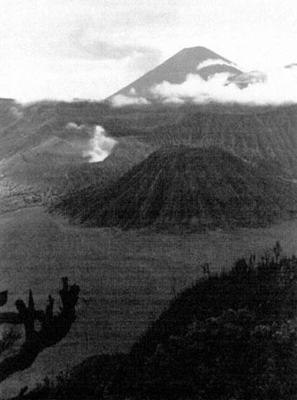
Plate 1:
Mt. Bromo (crater with smoke left of center)
with Mt. Semeru Rising in the Background
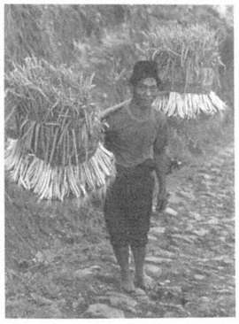
Plates 2-6:
The Faces of Upland Society
Plate 2
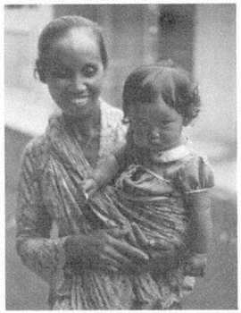
Plate 3
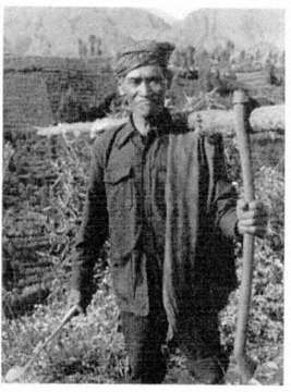
Plate 4
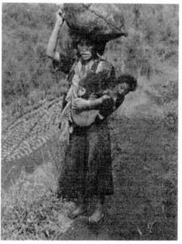
Plate 5
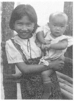
Plate 6
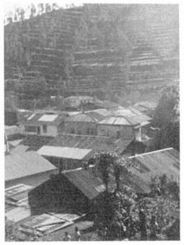
Plate 7:
Upperslope Villages Are Typically Nucleated
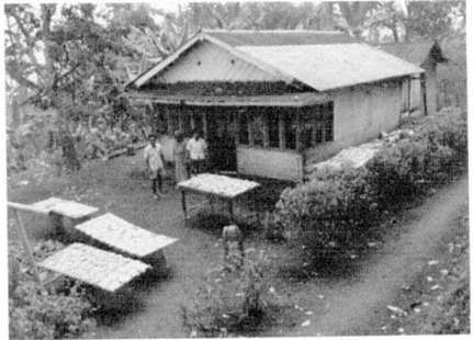
Plate 8:
Midslope Household Drying Cassava
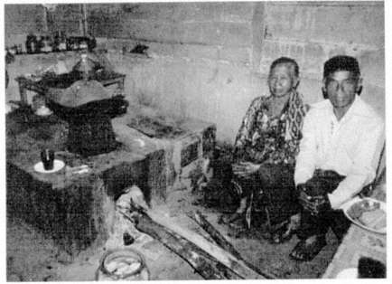
Plate 9:
A Traditional-Style Kitchen (Pawon ): Domestic Space and Guest Space as One
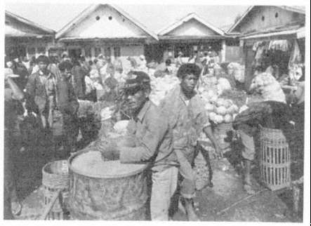
Plate 10:
The Tosari Market
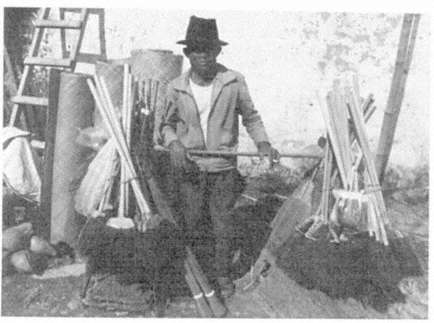
Plate 11:
A Madurese Peddler
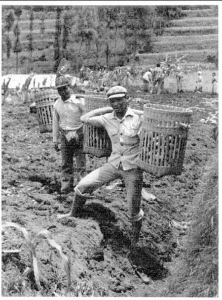
Plate 12:
Wage Laborers (kuli )
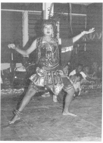
Plate 13:
Consumption Communities:
Female Tayuban Dancer in Traditional Festivity
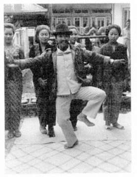
Plate 14:
Male in Festival
Dance
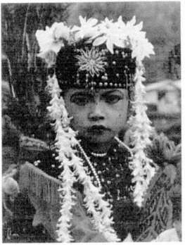
Plate 15:
Child in Festival
Costume
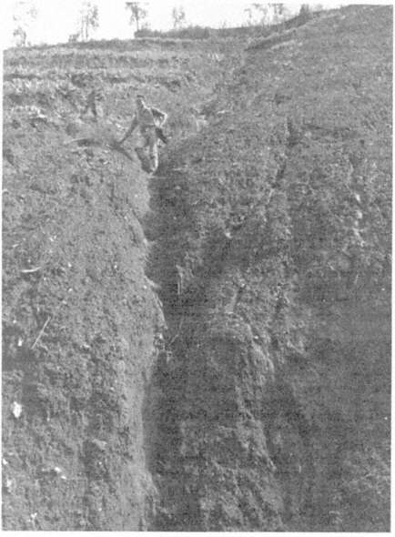
Plate 16
Plates 16-18:
The Ruinous Effects of Erosion in Upperslope Vegetable Fields
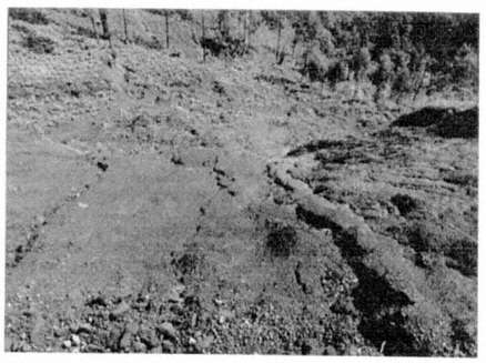
Plate 17
Plate 18
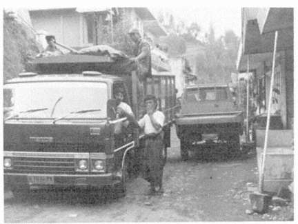
Plate 19:
New Instruments of Production: Truck Farming
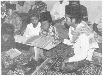
Plate 20:
A New Muslim Orthodoxy: Nightly Classes in Qur'anic Reading
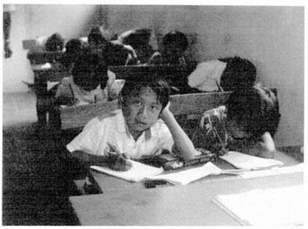
Plate 21:
Agencies of Resocialization: Village School
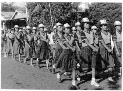
Plate 22:
Village Culture as National Community: Girl Scouts