Erosion History at the Self-Realization Fellowship Property
In 1938 the Self-Realization Fellowship built a temple on the bluffs at Encinitas (fig. 47a ). Following storms in 1941 the temple, which had been constructed thirty feet back from the bluff edge, was a victim of frontal landslides and collapsed to the beach (fig. 47b ). This property is especially prone to erosion, and numerous landslides have occurred as a result of wave action as well as from a rise in the groundwater level. Piezometers, placed in wells on the site, clearly indicate a rise in the water table beginning in about 1973, commensurate with the inland urbanization (fig. 48). This rise began during the end of a drought period that lasted from 1946 to 1977.
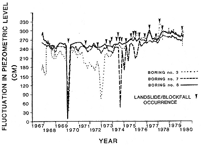
Figure 48
Piezometric well readings from three locations on the Self-Realization
Fellowship property in Encinitas. The small arrows indicate landslide
or block-fall occurrence. There has been a slow but steady rise in the
water table that began in 1973. This corresponds to extensive
urbanization and a marked increase in water use inland from this site.
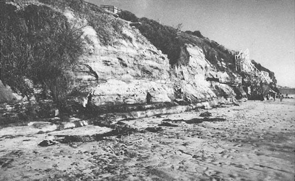
Figure 49a
February 1978 view of the cliff at the Self-Realization Fellowship. Note that the cliff face is not abnormally
undercut but that excessive wet conditions are visible.
Photo: G. Kuhn.
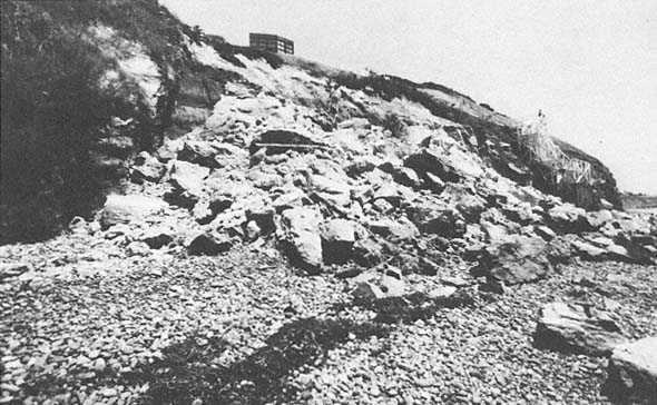
Figure 49b
May 1978 view of the same site as that in 49 a , following the cliff collapse of 26 April 1978.
Photo: G. Kuhn.
In April 1978, a cliff collapse measuring 110 feet along the bluff and 12 to 15 feet landward, with a maximum height of 40 feet, occurred at this same site (figs. 49a , 49b ). Saint and Turner (1980) investigated conditions at the site, including the 1978 event, and indicated that the cliffs in the area are subject to collapse because of a combination of factors. They state "large blocks, bounded by weakened joints, fractures, and bedding planes move out laterally following a build-up of pore pressure under the attack of wave action."
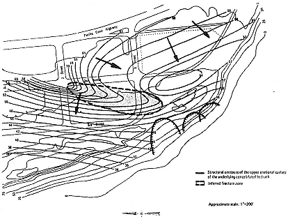
Figure 50
Subsurface groundwater movement along the old erosion surface. The arrows
indicate the approximate direction of the subsurface water.
From Saint and Turner, 1980.
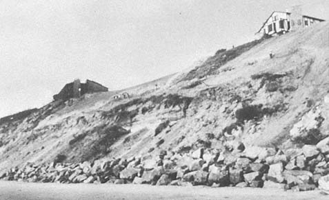
Figure 51a
View of the bluff face at the Self-Realization Fellowship, 1981. Note that the bluff face
was illegally graded and, as could have been predicted, it collapsed.
Photo: G. Kuhn.
After the storms in 1980, subterranean drains were installed around this property to intercept inland groundwater. Saint and Turner (1980) ascertained from a geological investigation that underground water was flowing directly under the Self-Realization property (fig. 50). An extensive stone seawall was installed along the cliff face in 1980. The bluff top was graded the following year, and, as could have been predicted, the cliff collapsed (fig. 51a ). Subsequently, it was covered with plastic sheeting to slow erosion of the bluff face (fig. 51b ). Since then the bluff face has been seeded and appears to be at least temporarily stabilized. Fortunately the winter of 1982 was very mild, with only a few storms and relatively little rainfall, so that not much erosion occurred. During the severe storms of January to March 1983, this was one of the few sites along the coast that was not damaged.
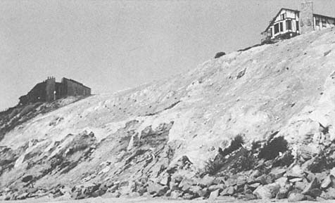
Figure 51b
May 1982 view at the same site as that in 51 a . Note that sheet plastic has been placed on
bluff face to slow erosion.
Photo : G. Kuhn.
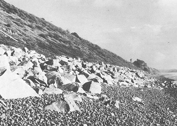
Figure 52
March 1983 view of the bluff face at Cardiff-by-the-Sea. The highway collapsed at this location in the late 1950s.
The slope was stabilized, subsurface drain pipes were installed to intercept groundwater, and the slope toe was
semiprotected by installation of riprap. Note that riprap was scattered by the high surf in various places during the
storms of January through March 1983.