Bar System Formed by Rapid Canyon Cutting and Landslides
Prior to 1978 the beaches in this area varied in width from 40 to 60 feet, with few sandbars offshore. This changed in 1978, however, when stormy weather caused extensive erosion of the bluffs and canyons, which in turn provided sediment that widened the beach by at least 40 feet and caused sandbars to form offshore. There were more storms in 1980, and eight to ten bars parallel to the shore were observed afterward. This source of sediment had not been recognized previously, nor had it figured into the sedimentary budget of this part of the littoral cell. Since at least 1950, the predominant longshore transport direction had been from north to south. Had this continued to be the case, large quantities of sediment would have been deposited on the beach in Oceanside and to the south, but since 1980 the net longshore drift has been virtually balanced (Seymore 1980–1982). After the very stormy period from January through March 1983, the beaches along this fourteen-mile stretch of coast were markedly widened and presently vary from 60 to 100 feet wide. It appears that sediment derived from erosion of bluffs and canyons, and landslides between 1978 and 1982 moved back onshore in 1983 (fig. 18).
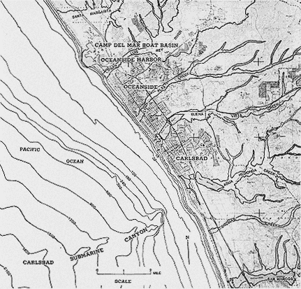
Figure 19
Location map of Santa Margarita River south through Oceanside and Carlsbad.
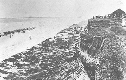
Figure 20
Summer 1885, photo looking north along the bluffs at Oceanside with the wide
beach below. Note the extensive landslide material fronting the cliffs, showing
a predominance of subaerial erosion and a lack of wave erosion.
Photo : SIO Archives, 4 July 1885.