The Faulted Coast at San Onofre and the Nuclear Power Plant
San Onofre State Park and Camp Pendleton are located in the north central portion of the Oceanside Littoral cell (fig. 12). A general idea of the character of the area is shown in figure 13, a photo taken when only the first building phase
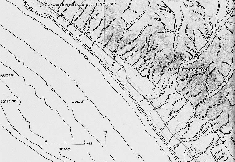
Figure 12
Location map of San Onofre State Park and Camp Pendleton.
NOTE: ocean bottom contours are in feet on this and other maps in the book.
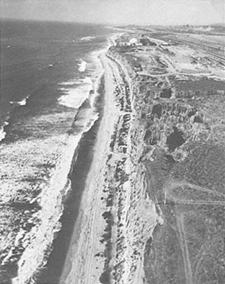
Figure 13
Oblique aerial view looking northwest at San Onofre Nuclear
Power Plant, located directly north of Camp Pendleton, 1970.
Since 1970, two additional units (nos. 2 and 3) have been built
at this nuclear power plant.
Photo : California Coastal Commission.
of the nuclear plant had been completed. The power plant is located on the coastal terrace, which is underlain by Miocene marine rock capped by Pleistocene marine and nonmarine sediments. These Pleistocene sediments are essentially horizontal and are easily eroded from the bluff face and along the canyons.
Approximately 80 percent of the cliffs between the power plant and Target Canyon six miles to the south, on Camp Pendleton, consist of landslides. The Cristianitos Fault is a major structural feature of the region and extends to within about five miles of the construction (not begun at the time of fig. 13) on the seaward side of the plant site. There is considerable difference of opinion among geologists as to the stability of the region relative to recent faulting (Converse, Davis and Assoc. 1970; Western Geophysical Co. of Amer. 1972; Fugro 1974; Hunt and Hawkins 1975; Ehlig 1977a , 1977b ; Fugro 1977; Woodward-Clyde Consultants 1978; Berggreen 1979; Greene et al. 1979; Legg and Kennedy 1979; Greene, Clarke, and Seekins 1980; Green and Kennedy 1981).
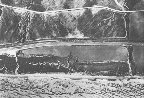
Figure 14
Vertical aerial view of the landslide of 1941 along the cliffs at Camp Pendleton, taken in 1953.
Photo : U. S. Dept. of Agriculture.