PREFACE
This guide to the natural history of the White-Inyo Range is designed to acquaint people with the anthropology, archaeology, geology, geomorphology, and meteorology of a part of eastern California and to aid in the identification of animals and plants in a region largely within Mono and Inyo counties near the California-Nevada border. Because each year more than one thousand faculty and students from universities and governmental organizations use the facilities of the University of California's White Mountain Research Station, and more than 40,000 people visit the Ancient Bristlecone Pine Forest in the White Mountains annually, it was clear to me in 1980 that there was a need for a natural history guide of the area. Experts in a variety of fields were asked to contribute to a guidebook for the White-Inyo Range; what follows is the result of their enthusiastic efforts. Those who have contributed to this guidebook wish to share with the reader and visitors to the region information that will allow for a fuller understanding and appreciation of the majesty and spirit of the beautiful White Mountains, with their local lonely areas, moonscape-like, arctic desert appearance, and dizzying heights.
The region is approximately equidistant from Los Angeles and San Francisco; east of the Sierra Nevada, the Owens Valley, and the towns of Bishop, Big Pine, Independence, and Lone Pine; and within the Inyo National Forest. The White Mountains are in the southwestern corner of the Great Basin and north of the Inyo Floristic region. This is one of the highest desert mountain ranges in North America and includes the largest expanse of rare Alpine Steppe or Tundra in the far western United States.
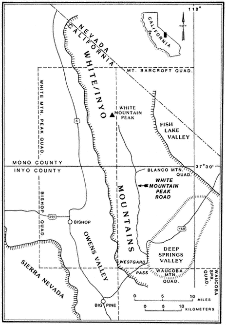
Special emphasis is given to the natural history of the general region north of Westgard Pass (Fig. I. 1). Early researchers and inhabitants of the region either referred to both the White and Inyo mountains as simply the White Mountains or called the entire range the Inyo Mountains, with general agreement that the boundary between the White and Inyo Mountains is arbitrary. A division between the White and Inyo mountains can be made on the basis of the occurrence of alpine zones in the range. The alpine zones of the White Mountains (i.e., above 9,600 ft, or 2,930 m) extend in a narrow band roughly from Westgard Pass in the south to north of Montgomery Peak in the north. However, because the range of many animals and plants and the geology of the White Mountains are not bounded or limited by Westgard Pass, but extend south of this low pass — used by students of the area to separate the White from the Inyo mountains — we have included some of the natural history of the Inyo Mountains in the guidebook. For convenience we have referred to the region included in the guidebook as the White-Inyo Range.
The White Mountains are apparently named after White Mountain Peak, and some authorities believe that White Mountain Peak was so named either because of the long-lasting snow on the sides of the peak or because of the "white dolomite" (a calcium-magnesium carbonate rock) that they believe makes up the peak. In fact,
the peak consists of reddish-brown, black, and locally white metamorphosed volcanic rocks, approximately 152 million years old, and not the sedimentary rock called dolomite; the peak is not white unless covered with snow.
The term Inyo has been translated from Paiute as "the dwelling place of a great spirit." It seems to be a fitting translation, particularly if one considers the reverence in which the region is held by laypersons, scientists, and the regional inhabitants who know and visit the White and Inyo mountains.
Over 1,000 native species and varieties of plants have been recognized in the White Mountains, and over 34,500 native species and varieties of plants are known from the Inyo Floristic region. More than 450 of the plant species in the Inyo Floristic region do not extend into the large California Floristic Province to the west, and 200 of these do not occur elsewhere in California. The flora of the White Mountains has close affinities to that of the Great Basin region and was apparently enriched during the Pleistocene (Ice Age) with many boreal (alpine) taxa (i.e., genera, species, and varieties) from the Sierra Nevada. The Inyo Floristic region includes a rich transmontane flora and is mainly distinctive owing to the flora from the high mountain ranges. Because of the unusual nature of the flora of the White-Inyo mountains, and because it is this feature of the natural history of the region that may be of greatest interest to most visitors to the region, special emphasis has been given to it in the guidebook.
The introductory section provides a brief synopsis of some elements of the history and natural history of the White-Inyo Range. It is followed by chapters on the physical setting of the region, addressing such topics as the geology, geomorphology, and meteorology. There is a section on plant communities including two chapters on plants — one on the grasses, wildflowers, and shrubs (~ 340 taxa, of the 1078 in the region, are considered) and the other on the trees (16 taxa) of the White-Inyo Range. The chapters on animals include the insects (113 taxa), fishes (4 taxa), amphibians (8 taxa), reptiles (37 taxa), birds (85 taxa), and mammals (45 taxa) of the region. The last section of the book is a chapter on the archaeology and anthropology or human occupancy of the mountains.
Because of space limitations, it is not possible to provide information on every plant or animal known in the White-Inyo Range, so only those of common occurrence that are readily identified have been included. Each account of a plant or animal states the common name and the two-part scientific name (genus and species), which is in italics. When there is more than one common name, or if a scientific name is no longer acceptable but is well entrenched in the older literature, these additional names are included. The guidebook contains descriptions of more than 650 taxa, species, subspecies, and varieties (most of which are illustrated); distribution maps; generalized geologic maps; and selected road logs.