PART THREE—
NEW MEANING FOR A NEW LAND
Chapter V—
Early Economic, Attitudinal, and Environmental Change on the Calapooia
The nineteenth-century history of the Willamette Valley is the story of the region coming under the influence of an expanding European and Euro-American economic and biological system. The settlers themselves were invaders. Furthermore, their reactions to the Willamette landscape—though partly, and importantly, modified by contact with this new land—were conditioned by cultural conventions that had originated outside the region. One way they viewed the environment was with a desire for personal gain. This attitude invited into the Willamette Valley new plants, animals, and methods of altering the land, and especially the influence of expanding regional, national, and world markets—markets that demanded agricultural and natural resources. As Willamette residents participated in these markets, the Willamette environment experienced increasing and intensified change.
Other histories have dealt extensively with the interrelated social, economic, and environmental consequences that the expanding European and Euro-American economic and biological system had on particular localities and native peoples in North America.[1] But what were the consequences for the local Euro-American population's cultural relationship with the land?
The earliest Euro-American settlers interacted with the Calapooia Valley environment on a variety of levels and in complex ways. They did not harbor the simple desire to rush off to the western wilderness to avoid the onslaught of civilization, nor did they wish to "tame the
wilderness" or even to destroy the primitive landscape. Although it is true that certain components of the landscape—for instance, wildlife and Native Americans—caused problems and could be and were controlled and even eliminated, the settling process on the Calapooia was one in which the earliest Euro-American arrivals, left to fend for themselves in a new landscape, recognized the independence of the environment and actually attempted in a number of psychological and physical ways to balance themselves with it. As a result of this balancing process settlers developed an intimate and in many ways positive relationship with the landscape.
At the same time, settlers also envisioned creating a pastoral community out of the primitive landscape of the Calapooia. But in their minds, the pastoral would not simply replace the primitive. Certainly, to the early settlers, the landscape's primitive aesthetic qualities were to play a central role in the building of their community, as would the utility that they could draw out of the land. The question they faced was one to which Wilson Blain alluded early on: could feelings for the charms of the scenery—indeed, a complex and intimate connection with the land—be reconciled with the utilitarian attitudes that his generation also harbored?
This and the following chapter assess community building in the Calapooia and ways in which the Calapooia and Willamette settlers and environment increasing became tied into broader, outside markets during the late nineteenth century. These chapters also outline some of the concomitant and subtle ways in which certain aspects of settlers' and their descendants' perceptions of the Willamette Valley landscape intensified and other aspects diminished in importance during this process. History reveals that as these people worked toward the type of community they had envisioned and were drawn into wider economic markets, their activities altered not only the original landscape but also their relationship with the land. In fact, this process led to an estrangement between themselves and the land. The course of events leading to an estrangement of the late nineteenth-century residents of the valley from the landscape did not occur in a continuous progression. But ultimately, gradually, subtly, and quietly—indeed, unbeknownst to the Calapooians—forces originating both inside and outside the valley effectively separated them from the land. Chapter 7 reveals that by the end of the nineteenth century the Calapooians had achieved a version of the
pastoral community they had initially desired to create, but the victory came with a price both they and the environment paid.
Richard Finley's Gristmill:
Landscape and Community Values
From the very commencement of settlement on the banks of the Calapooia River there existed forces within the valley itself that ultimately led to the psychological separation of Calapooia residents from the landscape. The incidents depicting this process are numerous, but the story of the construction of Richard Finley's gristmill on the falls of the Calapooia perhaps best shows these agents at work at a very early date. In this story, landscape plays a key role.
After arriving in the Oregon Country in the fall of 1845, John and Agnes Courtney wintered in the lower Willamette Valley. The following spring they traveled south and settled on the southern side of the Calapooia Valley on a small stream that now bears their name. With them came an entourage of immediate and extended family members, including their son John R. Courtney, who subsequently took up a claim of his own, just a few miles northeast of his parents. When John R. recorded his claim with the Oregon provisional government on 15 August 1846, he gave the following description: "640 acres of land in Champoeg County, situated on the Calapooigah river, above the Santyam, Commencing at an oak tree at the N.E. corner, thence running S. one mile to a stake, thence W. one mile to a stake, thence N. one mile to an oak tree marker, thence to the place of beginning. Said includes the falls of the Calapoiah and is held in personal occupancy. "[2]
For reasons that are not known, Courtney temporarily left his claim without making further improvements to it, even though the letter of the law required that a settler, to retain title to property, had "either personally [to] reside upon his claim himself, or to occupy the same by the personal residence of his tenant." Courtney did neither. But he also did not intentionally yield his rights to his land when he walked away from it. He had every reason to expect that the frontier custom of the "tomahawk claim" or "tomahawk law," long practiced in cis-Appalachia, protected his land from intruders.[3]
Because of the settlement nature of the early cis-Appalachian frontier, new arrivals there had for years abided by the tomahawk law, a
commonly recognized convention that flouted the letter of the law requiring occupation and improvement of claims. Under the tomahawk law, a settler, in order to hold his claim, had only to mark its boundaries by girdling a few trees. This practice allowed him freedom to move on to see if some other claim might suit him better. If he found no better site, he could always return to the earlier claim.[4]
Settlers carried the tomahawk law to Oregon. Men often left their families in the lower Willamette, sometimes even back in the Midwest, while they went ahead to find a suitable claim in western Oregon. Elias Keeney, for example, settled by himself on the Calapooia in 1847, headed to the gold-mining region of California in 1848, returned to his Calapooia claim in 1849, and then, in 1850, went to Missouri. When he returned to his land in the Calapooia, he brought a new family with him.[5]
On returning to their tomahawk claims, however, Willamette settlers sometimes found their lands occupied by people whom they considered "claimjumpers," but who in fact had every legal right to take up the technically abandoned land. Claim-jumping in the Willamette Valley frequently occurred during early years of settlement, particularly in the more heavily populated northern regions where poor land surveys, land frauds, dubious land sales, and speculation ran rampant. But in areas where effective government control did not exist, the community—particularly families, but also organized protective associations—generally rallied to support the first settler, as they had in cis-Appalachia.[6] A similar event, though with different results because of perceptions of the landscape's utility, occurred on Courtney's claim at the falls of the Calapooia in the late 1840s.
At about the time Courtney walked away from his claim on the falls of the Calapooia, two separate groups of families—who had become acquainted with each other during the migration of 1846—entered the northern Willamette Valley. The first group included James and Sarah Blakely of Tennessee and their five children and James's uncle Hugh and aunt Clarissa Brown, also from Tennessee, and at least five of their children. The other group comprised Alexander and Sarah Kirk with four children, their son William Riley Kirk and his wife and one son, and Alexander and Sarah's daughter Mary "Polly" (Kirk) Finley and her husband, Richard Chism Finley, and their two children, all from Tennessee, Indiana, and Missouri.[7]
On entering the Willamette Valley, the Blakely and Kirk parties headed south. The Finleys stopped on the Marys River on the west side of the Willamette, while the others went on until they reached the Calapooia. The morning after arriving, they surveyed the valley as far east as the falls on the Calapooia River (i.e., John R. Courtney's tomahawk claim) and decided that the little valley afforded them a suitable home. They proceeded to take up four contiguous claims near where the Calapooia River flows out onto the open Willamette prairies.[8]
James Blakely and Alexander Kirk found Isaac Courtney, brother of John R. Courtney, occupying the particular parcel of land they desired. Kirk had a special interest in the eastern portion of Isaac's claim because it straddled the Calapooia River at a ford where the developing pioneer wagon trail along the eastern foothills of the valley would probably lead farther into the southern Willamette and eventually to California. In acquiring such a claim, Kirk knew he could "control both banks of the river" where he would soon construct a toll ferry. Blakely later recounted that, "Mr. Kirk and I traded a yoak of oxen for . . . the parcel of land" Isaac held.[9] These apparently amicable relations with the Courtneys, however, soon soured.
With the Browns, the Blakelys, and William Riley Kirk entrenched in their claims, Alexander Kirk hired Isaac Hutchens to reside on his land while he returned with his family to the Marys River, where the Finleys had remained. It is likely that the Kirks, on reaching the Marys, related to their son-in-law Richard Finley—a miller by trade—the encouraging news about the falls they had found on the Calapooia, which locals described as "the best spot," "a fine site," and even "the only available spot" to build a gristmill.[10]
The Kirks and Finleys wintered on the Marys, but the following spring they headed for the Calapooia. At the time Finley entered the Calapooia, settlers in the southern and mid Willamette Valley had to travel as far north as the Hudson's Bay Company's mills at Oregon City to have their wheat ground into flour, a trip requiring about ten days. James Blakely later recalled that some spent as many as seventeen days taking wheat to the mill at Fort Vancouver, on the north side of the Columbia. For the ostensible reason that such travel was an inconvenience, a group of settlers headed by Blakely and Brown encouraged Finley to build a mill at the falls of the Calapooia on the site of John R. Courtney's claim.[11] Disregarding the tomahawk claim, they noted that
Courtney had gone away "without making any improvements [and] had no right to hold it," and they promised to "back Finley up in his claim at any cost." Finley wasted no time: on 22 April 1847 he was in Oregon City to have the claim legally recorded in his name with the provisional government.[12]
Finley returned to the Calapooia to begin to improve his claim. Just as he felled a tree for a footbridge across the river, John R. Courtney suddenly reappeared. Some versions of the story suggest that Courtney made threatening advances toward Finley, ordering him off his land. But Finley, ax in hand, was not to be trifled with. Courtney retreated to get reinforcements from his family, and Finley sent word to those settlers who had encouraged him to take the claim. Soon, two armed bands gathered at the disputed site. Finley's supporters included Blakely, Brown, Alexander Kirk, and possibly William Riley Kirk. The Courtney contingent comprised John B. Courtney, John R. Courtney, John Dunlap (Agnes Courtney's first husband's brother-in-law), and possibly Isaac Courtney.[13]
The traditional story holds that the Courtney clan did not want to sacrifice human life and so finally backed down. But it is very likely that the Courtneys realized that, although frontier tradition affirmed their superior moral position, they were legally in the wrong. Equally important in the Courtneys' decision to back down was their realization that the valley actually needed a gristmill. John Dunlap, in fact, calmed John B. Courtney, "who was very angry about the whole affair and was going to kill Finley," by assuring him that "Finley is all right and he will build a mill here long before you ever could." And Finley did (figure 3).[14]
Finley and his supporters saw the utilitarian significance of the landscape in this parcel of the Calapooia, and they were ready to take advantage of it. In this instance, utilitarian concern outweighed a vision of the land based on moral principles. As Finley's own daughter, Eliza, later pointed out, this event opened a social wound in the Calapooia community that took years to heal. But probably neither Eliza nor other Calapooia residents detected that this single instance of struggle between traditional morals of land claiming and the benefits of economic development—something that had occurred and would continue to occur on other parts of the western frontier—also opened a wound that slowly festered in the settler-landscape relationship on the Calapooia.[15]
Figure 3.
Richard Chism Finley's gristmill, ca. 1940. The flood of 1861 destroyed Finley's
first mill, built 1847–48. On the same site, the falls of the Calapooia River, Finley
immediately constructed this second mill, which the McKercher family purchased
about 1890. Courtesy of the Oregon Historical Society, Portland
(negative number ORHI 0029-P317).
Gold Rush, Livestock, and Environment
The influence of the California gold rush on the economic development of the Calapooia illustrates that forces that affected the settlers' relationship to the landscape also originated outside the valley. The gold rush also had a profound impact on the ecological balance of the valley. When Euro-Americans came to the Calapooia in 1846, the residents of the middle and northern Willamette Valley, with a longer settlement tradition there, had already developed a very limited market economy, though agriculture remained at or barely above the subsistence level. These settlers depended on the Hudson's Bay Company for some consumer goods and marketing outlets until the late 1840s. Limited access to outside markets and to hard currency kept the Willamette Valley economy in a state of virtual depression until the stimulus of the Cali-
fornia gold rush in 1849. In response to the depressed economy, in 1845 the provisional government even made wheat legal tender, though valley residents had been paying debts in kind—wheat and shingles—for several years. The worst of the depression came in 1847–48, when a surplus of wheat brought low prices.[16]
Although the older settlement in the northern Willamette Valley marketed some wheat through the Hudson's Bay Company—in the early 1830s the company already had a grain receiving station near Willamette Falls—settlers of the Calapooia had little opportunity to participate in the fledgling market economy for two principal reasons. First, the Calapooia in the late 1840s was a young settlement, and pioneers just arriving there occupied themselves primarily with building homes and clearing land. Second, the southern Willamette Valley simply lacked adequate transportation to the few outlets that existed. Therefore, the agricultural production that southern Willamette Valley settlers engaged in remained at subsistence levels. Thomas Kendall, who observed the settling process from his claim on the Calapooia, noted in 1852, "Our emigrants often hurry in a crop after they arrive, with as little preparation as possible, in order to bread them the following year; others attempt nothing more than to raise a sufficiency for their own use—and the very facility with which grain is produced leads to habits of careless cultivation." The 1850 census lends statistical support to Kendall's observation. Of the thirty-four Calapooia farms in the census, eighteen produced a total of only 2,265 bushcls of wheat, and two farms produced seventy pounds of oats. Most people subsisted on potatoes, swine, and wild game.[17]
Because there was no developed market economy, hard currency remained scarce in the Calapooia. The plight of James McHargue is a case in point. He settled on the Calapooia with his family in 1847, paying his last twenty-dollar gold piece for squatters' rights to a land claim. Now poverty stricken, the McHargues could only borrow flour from their neighbor Jonathan Keeney, who, after sizing up McHargue as "an impecunious young man from whom he could never hope to collect the loan," gave his new neighbor some of the poorest flour that he had. McHargue sowed about twenty acres of wheat that year and, according to an admiring descendant, surprised Keeney by paying him back in wheat twice that which he had borrowed. On another occasion, Clarissa Brown tailored a buckskin suit for McHargue, who paid for it with a pig.[18]
Some cash- and possession-poor arrivals like James McHargue found employment at Finley's gristmill. Of course, some of the settlers had either a more direct stake in the valley's economic prosperity or familial connections to the Finleys, or both, and thus donated their time and energy to mill construction. James Blakely, for instance, "hewed the timber free" for the mill, and Riley Kirk resided with his sister and brother-in-law for days at a time while he worked on the mill. But others in the valley, like the newly arrived McHargue, needed paying employment, and some received it from Finley. Unable to pay his workers in hard currency at first, however, Finley probably partially compensated them in kind, though he also ran up quite a debt.[19]
Just as Finley completed his mill in 1848, news of the gold strike in California came to the Willamette Valley. Being "so much in debt in building the mill" and wishing "to find a quick way to repay what he owed," the very day he ground the first flour, "he got on a horse and rode away to the California mines." From California, he sent gold to his wife, who "never kept the dust in her possession a moment longer than was necessary. Whenever she received a shipment . . . she would notify all the people about to come and present their bills. Upon the stated day, she would portion out the dust in equable portions as long as it lasted." Other locals also went to California and brought back gold with them. For instance, Elias Keeney went to California in 1849 and reportedly came back with fifteen thousand dollars in gold. But it was through the gristmill that settlers first exchanged gold in the fledgling local economy.[20]
Although the Calapooia community as a whole occupied itself with subsistence crop cultivation, a few other early settlers moved to establish local industrial and commercial enterprises. At the opposite end of the valley from son-in-law Finley, Alexander Kirk built a winter ferry across the Calapooia in 1846–47. Kirk located his ferry at the strategic spot where the river flows out of the foothills and onto the open plains of the Willamette. Because the floor of Willamette Valley was water-soaked through much the year, early travelers stayed along the base of the well-drained foothills bordering the valley. With his strategic position on the Calapooia, right where the road descends the foothills to ford the river, Kirk captured the profitable business provided by traffic moving into the southern Willamette Valley, and even on to California, as well as that coming to the Calapooia to deal at Finley's gristmill. By 1853 the Linn County court was allowing Kirk to charge "for wagon &
span of horses or yoke of cattle fifty cents, for each additional span of horses or yoke of cattle 12 1/2, man & horse 25 cents footman 10 cents lumber 100 ft 8 cents horse with packs 12 1/2 cents." Kirk probably had no real worry about losing his monopoly on traffic, but in 1848 he made sure to have himself appointed one of the two viewers for the official "Territorial Road," which he subsequently surveyed from Oregon City "to the crossing of the Calapooa at A. Kirks." With the Kirk-Finley economic axis firmly established, development continued in the valley. Kirk built an inn on his claim, and in 1850 Hugh Brown and James Blakely built a store on the road that traversed Blakely's claim between Kirk's and Finley's enterprises. In addition, small sawmills in the Calapooia flourished as increasing numbers of new settlers came to the southern Willamette. John Courtney built a mill on Courtney Creek soon after claiming land there in 1846; William T. Templeton built a sawmill on the Calapooia in 1850; Richard Finley built one in 1852; and Philemon Vawter Crawford did likewise in 1854.[21]
The stimulus of the California gold rush ended the depression in the Willamette and settlers' dependence on the Hudson's Bay Company for markets. For these reasons, historians have viewed the gold rush as a crucial turning point in the economic development of the Pacific Northwest. But while the gold rush called for greater production, stimulating trade, sawmills, and gristmills in some parts of the Willamette Valley, it limited development in the south. As Wilson Blain, whose house sat along the road leading south out of the Calapooia, noted, "Men bound to the gold mines are passing our door almost hourly for some weeks past; so that I should suppose the male population below this place must be pretty much gone to the far famed gold fields." Estimates indicate that two-thirds of the Willamette Valley's able-bodied men went to California, leaving not only unharvested wheat in the fields but also the limited labor of wives and children to look after farms. Because settlers arrived on the Calapooia precisely as the gold rush began, they had time only to claim land, make a few improvements, and perhaps sow a few acres to wheat before heading off to California. Thus, the more labor-intensive endeavor of large-scale agricultural production did not occur in the Calapooia at this early date.[22]
Other differences between development in the northern and southern Willamette Valley that the gold rush engendered are accounted for by the fact that in the north, with access to the confluence of the Willamette and Columbia rivers, settlers could more readily ship lumber to
California. Also, because of longer settlement history in the north, agriculture was more advanced there by the time of the gold rush. Those who remained in the northern valley reaped benefits as California markets demanded produce and timber. By contrast, in the southern Willamette, which had few roads and faced seasonally waterlogged prairies, lumber production remained local, and most other goods could not be shipped.[23]
In the southern Willamette Valley, then, still newly settled, far from markets, and suffering transportation deficiencies, the gold rush limited development, especially agricultural. Instead, remaining male settlers, or women and children left behind, found it easier to raise livestock, particularly cattle but also swine, which could walk themselves to the markets the gold rush generated. By the late 1850s, valley residents were herding up to twenty thousand cattle a year to California. In Linn County in 1850, the census taker counted 4,619 cattle, or almost five head per settler. Of the abundance of cattle, Benjamin Freeland commented that it looked like there "are as maney cattel in origen as . . . in the states but it owen to the hevery Emmegration and the deamand in the gold reigon and the heavy demand in Califo[rnia] for all kinds of produce."[24]
Thus, the southern Willamette Valley did slowly begin to participate in the expanding markets that accompanied the gold rush; however, because of the southern valley's poor transportation, limited labor supply, and recent settlement, the gold rush kept the region's agricultural practices at a subsistence level. In the Calapooia Valley in 1850, 219 people lived on thirty-four farms. They herded 522 cattle (more than fifteen per farm) but produced only 2,265 bushels of wheat, which works out to roughly two bushels of flour per person for the entire year. Fifteen farms produced no wheat, five farms had not a single acre of improved land, and the average amount of improved land (which the census took to include grazing and fallow lands) per farm was about twenty-six acres.[25] These statistics show that subsistence (perhaps even below subsistence) agricultural conditions dominated the economy of the Calapooia in 1850 at the peak of the gold rush.
The gold rushes and conditions of transportation, then, impeded large-scale commercial agricultural production in the southern Willamette Valley, but they also led to the growth of an enormous cattle industry. Increasing numbers of settlers spurred the growth of fledgling manufactories. The cattle industry and local sawmills and gristmills broke the Calapooia settlement's ties to complete economic self-sufficiency. Yet
this new market economy remained not yet fully developed. Freeland noted that "all kinds of produce" were in demand in California, and neighbor Fielding Lewis commented that "times is good and brisk here," but neither suggested that a market economy was fully developed. In fact, at about the same time Blain noted in a letter that "though the natural facilities are good, and merchandize of every description is abundant in consequence of money occasioned by our vicinity to the gold mines, markets, in the sense of exchanging agricultural products for merchandize, have almost no existence."[26] In other words, while Calapooians could sell produce more readily during the gold rush years, in the early 1850s they still did not benefit from a fully developed market economy.
Only in the late 1850s did wheat production pick up and allow for the expansion of gristmills on the Calapooia and elsewhere in the southern Willamette Valley. At that time, Richard Finley and Philemon Crawford, more readily able to conduct business with the influx of hard currency, built the Boston Flour Mill on the lower Calapooia. John A. Crawford, who had an interest in the mill, carried on a trade beyond the valley itself, for he shipped flour to the California gold mines by pack trains, each trip netting him one thousand dollars.[27] Thus, in the late 1850s, demand for lumber, distant (albeit limited) demand for flour, and the influx of California gold all induced the growth of a fledgling market economy in the southern Willamette Valley.
The livestock trade, particularly in cattle, gave the Calapooians and other southern Willamette Valley settlers their greatest access to the California markets during early years. As noted in chapter 3, the Willamette Valley's environment suited it ideally to the raising of both cattle and swine. The great demand for livestock in the gold regions, their ability to walk to market on their own, and the relatively little care they needed in the valley environment made them a good item of trade, particularly for the Calapooia and southern Willamette Valleys, where large numbers of cattle were herded (table 2).
The livestock trade dominated the local economy and at the same time changed the ecology of the Willamette and intensified certain aspects of the Calapooian's attitude to the landscape. Livestock seriously affected the "natural history" of the Calapooia and Willamette grasslands. Shrub invasion of the prairies largely resulted from the cessation of burning (discussed in greater detail in chapter 6) as white settlement commenced and the Kalapuya disappeared, but cattle also destroyed
| |||||||||||||||||||||||||||||||||||||||||||||||||||||||||||||||||||||||||||||||||||||||||||||||||||||||||||||||||||||||
tempting native grasses, such as Festuca idahoensis , which has a low resistance to grazing, and left alone unpalatable shrubs, both native and newly introduced. The plant ecologists William Moir and Peter Mika have argued that the complete story of grazing effects on the Willamette prairies remains unknown and probably unanswerable. But they also note that a combination of grazing and agriculture did have serious consequences for native vegetation. By 1919 perhaps as much as 52 percent of the 106 species of grass in one study area had been introduced in the sixty years after settlement. As early as 1872, one viewer of the southern Willamette Valley commented on the stock owners' "indiscriminate pasturing" of large cattle herds on the prairies during the gold rush and stated that it "injured the grasses and reduced them to shorter growth." Just twenty years earlier a Calapooia settler had noted the "nutritive qualities" of the prairie grass as "unsurpassed by any species of grass throughout the world."[28]
Cattle and swine disturbed the natural environment of the Calapooia and Willamette, and they also influenced the settlers' view of the landscape. Although utilitarian concerns for the Calapooia landscape had always been present, they had also been intertwined with the valley's aesthetic qualities, but this attitude soon began to change. During the 1850s and early 1860s, both Calapooians and other Willamette Valley settlers raced to exploit the prairies, grazing tens of thousands of cattle on them. Profit far outweighed any aesthetic or symbolic value of the prairies as valley residents realized the utility of the landscape and the profit to be had by participating in regional markets. In a series of petitions, settlers from Linn and Lane counties, the two southern Willamette Valley counties with the largest open prairie lands, voiced a new concern for the landscape when they complained about problems associated with cattle grazing during the mid 1850s. The inhabitants of both counties expressed annoyance with "wealthy men resident Among us . . . [and] wealthy men who reside on other localities" who leave "their cattle & other stock to run at large on the grass land of others" who had no livestock and lacked the resources to fence their claims. Petitioners complained of these cattle's "viscious & wild habits" because they attacked and wounded citizens and in some instances prevented children from attending school, but the heart of their message dealt with economic concerns. Linn County residents stated specifically that "the Grazing facilities of our Country are one of her Chief sources of wealth and prosperity, and that if proper care were observed the Great natural Meadows . . . would continue to be a source of incalculable advantage to her Citizens." To southern Willamette Valley inhabitants it appeared that the problem resulted from "the rich " taking advantage of "the poor ." As a solution, they asked that a law be passed apportioning the "number of Animals that may be allowed to run at large to a given number of acres."[29]
Marauding swine proved no less a problem to the environment and amicable social relations than did hordes of loose cattle. Hogs plundered the valley's great expanse of camas. Early Willamette settler John Minto wrote, "Swine . . . were the chief destroyers of the roots which were the chief foods of the natives." Swine caused social tensions as well. In 1856–57 more than seventy-five Linn County residents, many of them Calapooia settlers, petitioned the territorial government "to enact some law to prevent swine from running at large and that all persons keeping swine be compelled to keep the same upon their own
land." One of these petitioners was Robert W. Elder, whose claim lay along the lower Calapooia. At the same time that this petition was circulating, thirty-two other settlers drew up a counterplea stating that "a Law passed at the present time compelling people to keep up their hogs would be a great damage to many citizens." When Americus Savage, whose land claim bordered Elder's immediately to the north, became the first signer of this counterpetition, the stage was formally set for a personal quarrel.[30]
In retaliation for Savage's hogs constantly invading his gardens, one evening Elder marched over to Savage's home, which sat atop a small butte, and angrily knocked on the door. When Savage answered, Elder temporarily stunned him with a slingshot whose projectile was made of lead formed in the shape of an S. Whether the S stood for "Savage" or "swine" or both, we can only guess. But gathering his senses, Savage made his way to a pile of fir poles near his house. Grabbing one, he beat Elder all the way down the side of the butte. Because of the proximity of the small town of Boston, locals later referred to this fight as the "Battle of Bunker Hill."[31] Probably none realized at the time how the underlying causes of this battle fit into the ecological revolution then occurring on the banks of the Calapooia.
Once residents began to realize the utility of the prairies whose primitive and pastoral beauty they had at one time praised so gloriously, the meaning of these grasslands changed. Rather than a vision of beauty, or even an idyllic natural garden where prosperity and a pastoral community could be attained, the southern Willamette and Calapooia prairies became a battlefield on which the settlers waged economic warfare.
To combat unruly livestock, settlers had to enclose their land, especially since the provisional and territorial government laws left the legal burden on those who wanted to protect their property. The provisional government early on wrote into law meticulous specifications for building fences: "strong worm fence . . . locked at each joint, five feet in height, . . . or a hedge two feet high, or a sod fence three feet high, with a ditch on each side three feet wide and three feet deep, or a stone fence four feet high."[32]
By the mid 1850s, settlers had enclosed much of the Calapooia landscape. R.S. Williamson, railroad surveyor for the United States, traversed the base of the Calapooia foothills on 5 October 1855, remarking in his journal, "The road today was excellent, but greatly interrupted by fences." The open plains of the valley became so broken up with land-
claim fences already built during the early years that James Ayers commented, "If a man wished to cross the valley, there was no way to go except through the farms, opening gates as he came to each line fence." And, of course, fencing continued in the Calapooia for decades. Thus, when Calapooia resident William Templeton related the following in 1879 about the activities of his sons, he outlined some of the most important forces at work on the valley's landscape. He wrote that his sons "have got all their fence posts Drove they are going to make fence between them and Hugh Fields and Galbraith and on this side of the lane down from the orchard."[33]
The open-range cattle industry in the Willamette Valley declined during the 1860s, largely because of fencing and the diminution of demand from California as the gold strike played out there and other sources of cattle became available. In addition, the new mining strikes that occurred in eastern Oregon and Idaho in the same decade drew the Pacific Northwest cattle industry east of the Cascade Mountains, to the arid and semiarid Columbia Valley and Great Basin. There, cattlemen had access to wide-open ranges where their herds could roam at large. Despite this important shift in economy for western Oregon, the number of cattle—beef, milk, and work oxen—in the Willamette fluctuated greatly through the end of the nineteenth century: from 93,094 in 1860 to 45,692 in 1870, and back up to 73,970 in 1890.[34]
The relative economic importance of cattle declined, however, as the basis of the Willamette Valley agricultural economy changed. By 1870 wheat had finally become the single most important crop in the Willamette (though oats were important as well), and it remained so through the end of the nineteenth century.[35] The following chapter details this later shift in the economy, other commercial developments, and the accompanying environmental and perceptual changes of landscape in the Calapooia and Willamette for the remainder of the nineteenth century.
Chapter VI—
Changes in Landscape, Changes in Meaning: Settling the Calapooia Plains
During the late 1840s and early 1850s, the few commodities that southern Willamette Valley settlers had for sale were vended locally, herded to trade centers, or, in some few cases, carried in wagons to the navigable Willamette River and drifted downstream in flatboats and canoes to market. In the late 1840s, for instance, John McCoy in west Linn County built a dugout canoe to carry up to two thousand pounds of bacon from his farm to Oregon City, one hundred or so miles down the Willamette River.[1]
More advanced forms of transportation soon provided southern Willamette Valley settlers greater access to markets. In the early 1850s steamboats began running on the Willamette River. In 1856 the James Clinton became the first steamer to navigate the Willamette all the way from Oregon City to Eugene, and boats such as the Multnomah carried up to fifteen hundred bushels of wheat down the river at a time. Steamboat traffic on the upper Willamette River reached its peak in the 1860s and 1870s.[2]
The Calapooia's small size, and the fact that debris cluttered it, made it inaccessible to steamers, flatboats, and even canoes. But residents who lived along the foothills of the valley—distant from the Willamette River—did not completely have to fend for themselves. The Linn County government, for instance, aided Calapooians when it commissioned the construction of roads to them from the Willamette River. On 9 April 1852 the County Court "ordered that the Road from
Albany [on the Willamette] to Finley Mill be established, recorded and opened."[3]
Coinciding with the extension of improved roads and the steamboat into the southern Willamette Valley, farmers increased agricultural production, especially wheat. In 1868, when the first direct shipment of wheat from Portland to Europe occurred, Linn County produced 388,336 bushels. The production of oats (used primarily for farm animal feed) outstripped wheat, with 596,790 bushels produced during the same year. A year later Linn County production of wheat increased to 479,294 bushels, while the oat harvest dropped slightly to 519,694 bushels.[4]
When the railroad finally arrived in the southern Willamette Valley in 1870, it provided quicker and easier connections to national and international markets and had a number of ramifications for Linn County. Steamboat transportation on the Willamette declined in importance to the point of abandonment, and pioneer farming finally gave way to commercial agriculture. Within five years of the railroad's entrance into Linn County in 1870–71, wheat production had risen to 998,626 bushels, an increase of over 250 percent in seven years (table 3).[5]
During this time, southern Willamette residents realized the potential of the formerly avoided open prairies of the valley floor. The valley floor became the principal producer of agricultural crops for expanding markets. For reasons of convenience, the earliest settlers located their claims along the foothill periphery—for instance, the Calapooia—of the southern Willamette Valley and used the open prairies primarily for livestock grazing. Later arrivals, finding the best lands taken, had to claim land on the floor of the valley. Map 3 depicts the gradual movement of claims from the foothills out onto the Willamette Valley floor adjacent to the Calapooia Valley, and table 4 shows the increased area of farmland in the Calapooia, Linn County, and the Willamette for the period 1870–90.
Improved transportation, technology, and commerce reversed the economic importance of foothills and plains. In the process, these factors, as well as a whole set of related factors that allowed new settlers to make the plains profitable, also caused environmental changes in the Willamette Valley and encouraged the loss of the early, intimate relationship with the landscape that earliest settlers originally experienced. Part of the estrangement of people from the land came through new ways of
| ||||||||||||||||||||||||||||||||||||||||||||||||||||
| ||||||||||||||||||||||||||||||||||||||||||||||||
claiming the land provided in the United States Donation Land Claim Act, which guided the settlement of the plains.
Donation Land Law and the Federal Survey:
Claiming the Prairie Plains
The federal Donation Land Law, more popularly known as the Donation Land Claim Act (DLCA) provided land for males who (1) were white or half white and half Native American, (2) were at least eighteen years of age by 1 December 1850, (3) were either residents of the territory or to become such by 1 December 1851, (4) had cultivated their claims and lived on them for four years, and (5) were either United States citizens or to become such by 1 December 1851. If a settler met these qualifications, he could claim 320 ares (a half section) if single, and 640 acres (a full section) if married. The additional 320 acres were to be held in the wife's name, which made the DLCA the first federal land law granting title to women, albeit only through their relationship to men. The DLCA also allowed widows to take out claims if their husbands would have met the requirements for a claim if they had lived. For example, Elizabeth Ritchey, who settled on the Calapooia on 11 October 1853, benefited from this allowance. Her husband died in Iowa just as he was preparing to move to Oregon. He had even "obtained several waggons and teams for the purpose of going to Oregon that Season." After his death, Elizabeth determined to journey to Oregon anyway. On arrival, she received a land claim in her own name near the Calapooia River. Furthermore, the DLCA granted to male settlers who arrived after 1 December 1850 but before 1 December 1853, 160 acres if single and 320 if married. The act also required these later arrivals to live on the land and cultivate it for four years before receiving official title. In 1853 and 1854 Congress passed amendments to the DLCA. These amendments (1) commuted residency requirements on the land to two years if the claimants paid $1.25 per acre for their land, (2) allowed claimants to sell their rights to the land before receiving patents, and (3) extended the DLCA to 1 December 1855.[6]
This federal land act also provided for a surveyor general's office. The surveyor general's tasks included administering the DLCA, settling land disputes, and, most important for our discussion, establishing the township-range, thirty-six-section cadastral system in the Willamette Valley and making sure that new claims adhered to it. Section 6 of the
act delineated how land claims would be taken in reference to the cadastral survey:
In all cases it shall be a compact form; and where it is practicable so to do, the land so claimed shall be taken as nearly as practicable by legal subdivisions; but where that cannot be done, it shall be the duty of the said surveyor general to survey and mark each claim with the boundaries as claimed. . . . Provided , that after the first of December next [1850], all claims shall be bounded by lines running east and west, and north and south: And provided further , That after the survey is made, all claims shall be made in conformity to the same, and in compact form.[7]
The United States government adopted the DLCA and the federal survey at the very time that land claiming along the southern Willamette Valley foothills had pretty much ended and settlement of the plains was just beginning. Subtle but important differences existed, then, between claiming the plains and claiming the foothills. As previously discussed, earlier Oregon provisional and territorial laws governing the claiming of land allowed a certain flexibility when it came to accommodating the configuration of the landscape. The earlier method of survey—the use of natural markers—encouraged an intimacy between the settler and the landscape. Although settlers had to take claims, after June 1844, in square or oblong form, provisional government laws did not bind them to the cardinal points of the compass when positioning their claims on the idiosyncratic landscape. This older process, as explained in chapter 3, governed the claiming of the Calapooia foothills.
Based on the rational survey system initiated in the Northwest Ordinances of the 1780s, the Oregon Donation Land Law laid the groundwork not only for the way land claims would be taken out in the Oregon Territory after 1 December 1850 (and thus largely on the plains of the southern Willamette) but also prescribed abstract principles for claiming a landscape that quite naturally had little semblance to rational order. The taking of land in square form and in legal subdivisions, bounded by lines perpendicular and parallel to the (far distant) magnetic north, effectively terminated the older land-claiming process in which humans worked directly with topography. Settlers thereafter no longer had the choice of how and where to lay out a claim with reference to the idiosyncracies of the local landscape. The imposition of the Donation Land Law and survey culminated a process, initiated by provisional government laws requiring claims to be in rectangular form, that assisted in estranging post-1850 Calapooia settlers and other Willam-
ette Valley inhabitants from the land—particularly the land on the plains.
The government no longer accepted ash trees entwined at the roots, swales, creeks, and blazes on oaks as sufficient markers for land-claim boundaries. Rather, abstract numbers that had no relation to the landscape defined a claim's dimensions. Thomas Wilcox, who took a claim on the plains bordering the Calapooia on 10 November 1853, now knew his land as the southeast quarter of section 15, township 13 south, range 3 west; the south half of the northeast quarter of section 15, township 13 south, range 3 west; and the south half of the northwest quarter of section 15, township 13 south, range 3 west. And Wilcox and others like him had no leeway to arrange their claims on the land in the way they wanted.[8]
The new land law also affected older residents of the Calapooia. The government did allow the earlier claims to remain in their original configuration, though they had to be resurveyed and defined accordingly. Thus, the boundaries of Agnes Courtney's claim, which she originally knew as a "creek," several "white oaks," a "white fir," and "a fir on the mountain," now became a jumble of numbers that had little to do with the nature of the land that she and her husband originally settled: "Beginning 18.25 chains west of the southeast corner of the southwest quarter of section sixteen in township fourteen south range two west. Thence south 8 degrees, 15 feet west, 18.06 chains; south 81 degrees, 45 feet east, 41.27 chains; north 8 degrees, 15' east, 8.26 chains, south 81 degrees, 45 feet east, 39.03 chains."[9]
Imposing a geometric survey on an earlier system that had both complied with the local landscape and used natural features as markers ultimately led to innumerable disputes among the settlers. Henry H. Spalding's Donation Land Claim file reveals that after the surveyor completed his task in the Calapooia Valley, Spalding contested boundaries with James Blakely, John Findley, William R. Kirk, and William Glass—all but one of whom had taken land before the completion of the survey. The problem was resolved only when Spalding relinquished all disputed land to the men who claimed it.[10]
The survey left land in dispute throughout the Willamette Valley. James Andrews in Polk County, for instance, disputed with several neighbors, especially a Mr. Goff. Andrews alerted the surveyor general to Goff's claim and warned that if Goff tried to prove up on it, he was going to "have a mery time of it." Confusion engendered by the survey
in the Willamette went beyond neighborhood quarrels. In some cases the entire land-claiming process simply broke down. In the French Prairie region of the northern Willamette Valley, for instance, where the early French-Canadians claimed land in odd patterns reminiscent of the manorial system, settler S. D. snowden in 1853 had difficulty applying straight lines to the claim he wanted to take in the same vicinity. He complained that the French-Canadians seldom used "a straight line between the corners" of their claims and thus he was "at a loss how to comply with the instructions by running a line straight from the corner stake to corner stake." But Calapooian Joseph L. Evans best summed up the problem with the survey when he wrote to Surveyor General John B. Preston, "There is something going on in our County that I Doe not understand."[11]
Even as late as 1895, the survey caused problems. When Fannie Adams Cooper's parents took up a homestead on some unclaimed land in the upper Calapooia next to Frank Malone's presurvey Donation Land Claim, they made the usual improvements to their homestead, building a home and barn and planting a garden. After Malone died and his estate was settled, officials discovered that all boundary lines in the vicinity were incorrect. Not only did the Adams family find that their garden and barn were now on a neighbor's property, but they eventually lost their entire claim.[12]
In the transition from an intimate system of land claiming to an abstract system of laws to guide human activities on the landscape, both individual families, like the Coopers, and clusters of neighbors, like Spalding, Kirk, Blakely, and Glass, all encountered difficulties. At the same time, Calapooia residents began to lose their initially close relationship with the landscape. People like Calapooia settler Agnes Courtney, for example, no longer dealt with their parcels of the landscape purely in terms of its features. Rather, they now spoke of the landscape in terms of numbers, chains, links, degrees, townships, ranges, and sections. More important, rather than the exigencies of the landscape, township, range, and section lines on a governmental surveyor's map determined new claim boundaries. Changing attitudes toward the land that the DLCA and cadastral survey encouraged are exemplified in the experience of Jared Fox in the northern Willamette Valley in 1853. Fox had recently immigrated from Wisconsin, a state whose settlement the cadastral survey directed and which had thus conditioned his interpretation of the landscape. On 14 March he viewed the Tualatin plains,
settled long before the cadastral survey, and asserted that they appeared "in some respects the most like live of any I have seen, good faced, well fenced & a few tolerable buildings but too many sloughs, too much clay, & they have taken their claims in any possible shape so as to take a nook of timber or prairie, which spoiled the looks of the whole."[13]
Although the DLCA and the cadastral survey helped sunder an older, more intimate relationship between humans and the land in the Willamette Valley, the former also, in a few key ways, inhibited change in the Calapooia and Willamette Valleys. Because the parcels of land the DLCA granted were so large—up to a square mile to a husband and wife—claimants found it difficult to "improve" and cultivate their entire property. At the same time, the DLCA prohibited a claimant from selling off smaller parcels to other potential cultivators for several years until the claim had been "proved-up."[14] Thus, the DLCA preserved vast expanses of the valley in a nearly natural state. Table 5 shows the amount of farmland in an unimproved state in the Calapooia, Linn County, and the Willamette Valley between 1860 and 1890.
According to historians Dorothy O. Johansen and Charles M. Gates, the huge size of the land grants, in addition to leaving a large percentage of the valley in an unimproved state, impeded the growth of towns and the diversification of occupation, industry, and crops. Nineteenth-century critics roundly denounced the DLCA for its generosity with land and thus the negative effects it had on the valley economy. As late as 1874, L. B. Judson outlined in a letter to the editor of Willamette Farmer the multifaceted problem that large land holdings created. He first blamed the large land holdings for the lack of population growth and economic development in the Willamette Valley. He especially chided large landholders who lived "in towns and cities enjoying the advantages of city schools and city privileges . . . while they leave the country in which their land lies, in a state of wilderness." Because of the limited economic diversity in the Willamette Valley, Judson noted that farmers who did live on their land and were forced to "make mixed husbandry a means of support, cannot . . . afford to divide their land and sell off a part and confine themselves to small places; in fact under the present state of affairs . . . [this] farmer feels the need of room."[15]
Proposed theories explaining slow development of the economy and its relationship to large land claims in the Willamette Valley varied. E. Ingersoll, writing in 1882 for Harper's New Monthly Magazine , suggested that the problem lay with the character of the DLCA claimants.
| |||||||||||||||||||||||||||||||||||||||||||||||||||||||||
Although Ingersoll noted the beneficial effects of the DLCA—for example, promoting initial migration to the Willamette Valley—the problem remained that those who migrated and took up land were, in Ingersoll's mind, predominantly "vagabond farmers" from the upper South. "They were poor, also, in the sense of having little money, and this helplessness, added to their thriftless habits, made their possession of the land a misfortune to the State." Ingersoll expressed a prejudiced view, for though he was thankful that these "loungers" had declined in influence, he was equally happy that their children, who had taken over farming the Willamette and were apparently a "better class," had also "lost their drawl of speech and action."[16]
Opinions such as Ingersoll's about the character of the upper South
pioneer, whether right or wrong, had dogged these people across the American frontier all the way to the Pacific Northwest. But regardless of the character of those who settled in the Willamette Valley, the large land claims of the DLCA and their legacy for development were facts of nineteenth-century life in the Willamette. Claim sizes, indicated by the change in farm size, decreased very slowly through the end of the nineteenth century on the Calapooia, in Linn County, and in the Willamette Valley in general. The original 174 claims taken on the Calapooia averaged 352 acres. The 58 farms enumerated in the 1870 agricultural census averaged 455 acres apiece. By 1880, the 209 farms listed in the agricultural census had dropped to an average of 286 acres each. Table 4 more clearly shows the trend in farm sizes through the latter part of the nineteenth century. Therefore, as already discussed and as table 5 demonstrates, large areas of the valley remained uncultivated.
Environmental Change
The DLCA had a paradoxical effect on the valley. On the one hand, it led to apparent economic stagnation, which troubled many residents. On the other hand, it preserved large amounts of land in what a casual observer might call "a state of wilderness," leaving the valley with an aesthetic appeal that defied economic valuation. Thus, when Frances Fuller Victor examined the Willamette Valley in 1872, she wrote: "Although most of the open or prairie land in Western Oregon is owned by donation claimants, locators, and others, comparatively little of it is cultivated. The uncultivated prairie lands, together with the half-wooded bench lands of the foot-hills, make a large extent of country still in its primeval condition." Victor declared that such a scene left her with a feeling of "romantic freedom."[17]
Both the process of claiming the prairie and leaving parts of it "untouched" had effects not as environmentally benign as might have appeared to Victor. First, to settle on and cultivate the level prairie lands, new settlers had to drain them. Albert Waggoner, who grew up on the Calapooia, remembered, "This valley was too wet for much farming just at first. Later, when drains had been opened up and the sloughs drained wheat farming became all important." Commenting on drainage techniques of Calapooia farmers on the flat plains of the Willamette in 1877, a correspondent for Willamette Farmer wrote: "the country is flat, but the farmers have an easy-going way of ditching. . . . They plow
a few furrows in the center of the sloughs, and by just waiting the winter rains do the balance. I saw a few drains made in this way that were seven or eight feet wide and three feet deep, which were used as main drains into which were run one or two furrows at right angles, and this slow draining has enhanced the value of the land very much."[18]
Nineteenth-century Willamette Valley inhabitants recognized that although such ditching might not necessarily be the best way to drain lands, it did remain the most popular, for the more effective underground tiling system proved too expensive and labor-intensive. Thus, when Calapooian William T. Templeton reported the progress his sons had made in ditching during the winter of 1878–79, he related the more typical story: "The boys have been Ditching a good eale this winter but are pretty near through they have Diched down the slough back of the barn and change the water from rinning by the old Tobacco house it is all Down flat." Sarah Cornett, who lived on the level plains of the Willamette along the lower Calapooia in the 1880s, also made notes about the progress her son "J" and husband John made in ditching. For five consecutive days at the end of March 1883, for instance, Cornett noted that "J ditched today," "J ditched some," "J ditched all day," "John ditched this eveneing," "J ditched," and "J ditched." Sunday, a day of rest, intervened, but on Monday, 2 April, "J ditched in afternoon."[19]
The drainage of prairie lands had a deleterious effect on the environment. George Van Winkle staked his land claim on a series of sloughs that stretched along the Calapooia River on the plains of the Willamette, where concentrated a multitude of ducks, geese, cranes, snipes, and aquatic mammals. He and other nearby farmers opened furrows between these sloughs, and "the running water cut deeper until the sloughs and lakes became a connected stream" and drained away. Once the habitat vanished, so did the animals. At least one early resident made the connection between these two events: "The draining of the lakes and swamps have all had much to do with their [birds and animals] disappearance." Another Calapooia resident noted in later years, "The geese and ducks are almost gone from the valley. . . . It has not all been from shooting, however. The draining of the lakes and swamps have had much to do with their disappearance." And early settler John Minto noted the effect of land drainage on the Willamette, which "has largely ceased to be the home of the crane, curlew, gray plover, and even the snipe, as well as the beaver, muskrat and wild duck. These damp-
land and water fowls and animals, which once found here their breeding places, have gone forever, unless farmers in the near future construct artificial fish ponds, and reservoirs for irrigation when needed."[20]
Although the uncultivated lands might signify a wilderness condition to some, as they did to Francis Fuller Victor, or a stagnation in the economy to others, such as L. B. Judson, the natural history of these lands continued to change. The forces of environmental succession naturally converted the untouched Willamette grasslands into forests. With cessation of Kalapuya burning, the effects of livestock grazing, and parts of the prairie lying idle, shrubs and trees quickly colonized the uncultivated lands. In some instances, shrubs and seedlings appeared very quickly after the demise of the Kalapuya and the onset of European-style agriculture. Already in the early 1840s Charles Wilkes had noted "that since the whites have had possession of the country, the undergrowth is coming up rapidly in places."[21]
In the later nineteenth century, Willamette Valley inhabitants came to recognize the relationships among Euro-American settlement, livestock grazing and rooting, the problems that confronted the farmer who desired to cultivate the valley, and the role of the Kalapuya. One resident noted, "Since the advent of the whites the Indians have ceased to burn over the country every fall. . . . The fires burnt, and kept down, all young growth of every kind of timber in the Willamette." He went on to note that some groves of timber and shrubs, especially on the moist north sides of buttes, as well as large oaks, had escaped firing. Then he commented that livestock "have eaten out the native grasses, the turf or roots have died, leaving the earth mellow and in a fine condition for the reception of . . . seed" from the Douglas fir and oaks in the valley. This forestation caused difficulties for valley inhabitants, for shrubs and small tress invaded much land that was becoming more valuable for cultivation as the agricultural market expanded. The lamentable result for farmers, noted one valley inhabitant, was that "few have the time, will, strength, or means, to grub vast tracts of land, often so thick with brush that you can hardly 'stick a butcher-knife through it.'" But the value derived from productive land, assessed at $40 per acre, was well worth the estimated $22.50 per acre cost of slashing down the brush in June, burning it the following autumn, putting goats on it to eat for a year, and then plowing it twice.[22]
Cutting and burning shrubs—what residents called brush—occupied much of the time of late nineteenth-century Calapooia farmers. A typi-
cal notation in Sarah Cornett's diary from the 1880s about daily activities on her family's farm was "John cut and burnt brush." One scholar of nineteenth-century Willamette Valley civilization found that white day laborers tended to refuse the arduous task of brush grubbing, so typically the head of a household had either to do the work himself or hire Chinese labor.[23]
Willamette Valley farmers waged an ongoing battle against shrub and tree invasion through the nineteenth century. On some fronts they ultimately lost the war. At the turn of the century one chronicler of Calapooia Valley history, looking back onto the landscape of the past, remarked that previously the small hills and buttes rising from the floor of the valley had been "free from timber and covered with beautiful grass. . . . The Indians had kept the brush burned down, burning over the hills each year. The white man neglected to do this, and now in many places the grass has given way to moss and timber." In the 1930s a Calapooia resident remarked, "There was not so much brush in the country then as now, because the Indians came through in little bands and set fire to the range, thus keeping it down. The open country, free from brush and undergrowth made hunting and cattle herding a much easier task than it is now."[24]
In addition to the encroachment of shrubs and trees, other problems beset farmers as well. In 1872 Frances Fuller Victor commented that "one of the pests of Oregon farming is a large, coarse fern [bracken, Pteridium aquilinum ] . . . which is common to the forests, and which encroaches on the improved lands contiguous to them. . . . It is very difficult to eradicate, the roots penetrating to a great depth, and being very tough and strong." As early as 1852 Thomas Kendall had noted that bracken covered some areas of the valley so densely "as to prevent a heavy coat of grass, rendering [these lands] far inferior, for stock, to the rich grass of the plains."[25]
Calapooia residents resorted to various techniques of dealing with bracken. Fannie Adams Cooper's family found the best way to eradicate it. On the spot selected for their garden on the upper Calapooia, bracken grew "two and three feet high and brush everywhere." Cooper's husband rolled an immense pile of logs onto the garden and set them afire, burning the soil "deep and black far in the ground." The result was that "never a weed grew there," though Cooper had to admit that bracken "once in a while" did return. Since some Calapooia residents could not beat them, they joined them, finding ingenious ways to
use bracken. On a trip up the Calapooia Valley in 1861, George A. Waggoner and a companion had dinner and spent the night with a local settler. After the main course, Waggoner and his friend expressed surprise when their host presented them with a "fern pie." This dessert so impressed Waggoner's traveling companion that he immediately wrote to inform his wife to "experiment with [bracken] as food, in different forms."[26]
When they attempted to engage in agriculture, settlers found they also had to contend with the invasion of a number of other native and exotic plants, such as "blue pod" (a native vetch, Vicia sp.), thistles (Cirisium spp.), and dog fennel (Foeniculum vulgare , an exotic), all of which readily colonize disturbed sites, particularly tilled soil. Calapooia settler John Wigle recalled that geese and ducks grazed on young wheat, stunting it, so that "the blue pod and thistles would come on and hinder the growth of the wheat." Several early valley residents noted the inability of mill screens to separate blue pod from the wheat, and thus much of it ended up in flour and "women complained of it bitterly." Sarah Cornett's diary reveals problems with thistles and dog fennel. For instance, on 4 July 1885, her husband John "finished mowing in the Orchard and then some in the field," while the hired hand, Hunter, "killed thistles." Cornett also mentioned that another hired hand "pulled dog fennell the rest of the day" on 21 August 1885. Later that month, he spent two more days on the pesky weed, finishing up on the twenty-ninth by "pulling and mowing" it.[27]
Market agriculture in the Calapooia and the southern Willamette Valley in the late nineteenth century caused other changes in the ecosystem. In addition to the draining of the plains, which reduced fowl and aquatic animal populations, enclosing open lands and the invasion of shrubs resulted in the decrease on the prairies of certain other animal species, such as the white-tailed deer. One Calapooia pioneer descendant declared, "Deer seldom came out on the valley floor much after the settlement was well started, but earlier settlers say that they formerly roamed in herds all over the valley." Another noted, "White tailed deer are more an animal of the open valley than the smaller black-tailed deer. . . . Now I presume they are all gone, though it may be possible that there are still a very few of them in the woods and among the small wooded islands there."[28]
Beginning in the 1850s, Calapooia settlers set out to fulfill Kendall's dream that the "central portions of the prairies" would "one day be the
great agricultural spots." In some ways they achieved this pastoral dream. The Donation Land Claim Act placed virtually all of the Willamette Valley's cultivable land into private hands by the mid 1850s.[29] Through drainage, settlers converted much of this land into farmland. Between 1850 and 1890, depending on location in the Calapooia, Linn County, or the Willamette Valley at large, improved acres of farmland equaled between 50 and 80 percent of total claimed land (table 5).
Agricultural development in the Willamette, however, did not necessarily spiral continuously upward. Large segments of claimed land remained unimproved through the end of the century. In part, responsibility for this situation lay with the original generosity of the Donation Land Claim Act. One geographer found that in the four middle and southern counties of the Willamette Valley—Marion, Benton, Linn, and Lane—the ratio and absolute amount of improved land declined after 1880. Also, although the amount of wheat harvested in the Calapooia, Linn County, and the Willamette between 1850 and 1890 increased, the total amount of acres of wheat declined in Linn County and the Willamette between 1880 and 1890 (table 3). Reasons for abandonment of cultivable lands include exhaustion of soil, a shift in the center of wheat industry in the Pacific Northwest to the Inland Empire after 1880, and the shift in husbandry and agriculture to dairying and orchards in the later nineteenth century.[30]
But the central agricultural district in the southern Willamette Valley, Linn County in particular, remained the plains rather than the foothills through the end of the century. The plains were no more fertile than the land cultivated along the foothills, but there were more cultivable acres and more cultivable acres per claim. And on the plains, farmers improved more land than they did in the hills.[31] In the narrower Calapooia Valley, forest and foothills became obstacles to cultivation on a large scale. Farms along the foothills had more acres of woodland and fewer acres in cultivated fields than did their counterparts on the prairies (table 6).
In a sense, farmers relatively though not absolutely fulfilled Kendall's 1852 expectation. The open prairies west of the Calapooia foothills definitely became the center of agriculture in the region. But development proceeded in a halting fashion. Important changes in residents' attitudes and perceptions of land accompanied the claiming of the prairies. Claiming and cultivating the prairie had severe repercussions for the environment as well. Some of these changes that Calapooia and
| |||||||||||||||||||||||||||
other Willamette residents unwittingly initiated also came back to bedevil them. The invasion of blue pod, thistles, bracken, dog fennel, and brush was a natural reaction to changes in the environment that humans had initiated. Despite these and other impediments to cultivation and success—such as loss of soil fertility and even abandonment—agriculture on the plains continued to dominate the economy of Linn County and the Calapooia Valley.
At the same time, locals also saw the utility of the landscape in terms of industrial potential and thus established manufactories around which grew up towns. As with the extension of husbandry and agriculture in the Calapooia, we can see changes in human attitudes toward the environment by analyzing early industry and town development.
Town Building and Industrial Diversification
In 1853 James Blakely, with the help of local resident and surveyor Luther White, laid out the town of Brownsville on his claim along the banks of the Calapooia where the stream flows out onto the plains of the Willamette Valley. Blakely named the village in honor of his uncle and nearby settler, Hugh Brown, who had established a small store in the vicinity as early as 1849–50.[32] Modified and refined expressions of residents' attitudes about landscape and the environment are detectable in the founding and growth of this and other early Calapooia towns.
In 1859 the partnership of Brown, Blakely, James McHargue, and Robert A. Johns established Brownsville's first manufactory, a flour mill. The mill needed a water race. But because a minor heir of Eliza Spalding held the title to the best property for the race, the mill partners had to request special permission from the territorial government to purchase a right-of-way. Forty-three locals signed the petition. In their supplication, they pointed out that "the erection of extensive flouring mills and other machinery in the vicinity . . . [is] needed to promote the public convenience, and develop the resources of an extensive agricultural region." The petitioners sweetened the prospect when they implied that such improvements would tend to "enhance the value of said lands." In this instance, the first establishment of manufacture in Brownsville, local citizens suggested that the needs of their community—especially public convenience—would be best met by using the landscape for industrial purposes. At the same time, such use would result in further development of the local economy. Once constructed, the millrace itself would impart value back to the landscape. To a degree, this prospect did indeed come to pass, and the millrace eventually powered the industrial center of Brownsville.[33]
This first manufacturing establishment on the Calapooia was promoted by a group of Brownsville residents who continued to influence development of the town over the next few decades. In 1860, a year after the establishment of the flour mill, the population of Brownsville had already reached ninety-nine. On 24 November of that year, residents R. H. Crawford, Timothy Riggs, William T. Templeton, E. M. Griffin, and Joseph Hamilton put their heads and money together with the intention of creating a new industry for Brownsville: a woolen mill. The woolen mill had great economic potential. County-fair promotion and especially national demand during the cotton shortages engendered by the Civil War stimulated the growth of the woolen industry in the Willamette during the 1860s. In 1865, Linn County yielded 132, 148 pounds of wool, making it the leading producer among Willamette Valley counties. Brownsville entrepreneurs, in hopes of an increasing national demand, incorporated the Linn County Woolen Mills, contracting with the McHargue flour mill for fourteen horsepower of water from its race. By the spring of 1860 they had constructed buildings on the north bank of the Calapooia, but they did not receive looms, carding machines, and spinners (shipped from New Jersey) until 5 June 1863. Although the Linn County Woolen Mills burned down on 29 March
1865, the local directorship of Hugh Brown, William Kirk, Arnold Bassett, Hugh Dinwiddie, and E. E. Wheeler opened the newly organized Eagle Woolen Mills one year later. In August 1866 the mill employed fifty people, produced five hundred yards of cloth a day, and paid wages of about $50,000 a year. Because of litigation and economic difficulties, the Eagle Woolen Mills closed at the end of 1868.[34]
The woolen mill reopened in 1873, and the town continued to grow. By 1880 its population had reached 450. In the middle of the decade the gristmill, valued at $15,000, produced 150 barrels of flour a day. A sash and door factory (figure 4), valued at $8,000, turned out 500,000 board feet of lumber annually. The woolen mill had a value of $75,000, worked 9,500 pounds of wool monthly, employed twenty-six, and had an additional tailor shop with twelve workers. Other commercial interests included a picture gallery, two furniture stores, a notions dealer, and several professional offices for physicians and attorneys. Brownsville's growth, while slow, continued through the end of the century. In 1890 its population reached 580, and in 1900, 698.[35]
Established as the first town on the Calapooia, Brownsville remained the largest and most important in the valley proper through the nineteenth century, but it had competition. In 1850 the Reverend Wilson Blain founded on his claim the town of Union Point, named for the United Presbyterian Church he had already established there. Blain originally hoped to develop Union Point into a cultural center based on the territorially commissioned academy he headed. During the 1850s the town included some small commercial establishments—a blacksmith, a gunsmith, and a store—but Union Point never succeeded, partly because no major source of waterpower flowed through it. The academy closed in 1857, and citizens had part of the town plat legally vacated in 1858.[36]
The history of another Calapooia town, Crawfordsville, differed from Union Point. Just upstream from Richard Finley's gristmill, where Brush Creek flows into the Calapooia, Philemon Vawter Crawford laid out the town of Crawfordsville on properties he acquired in about 1869. Crawford built a sawmill and carding mill, both powered by water drawn from Brush Creek, but Crawfordsville remained not much more than a hamlet. In 1880 its population reached fifty-eight, and according to the immigration agent's report in 1887, the town had "two harness and saddle shops, two blacksmith shops, one ax manufactory, one planing mill, two dry goods stores, one boot and shoe shop, one drug store, one tannery and one hotel."[37]
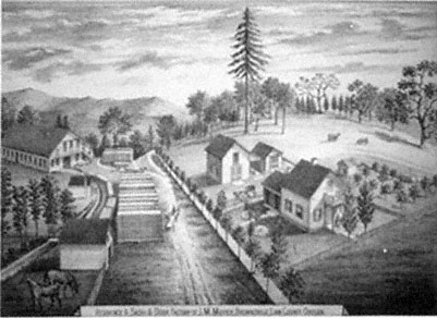
Figure 4.
John M. Moyer's sash and door factory, 1878. Moyer purchased this sash and
door factory in Brownsville in 1863. Note the millrace leading into the factory
along the left side of the picture.
Source: Illustrated Historical Atlas Map of Marion and Linn Counties, Oregon .
Located well into the forested foothills of the Cascade Mountains, Crawfordsville depended principally on the lumber industry, which fed primarily a local market. Small water-powered sash-frame mills such as Richard Finley's, P. V. Crawford's, and Timothy Rigg's existed on the upper Calapooia and Brush Creek as early as the 1850s. By the 1870s larger mills had made their appearance. David Allingham's forty horsepower steam mill, the largest, had a capital investment of $6,300. It conducted business six months of the year and employed six men over sixteen years of age. McDowell and Company's thirty-five horsepower, water-driven mill had a capital investment of $3,000 and operated year-round with a work force of eight and total lumber production value of $13,200.[38]
Allen, Robinson and Company, a large lumber firm located on the Willamette River in Albany, logged on the upper Calapooia above Crawfordsville for a more extensive market. Allen, Robinson owned a controlling interest in the Calapooia Boom Company. In 1876 the state legislature granted this company exclusive rights to "improve" about
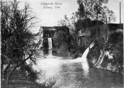
Figure 5.
Mills on the lower Calapooia River, 1895. The Calapooia River was both a means of
transporting logs to Albany and a source to power the lumber mills. Courtesy of Print
Collection, A9415, Special Collections, Knight Library, University of Oregon, Eugene
(negative number CN 924).
forty miles of the Calapooia River from Crawfordsville to the Willamette in order to float logs to the Allen, Robinson mill. Once this work was completed, loggers felled timber into the Calapooia and Brush Creek above Crawfordsville for several months of the year, then waited for the winter rains to float the logs the forty-plus miles to the mills in Albany. Figure 5 shows some of the mills on the lower Calapooia in Albany.[39]
Log drives on the Calapooia, which began in 1878, commonly occurred in fall and winter. One newspaper account reported that the Allen, Robinson loggers felled up to five million feet of timber into the upper Calapooia River and Brush Creek in anticipation of autumn rains. On 12 December an Albany newspaper reported, "On Thursday of last week they were running so fast and thick at Crawfordsville that men could cross the river on them, and we are informed that on last Monday the entire drive had passed there." From her farm on the Calapooia some twenty-five miles below the timber belt, Sarah Cornett
noted in her diary in January 1885, "Jo and George went over to Mr. Farwells then up to the dam to see the logs come over the rest of us staid at home." Two days later she casually remarked, "The logs went by to day."[40]
Although a number of firms—essentially small mills save for Allen, Robinson—exploited the forest of the upper Calapooia, the amount of timber taken remained limited during this period. Because of the inaccessibility of the steep and rugged valley of the upper Calapooia, loggers took only trees along the banks of the river. Because of unreliability of the Calapooia itself as a highway for logs to Albany, a fifteen-year cessation of log drives on the river began in about 1890.[41] Not until well into the twentieth century did increasing regional and national demand and technological improvement allow for the extensive logging of Calapooia forests.
The cutting of forests along the banks of the Calapooia, while limited, and the "improvement" of the stream for drives between 1876 and 1890 did have environmental consequences. Logging increased erosion and runoff. In improving the river, Allen, Robinson eliminated sloughs and minor courses, removed trees and debris, tore out drifts, and confined floating, stationary logs to the stream's banks (known in the trade as booming) in order not to obstruct the central channel. This work, coupled with the loss of riparian forest from local logging, altered the nature of the Calapooia. On the one hand, floods still occurred and perhaps increased in ferocity, but on the other hand, humans forced the river into a narrower channel, actively and continually separating it from its flood plain. On its flood plain, in its sloughs, and among its forested banks, the river had prehistorically deposited large amounts of sediment. In addition, the original riparian forests traditionally reduced erosion. In their absence, and with the river unable to unload much of its organic material, the Calapooia naturally increased in turbidity as well as nutrients, increasing algae and decreasing stream clarity, and thereby decreasing fish populations. Before stream improvement, the higher water table added to marshlands, home to a multitude of aquatic animals and fowl. Now, during log drives on both the Calapooia and Brush Creek, logs blocked the migration of some fish and scoured the riverbed, reducing fish habitat and destroying aquatic plant communities. The floating logs also shed bark, which sank to the bottom and destroyed fish spawning grounds. Decomposing bark removed needed oxygen from the water, and log rafts blocked sunlight from plants on the riverbed.[42]
As a thriving community, Crawfordsville depended for prosperity on the early logging industry, but locals also exploited other forest products, such as cascara bark or chittim, which was used in laxatives. In the 1880s and 1890s, cascara bark collecting became a prosperous cottage industry, and residents removed tons from the forest, in the process killing large numbers of cascara trees. One east Linn County inhabitant, Joseph Stein, shipped sixty-eight tons of chittim in June 1890. Fannie Adams Cooper remembered that her husband collected bark and "packed it out of the woods on his back." She would "scrape off the moss and spread it to dry," and her husband would then "put it in a big deep box and chop it with a spade and sack it." In town, the Coopers exchanged the bark for groceries, shoes, and other necessities. Cooper recalled that it "took a lot of bark at 2 cents a pound to buy things."[43]
In addition to the exploitation of forest products, Crawfordsville residents also had other commercial interests. The same individuals who gave impetus to the town, Richard Finley and P. V. Crawford, worked together in 1858–59 to establish a new and larger gristmill and town out on the plains of the Willamette. Finley's original mill on the upper Calapooia had primarily served the local economy of the Calapooia and the southern Willamette Valley. A typical order in 1856, revealing the limited nature of his operations, was the milling of four bushels of wheat for three dollars. As more settlers moved into other areas of the southern Willamette, other millers constructed flour mills. In 1860 the census taker counted four flour mills in Linn County. One of the larger of these, the Magnolia Flour Mill, was constructed in Albany on the Calapooia where it flows into the Willamette River (figure 6). Finley's mill, well up the Calapooia and now distant from the population and thriving trade centers, began losing business.[44]
To recapture his lost market, as well as take advantage of the growing population in the Willamette Valley, Finley formed a partnership with Crawford and Alexander Brandon to begin a new mill, the Boston Mills, several miles downriver on the plains of the Willamette. Finley acquired land from Americus Savage and water rights from Robert Elder, enabling him to construct a dam across the Calapooia for milling purposes. He cut and hewed the timbers for the mill near Crawfordsville and hauled them to the new town site, some twelve miles away. Eventually a carding mill came to the area. Although the mill burned down a couple of years after its completion, its owners rebuilt it. Near the mills, Richard Finley laid out the town of Boston, which included a central
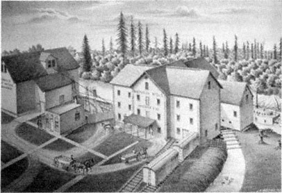
Figure 6.
Magnolia Flour Mill, 1878. The Magnolia Flour Mill, built near the confluence of the
Calapooia and Willamette rivers at Albany, drew much of the business away from
Richard C. Finley's small flour mill on the upper Calapooia. Note the steamboat on the
Calapooia at the right edge of the picture. Because of the small size of the Calapooia,
steamboats never ascended above its mouth.
Source: Illustrated Historical Atlas Map of Marion and Linn Counties, Oregon .
town square surrounded by several blocks divided into building lots. Although the community remained small, it did have a store, blacksmith, and the carding and flouring mills, and it also became an important stage stop.[45]
The town of Boston had a very short life, however, and its history reflects the general pattern of events in latter nineteenth-century Calapooia and Willamette Valleys. In short, although Boston's beginnings were closely tied to happenings in the Calapooia foothills, its demise was determined by events occurring on the plains of the Willamette. On 8 December 1870, less than a decade after Finley laid out Boston, Ben Holladay's Oregon and California Railroad, coming from the north, reached Albany, the seat of Linn County. In June 1871 it extended onto the central portions of the county's prairie west of the Calapooia Valley and just one and one-half miles west of Boston. Now off the main transportation route, Boston withered away while its popu-
lation moved west to meet the railroad. Because of the railroad—in the middle of open farmlands—the town of Shedd sprang up, as did a neighboring village, Halsey, five miles south.[46]
Four years after its founding, Shedd had two general stores, a blacksmith, shoemaker, hotel, two warehouses, and one church. Halsey had a population of 250 and a long list of commercial establishments including four general merchandisers, two blacksmiths, a telegrapher, a sash and door factory, a hotel, and five warehouses. Although neither town even existed in 1870, 306 people lived in Halsey and 55 in Shedd in 1880, ten years later, Shedd had a population of 355.[47] Located in the center of Linn County's vast agricultural district on the plains of the Willamette, both towns became shipping centers for the county's wheat and other produce.
The Oregon and California Railroad never reached Brownsville, but local promoters there finally acquired a connection to the Oregon Railway Company's narrow-gauge line on 28 December 1880. During the preceding nine years, between the time the Oregon and California came to the valley and Brownsville received a railroad connection, commercial interests in Brownsville had difficulty accepting the phenomenal growth of their two new competitors, Halsey and Shedd. Brownsville residents argued that there was no natural reason for Shedd's and Halsey's existence: "What has made the town of Halsey? Has she any real, natural advantages? . . . Is the land around there any better, or more productive? We say not a bit." In promotional articles and editorials week after week, the Brownsville Advertiser demanded that the railroad come to its hamlet. The Advertiser constantly threw disgruntled barbs at growing communities like Halsey whose very existence seemed artificial. And just as constantly they promoted the natural resources and situation of Brownsville:
The large section of country covered with heavy timber above us, would resound with the lumber-man's axe . . . ; town property would be increased; more people would come in with capital; more houses would be built; more goods would be sold; . . . this town would grow up into a great manufacturing center, situated as we are with almost unlimited water power, and an endless supply of timber of the finest quality, within easy reach, and good farming land on every side, who can say what the future of Brownsville would be, with Rail Road and river connection in Albany?[48]
In this example of the idea of community building, the theme of utility is fully pronounced. At the same time, the relationship between
utility and landscape changed through the long process of estrangement of the Calapooians from the natural landscape. No longer did they see landscape itself as the sole provider of resources; instead, these resources could be made profitable only through the acquisition of more and better technology, in this case the railroad. In other words, the citizens of Brownsville realized that they could not place the future of their community solely in the landscape, either its primitive or pastoral prospects. Rather, having witnessed the rapid development of Halsey and Shedd, they came to believe that it was really mechanization that would allow them to progress. Asking themselves, "Why all this difference?" between Halsey and Shedd and their own town, they summed up the answer in their response, "The railroad is the reason!"[49] Though the Calapooians did not forget the primitive and pastoral beauty of the land, their narrowing and intensifying focus on mechanization, profit, and better access to outside markets—which was also seriously affecting the environment—would ultimately have severe consequences for their psychological relationship to the land.
With the establishment and growth of towns on the banks of the Calapooia, not only industry but also personal occupations grew and diversified. The first census of the Calapooia Valley in 1850 listed 219 people. Out of the 39 people who gave an occupation, 32 described themselves as farmers. In 1860, 915 people lived in the valley; 114 worked as farmers or farm laborers, while day laborers accounted for 37 and stockraisers and herders 14. Most significant was the appearance of 19 other occupations accounting for some 50 people, including 2 sawyers, 5 blacksmiths, 3 cobblers, and 4 schoolteachers, as well as merchants, grocery clerks, and physicians. The 1870 and 1880 censuses reported more new occupations: engineers, photographers, coopers, wagon makers, justices of the peace, telegraphers, gardeners, and woolen-mill workers.[50]
Population growth related directly to the diversification of occupation, nascent industries, the establishment of towns, the improvement of transportation, and the extension of agriculture. (Table 7 shows the increase in population in the Calapooia area and comparison figures for Linn County and the Willamette Valley.) The economic historian James Tattersall has pointed out that population grew in Oregon during the 1850s because of both the California gold strikes and the Donation Land Law. Population growth slowed down during the 1860s, as immigrants chose more often to go to California than to Oregon, but it
| ||||||||||||||||||||||||||||||||||||||||||||||||||||||||||||||||||||||
continued to grow because of more gold strikes in the Pacific Northwest. Population growth picked up in the 1870s because of the extension of transportation and the entry of northwestern agricultural and forest products into world markets. Population continued to grow, but again at a slower pace, through the end of the century.[51]
While following the general population trends for Oregon and the Willamette Valley, Linn County and the Calapooia differed in rates and reasons for growth. For instance, in the 1850s the growth rate of the Linn County and Calapooia population was greater than that of the Willamette as a whole. Since Linn County and the Calapooia are near the southern end of the valley, where initial settlement occurred later, more land was open for settlement and a greater proportion of immigrants could be absorbed during the years of the Donation Land Law (1850–55). Population growth slowed greatly in the 1860s as land supplies diminished and as the county still remained somewhat cut off from markets during this period—again in part because of the Donation Land Law, as discussed above. Furthermore, the general population of Oregon expanded, thanks partly to the lumber industry; the expansion was greatest in the northern valley at the confluence of the Willamette and Columbia rivers. But Linn County, located in the southern valley and lacking adequate means of lumber transport, could not take advan-
tage of the wider regional timber trade during these years. By 1880 the population of Linn County and the Calapooia again burgeoned with the coming of the railroad, and it kept climbing through the end of the century.
Calapooia residents founded early towns, with the exception of Union Point (significantly, it failed within seven years), on the principle of utility derived from the landscape. The examples of Brownsville's flour mill and the town's demand for a railroad connection demonstrate how human changes in the natural landscape could increase the utilitarian potential of the landscape. The example of Crawfordsville shows how the extraction of timber and the use of the Calapooia as a log highway could limit the ability of the environment to rejuvenate what settlers had first recognized as most valuable—in this case, fertile soils. The rise and fall of Boston discloses a pattern first of the plains becoming more important than the foothills, and then the location of the railroad becoming more important than anything else. The growth of Shedd and Halsey demonstrates the importance of the proliferation of technology during the nineteenth century.
The founding of communities; the establishment of manufacturing and industry; the rise of logging; the increase in agricultural production; the building of roads, steamboats, and railways; the imposition of the cadastral survey and land claiming laws that forced adherence to it; and the growth of the population—all of these reveal how in the later nineteenth century the Calapooia settlement and the environment increasingly became integrated into a world that stretched far beyond the walls of the valley. Accompanying the economic integration of the Calapooia into the region, nation, and world was a change in the residents' attitudes to and psychological relationship with the environment. The settlers had once considered the landscape to be in some ways separate from humans and in many ways something on which humans depended; over time, though, the landscape increasingly became just the object of utilitarian desires and economic demand. Throughout this process, however, the environment was also an actor, and it responded in ways that proved costly to its inhabitants.
Chapter VII—
Life and Reflection on a Transformed Landscape
Within the space of about fifty years, from the 1840s to the 1890s, the environment of the Willamette Valley underwent incredible and rapid change. By 1890 the Kalapuya had completely disappeared, and with them went an age-old landscape, ecological balance, natural abundance, and a cosmology that viewed the land and its animals in spiritual relationship to people. Although white-tailed deer and migrating and resident fowl still remained in or frequented the valley, their numbers had been greatly reduced. By the 1890s some native animals, among them the grizzly, cougar, and wolf, were locally either extinct or near extinction. Exotic species such as cattle, swine, and horses had replaced them. Non-native and native grasses, shrubs, and trees had invaded the prairies, from which various native grasses and large expanses of camas had disappeared. Euro-Americans had also introduced to the valley a number of cultivated plants—wheat, oats, and garden vegetables. The once scantily timbered foothills supported denser forests, while streamside woodlands had become sparser. Some soils in the valley had been exhausted. Erosion had increased on certain streams, and at the same time flood plains had been diminished and many marshes eliminated. Fish habitat and spawning grounds were impaired or altogether destroyed. And the valley was now divided into parcels of privately owned property.
This enormous disruption and change occurred because one group of people, Euro-Americans, replaced another, Native Americans. But the Kalapuya had altered the environment as well. They did so most strik-
ingly with the annual use of fire, preventing continuous forests from covering the Willamette Valley. For basic needs of food and shelter, the natives, working within the limits of natural possibilities, created in the valley an environment that included, among other things, an abundance of camas meadows, oak groves, forest-prairie edges, tarweed, and white-tailed deer. But merely listing the separate components of the environment does an injustice to the complex ecological relationships among animals, plants, climate, and people that existed in the Willamette during prehistoric times. The environment that the Kalapuya and nature wove together in the Willamette remained in ecological balance for at least several hundred years. The people, and the environmental change they induced, followed a continuous seasonal cycle year after year after year. Of course, this cycle may not have continued indefinitely had not Europeans and Euro-Americans arrived on the scene. Larger, slower changes have occurred in the Willamette, with the climate varying between dry/warm and moist/cool periods. These changes have influenced and will continue to influence vegetation and animal life as well as human occupancy.
Euro-American settlers replaced the Kalapuya in the Willamette Valley within a brief period of time. Because the culture of the Kalapuya and the Willamette were closely intertwined, the tumultuous disruption of native culture also represented a convulsive change in the ecological balance of the valley. As the Kalapuya vanished, so, too, did the environment they and nature had created. Nature, however, remained a constant, and Euro-Americans working within its possibilities and responding to growing and distant markets created a new, relatively unstable environment in the valley. Euro-Americans entered the Willamette with a set of cultural assumptions much different from the one their predecessors had held. The new inhabitants conceived of their whole history of westward migration as one of continual progress. They had a sense of time as linear, not cyclical. They hoped to transform the valley into an environment based on the vision of their history and future: towns, farms, wheat fields, pastures, fences, private property, factories. Essentially, they wanted to create a pastoral landscape. With the pastoral in mind, Euro-Americans believed that they depended less directly on the primitive environment than had their predecessors. This belief may have led them to take the environment for granted; it certainly encouraged them to take less care of it.
The evidence I have collected here certainly supports some of the
conclusions of other environmental historians interested in explaining the differences between native and Euro-American cultures and economies and the environments they create.[1] But I am primarily interested in asking and answering other questions about the relationship between settlers and the western environment: How did settlers respond to the primitive environment of the West? How did the western environment influence settlement culture? What role did Native Americans play in the cultural-environmental relationships of Euro-Americans settlers? What changes in peoples' minds accompanied changes in the environment? And how did Euro-Americans feel about the changes in the landscape as it altered over the course of settlement?
Mid nineteenth-century western settlers responded to the environment of the Willamette in a number of positive ways. They appreciated its primitive beauty, they valued some of its "wilderness" qualities, they worked within its possibilities, and they even incorporated some of its natural attributes into their vision of a future pastoral community. The initial settlement of the Calapooia Valley shows that Euro-American pioneers, on levels from material culture to aesthetic responses to emotional connection, intimately interacted with and felt positively about their surroundings.
Environmental historians accept without question that when Euro-Americans moved West and imposed their culture on a new landscape, they necessarily altered the environment in significant ways, with both short-term and long-term consequences. But historians still debate whether or not the western environment—more precisely, the frontier—influenced the mind and therefore the institutions of the American people. The history of the settlement of the Willamette demonstrates that Euro-Americans did indeed alter the environment. This history also shows that the environment did subtly influence the culture and attitudes that settlers brought with them from the Ohio Valley. For instance, housing styles remained the same, but settlers realized these styles with new materials. Settlers found the Willamette Valley initially easier to clear as the forests were already diminished because of Kalapuya burning. Similarly, farmers found the sod of the Willamette easier to plow than the sod of the Midwest, but they had to give up the cultivation of corn. Settlers continued to raise livestock in their new home for the same reasons they had in the Ohio Valley, but the nature of the Willamette, with its grasslands, camas meadows, and mild climate, allowed livestock to forage year-round. In addition, early settlers recognized and appreciated their
new home's milder climate, lack of summer humidity, dearth of thunder storms, and healthier atmosphere. Finally, Euro-Americans had to balance themselves with the idiosyncrasies of the landscape, especially the nature of its foothills and prairies, thus making the Willamette settlement process a unique experience in the West. Although subtle, these environmental differences between the frontiers of the Willamette and cis-Appalachia underlie cultural differences between the Midwest and the Far West, particularly western Oregon.
An examination of the Euro-American settlement process in the Willamette Valley demonstrates that Native Americans played a role in shaping the settler-environment relationship, influencing settlement culture, and conditioning the vision Euro-Americans held of their own future in the valley. For example, the Kalapuya were largely responsible for the location of wood and summer water sources in the valley, and thus for early Euro-American settlement patterns and the settlers' intimate connection with the environment. The Kalapuya were also partly responsible for the abundance of deer and fowl that settlers depended on and appreciated. And the Kalapuya created the prairies that settlers looked at in pastoral terms. Undoubtedly, mid nineteenth-century Americans would have held much the same pastoral vision of their future regardless of where they settled, but the Kalapuya-created grasslands of the Willamette captivated settlers' imaginations.
As a case study of the West, the example of the Calapooia and Willamette valleys demonstrates that settlers had an intimate and often positive relationship with the primitive landscape; that they altered the environment; and that the environment, which the natives had been instrumental in shaping, modified the culture Euro-Americans brought with them from other western frontiers and also influenced their vision of the valley's possibilities. The last and perhaps most important question this study has centered on, and which the remainder of this chapter assesses, concerns Euro-Americans' changing feelings and attitudes about the primitive environment and the pastoral landscape of the Willamette. To shed light on this fundamental question of nineteenth-century settlement in the Far West, this study has employed the metaphor of movement between the foothills and the plains of the Willamette Valley.
From Foothills to Valley Floor:
Flux in the Late Nineteenth Century
During the early years of frontier settlement, Euro-Americans avoided the open prairies of the southern Willamette Valley, instead taking refuge among the foothills of the periphery and secondary valleys such as the Calapooia. Settlers consciously sought out the forest-prairie ecotone along the foothills, for this environment afforded the various resources they needed during this primitive phase of living in the Willamette: wood, water, and well-drained soil, as well as the prairie grasslands. During this initial phase of settlement, and because of a plethora of factors (including access to resources, poor transportation, aesthetic appreciation, lack of a developed market economy, land-claim laws, and psychological need), settlers of the foothills developed a direct and intimate relationship with the environment. But they also brought with them to the Willamette Valley a vision of a civilization they wished to create there, and they constantly looked away from the foothills to the plains as the refuge for this ideal, which was a brand of pastoral or garden imagery.
By the late nineteenth century, the population center of the Calapooia and southern Willamette valleys had indeed moved out onto the plains. By 1887 four-fifths of Linn County's population, which reached more than sixteen thousand in 1890, lived on the open prairies on farms, in Albany (the county seat) along the Willamette River, or in villages that the railroad had created, such as Shedd and Halsey. In this same year the plains region contained eleven-twelfths of all taxable property in Linn County. Of inestimable value to the early settlers, foothills had at one time been taxed at a higher rate than the prairies. But during the shift of the center of economy and population, the value of prairie land actually rose above foothill land (table 8). The impending arrival of the railroad in 1870–71 had the greatest influence on the change in value of prairie land. Between 1864 and 1870 the taxable value of prairie land rose 110.6 percent higher than what it had been in 1864. Simultaneously, the market value of prairie land skyrocketed over lands along the foothills. In 1875 prairie land ranged from $20 to $40 per acre while foothill land was only $3 to $15. The proximity of the railroad had a direct bearing on these figures. Land within five to six miles of a shipping point sold for at least $30 per acre.[2]
By the late nineteenth century, residents of the southern Willamette
| |||||||||||||||||||||||||||||||||||||||||||||
Valley considered the most valuable land to be the open prairies. There, too, concentrated the bulk of the southern valley's population. Calapooians achieved this transformation through a number of means: the Donation Land Claim Act, modern transportation (the steamboat and the railroad), prairie drainage, a developed market economy, and manufactories. In achieving the future, the Calapooians also cultivated a new relationship with the landscape. In the case of the Finley gristmill, utilitarian values of the landscape became preeminent in the fledgling community, and traditional mores concerning land claiming fell by the wayside. The Donation Land Claim Act forced new and old settlers alike to abide by arbitrary and invisible survey lines, no longer allowing them to place claims on the landscape according to the natural setting. The same survey also shunned property boundaries recognized by the land's natural features.
With the growth of the livestock trade in the 1850s, the open prairies' utilitarian values became most pronounced, and a struggle ensued over who would control these grasslands. One of the results of this battle was a decided effort to fence the land. Eventually, improved transportation, the growth of a commercial market, and the drainage of wet prairies all combined to allow human occupation and exploitation of these very same lands. In the midst of these prairies, towns sprang up practically overnight. Finally, with the establishment of manufactories and the growth of technology came the full development of the land's utility. The diversion of the Calapooia's waters allowed the establishment of
grist, lumber, and woolen mills. And the railroad became the most promising way to allow the landscape's utility to be fully realized. Within a few years, the earliest Calapooians and their descendants had created a pastoral landscape, simultaneously cultivating a new relationship with the landscape as well.
The Garden Realized
A comparison of two panoramic views of the Willamette Valley one dating from 1847 (figure 1) and the other from 1888 (figure 7), reveals the great transformations that the landscape had undergone. The 1888 sketch shows the forests of 1847 cut down, with only patches confined to the geometrical divisions conforming to fence and DLCA survey lines. No longer are natural divisions between forest and prairie discernible. Furthermore, the three deer in the foreground of figure 1, representing the valley's primitive nature, have yielded in 1888 to three Euro-American inhabitants of the valley, representing civilization. The 1888 picture also shows a variety of fences and fields disunifying the scene, with a village barely visible in the hazy distance.
As early as 1855, Blain had seen the beginnings of this transformation, as he noted in a letter after returning from a spring trip to the lower part of the Willamette: "I was on the whole much pleased with the evidence of extensive improvement which every where met the eye. New houses, barns, and farms clothed many portions of the road, with which I had been familiar, with the novelty of a new country."[3] Blain, as we have seen, appreciated the natural beauty of the valley as well as its primitive, even wilderness aspects. Indeed, he revealed equivocal feelings about the effects of continued Euro-American settlement on the primitive nature of the valley.
Late nineteenth-century Euro-Americans' relationship to, and perception of, the transformed, pastoral Willamette landscape were as complex and multifaceted as Blain's and others' initial responses to the primitive landscape. What is most intriguing about this later generation's reactions to the transformed landscape, however, was their concentration on the beauty it still possessed. To late nineteenth-century Willamette and Calapooia valley inhabitants, human artifice, such as villages, farmsteads, and mills, coupled with the valley's remaining primitive qualities, created a scene of domestic enchantment that they considered beautiful in its own right. Thus commented the Willamette
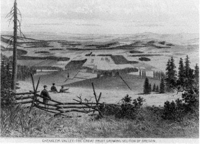
Figure 7.
The transformed landscape of the Willamette Valley, 1888. Compare this sketch of the
Chehalem area of the Willamette Valley (near Newberg) with Paul Kane's rendition of
the valley in 1847 (fig. 1). Unlike Kane's painting, which depicts an uncultivated
landscape inhabited only by wildlife, this 1888 illustration emphasizes the Euro-American
presence—humans, fences, rectangular fields, a village in the distance, and abrupt
divisions between prairies and forest patches. Courtesy of the Oregon Historical Society,
Portland (negative number ORHI 35543).
Farmer in 1873: "Neither can there be a more charming spot of earth than this blessed valley which offers us a home, with its delightful climate, rich and certain harvests and with its undeveloped resources." One year later the same newspaper commented, "Is this a dream? Beautiful fields of golden grain, green orchards, meadows, the Willamette River, like a silver belt, glistening in the sunlight."[4] In both these instances, the observer paired the valley's natural beauty with utility and human artifice.
More vividly, in 1882 an observer of the Willamette Valley scene, E. Ingersoll, wrote at length about the confluence of nature and human artifice on the valley's landscape.[5] Ingersoll began by describing average Willamette Valley farms that "follow one another from the river back into the wooded foot-hills." He then turned his attention to the houses,
"which are almost invariably of frame, and of good size, with far more attention paid to comfort and attractive surroundings than it is customary in the Eastern States." He also noted the "little villages scattered here and there," as well as schoolhouses and churches. The vision he describes conveys to his reader an idea of a domesticated landscape.
Significantly, nature had a role here, too, for it provided a charming setting within which Willamette Valley inhabitants built their community. Ingersoll mentioned, for instance, the "many scattered oaks," "yellow pines," and "stately firs," which "gave an opportunity not lost sight of to place one's house where the effect would be that of an ancient homestead, around whose sacred altars trees planted in grandfather's youth had had time to become of great size and dignity." This "pleasant description," Ingersoll explained, "is seen everywhere; and it is deceptive, . . . giving an impression of a country occupied for centuries and full of traditions."
For Ingersoll, human occupation of the land transformed nature, turning elements of the landscape into embellishments of a domestic garden. From this immediate scene, which he himself termed one of "domestic felicity," Ingersoll then described the greater surrounding landscape: "The whole wide basin lies open to the eye, robed in green, but green of what infinite variety of tint and shading, between the emerald squares of the new wheat and the opaque mass of the far-away hill forests sharply serrate against the sky, or melting into farther and farther indistinctness of hill and haze. The foreground, too, is always pleasantly sketchy."[6] Reminiscent of Blain's descriptions of the Willamette and Calapooia valleys just thirty years earlier, Ingersoll's verbal rendition of a visual experience, however, is punctuated by the hand of man, though in a positive way, as seen in the "emerald squares of the new wheat." Ingersoll continued, "if you think my picture lacks color, look at that . . . brown patch of freshly ploughed ground; at this brilliant red barn and white farmhouse half hidden in its blossoming orchard!" For Ingersoll, only with the addition of human artifice—houses, barns, plowed fields, and orchards—could the true beauty of the landscape be appreciated.
The overwhelming beauty found in the now domesticated, pastoral Willamette Valley was commented on by observers of the Calapooia area and Linn County as a whole. A correspondent for the Willamette Farmer who traveled from Lebanon to Shedd in May 1877 declared of the view near the foot of Saddle Butte, "The scenery was magnificent.
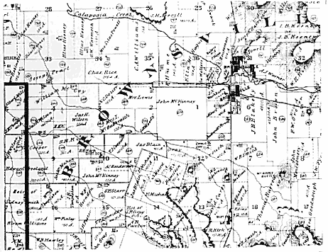
Map 8.
Land claims at the mouth of the Calapooia Valley, 1878.
SOURCE: Illustrated Historical Atlas Map of Marion and Linn Counties, Oregon .
We could count twenty-one teams putting in grain, in going one mile. Linn County is literally one grand wheat field." Another correspondent wrote later the same season about the view as he and his companion headed southeast from Halsey to the foothills, "passing nearly all the way over prairies as rich as need be, showing everywhere comfortable homes."[7]
Much of the area through which they traveled, the once formerly open, uninhabited plains of the Willamette Valley west of Brownsville at the mouth of the Calapooia Valley, is shown in map 8. Note that on this map, executed one year after the newspaper correspondent traversed the area, the landscape is divided into numerous farms. Figure 8 allows us to glimpse the plains of the Willamette adjacent to the Calapooia River as they appeared in 1878. This lithograph shows the formerly avoided prairies now transformed into a realm of domestic bliss. it reveals neatly kept farms, with fences dividing and therefore
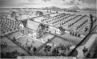
Figure 8.
D.P. Porter's farm and residence, 1878. Located near the town of Shedd, Porter's
residence is an example of the pastoral achievement of southern Willamette Valley
inhabitants in the late nineteenth century.
Source: Illustrated Historical Atlas Map of Marion and Linn Counties, Oregon .
putting into captivity prairies that have now been changed into productive fields and pastures. Barns, other outbuildings, and young orchards embellish the scene, while men busily attend grain fields, and farm animals laze about the barnyard. The lithograph even captures a croquet match in progress. All these adornments and activities however, serve only as embroidery for the most important feature of the scene, the domestic abode, standing in a central, stately location.
In this lithograph and the period descriptions, the natural beauty of the primitive valley has given way to the utilitarian beauty of the transformed landscape. The meaning of this landscape had also changed. We see this most graphically in the comments of an 1884 correspondent to an Albany newspaper. This writer first described the panorama of the valley as viewed from "a slight eminence on the [east] edge of the Willamette valley," where the town of "Brownsville stands in her glory." This correspondent appears to have stood in almost exactly the same place where Wilson Blain had stood thirty-three years earlier when he "gazed with rapture" across a valley that combined, in the most
"remarkable manner, variety, beauty, and sublimity, in the natural world."[8]
But the vision of the 1884 observer, while superficially similar to Blain's, is in fact quite different. He begins by regarding the "background made up of the Cascade range and with a front view of the beautiful Willamette valley and its native scenery." He continues, "But a little beyond this scenery is the Coast range, which has been termed the dyke of the great Pacific." What made this scenery most "beautiful, indeed romantic" to this viewer, however, was not simply its natural and sublime beauty—as it had been for Blain—but the fact that he heard a special message "echoing" over the valley, reverberating from the heights of the Coast Range. That message was "business."
Notes on the beauty of the transformed Calapooia scenery were not limited to panoramic vistas alone, for observant eyes dissected this landscape, isolating its important utilitarian features, such as the Calapooia River itself. Regarded as the "leading element" in North Brownsville's prosperity as of 1878, observers saw the Calapooia as "splendid and never-failing [in] water power . . . which drives all . . . mills and factories." Eleven years later another viewer of the Brownsville scene remarked that the dam built across the Calapooia turned "almost the entire river into a race." One year later, another enumerated the manufactories the river powered in Brownsville: "a woolen mill, flour mill, saw mill, sash and door factory, furniture factory, etc." He ended his commentary by noting that there was yet "plenty of power to spare." Commentators on the Calapooia positively assessed this realization of the river's utility; indeed, in 1876 one resident of Crawfordsville suggested that the river was so important that it deserved "a better name than it bears."[9]
Even individual towns and their situations were considered idyllic scenes. In 1878 a viewer described South Brownsville as "picturesquely-situated and flourishing . . . at the entrance to the valley of the Calapooia River, and more beautiful surroundings than it possesses would be hard to conceive." The twin towns of South and North Brownsville together had "picturesque dwellings, neatly-arranged grounds, in the cool shade of innumerable trees, present[ing] a picture of comfort which no other town can excel and few equal." Even Brownsville's small industrial area around the woolen mills had a domestic lure, according to one late nineteenth-century observer: "Surrounding, and in near proximity to the mill, are the dwellings of the operatives, and the
observer will be pleased with the general air of neatness and comfort pervading this section of the city, most of the houses being built and surrounded by orchards and gardens prolific in their yield."[10]
The late nineteenth-century Calapooia, as well as the whole of the Willamette Valley, may not in reality have been the tranquil pastoral landscape that its inhabitants so gloriously proclaimed. In fact, these descriptions ignore some of the reality of environmental degradation under which these people suffered. But it is important to note that this is how they wished to view the world they and nature had created. Here, comfortable houses and productive farms dotted the prairies, industrious villages reposed among shade trees, and bustling rivers powered factories. All this they viewed as a jewel set in the beautiful green basin of the Willamette.
Late nineteenth-century Willamette and Calapooia residents believed they lived in an actual garden. Immigration agent C. G. Burkhart, who lived in Linn County his entire life, argued in 1887, "It is stated that if the Willamette Valley is the garden spot of the state, Linn County is the garden spot of the valley. The comparison is now extended and the statement confidently made that, if Linn County is the garden spot of the valley," the prairie extending west of the Calapooia "is the garden spot of the county." In other words, these open prairies that the Calapooia community once hoped would become a garden had, by the end of the nineteenth century, far exceeded all expectations and had become literally the garden spot of the garden spot of the garden spot of the entire state.[11]
Burkhart and his successor, B. F. Alley, marketed the garden image of the Willamette plains adjacent to the Calapooia during the end of the 1880s. Burkhart noted, "In all this plain the land is all taken and converted into fine farms." In another reference he remarked that the "belt from the Willamette River to the foothills . . . is an open, level prairie country, the most productive in the valley. . . . Wheat, oats, barley and all kinds of vegetable and fruits are grown here with the greatest success." Elsewhere he pointed out,
In all parts of the country, along the river and creek bottoms and all through the foot hills, fruits of most kinds are grown in the greatest abundance and the quality is unsurpassed by that of any other state. Apples of all varieties, pears in size and quality call out the unstinted praise of all who see them, plums as large as hen eggs, rich and juicy, cherries that in both quality and
quantity challenge comparison with similar fruits grown anywhere else, prunes that delight the eye and taste of all.[12]
Alley described the fertile plains of the Willamette, "stretching away to the west and south" from the Calapooia, as "carpeted with numberless fields of grain, dotted with farm houses and settlements, showing a prosperous and successful people." He also wrote of "the beauty and fertility" of the prairies surrounding the town of Halsey and of "the unmistakable healthfulness of its climate." According to Alley, "All the essentials that go to make up a desirable country abound here."[13]
These descriptions of the Calapooia's prairies in particular, and the Willamette Valley in general, rely on the image of the garden. Settlers dreamed of such a garden at an early date and then realized it through a variety of interdependent natural and human factors: fertility of soil, drainage of the valley's plains, a variety of natural resources, a salubrious climate, the growth of markets and their accessibility through improved transportation, a growing population, development of early manufacturing and the utilization of rapid streams, and the expansion of agriculture. Here, indeed, a garden thrived.
The beauty and utility of the landscape, however, were as two-dimensional as the descriptions and sketches of the Calapooia's gardenlike appearance. Scratch the surface of these lithographs and we find that the grazing cattle and rooting swine, coupled with the cessation of burning by the Kalapuya, helped destroy the grasslands of the plains on which settlers once gazed with pleasure. Fencing diminished the Calapooia as a wildlife habitat. The draining of prairies destroyed the valley's natural sloughs, home to waterfowl and animals. Furthermore, the early lumber industry not only felled the native trees but converted the Calapooia into a highway for logs, with harmful effects on the stream and its ability to replenish the floodplain. And nature reacted. The environment continued to act independently of its human inhabitants, as it had during early pioneer years. But its reaction in these later years was magnified because the changes humans attempted to make were more environmentally significant. Although settlers could alter prairies and woodlands, they could not stop natural succession. Soon, invasions of brush and weeds, native and exotic, and the depletion of soil fertility made life difficult for the civilization that unwittingly initiated the change.
From at least the 1890s and well into the twentieth century, longtime settlers recognized changes in the land, many of which they lamented. John Minto noted just after the turn of the century, "These damp-land and water fowls and animals, which once found here their breeding places, have gone forever, unless farmers in the near future construct artificial fish ponds, and reservoirs for irrigation when needed." A Calapooia Valley old-timer remarked to a historian at about the same time, "You can not imagine the beauty of this country when we first came here." Another Calapooian remarked in the late 1930s of the vanished white-tailed deer, "Now I presume they are all gone, though it may be possible that there are still a very few of them in the woods and among the small wooded islands."[14] Lamentation over the lost wildlife and primitive landscape of the Calapooia and Willamette valleys certainly composed part of residents' responses to the transformed environment.
One can also find at the end of the nineteenth century a human-landscape relationship truncated by a myriad of intermediaries now separating the two. Living in this garden, valley inhabitants lacked a certain depth in their relationship to the landscape, for the process undertaken to achieve this garden actually amputated the third dimension of intimacy, a closeness to the primitive landscape that the early settlers enjoyed. Lacking this third dimension, residents' relationship to the land collapsed into two-dimensionality. They still went about their activities, but they felt a significant loss that they were unable exactly to describe. This change, and the necessity of leaving the foothills for the prairie where future development would take place, resulted in the loss of a certain quality of life. By the end of the nineteenth century, valley inhabitants were looking back to the foothills, and their still relatively primitive nature, for this vanished quality of life, and aspects of the foothills were celebrated in literature and deemed desirable. If the garden qualities of the Willamette could be so widely glorified, the foothills, too, had their own benefits, which were missing from the plains.
Foothills in Retrospect
When George Atkinson traveled through the western portion of the mid Willamette Valley in 1848, he kept a diary of his journey. On 15 July he noted in his journal that he had met along the way a Mr. B. (possibly Glen O. Burnett), who evidently mentioned that "a man can live [in the Willamette] with half the labor done in the States." Three years later
Wilson Blain reported that he had "heard an Illinois farmer sum up the character of Oregon in a very few expressive words. 'It is a great country . . . for a lazy man; for in no other could such a man live with so little care or labour.'" Blain went on, however, to note how "great" the country was "for an industrious man."[15]
Some thirty years later, an important change in the message that Atkinson and Blain related can be detected. In 1887 the Linn County Immigration Agent wrote, "This County is not a paradise. It requires labor and industry, indefatigable to win a fortune here. It requires earnest effort to make a living here. If a person cannot sacrifice this much of self, he should not make this his home." This message to prospective immigrants was probably designed, in part, to weed out what the Immigration Agent called "sluggards." But it also reveals a clue to a changed relationship with environment of the Willamette and Calapooia valleys.[16]
From late nineteenth-century valley literature, we hear complaints from inhabitants about the life they led. Some of these complaints came from farmers whose agricultural practices had changed, or at least intensified, since the early years. Drawn into a market economy, they extended cultivation onto the Willamette prairies, which they had to drain of excessive winter and spring waters. In time the fertility of these same lands declined, forcing the complete abandonment of some areas.
In response to this environmental change, one valley farmer wrote to the Willamette Farmer in 1872, "When the soil was new and rich, it did not seem to take much thought how to farm; but, as the fertile prairies have been used for many years in constant cropping, men began to see the necessity of more thorough farming." Two techniques required for this "more thorough" type of cultivation, and on which this farmer commented, were draining and subsoiling, both arduous tasks. He then commented that although Oregon farmers should write to the Willamette Farmer for advice, they were unlikely to do so: "The truth is farmers, after the toils of the day, feel more like resting than writing [to your paper for successful advice]."[17]
In response to growing markets, the Willamette Valley farmers demanded increased yields, which required extensive cultivation techniques and resulted in complex and perplexing ecological responses, and in turn caused the wearisome toil they experienced. As we have seen, the cessation of Kalapuya burning, for instance, encouraged shrubs to invade prairies now used for cultivated crops. When commenting on the "brush invasion," one valley farmer prefaced his remarks by
noting, "It is natural for man to shun hard labor." But in combating ecological succession, this same farmer submitted, "It requires not only a strong head but strong muscles." The invasion of other plants, such as bracken, added to these problems and were themselves "very difficult to eradicate."[18]
Burkhart, the Linn County immigration agent and a lifetime resident of the area, noted, however, that there existed refuge from such wearisome toil. This refuge could be found in the landscape itself:
Situated in and rising out of this [Willamette] plain are quite a number of buttes or single circular hills from three to five hundred feet high, covered more or less with timber or brush though some are destitute of both.
Bubbling from the sides of these hills are to be found springs of pure, living water, as well as rich nutritious grass. . . . Dotted over these hills are many romantic, shady groves, where, in spring and summer time people from all surrounding country hold their picnic, grange, and other outdoor gatherings to recuperate from the exhaustion brought on by the toils and burdens of every day life.[19]
The description of this geographical refuge suits well the land the first settlers, such as Thomas Ward (map 6), took up in the late 1840s and early 1850s before extensive settlement on the prairie proper. Figure 9 shows one such butte as it appeared in 1878.
Retreated to out of necessity during early days, and then considered of secondary importance as later arrivals realized the potential of the valley's floor, the small buttes and foothills of the valley now became "romantic" refuges where locals "from all surrounding country" could "recuperate" from everyday toils. Some locals have left references about such retreats. For instance, during the mid 1880s Sarah Cornett noted in her diary the daily weather conditions as well as the innumerable chores she, her husband, and other members of the family performed every day. Sunday, though, was usually a day of rest. On Sunday, 10 May 1885, she wrote of a family outing to Soda Springs in the foothills: "quite warm has some appearance of rain John and I and Mother and Mary all went to Soda to day we had a very nice time." Living in the shadow of the isolated Saddle Butte, Cornett simply mentioned on another Sunday, "John and I went to the butte this evening." In 1866, Jasper Cranfill remarked, "Ploughed one half the day. Remainder I passed off in going to the largest Buttes on a hunting tour & pleasure trip."[20]
But Burkhart's comment on "the exhaustion brought on by the toils
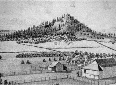
Figure 9.
Small butte in northern Linn County, 1878. Conical buttes, such as the one pictured
here, and surrounding foothills offered southern Willamette Valley inhabitants a
romantic refuge from the drudgery of everyday life. Note the dense forest on
the north (left) side of the butte and the sparser woodland on the drier south side.
Source: Illustrated Historical Atlas Map of Marion and Linn Counties, Oregon .
and burdens of every day life" had a broader meaning than just the laborious work experienced in rural living as farmers attempted to produce more efficiently for wider markets. When looking to the foothills, Burkhart, like other Calapooia and Willamette Valley citizens, was actually looking away from the complexities of life in the late nineteenth century. Another valley inhabitant summed up the problem—after glorifying the amenities of life that might be enjoyed in the foothills—with his remark, "If some of us must wear our lives out in the drudgery of town work, we hope the people of the hill country will appreciate their privileges and use them right."[21]
Commentators celebrated at length the privileges of living among the foothills: "The water is better and the air is purer in the hills"; "It must be healthier in the hills, and where there is health there is happiness"; "A single day among these hills will make any man who has eyes for beauty and lungs for fresh air." The practical qualities the earliest set-
tlers noted about the foothills, especially good drainage but also access to water, timber, and good pasturage, were all once again discussed at the end of the nineteenth century.[22]
Observers realized that practical considerations were not the only qualities of the foothills to be enjoyed. What became the most significant feature in this celebration of the foothills was the "natural" quality of life available there and its psychological implications for residents. Thus on a trip to the foothills, one valley inhabitant remarked about a particularly memorable moment "not beyond the reach of settlement where the foothills wear inviting aspects and the sounds of civilization seem an actual invasion of Nature's domain."[23]
Linn County and Calapooia residents desired the release that nature afforded them during the late nineteenth century. Some residents, not always able to go to the foothills, substituted a wilder area of their farms. Jasper Cranfill, for instance, did not always have time to retreat to the hills, but he still needed to get away from everyday toil. Thus, he "went down into the timber for diversion" on more than one occasion in the late 1860s.[24]
Another telling incident is recorded in Sarah Cornett's diary. As noted in chapter 4, Cornett's forebears on the Calapooia in the late 1840s and early 1850s, Agnes Courtney and Elizabeth Blain, domesticated their wilderness claims by planting flowers. In the 1880s Cornett also had a flower garden in which she took great pride. She lamented in her diary on 19 January 1883, for instance, that it was "very cold last night" and "froze all of our flowers." Another time she was apparently delighted when Allie Elder stopped in "and brought me some dahlah bulbs." While Cornett enjoyed her garden very much, her domestic flowers did not always provide her with the satisfaction she desired. One day, when "Ada and Nellie were here . . . we went down to the timber to get some wild current blossoms." Agnes Courtney and Elizabeth Blain used flowers to domesticate their wilderness claims during early settlement; Sarah Cornett used a bit of the "wild" to embellish her domesticated surroundings in the 1880s.[25]
Western Oregon resident Frances Fuller Victor noted the significance of wooded corners of inhabitants' claims and labeled them "truly 'Arcadian' groves." On one occasion in the 1870s, Victor lamented at length the abuse of one of these patches of timber. On visiting the home of one valley farmer, she declared it "a sort of profanation that [he] . . . has allowed one of these grand forest cathedrals to be used as a shelter for
his stock, and so to become defiled." In essence, Victor criticized what had transpired in the Willamette over the past few years when she chided her own view as having neither "utilitarian, nor even humanitarian" values. To Victor, utility and "humanity" had wrought havoc on the naturalness of the valley. In making a deep bow to these forces, Victor also averred that there was still something mystical in remnant stands of "these giants of centuries old" to which impermanent humans (specifically their cattle which "are born and die in half a dozen years") had no right "to bring grief."[26]
While wooded corners of late nineteenth-century farms provided havens for valley inhabitants, as they had for Cranfill, Cornett, and Victor, the foothills, with vaster areas of what appeared to be natural or wild, became the focus of attention. Descriptions of little valleys like the Calapooia and nearby foothills tended to concentrate on the more natural surroundings than could be found on the plains of the Willamette: "The prospect is better and the scenery more varied. The groves of oak timber are a delight to the eye." The following lengthy description of Brownsville's setting also shows a concern to point out the natural beauty of the Calapooia and not the signs of human habitation. Brownsville, we are told, is situated
at the entrance to the charming little valley of the Calapooia, where the first low hills rise from the level plains of the Willamette Valley, and stretch in rolling landscape, hill upon hill, away toward the snow clad Cascades. The village has a population of something like six hundred, and is nestled along the margin of the Calapooia Creek, about one-half on the grass covered hills that reach down almost to the sparkling waters of the stream, and the other on the sough bank, whence the level bottom land extends out for miles toward the ever green hills. [It] is the most romantically situated of any village in the country, and is remarkable for its pleasant surrounding.[27]
Breathing fresh air, drinking pure water, and looking onto the foothills' scenery lent a certain "naturalness" to life that had been lost on the valley floor. The late nineteenth-century way of life in the foothills, particularly in the small valley of the Calapooia, allowed residents to participate in what might appear to be a completely different realm of psychology:
This rolling, hilly region is interspersed with little skirts of prairie bottoms here and there along the creeks and rivers that wend their way to the Willamette River from the snows of the Cascades. These little valleys along these streams are a thing of beauty, a joy forever to those who are so lucky as to
find a home in them. So varied and romantic in their form and appearance as to excite the admiration of all who are of poetical inclinations.[28]
Thus, the variety of elements the foothills mysteriously possessed made it possible to lead in them a life of romance. In fact, those "so lucky as to find a home in them" might even live a life there that replicated poetry. These surroundings would induce, according to another observer, a certain quality of thought in its residents so that one day "some of the best brains and truest hearts of future generations will come from 'The Hills.'"[29] Essentially what these people noted about the foothills was that their primitive qualities still existed and were vital for psychological health.
Psychologist Harold F. Searles has noted that the "advancement of our technology has made for a psychological distancing of man from . . . innumerable . . . elements of his non-human environment." This distancing has been caused by a loss of "contact with nature," resulting in a "profound sense of meaninglessness."[30] The history of Euro-American settlers and their relationship to the environment along the banks of the Calapooia in the nineteenth century is a history of humans becoming estranged from the land. The earliest settlers sought out the foothills along valleys like the Calapooia as the best place to settle. There they developed a close relationship with the land. In time, the various values of this land went down as settlers and their descendants exploited the expanse of the Willamette plains. But by the end of the nineteenth century, people looked back to the little valleys and foothills for something they apparently no longer experienced on the floor of the Willamette Valley. If the plains of the Willamette west of the Calapooia had become a two-dimensional garden spot, then the smaller valleys like the Calapooia, with their numerous foothills and small patches of prairie, held within their geographical form the psychological third dimension missing from the complex life on the expansive plains of the Willamette.
History had come nearly full circle. Retreating to the foothills to make a living during the early years, settlers looked wistfully on the open prairies. On those plains they believed a pastoral community would be created. In reality, when looking onto the plains from the vantage of the foothills, they looked into their future. Unable to know what the realization of this future would mean—most important, a changed relationship with the landscape—they set about working to-
ward it. When sitting on their farms of the prairies at the end of the nineteenth century, however, valley inhabitants noticed a void in their lives, a void that could be traced to their changed relationship with the land. Thus, when they looked to the foothills for the answer, they were, metaphorically, looking into their own past.