Preferred Citation: Howse, Derek, editor. Background to Discovery: Pacific Exploration from Dampier to Cook. Berkeley: University of California Press, c1990 1990. http://ark.cdlib.org/ark:/13030/ft3489n8kn/
 | Background To DiscoveryPacific Exploration from Dampier To CookEdited by |
Dedicated to the late
JOHN HORACE PARRY,
who should have been editing this volume
Preferred Citation: Howse, Derek, editor. Background to Discovery: Pacific Exploration from Dampier to Cook. Berkeley: University of California Press, c1990 1990. http://ark.cdlib.org/ark:/13030/ft3489n8kn/
Dedicated to the late
JOHN HORACE PARRY,
who should have been editing this volume
Preface
Since 1968, the William Andrews Clark Memorial Library of the University of California, Los Angeles (UCLA), has annually appointed a Clark Library Professor, sometimes from within the University of California, sometimes from elsewhere. One of this person's tasks is to organize a series of seminars on some chosen theme relating to the particular interests of the Clark Library—English culture during the seventeenth and eighteenth centuries. Each seminar is addressed by an eminent visiting scholar invited by the Clark Professor. While faculty members and graduate students from UCLA and other southern California institutions make up most of the audiences, the seminars are advertised and open to all, often attracting scholars from outside the area. The texts of these Clark Professor lectures are generally published; a list of the published volumes faces the title page of this book.
Early in 1982, the distinguished English historian of maritime and Latin American affairs, John Horace Parry, CMG, Professor of Oceanic History and Affairs at Harvard University and former Vice-Chancellor of the University of Wales, accepted an invitation to become Clark Library Professor for the academic year 1983-84. For the Clark Professor seminars during 1983-84, he chose as his theme Background to Discovery: England from Dampier to Cook—roughly speaking, maritime explora-
tion (or rather the background to it) from 1680 to 1780, mainly in the Pacific, because the main thrust of exploration during that period was there. This was a field in which he himself had made many contributions as a historian.
By mid-1982, Parry had already contacted many of the speakers who eventually contributed, including the present editor. Then, very suddenly, on 25 August 1982, John Parry died at his home in Cambridge, Massachusetts, aged sixty-eight, immediately following a foreign lecture tour. The present editor, who retired from the post of Head of Navigation and Astronomy at the National Maritime Museum, Greenwich, England, in October 1982, accepted with great humility the invitation to become UCLA's Clark Library Professor for 1983-84.
With the general theme of Background to Discovery: England from Dampier to Cook, the seminars took place at the Clark Library, Los Angeles, once a month from October 1983 to May 1984. The series opened with the lecture "Seapower and Science: Perspectives on the Motives of Exploration in the Eighteenth Century," by Daniel A. Baugh, Professor of English History at Cornell University, setting the scene and giving the underlying motives, political and economic, for eighteenth-century exploration. The November lecture, "The Achievement of English Voyages of Discovery, 1650-1800," by Glyndwr Williams, Professor of History at Queen Mary College, University of London, and President of the Hakluyt Society, 1978-1982, gave the story of the voyages themselves. In December, Seymour Chapin, Professor of History at California State University, Los Angeles, in his lecture "The Men from Across La Manche: A Brief Overview of French Voyages of Scientific and Geographic Discovery, 1660-1790," broadened the political field by detailing French exploration activity during the same period.
The 1984 seminars concerned specific subjects within the main theme. The January lecture by Charles L. Batten, Jr., Professor of English at UCLA, was entitled "Literary Responses to Eighteenth-Century Voyages of Discovery."
In February I explained the state of the art in navigation and the physical sciences in "Navigation and Astronomy in Eighteenth-Century Voyages of Exploration." The March lecture was by another scholar from England, Nicholas Rodger, Assistant Keeper at the Public Record Office, Kew, Richmond, and Honorary Secretary of the Navy Records Society since 1975—"The Royal Navy and Its Archives," an amusing and sometimes provocative paper. The April lecture, "The Noncartographical Publications of the Firm of Mount and Page: Some Problems and Opportunities in Eighteenth-Century Maritime Bibliography," was given by Thomas R. Adams, John Hay Professor of Bibliography at Brown University and formerly Librarian of the John Carter Brown Library. The last lecture of the series, given on 25 May 1984, looked at the subject with an eye to the fine arts—"The Sailor's Perspective: British Naval Topographic Artists," by John O. Sands, Director of Collections at the Mariners' Museum, Newport News, Virginia. One aspect which we would have liked to include was natural history—botany, zoology, anthropology, and so on, all important in eighteenth-century voyages of discovery—but, alas, this did not prove possible, though the topic is of sufficient substance that it may one day form the subject of a seminar series on its own.
The texts of all but two of these lectures are published here. The lectures by Professor Adams and Dr. Rodgers, not quite so closely connected with exploration as were the others, have been published elsewhere.
I am grateful to all the contributors for making the series the success I believe it was, and my sincere thanks must go to the Director of the Clark Library, Professor Norman J. W. Thrower, to the Librarian, Dr. Thomas F. Wright, and to all the library staff, for making each seminar such a pleasant and satisfying occasion.
DEREK HOWSE
SEVENOAKS, KENT
Contributors
Charles L. Batten, Jr ., is Associate Professor of English at the University of California, Los Angeles. In Pleasurable Instruction (University of California Press, 1978), he investigates the generic convention of eighteenth-century travel literature. He is currently tracing the influence of eighteenth-century travelers on philosophical controversies in England.
Daniel A. Baugh is Professor of Modern British History at Cornell University. He is the author of British Naval Administration in the Age of Walpole (1965) and the editor of Naval Administration, 1715-1750 (1977), and he has written articles on both maritime and non-maritime subjects within the period from 1660 to 1830. He is presently writing a book on Great Britain's "Blue-Water" policy from the sixteenth to the twentieth century.
Seymour Chapin is Professor Emeritus of History at California State University, Los Angeles. He has published extensively on the history of French science, scientific institutions, and scientific voyaging in the seventeenth and eighteenth centuries.
Derek Howse was the William Andrews Clark Memorial Library Professor at the University of California, Los Angeles, in 1983-1984, having retired the previous year as Head of Navigation and Astronomy at the National
Maritime Museum, Greenwich, England. Among his publications are The Sea Chart (with M. Sanderson, 1973), Greenwich Time and the Discovery of the Longitude (1980), A Buccaneer's Atlas (edited with N.J. W. Thrower; University of California Press, forthcoming), and Nevil Maskelyne, the Seaman's Astronomer (1989).
John O. Sands is Manager of Administration in the Collections Division of the Colonial Williamsburg Foundation. He was previously senior curator for the Mariners' Museum, Newport News, Virginia.
Glyndwr Williams is Professor of History at Queen Mary College, University of London. A former president of the Hakluyt Society, his main research interest is the exploration of North America and the Pacific in the eighteenth century. His most recent books are (with P.J. Marshall) The Great Map of Mankind: British Perceptions of the World in the Age of Enlightenment (1982) and (edited with Alan Frost) Terra Australia to Australia (1988).
I
Seapower and Science:
The Motives for Pacific Exploration
Daniel A. Baugh
Among the principal expanses of ocean there were three whose geography remained substantially unknown to Europeans at the beginning of the eighteenth century: the Arctic, the Antarctic, and the Pacific. The Pacific, still generally called the South Seas (Mer du Sud, Mar del Sur), was the prime focus of curiosity. Its uncharted regions were suspected of containing not only many more tropical islands but also considerable landmasses in temperate latitudes. Eighteenth-century explorers investigated the Arctic and Antarctic mainly to facilitate development of Pacific routes: Their object was either to find a short passage via the Arctic or to discover and secure places suitable for refreshing ships' crews along the two lengthy cape routes, both of which skirted the Antarctic.
European curiosity about the Pacific Ocean intensified suddenly at the end of the 1690s. Soon thereafter Daniel Defoe and Jonathan Swift, to name only the most famous of early eighteenth-century English authors, put the grow-
ing curiosity about the unknown ocean to various literary and loosely philosophical purposes. Granted, the plots of Robinson Crusoe and Gulliver's Travels both required some sort of "men from Mars," and in those days the Pacific seemed to provide the most plausible source and setting. But there also arose at this time a quasi-scientific curiosity about the South Seas. This was enhanced enormously by William Dampier's charming yet incisive and faithful accounts of his voyages. His first account was published in 1697.[1] Moreover, there was a firm popular belief, especially in England, that the commercial and strategic potential of the South Seas was enormous.[2]
All these infatuations spread remarkably during the first two decades of the century, and if nothing more than curiosity and enthusiasm were needed to launch expeditions, a flurry of exploratory activity in the Pacific, led by the English, should certainly have commenced by about 1720. Nothing of the sort occurred. The years 1697 to 1760 saw only four significant voyages of exploration in the Pacific, that is, voyages properly equipped and primarily intended for exploratory purposes: one by an Englishman, Dampier; two by a Dane, Vitus Bering, who was hired by the tsar of Russia; the other by a Dutchman, Jacob Roggeveen. Thus, notwithstanding the heightened curiosity early in the century, the major powers of Western Europe mounted only two exploratory voyages—Dampier's and Roggeveen's—before the 1760s.
This eighteenth-century period of delay was really the latter portion of a longer period, roughly 120 years, in which very little effort was made by Europeans to unlock the secrets of the great ocean. This period, stretching from the 1640s to the 1760s, separates two great ages of Pacific exploration. The first age was long and drawn out; it lasted from about 1510 to the 1640s. Then came the 120-year period of fallow. The second age, signaled by the voyages of Bougainville and Cook, ran from the 1760s to about 1800; exploratory voyages in the Pacific did not thereupon
cease, but all the main cartographical outlines were filled in by 1800.
Two questions are raised by these chronological facts, and they constitute the main concerns of this essay: Why was there a 120-year lapse of exploratory effort? And in what ways, if any, did the leading motives of the 1760s and 1770s differ from those of earlier times? As to the first question, some historians would not agree that there was a 120-year lapse. It will be necessary, therefore, both to establish the limiting dates clearly and to offer an explanation of why the lapse occurred. The second question, regarding differing motives, lies at the heart of my interpretive theme.
Perhaps the most famous person to comment on the question of differing motives was the great Polish-English writer Joseph Conrad. He judged that the era of Cook's voyages marked a fundamental change:
The voyages of the early explorers were prompted by an acquisitive spirit, the idea of lucre in some form, the desire of trade or the desire of loot, disguised in more or less fine words. But Cook's three voyages are free from any taint of that sort. His aims needed no disguise. They were scientific. His deeds speak for themselves with the masterly simplicity of a hard-won success. In that respect he seems to belong to the single-minded explorers of the nineteenth century, the late fathers of militant geography whose only object was the search for truth.[3]
Conrad appears to be focusing here on personal motives, but he would not have denied the influence of culture in shaping personal motives. He is, in fact, contrasting modern, disinterested, scientific exploration with the exploratory venturing of the bad old days of blatant acquisitiveness. (The passage is suffused with esteem for nineteenth-century liberal virtue.) As we shall see, this historical contrast is broadly valid, but not so starkly as Conrad implied. One need only recall from the earlier period the conduct of Columbus, Verrazano, Torres, the Nodal brothers, or Hudson to be reminded that there were men of those times whose desire to be honored for sedulous
and dangerous navigation seems to have matched, and possibly exceeded, their desire for material gain. And if Captain James Cook's motives were "free from any taint" of "the desire of trade or . . . loot," that was partly because as an officer of the Royal Navy he belonged to a well-established and respected professional corps. Within that institution he could look forward to material and social advancement as well as honor, if he did his job well.[4] Very few explorers of the sixteenth or seventeenth centuries were in anything like that position. The institutions of their times were less solidly established.
In this essay, however, we are concerned not with the personal motives of the explorers but rather with the motives that underlay decisions to finance the voyages. To put the matter bluntly, Cook's voyages were expensive and obviously he did not pay their costs. The expenditures for his three voyages were authorized by the British government within a framework of objectives that could be expected to stand up to taxpayer scrutiny. Similarly, Dampier was expected to pursue objects that "may tend to the advantage of the Nation." Lord Keynes's remark, "For only individuals are good, and all nations are dishonorable, cruel and designing," although perhaps unduly bitter, has a bearing here.[5] In short, it is one thing to say that an explorer's motives were purely scientific and professional and quite another to say that the motives underlying the decision to finance his voyages were equally of the same character.[6] Even in our own time, when the pursuit or maintenance of scientific preeminence is generally acknowledged to be a motive sufficient unto itself, considerations of national power and prosperity set limits on public appropriation of funds for exploratory research.
Our theme therefore requires us to step back from the voyages themselves in order to examine the kinds of motives that got the explorers their authorization and funding. We shall find that throughout the whole period from 1500 to 1800 one consideration never ceased to be of primary importance: great-power politics. But we shall also
discover that the geopolitical perspective of ministers of state did begin to change in the 1760s and 1770s.
In the end we shall see that the surge of exploration in the Pacific during those decades was carried forward by a convergence of three broad motivating forces. One of them had operated powerfully from the sixteenth century onward and never ceased to operate: the inclination of the European powers to parcel out the world and its resources—le partage du monde , as Fernand Braudel has spoken of it—in which process the Treaty of Tordesillas (1494) between Portugal and Spain stands as one of the earliest and greatest landmarks.[7] Although traces of the second motivating force might be seen in the sixteenth century, it did not crystallize as a powerful force in Western Europe's policy-making until the later part of the seventeenth: this was the development of a widespread public appreciation of the role and importance of seapower. (The focus on seapower was not the same thing as le partage du monde ; its rationale and policy implications were considerably different.) The third was a force whose promise was first announced by Francis Bacon in the 1620s; however, it did not attain the power to open large purses until the middle of the eighteenth century: a new conception of the role of science. This conception held that knowledge of the natural world should be pursued not only for the glory of God and man but also because such knowledge translates to prosperity and power. In this view, any society whose capacity for acquiring knowledge is inferior or merely derivative must therefore expect to hold an inferior and derivative role in global affairs.
The impact of the second and third of these motivating forces, seapower and science, forms the concluding theme of this essay. More immediately our task is to place all three forces in the long historical context of exploration in the Pacific, taking notice not only of their influence, stage by stage, but also the conditions and developments that at certain times overrode them and thus inhibited exploration.
The First Age of Pacific Exploration (ca. 1510-1640s)
The European exploration of the world's largest ocean may be said to have begun either with the penetration of Indonesian waters by the Portuguese in the decade after 1510 or with the circumnavigation by Ferdinand Magellan's ship (1519-1522). Whichever beginning is preferred, it must be granted that the "year 1519 was indeed a year of destiny for the Pacific. A month before Magellan sailed from San Lucar, the city of Panama had been founded."[8] The first age of exploration may be divided into two phases. The initial phase was dominated by the Iberians and lasted about a century. The Spanish played by far the dominant role—largely because after about 1520 the Portuguese concentrated their energies on integrating a trading system based on the Indian Ocean.
What were the Spanish trying to achieve in the Pacific? This question raises the larger question of the motives of Spanish imperialism. The familiar historical answer is that offered by the conquistadors: to seek gold and to serve God. Certainly these goals were approved by Ferdinand and Isabella and their successors. Yet Columbus himself repeatedly sought and was expected by his backers to find an alternate passage to the Indies, so that Spain might enjoy the same profits of trade in spices that Portugal seemed to have within its grasp. Just five years after the conquest of Mexico, Cortés was urged by dispatches from the Spanish court to launch exploratory expeditions in the Pacific (from the west coast of New Spain). The Philippine Islands were finally reached from America in 1543. It took another thirty years for the Spanish to work out a practicable return route, and until the correct method was found (by sailing in more northerly latitudes where the winds were favorable) dreadful losses were incurred from lack of water and shipboard diseases. Hence it was not until the 1560s that "the Manila galleon" could be instituted; Spanish trad-
ing with the Indies became an accomplished fact seventy years after Columbus's first voyage.[9]
Clearly this exploratory thrust across the Pacific had an ambitious yet narrow purpose: to reach the islands discovered by Magellan, to establish a trading center there, and to learn how to get back. Along the way other islands were inevitably discovered, most notably the Marianas (Guam was settled for a watering and refreshment station), but once the correct routes were known most voyages adhered closely to them. The exceptions were the voyages of Mendaña and Quiros, in pursuit of gentlemanly and religious goals, and the voyage of Torres (an experienced pilot of Portuguese extraction and low birth), the first great explorer of the waters around New Guinea.
The voyages of Quiros (1606) and Torres (1610) marked the end of Spanish transpacific probing. Thereafter the policy of the Spanish Empire reflected an awareness of inadequate and declining resources. The result was a defensive posture marked by an almost paranoid attitude toward foreign intrusion, particularly in the Pacific Ocean.
The preceding sketch represents the less familiar, oceanic side of Spain's thrust in its first and greatest century of overseas expansion. It ignores what are generally regarded as the key developments: the impact of silver, the encomiendas , the Christian missions, the conquest of Peru, and so on. But it reminds us that the Spanish crown did not abandon the original purpose of Columbus's voyages. Although the large expedition (seventeen ships) that comprised his second voyage might seem to have reflected a change of priorities, it really reflected only a change of plan. Hispaniola was to be settled with Spaniards and sprinkled with cattle chiefly that it might serve as a marshaling point for further exploratory attempts to find a sea route to the true Indies. In the meantime, the aim was to enable the colony to support itself by gold discoveries and plantation products, following models established principally by the Portuguese at Madeira and other Atlantic islands.[10] To be
sure, when silver was discovered on the mainland in great quantities, development of territory proceeded apace. But before then development of territory was by no means the clear-cut primary goal of the crown. In the early decades Castilian authorities were undecided as to the course of empire, and there were strong pressures in favor of continuing to seek out a path to the Indies.[11] Of course the Spaniards who migrated generally cared nothing about this, and it was they, plus the discovery of silver, that set the dominant style of Spain overseas.
The amazing energy and persistence of Spanish expansion in the sixteenth century, fully exemplified by not only the conquistadors but also Mendaña, Quiros, and Torres, was blanketed in the early seventeenth century by a protective conservatism that proved to be profound and enduring. In this regard the influence of the crown, whose concerns were primarily centered on Europe, was decisive. The cost of maintaining Spain's European dominions, though diminished in the seventeenth century by a less ambitious policy, remained heavy. From Madrid's viewpoint, therefore, nothing was more important than the continuance of plentiful bullion supplies from America. There were even moments when the crown considered abandoning the Manila galleon. Since Manila was essentially an entrepôt at which Oriental luxury goods destined for New Spain were traded for silver, Manila appeared to be diverting the all-important silver flow away from the mother country.
This protective conservatism had a pervasive effect on the general pattern of Pacific exploration. It not only curtailed Spanish exploratory activity but also constrained the initiative of other nations. As thinking in Seville, Cadiz, and Madrid became increasingly preoccupied with the narrow aims of shielding the monopoly of Spanish-American trade and the bullion lifeline, a lifeline that traversed a small corner of the Pacific Ocean, the possibility that the Pacific might be better known or "opened up" could only be regarded with foreboding. In fact, a major reason why
the crown could never bring itself to abandon the Manila trade altogether was the strong probability that some other nation might eagerly fill the role. That nation would not only break the trade monopoly but also seek to dominate the Pacific coast of the American empire and thereby command the fate of the indispensable silver shipments from Peru to Panama. Because the seventeenth-century Spanish Empire was usually destitute of means to police its Pacific shores and sailing routes, it saw its best hope in preserving their inaccessibility. The obvious policy was to discourage anyone, even Spaniards, from finding out anything that might entice other Europeans into establishing a foothold nearby. Accordingly, the achievement of Torres was virtually suppressed,[12] and the first circumnavigation of Tierra del Fuego by the Nodal brothers—an impressive voyage which exhibited effective command, navigational skill, and seamanship—was largely obscured.[13]
From a legalistic viewpoint the government of Spain had long regarded the entire ocean from the Philippines to the New World as an exclusive Spanish preserve. During the seventeenth century, and most of the eighteenth as well, Spain treated its vast claim to the Pacific as would a manufacturing company that has obtained a patent in order to suppress its use. The Manila trade, which was the culmination, however disappointing, of the initial excitement about westward access to Eastern riches, was the sole and rather reluctantly pursued exception.[14]
The first age of Pacific exploration was not yet at an end, however. In the decades after 1600 the Dutch converted a prolonged struggle for independence into an aggressive global maritime war against the Iberian powers; they did not hesitate to ignore Spanish claims. By 1625 the Dutch East India Company had effectively expelled the English from the Indonesian archipelago and pushed the Portuguese to the perimeter. In the 1620s the worldwide expansive energy of the Dutch was at its peak, and no other nation was better positioned to embark on further probing of the Pacific. Yet the Dutch exploratory effort was initially
delayed, and after it did begin it was quickly aborted. Although the governors-general and councillors at Batavia in the 1620s and 1630s were, according to their successors, "seriously inclined to send out expeditions for the discovery of the unknown regions," they had wound up giving other matters priority.[15] At last in the 1640s, while Anthony Van Diemen was governor-general, two voyages for this purpose were sent out in quick succession. Their main objectives were, first, to learn more about the "Southland" (Australia), whose coasts and adjacent sea passages were only slightly known; second, to find and claim for the States General any unknown lands which might lie east of the Southland; and, third, to be "better assured of any eventual passage from the Indian Ocean into the South Sea, and to prepare the way for ultimately discovering a better and shorter route from there to Chili" (shorter because of the favorable prevailing wind in southerly latitutdes).
Upon examining the details of the instructions one is struck by the businesslike and practical outlook. The chance of running into civilized peoples was deemed to be slim; the objectives were realistic (Tasman by his two voyages did in fact validate many of the key expectations); and it was even recognized that trading to Chile might, at least initially, be forbidden by authorities in Amsterdam because Chile lay within the West India Company's sphere.[16] Tasman carried out his instructions competently, but no more than that. His main accomplishments were to establish the existence of the southernmost route from the Indian Ocean to the Pacific and to reckon the approximate size from north to south of the Australian continent. A report sent from the officials at Batavia to the company directors at the end of 1644 presented a calmly balanced assessment of the possibilities, problems, and requirements of dealing with the Australian landmass. The assessment was guardedly optimistic, but the task, they said, could not be hurried. They admitted that "investigating lands is not everybody's work," while adding: "God grant but one rich silver and gold mine, . . . to the solace of the general shareholders and honour of the finder."[17]
But the directors were not interested. In 1645, responding to a preliminary report from Batavia, they wrote a letter that effectively terminated all further exploration of both the Australian landmass and the South Pacific. As for attempting to investigate the southern landmass in hopes of discovering precious metals, the directors wrote:
We do not think it part of our task to seek out gold- and silvermines for the Company, and having found such, to try to derive profit from the same; such things involve a good deal more, demanding excessive expenditure and large numbers of hands; it is clearly seen in the West Indies [i.e., New Spain], what numbers of persons and quantities of necessaries are required to work the King's mines, so that gold and silver are not extracted from the earth without excessive outlay, as some would seem to imagine. These plans of Your Worships somewhat aim beyond our mark. The gold- and silver-mines that will best serve the Company's turn, have already been found, which we deem to be our trade over the whole of India, and especially in Taijouan and Japan, if only God be graciously pleased to continue the same to us.[18]
It was a sound, conservative, business decision. A century later Charles de Brosses remarked that the driving spirit of business was to make timely profits. When big commercial companies undertook voyages of discovery, he noted, they tended to focus on particular prospects of profit; upon encountering great expense or obstacles, they tended quickly to revert to their customary modes of commerce.[19] Certainly this describes the Dutch East India Company's policy in the 1640s. The company's success had been founded on ships, efficient commercial operations, shoreline establishments, and control of small enclaves and islands. Soldiers were expensive and the company tried to keep their use to a minimum. Investigation of Australia's interior therefore would have constituted a marked departure from the hitherto successful line of Dutch East Indian enterprise. The directors' refusal to undertake such exploration was consistent and understandable.
It is, rather, their refusal to countenance maritime exploration in the unknown parts of the Pacific that constituted a departure. They ruled out the possibility of a transpacific trade with Chile because that coast lay within the West In-
dia Company's preserve. Hence exploration of the seas to the eastward was useless. And, in the same vein as the Spanish imperial authorities, the directors hoped that the unknown land would remain unknown, "so as not to tell foreigners the way to the Company's overthrow."[20] Hitherto the directors had often been willing to assent to bold proposals from abroad, even where commercial prospects were distant or uncertain. In the mid-1640s, however, their policy changed.[21]
The change of policy was undoubtedly a reflection of the general pressure, especially financial, on the Dutch republic that began to take the wind out of its maritime expansion. The Dutch West India Company, whose objectives proved beyond its means, had begun to impose heavy demands on the taxpayers that appeared to have no limits. By the 1650s—in fact from then on—the Dutch Were on the defensive: the English attacked their commerce and Atlantic settlements by sea, and the French, in the 1670s, put pressure on their home borders by land. Although the directors of the East India Company were overly optimistic when they presumed that Japan and Taiwan would remain part of the eastern network, their commercial decision to stick to the profitable spice trade proved to be wise.[22] But as a result the Dutch East India Company, like the Spanish Empire, retained yet refused to exploit a diffuse monopolistic claim to the vast expanses of the Pacific.
Diversions and Deterrents (ca. 1640s-1760s)
Exploration is planned discovery. Discoveries may be made casually or accidentally, but those are not part of our subject. We have thus far traced the manner in which planned exploration of the Pacific came to an end by the 1640s. Our task now is to explain why the lapse persisted for 120 years. Basically there are two avenues of interpretation. One would emphasize diversions—other concerns, other
priorities. The other would emphasize deterrents—most of which related directly to the geographic and political situation in or near the Pacific basin. In some respects the two interacted, of course, but on the whole they remained separate.
Certainly there is a powerful case for stressing exogenous diversions. Key points would include the conservatism which enveloped Spanish and Dutch policy, concentration of English and French resources on colonial development in North America and the West Indies, and the task of improving trading opportunities in India. Perhaps the most important diversion of all was the peculiarly unsettled condition of seventeenth-century European politics, marked by an intensive yet highly unstable process of state building in the two emerging maritime powers, England and France; for this reason those countries were strongly inclined toward short-term goals. Furthermore, throughout the first half of the eighteenth century all European governments tended to concentrate on the immediate requirements of European rivalry and the balance of power.
Turning to the factors indigenous to the Pacific basin that tended to deter exploration, the most obvious was geographic—the Pacific Ocean's size, distance, and difficulty of access from Europe. Nevertheless, the monopolistic claims of the Spanish Empire and the Dutch East India Company did in fact play a powerful role in discouraging exploratory activity after the 1640s.
At first glance a historian would be tempted to deny this. Everyone knows that Spain's bold claim to the whole of North America was freely ignored by the English, Dutch, and French with impunity. Although seventeenth-century Spain made an effort to police its vital core of American waters in the Caribbean and near the isthmus, [23] practically nothing was done to guard the periphery. Similarly, the Dutch East India Company did not attempt to police any regions east of the Spice Islands. Thus, though trespassers were warned, the ocean between the Moluccas and the South American coast appears to have been wide open.
But in reality it was not. By themselves the inflated monopolistic claims were undeniably frail. But when taken in combination with circumstances of geography, the limited range of commercial opportunity, and the vicissitudes of European diplomacy, the claims wound up having a powerful influence on the history of exploration.
We begin by examining the ways in which the combination of these circumstances and the monopolistic claims tended to deter serious exploration. Then we will take up the influence of Atlantic and European diversions.
The size of the Pacific and its distance from Europe were of course unchanging factors, but however great the toll on ships and crews, these obstacles obviously did not deter exploratory efforts prior to the 1640s. There was, however, a third geographical factor: Ships could reach the Pacific only by the two southerly approaches, both of which—unless the voyage was very fortunate—entailed the hazards of human and material exhaustion. The fact that within a century of Magellan's voyage the two routes of access had come to be dominated strategically by the Spanish Empire and the Dutch East India Company constituted a considerable hindrance to other nations. These two powers might contrive to interdict the approaches, of course, but mainly they rendered the nearby shores hostile and hence substantially increased the risks of passage.
Let us first consider the South Atlantic approach. The discovery of the route around Cape Horn by Jacob Le Maire made it theoretically far more difficult for the Spanish to interdict this approach. But because the Spanish could scarcely afford the resources to guard either the straits or the cape route on a regular basis during the seventeenth century, Le Maire's discovery did not in reality make much difference. [24] The key problem was wear and tear on ships and crews. Both routes were arduous; voyages completing the passage often needed repairs and refreshment. The austere, rockbound coast of the far south, though unoccupied, was hardly suitable. Because of the pattern of wind belts it was prudent (necessary really) to
head north for quite a distance before striking out westward. Along this path there existed one useful point of relief, 600 miles off the coast and not occupied by the Spaniards: the island of Juan Fernández (Robinson Crusoe's island), where ships could find fresh water, fruits, and greens. It became a well-known refuge for early eighteenth-century English adventurers. [25] But because no accurate method of ascertaining longitude at sea existed before the 1760s, there was considerable risk of not finding the island. For instance, in 1741 Commodore George Anson, upon reaching the island's known latitude, mistakenly estimated that he was west rather than east of it and therefore began his search by sailing away from it; the consequent delay cruelly amplified the deaths from scurvy. As a result of Anson's use of the island, the Spanish undertook at long last to occupy and fortify it. [26] Since in 1741 Britain and Spain were at war, Anson's voyage was an expedition of war. In peacetime a foreign vessel in dire distress might venture to call at a South American port, but it was taking a chance, for the Spaniards assumed—almost always correctly—that foreign vessels in those waters were up to no good.
The importance of this inhibition to Pacific voyaging is further illustrated by the repeated efforts, made especially by the English, to find a Northwest Passage; these efforts were motivated by a desire to find not only a shorter route to the Far East but also a route which was well clear of Spanish power. As well, the flurry of excitement over the Falkland (or Malvinas) Islands in 1770, a feature of the second age of Pacific exploration, was founded on a British urge to possess a base for refreshing crews en route to and from the Pacific via Cape Horn.
On the other side of the Pacific there were, after Tasman's discovery of the passage south of Australia, two known approaches. The southernmost route was favorable only for eastbound voyages because of the prevailing winds. Access north of Australia passed through the Dutch preserve. Again, it was the need for a safe place to recu-
perate that mattered most. Two illustrations of the difficulties encountered by explorers because of the Dutch East India Company's attitude toward trespassing will suffice.
When William Dampier made his second voyage to the western Pacific, a planned voyage of exploration sponsored by the English government, he found his ship to be much in need of water and sought assistance at Dutch Timor. He sent his clerk ashore to tell the governor the nature of his voyage, and
that we were English Men: and in the King's ship. . . . But the Governour replied, that he had Orders not to supply any Ships but their own East-India Company ; neither must they allow any Europeans to come the Way that we came; and wondred how we durst come near their Fort. My clerk answered him, that had we been Enemies, we must have come ashore among them for Water: But, said the Governour, you are come to inspect into our Trade and Strength; and I will have you therefore be gone with all Speed. My Clerk answered him, that I had no such Design.
Agreeing to keep a distance from the fort, Dampier got the water. [27] This occurred in 1699, in the reign of William III. It was probably not a coincidence that Dampier's voyage of exploration to regions near the Dutch East Indies was authorized at a time when the English and Dutch heads of state were, to say the least, on good terms, being the same person. Even so, the Dutch reception of Dampier at Timor exuded hostility and suspicion.
The voyage of Jacob Roggeveen, who set sail from the Texel in August 1721 with two ships, provides our second illustration. It was also a genuine voyage of exploration, undertaken by arrangement with the Dutch West India Company. Roggeveen's aim was to try to find terra australis incognita , the great continent rumored to exist in the south central Pacific. He had some goods with him for trading with the new customers. After an extensive voyage, with provisions running low, he was forced to find relief at Batavia. Roggeveen had been worried about this eventuality and had written ahead requesting permission to put in there for supplies. To no avail. When he reached
Batavia ships, crews, and cargoes were detained. He had to return home in an East India Company vessel. [28]
To sum up the account at this point, we have seen that neither the Spanish Empire nor the Dutch East India Company was willing after the 1640s to undertake serious exploration. Although they were incapable of closing the Pacific to foreign intrusion, they were able to make repeated intrusions hazardous and thus to call into question the future usefulness of exploratory findings. Outsiders had to calculate that substantial and expensive force would eventually be required. The deterring consideration was not so much the hazard of the single exploratory voyage as the degree of commitment faced by sponsoring governments, syndicates, or companies if they wished to assure themselves of future returns. It is small wonder that most ventures in this period pursued quick profits rather than long-term goals. But of course serious, planned exploration generally presumes long-term goals; it is ordinarily a kind of preliminary research in which the benefit, if any, is to come from subsequent and repeated journeys.
There is no doubt that in some spheres quick profits could indeed be got, and this brings us to the question of commercial opportunities. At the outset, a negative point should be noted. Because the Pacific Ocean was distant and relatively inaccessible from Europe, its islands were not economically suitable for "plantation" products except for those which would not flourish in Atlantic regions. Similarly, its fisheries were too far away for the catch to be sold competitively in European markets (during the eighteenth century). These constraints ruled out two inducements that had played major roles in opening up the Atlantic and Caribbean.
The commercial opportunities that did exist in the Pacific during this 120-year period may be divided into five categories. First, the real and attainable but not glitteringly attractive: furs, skins, walrus ivory, whale oil, and minerals. Second, the real and attractive but probably unattainable: chiefly trade with Japan, which the Japanese kept
closed off except for a tiny window open to the Dutch; trade with the Spice Islands, tightly monopolized by the Dutch; direct trade to South America, about which more will be said in a moment; and a transpacific carrying trade between China and South America, which only the Spanish were in an immediate position to conduct through their entrepôt at Manila. Third, the real and probably attainable but essentially irrelevant to discovery of the unknown parts of the Pacific: chiefly trading between China and India. The fourth category does not perhaps deserve to be classed as commercial opportunity: the real though unknown and problematic. For instance, an exploratory voyage, if conducted assiduously, could hope to discover "rare commodities"—pharmacopoeial, culinary, or otherwise. If the plants that produced them could be made to grow on islands or shores nearer Europe, the eventual returns could be sizable. The search for valuable and exotic commodities was a commonly stated object of later eighteenth-century European exploration in the Pacific, even before Sir Joseph Banks applied his enthusiasm, wealth, and influence to the quest. [29] But clearly this sort of goal—not at all foolish—tends much more toward basic research than commercial viability. The fifth and last category of opportunities is impossible to ignore though it may appear strange on the list: the unknown and unreal. It cannot be ignored because it played a role in the resumption of European exploratory activity after 1760. Our concern here, however, is with the first three categories—the known and calculable opportunities.
It was the first category that led the Russians into the North Pacific in the eighteenth century. In the nineteenth century these commodities (especially those derived from sea mammals) became an important foundation of Western European and American commerce in the Pacific, but their value-to-bulk ratio was not generally high and therefore the profit margins did not seem attractive in the early eighteenth century—except to the Russians. But the Russian situation was unique. In the seventeenth century the
Russian Empire had extended itself across all of Siberia and was probing Kamchatka. The drive had been fueled mainly by profits from furs and to a lesser extent by iasak , a tax payable in furs levied upon subjugated aborigines. The furs were chiefly sold by Russian entrepreneurs to China, and the tsar's treasury took 10 percent of the gross. By the early eighteenth century Siberian sources were showing signs of becoming depleted, but entrepreneurs, taking to the sea, were finding plentiful supplies in the Aleutian Islands. Thus Russian expansion into the "Eastern Ocean" was economically self-sustaining, indeed highly practical. The product could be conveniently sold in Asia, and a handsome income flowed to the tsar's treasury, which grew ever more needful of it as Peter the Great and his successors pursued militarily expensive ambitions in Europe. In fact, there is a strong case, contrary to the traditional view, for thinking that the primary purpose of the government's sponsorship of Bering's voyages, even his first voyage, was not to settle a geographical question but to lay a foundation for eastward expansion of the Russian Empire. [30] Obviously, in this period such commercial attractions could apply only to Russia.
Western Europeans when they eyed the Pacific were left to contemplate, among the known commercial opportunities, only the very faint hope that either Japan or the Dutch Spice Islands would be opened to them and the extreme unlikelihood of being able to mount a successful transpacific carrying trade. In the latter regard the most likely Asian country was China; it became gradually more accessible to the British in the eighteenth century. But the British East India Company stood in the way. China lay within its monopoly sphere, and in the later eighteenth century the growing trade between China and India was seen as essential to the company's financial viability. With the whole imperial position in India at stake, there was no chance that parliament or cabinet would allow a transpacific side-show unless the company wanted to undertake it, however much free-traders might rail against the allegedly con-
straining effects of the company's monopoly. The overall effect on British policy was to attach China to concerns in India rather than to new possibilities in the Pacific. [31] The French government, on the other hand, was from time to time prepared to close its eyes to the monopoly claims of its India company if there was money in it for a hard-pressed treasury to tax or borrow. [32] In the first two decades of the eighteenth century French trading vessels made more than a half-dozen voyages carrying Chinese goods to South America. These voyages fitted the description of a carrying trade, but they were in reality only a small adjunct to a much larger commercial enterprise of the time whose focus was South America—by far the most enticing of the opportunities on our list. To the South American opportunities we now turn.
In 1669, amid a burst of enthusiasm at court for distant commerce, two English naval vessels under the command of Captain John Narborough were dispatched to the nether part of South America "to make a Discovery both of the Seas and Coasts of that part of the World, and if possible to lay the foundation of a Trade there." The plan entailed charting, recording navigational data, and inventorying flora, fauna, and minerals. Perhaps most important of all, Narborough, while taking care to avoid contact with the Spaniards, was to "mark the temper and inclinations of the Indian Inhabitants" in hopes of making friends and preparing the way for trade. [33] The idea was far from new. Though such schemes repeatedly failed, the Protestant powers could not bring themselves to give up the hope that friendly natives, annoyed with Spanish rule, might provide access to the wealth of Peru. (Hendrick Brouwer had led a similar venture in the 1640s on behalf of the Dutch West India Company; he used force, and it ended in disaster.) [34] The English probe of 1669 ended in disappointment and minor losses. The mission and its results illustrated two key points: the tremendous allure of Peruvian treasure (chiefly the silver from Potosí) and the futility of English attempts to find a peaceful method of trading for it.
Narborough's voyage is properly classed as one of exploration. It was designed to gain geographical knowledge and to smooth the way for future developments, and he did succeed in obtaining data for some high-quality charts. As it happened, the English wound up devoting their navigational research to predatory rather than commercial purposes. There was further navigational "research" of a more casual sort: Bartholomew Sharp, during a piratical expedition upon the Pacific in 1680, managed to take from a Spanish ship her secret book of charts and sailing directions and bring it back to England. He reported: "The Spaniards cryed when I gott the book (farewell South sea now)." [35] One may well doubt that this cry was really voiced, but the point is easy enough to grasp: the era in which the Spanish could rely on the assistance of navigational ignorance to protect the west coast of America from foreigners had come to an end. [36] William Dampier's career illustrates the importance of buccaneering to the English. He began his nautical career in the South Seas as a buccaneer—in the same expedition as Bartholomew Sharp—and ended it in a similar manner with two privateering voyages during the latter part of the 1702-1713 war. Another English privateer of the period, Edward Cooke, wrote in the dedication of his published account: "I present a Voyage round the World, principally intended to reap the Advantages of the South-Sea Trade, whereof your Lordship is the Patron, and which prov'd successful in the plundering the Town of Guayaquil, on the Coast of Peru, and the taking of a rich Ship bound from Manila to Acapulco." [37] Cooke's manner of using the word "trade" is interesting. It neatly sums up the overall character of English enterprise on the west coast of South America at this time.
On the whole, the various English efforts to tap the wealth of that coast must be counted a failure—though punctuated here and there by some dazzling successes. Buccaneering in the reign of Charles II did not yield much success. The Darien scheme (1697-1700), aimed at siphoning Peruvian wealth at the isthmus, was wiped out by Spanish arms. The War of the Spanish Succession (1702-1713),
which many enthusiasts hoped and believed would have the effect of securing direct English access to the west coast, yielded instead the Asiento privilege, whose stipulations explicitly forbade such trade. (In the treaty negotiations Spain obdurately refused the English request for a port of call on the coastline.) Even Anson's voyage during the war of 1739-1748 became a material success only by the lucky stroke of his running into a well-laden galleon near the Philippines. There had been so much noisy English enthusiasm, over so long a period of time, yet so little to show for it. [38]
Until about 1700 the French had no better access to the region than the English. After that the story was quite different. In 1698 a reconnaissance voyage by Beauchesne wound up paving the way for a new era. For by the time he returned home in 1701 France and Spain were united by a strong dynastic tie—the dying king of Spain had bequeathed the throne to Louis XIV's grandson—and a war to defend that inheritance was fast brewing. The Spanish navy at this point was moribund, so the task of defending the silver lifeline and the trading monopoly in wartime had to be given over—though Madrid did so with the greatest reluctance and misgiving—to the French. Because the approved imperial channels of trade to Peru had been cut off for almost a decade, the west coast was sitting on a great pile of silver and starved for European goods. At the end of the war of 1689-1697 the Compagnie de la Chine and the Compagnie de la Mer Pacifique (or Mer du Sud) had been allowed to form in order to provide employment for privateering crews and ships, especially those of Saint-Malo, upon which the monarchy had come to rely heavily for carrying on maritime warfare. [39] When war recommenced in 1702 the moment had come for direct French trade to the west coast. Wartime circumstances, extraordinary influence at the court of Madrid, and subterfuge at Versailles, as steady as it was shameless, produced a bonanza for the adventurers of Saint-Malo, La Rochelle, and other ports. Between 1695 and 1726 the figures show 168
French vessels venturing to the South Seas, of which 117 returned (26 were sold in America, 12 wrecked, 13 captured). More than half a dozen are known to have crossed the Pacific. [40] The Spanish were given to understand that it was all occurring without French governmental approval. After granting permission to some merchants of Saint-Malo to trade in the South Seas in August 1705, the king's minister, Chamillart, wrote to the minister of marine: "Since the king does not wish to give any public title or personal authorization to their enterprise, it is necessary for the passports to state some other purpose, such as going to our American islands, or going on exploration, or some other pretext." To the French ambassador at Madrid, who was raising questions, he wrote: "You may assure the Spaniards that the king has not given and will not give any permission to his subjects to go and trade in the American territories ruled by the king of Spain. All that have been issued are some permits given in the normal way for the French islands in America and for going on explorations." [41] The returns were enormous, and largely in the form of bullion.
On the one hand, this surge of lucrative trade actually tended, at least in an immediate sense, to deflect interest away from exploration of the unknown parts of the ocean. The many French voyages tracked along known coasts and routes, and although the government took steps to gather accurate navigational knowledge of the South American littoral, the character of the voyages was almost wholly commercial. On the other hand, these voyages demonstrated to the European nations the feasibility of regular sailings around Cape Horn (at least when the nearby shores were not guarded in a hostile manner).
Thus by about 1710 the Pacific Ocean seemed open. Ordinary merchantmen were sailing there, and the breach of the Spanish monopoly seemed irreparable. Yet, as it happened, there was only one serious exploratory effort in the epoch that followed—by Roggeveen, the Hollander, in 1722. Neither Britain nor France essayed a serious voyage
of Pacific exploration for the next forty years. And by the mid-1720s trade to the west coast was again closed to outsiders.
Both Britain and France deliberately allowed the Spanish monopoly to be restored. To explain why they did this is also to explain why the British and French governments did not encourage peacetime expeditions of any kind to the Pacific during the next forty years. The explanation is to be found partly in the Atlantic but mostly in Europe. Hence the last 40 years of the 120-year period of fallow are to be explained primarily by the influence of exogenous diversions.
Notwithstanding the attractiveness of Peruvian wealth, Britain and France had higher priorities. The final outcome of the treaty negotiations of 1713 made this clear: Both nations agreed to forgo direct trade with the west coast. In each case the policy was prompted by caution and therefore acceptance of the status quo ante, and during the next two decades this disposition suited well the inclinations of the leading ministers of state, Sir Robert Walpole and Cardinal Fleury. The calculations were nicely balanced. Britain feared that French influence at the court of Madrid, enhanced by the Bourbon connection, might secure to French merchants a continuing privilege of direct trade. The French feared that if their own direct trade to the west coast persisted, the burgeoning power of the British navy would be brought to bear in support of British contraband traders on that coast. It was for this reason that the French court decided it could no longer wink at the direct trading. [42] The two newly risen giants of maritime enterprise, warily eying one another, thus kept their distance from the Pacific except when Britain was formally at war with Spain.
France's general inclination to cultivate Spanish allegiance is a commonplace of eighteenth-century diplomacy. It is Britain's posture that requires explanation. Although Britain went to war with Spain three times between 1714 and 1750, British interests on the whole were well served
by the policy of trying to maintain peaceful relations with Spain. Of course, the proponents of aggressive maritime expansion did not agree; the popular cause—popular in London anyhow—mustered enough political support to bring on a major war with Spain in 1739. (On the other two occasions armed conflict arose more from Spanish than from British impetus.) Popular clamorings for war, however, were offset by British statesmen's concern not to put the export trade with southern Europe to hazard. During the fifty years after 1714 this trade was very important. [43] Within its orbit the Iberian peninsula played a major role both as a market itself and as a conduit for goods reexported to South America via Cádiz and Lisbon. Moreover, both Spain and Portugal bought large quantities of the most politically sensitive English export product: wool cloth. (Portugal was practically the only market in the world where English cloth exports expanded during the eighteenth century.) Finally, the trade balance with Iberia was strongly favorable to England, and the difference was made good in precious metals and coin. In fact, a prime reason for the expansion of Anglo-Portuguese trade in the decades prior to 1760 was the discovery of gold in Brazil in the 1690s. [44]
Over many centuries England had little difficulty in maintaining close ties with Portugal, both for strategic and for commercial reasons. Relations between England and Spain, on the other hand, were continually plagued by basic problems. Aside from the popular English enthusiasm for aggression in Spanish America, there were the potentially hostile Bourbon connection, the English wish to retain Gibraltar and Minorca (for strategic positioning against French seapower), incidents arising from contraband trading in the Caribbean, and other frictions. In view of these issues and the actual eruptions of war, it is all too easy to forget that during the half-century that followed 1714 British diplomacy generally tried to steer its way through the difficulties. It did this out of concern not only for the balance of power in Europe but also the substantial
commercial advantages of the trade with Old Spain. In 1750 a commercial treaty, highly beneficial to English trade with Old Spain, was concluded under auspicious circumstances, and Anglo-Spanish relations remained friendly until Ferdinand VI died in 1759.
Summing up the situation down to 1759, we may say that both Britain and France avoided the Pacific in time of peace in order to avoid offending Spanish sensibilities. In 1749, for example, the British cabinet canceled a projected voyage to the Falkland Islands and South Seas because Madrid learned of it and objected—this occurring at a moment when promising negotiations were under way concerning the commercial treaty signed in 1750. [45] But after 1759 British policy toward Spain underwent a significant change.
The seeds of change lay in the new Spanish monarch's mistrust of the British. By 1761 William Pitt, who had formerly valued Spanish neutrality (and the lucrative trading that went with it), believed that Spain was preparing for war and urged his cabinet colleagues to commence hostilities immediately. They refused and he resigned. But Pitt had read the drift of Spanish policy correctly: French counsels were prevailing at the court of Charles III and the following year Britain found itself at war with Spain anyway. For Spain had made a decision unequivocally, willfully—and disastrously as it turned out—to join France in the Seven Years' War.
This decision transformed the extended outlook for Anglo-Spanish relations, because it happened at a time when English politicians of an older generation—Walpoles and Pelhams—who had nursed relations with Old Spain as best they could for half a century were retiring from the political stage. The new men fretted far less about European ties than had their predecessors. Moreover, the trend of trade statistics in the 1760s showed that the relative importance of Iberian trade was declining rapidly. [46] Spanish goodwill seemed scarcely worth an effort. When peace re-
turned to Europe in 1763, an altered British attitude toward Spain soon became obvious. Hence the somewhat nebulous opportunities and concerns of the Pacific no longer had to be weighed against a concrete and compelling European case for not giving offense to Spain.
The Commencement of the Second Age of Exploration
Initially, we saw how the Spanish Empire and Dutch East India Company turned conservative and thus inclined toward keeping others and even themselves ignorant of the Pacific Ocean's geography. In the preceding section we noted that reliable access to the ocean was circumscribed by Spanish and Dutch monopolistic claims; that French and English activity on the west coast of South America between about 1700 and 1720 had much to do with immediate acquisition of wealth but little to do with exploration; and that during the period from 1713 to 1760 diplomatic and commercial considerations in Europe inhibited both Britain (when not at war with Spain) and France—the emergent maritime powers—from undertaking Pacific ventures because the Spanish so disliked them. Finally, we observed that in the early 1760s the third point lost most of its force as far as the British were concerned.
It is important to notice the kinds of deterrents and diversions that are being excluded. My inclination is to share Spate's doubts about the applicability to the history of the Pacific of long waves of economic expansion and contraction ("phase A" and "phase B") which some modern French scholars have put forward with skill and subtlety. [47] Moreover, Braudel's accent on the diversionary effect of the effort put into "building America" ("it was necessary to build America, which was Europe's task, in the long term ") is not detectable in the policies of the various European powers. His idea appears to be based on the energies and
efforts of colonists, but the logic of a diversion-of-effort argument must rest on what mother countries do, not what colonists do.[48]
But the most notable proponent of the diversion-of-effort thesis was Vincent Harlow, who stated it as follows:
The seamen and geographers of the Renaissance had devised the novel and daring expedient of establishing a means of communication with the Eastern World by sailing west across the unknown ocean of the Atlantic, but the unexpected discovery of the American barrier between Europe and Asia had caused a complete diversion of this outward movement. The Europeans who used the sea-routes opened by Cabot, Columbus, and other navigators of the time were not merchants on their way to the court of the Great Khan or the bazaars of Ophir, but conquistadors , sugar and tobacco planters, settlers, and coureurs de bois . For a century and a half the Europeans devoted their energies to the consolidation of the American inheritance, interspersing their activities with fierce quarrels among themselves. . . .
By the middle of the 18th century the Europeans were on the move again.[49]
Down to about 1700 this thesis has some validity. Undeniably, the "consolidation of the American inheritance" was the main preoccupation in the seventeenth century (though one should not forget the activities of the Dutch and English East India companies). After 1700, however, there was ample energy and eagerness available for the Pacific in London (and Saint-Malo too). We have seen that the British and French governments were unwilling to unleash it in peacetime. Moreover, when these governments did show interest in the Pacific in the 1760s, the "fierce quarrels among themselves" were by no means considered to be things of the past.[50] All in all, the diversion-of-effort thesis cannot surmount two historical obstacles: why the Spanish and Dutch ventured in the Pacific and East Indies before the 1640s and why the British and French did not do so from about 1720 to 1760.
Harlow's diversion thesis laid the groundwork for the main objective of his study, which was to show that British imperial policy underwent a profound reorientation after
1763. The new orientation was marked by two features: a preference for trade over territorial dominion and a "swing to the East," where the new trading opportunities were to be sought. ("The Second Empire began to take shape in the 1760's as a system of Far Eastern trade.") The "First" British Empire had got itself entangled with colonies of settlement, plantations, and the like, and these, he argued, entailed vexing political problems which came to a head in the 1760s and provoked a search for different methods in a different place. Britain's interest in the Pacific Ocean, signaled by the surge of exploratory voyages, her-aided the change.[51]
This is no place for a comprehensive critique of Harlow's schema. But the terms of the debate "on the questions of motivation and direction" of British imperial policy after 1763 have been set by him,[52] and he interpreted the commencement of British exploration in the Pacific during the 1760s as a leading indicator of "the swing to the East" and the new preference for commerce over dominion. Since our purpose here is to ascertain the motives and reasons for the timing of the second age of Pacific exploration—and in so doing to show that concerns over seapower as well as a new way of thinking about scientific research were paramount (and commerce was not)—it is necessary to confront Harlow's interpretation.
The basic flaw is that both of Harlow's key propositions are largely chimerical. The "swing to the East" cannot be substantiated by evidence of any type.[53] The other proposition, that British policy moved toward a preference for trade over dominion after 1763, is to be doubted on three counts.[54]
First, it is a profound error to suppose that the quest for dominion had ever been the mainspring of English imperial policy before 1763. Recently a very strange reinterpretation of the British Empire has been elaborated on the basis of a similar idea.[55] To accept it one has to perceive the empire throughout its earlier history as mainly a matrix of tributary arrangements designed to satisfy the patronage
needs and military predilections of a portion of the English governing class. Undeniably such a matrix formed a subplot and appeared dominant on some occasions and in some places, but it is beyond question that trade, plunder, and the defense of trade had always been the primary motive forces of English overseas policy before 1763.[56]
Second, there is the problem of Indian imperialism. If any imperial situation did accord with the idea that the main concerns were tribute, patronage, and dominion, it was the situation in India after about 1760. From then on the East India Company behaved more like a tax-collecting governing body than a trading establishment. The scope of its dominion expanded. In fact, the idea of a commercial "swing to the East," to the extent that it has any genuine substance (trade to China and Southeast Asia), tends to clash with the idea that dominion was shunned, because the urgent quest for these new avenues of trade was spurred by the need to find an economically viable method of supporting dominion in India within the framework of a private company. [57]
The third count is that in the 1760s British policymakers were still at least a half-century away from putting their faith in free trade. Rightly or wrongly, commerce was still seen as something that had to be husbanded and therefore carried on under conditions controlled by the mother country. In other words, trade continued to be conceived of as an "imperial" matter.[58] One may fairly say that Harlow was not denying this. His argument did not directly address the question of free trade but centered rather on a preference for trade over dominion—in the same manner, one might say, that the Dutch East India Company had preferred trade to dominion in the seventeenth century. The eventual development of British commerce under "informal empire" (that is, relying on economic rather than political sinews) appears to lend substance and plausibility to the argument. Still, Harlow's discourse at times verges near the authentic language of free trade. The British Empire was, he says, moving toward a commercial system "beneficent and profitable, imposing no restrictions and
incurring no burdens." He envisions a "network of commercial exchange extending through the Pacific and Indian Oceans. By opening up vast new markets in these regions, a diversity of exotic commodities, earned by home production, would flow back into British ports." This was what the architects of the "Second British Empire" were looking for: "The hope and intention was to find a vent for the widening range of British manufactures" by creating such a network.[59] The puzzle is that if finding a vent for the widening range of British manufactures was the main object, why was it desirable to search for the solution in distant and unknown seas while a booming trade with North America was admirably serving the purpose? Harlow does not address this point. Alexander Dalrymple, however, clearly did, and because Harlow derives a good deal of inspiration from him, Dalrymple's views on this question, published in 1770, are worth examining.
Dalrymple saw nothing but danger in the North American trade. His reason was unusual and highly relevant to our purpose. It was not the familiar objection that North America did not fit into the Old Colonial System but rather that the North American market was too successful in receiving British manufactured goods. The American colonists were thus in a position to put pressure on the imperial government; the mother country was too dependent upon them as buyers. "Discovery of new lands" and thereby new markets for British goods, he wrote, would diminish the "decisive importance" of the American colonies to the empire.[60] In other words, a new trading region and system were needed to keep the imperial-commercial system from becoming too dependent upon one region—particularly a region that, at the time Dalrymple was drafting these ideas, had become notably obstreperous about obeying the decrees of the imperial legislature.
The key point here is that Dalrymple's reasons for exploring new commercial realms do not accord with Harlow's. For Dalrymple's argument is essentially defensive in character: he insisted that Britain must seek to develop a controllable and counterbalancing alternative system. To
be sure, he spoke of "discoveries in the South Sea" leading to "an amicable intercourse for mutual benefit," but these benign and optimistic phrases must be evaluated in the general context of his imperial objective.[61] Whereas Harlow sees the thrust into the Pacific as something born of confidence,[62] Dalrymple saw it as an antidote to potential imperial disaster.
Upon turning to the true motives, we may begin by observing that the motives behind the British thrust to the Pacific in the 1760s and 1770s involved both moods: confidence and anxiety. There was in the early 1760s (as there had been for forty years) great pride and confidence in Britain's standing as the world's leading naval power. There was also a deep concern to do everything necessary to retain that position of naval preeminence. It is not a trivial fact that the British voyages of discovery were all organized by the Admiralty (with cabinet approval) and in each instance—John Byron, Samuel Wallis, Philip Carteret, and James Cook—the ships were commanded by officers of the Royal Navy. The primary objectives, both short-term and long-term, were directly concerned with seapower.
The initial strategic aim was to secure claim to the Falkland Islands, an independent way station for assisting ships on the Cape Horn passage; their possession, as Lord Anson had remarked, would make the British "masters of those seas." Anson was First Lord of the Admiralty and was thinking mainly of the problem of supporting naval expeditions to the Pacific in time of war, though he also spoke of the potential advantages of gaining a commercial foothold in Chile. The Earl of Egmont, the First Lord who presided over the dispatching of Byron's expedition, was thinking along identical lines. A secondary objective of the 1760s was to see whether any islands or continents existed in the Pacific which might be made to serve naval or commercial ends. But the immediate concern was a base in the Falkland Islands.[63] The Admiralty had pursued a policy of establishing permanent overseas bases since the 1720s; the interest in the Falklands harmonized with this trend.
But the secondary objective may have weighed just as heavily on the minds of those who looked to the future of British seapower. Their concern was to maintain a continued preponderance of the two main underpinnings of naval strength at that time: merchant shipping and skilled seamen. The Navigation Acts had been chiefly addressed to these ends; they were designed to facilitate a national merchant marine and thus to provide early training and subsequent employment for skilled British seamen who could be enlisted or impressed into the navy in wartime. The trouble with the vibrant, growing, industrially beneficial transatlantic trade with America was that it was being carried on increasingly in ships of the Thirteen Colonies, many of which never got near British ports. Moreover, impressment of "American" seamen (it was often a nice question what "American" meant in this regard) had been running into serious political and practical barriers. The seamen in the transatlantic trade thus appeared to be largely unavailable to the Royal Navy in case of need. This problem was plainly visible by 1763—well before American independence.
To those concerned for the future of the navy, therefore, the development of new arenas for British shipping seemed highly desirable.[64] And it was even more important to prevent the French from doing the same thing. Thus the British Admiralty was, in effect, buying insurance. The cost of all the British exploratory voyages of the 1760s was probably less than the cost of one ship of the line fully fitted—a reasonable insurance premium. The lords of the Admiralty did not need to suppose that possibilities of commerce were of much immediate importance; nor did they have to seriously believe that large, well-populated, undiscovered continents or islands existed. They only had to make sure the French would not be able to claim such places first.[65]
The question of underlying British motives in the Pacific, it might be noted, has given rise to an interesting debate on the decision to colonize New South Wales. In this
debate the revisionists argue that the government had something more in mind than a place to dump convicts when it chose Australia. The subject lies in the 1780s, beyond the bounds of this essay, but the theme is highly relevant. All in all, the case for a naval role is rather strong, but it does not nullify the importance of finding a suitable spot for the convicts. The case for a commercial role, however, seems to be rather feeble.[66]
In sum, then, the financial sponsorship of British exploration in the 1760s was motivated by a protective maritime imperialism . (One witnesses here an early instance of that phenomenon which became so characteristic of modern British imperialism and so exasperating in its apparent hypocrisy to Britain's rivals: expansion for defensive purposes.) The voyages to the Pacific were part of the ongoing global struggle between Britain and France. The key ingredients were national defense, rivalry, and pride. The voyages were undertaken not in a spirit of fulsome self-confidence but in the mood that purchases insurance. If prospects of commerce proved to be unreal or remote, the premium would nevertheless have been wisely paid.
Seapower also played an important role in the French effort, but allowance must be made for the differing commercial and naval situations of the two nations. It is well known that Charles de Brosses, whose work inspired Louis Antoine de Bougainville to go out to the Pacific, was an Enlightenment figure of some note, a savant fascinated by geography who like Dalrymple believed the "scientific" case for the existence of terra australis incognita to be very strong. De Brosses was also a fervent patriot convinced that France's future lay in maritime commerce and naval strength. The trouble was, he wrote in the preface to his Histoire des Navigations aux terres australes , that Britain ("a neighboring power") had appropriated to itself "la monar-chie universelle de la mer," without consideration or care for any other nation. It was that fact, he said, which gave birth to the book.[67] Inspired by reading de Brosses's book, Bougainville set out first to claim and establish a base on the Falkland Islands. He arrived there before Byron, whose
mission was practically the same. In the instructions for his second voyage, however, the famous circumnavigation of 1766-1769, one may detect a more specific commercial accent than one finds in the instructions of Wallis, Carteret, or Cook. The French hoped that Bougainville might help to lay new foundations for a revival of French maritime power, whereas the British were mainly concerned to hold onto their advantage.[68]
There remains the question of why the surge of activity occurred in this particular decade. In the first half of the eighteenth century statesmen in Britain and France had turned away from conjectural and distant prospects. Yet it cannot be disputed that the potential importance of the Pacific to seapower was pointed out by maritime expansionists at that time. Captain George Shelvocke wrote in 1726 that anything which would contribute to the improvement of British "Navigation, tho' in never so small a degree," ought to be considered acceptable to the people of a maritime power like Britain.[69] In 1740 and 1741 De Lozier Bouvet used a traditional blend of mercantilist arguments, including the bullionist theme, when seeking sponsorship for an exploratory voyage to the South Pacific. He also used the naval argument: "It is no longer permissible that France should neglect this means of increasing her own power. Nothing but a great commerce can support a great navy."[70] Yet nothing was done until the 1760s—when a great deal was done.
Why the 1760s? The answer has two aspects: One involves politics; the other concerns the role of science and involves deeper currents of cultural history. In the political aspect there is considerable continuity with past motives. In the second aspect there is a rapidly unfolding, profoundly interesting discontinuity.
We have already laid much of the groundwork for the political aspect of the answer. Admiral George (first baron) Anson, who became head of the Board of Admiralty not long after completing his voyage across the Pacific, naturally had his eye on that ocean as a possible theater of war and therefore wished to secure for Britain the assured use
of the Falkland Islands as a way station. The voyage the Admiralty was putting into preparation in 1749 for this purpose was canceled because commercial and diplomatic relations with Old Spain held priority. After 1762, however, concern for Spanish goodwill evaporated; the cabinets of the period of peace after 1763 generally cared less than their predecessors had cared about relations with Europe, and in fact these cabinets were quite attuned to maritime concerns.
There was in addition a personal ingredient. The First Lord of the Admiralty from 1763 to 1766, the second earl of Egmont, was a fervent advocate of a more forward policy and was especially inclined toward the Pacific. Egmont's main concern, like Anson's, was strategic, and his attention was fixed on possible future operations against the Spanish Empire. When, in 1766, a planned expedition (under Wallis) ran into high-level opposition—certain cabinet members were apprehensive as to French and Spanish repercussions—he managed to execute a modified plan as a last act before resigning his office.[71]
But there was more to the new orientation of British policy than Lord Egmont's enthusiasm. A year and half later, when the Royal Society asked the government to sponsor and prepare a scientific expedition to the South Seas, the proposal was approved and a suitable vessel purchased in only seven weeks by a different Board of Admiralty. A. C. Taylor has commented: "Such haste, which might almost be described as indecent, might well suggest that the Authorities regarded the Royal Society's request as a heaven-sent pretext to allow them to carry on the series of voyages designed to forestall the French in general and Bougainville in particular."[72] "Heaven-sent" is exactly right; the result was Cook's first voyage, which went out ostensibly to carry observers to an optimum location for recording one of the rare transits of Venus. It is easy, however, to detect the continuity of naval motives—motives which were able to find expression in the 1760s because of significant changes in British political leadership and Anglo-Spanish relations.
Turning briefly to the French political causes, we may
observe that there is probably no period of French history in which maritime concerns played a greater role in French policy than the period delimited by the rise of Choiseul and the demise of Vergennes (roughly 1763-1783). In the 1760s, however, the French were more careful than the British to stay in the good graces of the Spanish. Hence they quickly handed over their claim to the Falklands to Spain and sought new commercial opportunities farther westward.
As a postscript we may note that activity bred activity. The intensified rivalry of the British and French in the distant ocean, combined with the ambitious probes of the Russian Empire across the North Pacific in the 1760s, even woke up the Spanish. The missionary establishments and settlements in Alta California during the 1770s were aimed at solidifying the claim and keeping the Russians at a distance. The viceroy of Peru, with Madrid's approval, even sent an expedition westward in 1770 to make sure there was no large and alluring island nearby.[73]
From the foregoing it would appear that scientific curiosity merely provided a convenient cover for moves in a maritime cold war. It did. But upon examining science's role at this moment in history one realizes that it was in fact genuine and pervasive.
Public sponsorship of science was not a new phenomenon in the 1760s, any more than concern for the foundations of seapower was new. From Louis XIV's reign onward the court of France had supported scientific research rather handsomely, particularly with respect to establishing a correct geography of the world. Admittedly the English government had not been lavish in this regard. According to a (possibly biased) English opinion, given in 1694, the other leading maritime nations made it a practice to send technical observers and recorders on voyages:
'Tis to be lamented, that the English Nation have not sent along with their Navigators some skilful Painters, Naturalists, and Mechanists, under Publick stipends and Encouragement, as the Dutch and French have done, and still practice daily, much to their Honour as well as Ad-
vantage. . . . We are apt to imitate a certain Prince in every thing, except in the most glorious and best part of him, viz. The Encouragement and Rewarding great Men in all Professions, and the promoting Arts and Sciences with his Treasure: A Secret which some Ministers think not fit to practise, or perhaps may be insensible of, for want of penetration. This makes a great Figure in the present and future Ages, covers many Spots and Deformities, and secures the best Heads, and Hands to carry on, and effect great Designs.
Whether this opinion (put forward by the "Printers to the Royal Society") accurately reported the practices of the Dutch and French is not so interesting as the manner in which the quotation captures the essence of attitudes prevalent seventy years later.[74]
The charge that English royal government was backward about giving broad support to science was valid.[75] This, however, should not be allowed to obscure the intimate and long-standing connection in England of science and navigation (in both the sense of the word "navigation" today and the broader sense familiar in the Early Modern period)—a connection reinforced by the growing belief in the seventeenth and eighteenth centuries that human progress and maritime-commercial progress were interdependent. Moreover, in the century that dates from the founding of the Royal Observatory at Greenwich in 1675, the main object of which was to develop means of ascertaining longitude at sea, the government showed itself willing to pay lavishly in order to encourage the progress of navigational science. Parliament's establishment in 1714 of the Board of Longitude and its £20,000 prize is a notable further instance.[76] Finally, for reasons I have not been able to unearth—perhaps because the relevant statesmen's papers are not extant—a few voyages primarily of a scientific character were authorized (prepared and paid for by the navy) during the brief period of peace toward the end of William III's reign. Edmond Halley's voyages to the South Atlantic (1698-1700) were chiefly aimed at learning more about the southern skies and compass variation. The case for thinking that Dampier's voyage begun in 1698 was
mainly scientific in character is also quite strong.[77] These were certainly the only English voyages of the century from 1660 to 1760 whose primary aims were scientific—and quite probably the only primarily scientific voyages authorized by any European power in that period.[78]
The modern tendency to suppose that scientific curiosity, pure and simple, motivated the voyages of the 1760s is understandable. That Cook's first voyage was occasioned by the broad international effort made to observe a transit of Venus is well known. As well, speculative geography certainly played a role in determining areas to be searched. Most important of all, Bougainville and Cook, each in his own way, put a personal imprint on the voyages that imparted a scientific as well as heroic character to them: Bougainville was an educated, insightful, articulate observer; Cook was as meticulous as he was relentless. All this is true, but the voyages of the 1760s would have gone forth to the Pacific regardless of the wishes of scientists and scholars. In that decade science was only marginally the motivating force.[79]
But its role became increasingly evident in the ensuing decades. The British government's willingness to support voyages to assist the observation of the transits of Venus (1761 and 1769) foreshadowed the change. One indicator of the shifting attitude in the 1770s was the preamble of the statute of 1775 which extended the £20,000 reward for finding a Northwest Passage that Parliament had originally established in 1745. As Beaglehole has observed: "The 1745 act was all trade—'of great benefit and advantage to the trade of this Kingdom'; it was now, in 1775, possible to bring science before a British parliament, and the bill was aimed at the 'many advantages both to commerce and science' that were promised by the discovery."[80] By the 1780s the Admiralty was routinely allowing scientists to accompany pioneering voyages.[81] Although the European world had not yet entered the era of "militant geography whose only object was the search for truth,"—remembering Conrad's words—its foot was on that threshold.
Concomitant with this change came a shift in the character and class of public support in Britain for voyages of discovery. Elite groups—the Royal Society, for instance—were successfully enlisting in the cause a considerable constituency. This enlargement of the "scientific" public occurred notably in France as well as Britain; its growth was of course a symptom of the Enlightenment and occurred in some degree throughout Europe.[82] The primary themes of the earlier part of the century—commerce, naval strength, and national defense (whose noisiest adherents were the partisans of aggressive mercantile expansion)—were not abandoned, but after 1750 the combined themes of farseeing scientific progress and imperial destiny imparted a new accent. The new themes were of course more congenial to the polite, educated persons who now took up the cause.
Some of these new supporters of exploration and expansion undoubtedly disdained the social character and some of the leading shibboleths of the old.[83] But one should not push this idea too far. Just as scientists in former times had willingly linked many of their concerns with those of mariners and traders, so the geographical savants of the later eighteenth century commonly subscribed to the precepts of commercial and imperial power. Sir Joseph Banks—a natural-resource imperialist if there ever was one—could write as follows in the later 1790s: "As increased Riches still increase the wants of the Possessors, and as Our Manufacturers are able to supply them, is not this prospect, of at once attaching to this country the whole of the Interior Trade now possessed by the Moors, with the chance of incalculable future increase, worth some exertion and some expense to a Trading Nation?"[84] One point, however, is clear. The new supporters of exploration were quite fond of high-minded motives, whether scientific or imperial.
The public sphere quickly felt the effects. Support of scientific discovery became a matter not only of royal honor but also of national honor.[85] Exploratory voyages were con-
sidered in the later eighteenth century to be under international inspection; the conduct of scientists, explorers, and governments that supported them was watched with critical interest. As the Royal Society commented, it was desirable to satisfy "the universal Expectations of the World in this respect."[86]
We noted a moment ago that the personal qualities and conduct of Cook and Bougainville gave the voyages of this epoch a scientific character. But we should not overlook the role of technology in this same regard. To consider Cook's case in particular, we must take note that his habitual persistence and exactitude paid unprecedented cartographical dividends because he had the advantage of new precision instruments for ascertaining his geographical position (most notably, quadrant, sextant, and chronometer). Above all, two valid techniques for ascertaining longitude at sea—the age-old problem—came to fruition in the 1760s (by chronometer and by observation of lunar distances) in time for Cook to make the best use of them.[87] To appreciate the scientific value of the voyages it was sufficient to note the quality of the charts that they yielded.
Certain general cultural factors also served to elevate the influence of science and long-term perspectives at this time. There was not only the rise of anthropological curiosity (which made the Tahitians "Exhibit A" for all sorts of theories) but also, and perhaps more important, the full flowering by the 1760s of the idea of a stage-by-stage development of human society. This notion was accompanied by the idea that advanced societies (in the "commercial stage") bore prime responsibility for further human progress. Few doubted that Europe had moved forward into higher ground and that scientific achievement was the main reason for thinking so. Furthermore, at this same historical moment romantic ideals were claiming attention. Enthusiasm, though hardly back in fashion, was no longer condemned in all spheres. The passionate, single-minded vision, however dubious the practicality of its objects, now seemed acceptable, even laudable. One result was a greater
patience regarding profits and dividends. Long-term possibilities of commerce and strategic advantage seemed worth considering. A final point: One of the greatest figures of the British Enlightenment, Adam Smith, published in The Wealth of Nations (1776) an argument that not only made a strong case in the economic sphere for a gradual, developmental view of progress but also—this is particularly relevant—belittled the role of precious metals, which had so dazzled the proponents of maritime aggressiveness in earlier times.
To end this essay on the subject of science and its relation to intellectual culture would perhaps be a mistake. History best remembers beginnings—achievements that are new and pointed toward the present. The new, strong scientific tone of the voyages of the later 1760s and 1770s clearly suits this disposition. If these voyages, especially Cook's, strike a responsive chord in us today, it is mainly because we recognize their scientific and technological modernity (dramatized by the exemplary conduct of the two great explorers of the age) and are fascinated by its infant freshness. But we must not forget that in those decades, though science provided a further motive of exploration, it did not replace the traditional motives. Seapower remained at the center of governmental concern. In fact, long-term projection of sea-power's requirements was a notable feature of eighteenth-century strategic thinking. The world chiefly remembers the voyages of Bougainville and Cook for the heroic quality of the scientific endeavor. But the voyages also stand as testimony to the geopolitical hopes and fears of a bygone age.
II
The Achievement of the English Voyages, 1650-1800
Glyndwr Williams
The first hundred years of the period under study fall within the era which Oskar Spate has categorized as "the Dark Age of Pacific historiography,"[1] the long interval between the first hesitant European incursions of the sixteenth century into the Mar del Zur and the systematic explorations of the late eighteenth century. From Magellan onward Europeans of several nations—Spaniards, French, Dutch, English—had ventured into, and sometimes across, the Pacific; but their explorations were for the most part inconclusive and little known. The immensity of the ocean, 10,000 miles in each direction, primitive methods of navigation, the ravages of scurvy, and the straitjacket of wind and current posed apparently insuperable obstacles to methodical exploration. After Tasman's voyages in the 1040s the slow-moving course of Pacific discovery practically came to a halt. To the north Japan was roughly charted, but the ocean to the north and east remained unexplored. The Pacific coast of America was known only as far as California, a peninsula on some
maps, an island on others. In the South Pacific a fair knowledge had been obtained of the island groups lying on the diagonal course between the tip of South America and New Guinea, but their exact position and extent were largely a matter for conjecture. The western fringes of Australia, the southern coast of Tasmania, and a stretch of the New Zealand shoreline were known from the Dutch explorations; but the relationship between these lands was far from clear. In particular, it was not known whether any of them formed part of the great southern continent—terra australis incognita . The case for a southern continent was as old as geographical science, for Ptolemy in the second century had argued that there was a huge counterbalancing landmass in the Southern Hemisphere; and believers in the concept were not unduly depressed by the failure of the explorers of the sixteenth and seventeenth centuries to bring back conclusive evidence. Since vessels tended to follow a track which slanted away from high latitudes as it left Cape Horn, mapmakers merely had to shift their continent a degree or two farther south. Geographers found compensation for this limited retreat by hinting that the islands (or cloud banks) sighted by the explorers to port were in fact the outlying capes and promontories of a continent lying just over the horizon.
English interest in the Pacific was chauvinistic and materialistic. In the pages of Hakluyt and Purchas it was the circumnavigations of Drake and Cavendish, spectacular in intention but meager in geographical information, which took the limelight. As the title page of the Principall Navigations announced, they were "the two renowned and prosperous voyages . . . round about the circumference of the whole earth." When English attention revived in the second half of the seventeenth century, the motives were the same as those which had prompted the Elizabethans: trade and plunder. The Pacific caught the English imagination not as a vast, trackless ocean but as the western rim of Spain's American empire. The "South Sea" which now began to exercise its fascination over distant enterprises
was confined, in English eyes, to the waters which lapped the shores of Chile, Peru, and Mexico. The voyages, from Narborough's of 1669-1671 to Anson's of 1740-1744, produced some useful information.[2] Narborough's Peruvian venture—the first English expedition to enter the Pacific since Richard Hawkins in 1594—was a failure, but it resulted in a map of the Strait of Magellan which long remained a standard authority. Better received in England than this disappointing enterprise were the exploits of the buccaneers who pillaged and burned along the Pacific shores of Spanish America. Among them were men with literary skills, notably William Dampier, a gifted observer whose books became classics of travel and adventure (Figure 2.1). Although Spanish America and the East Indies saw most of him, he also ventured into areas on the very periphery of Europe's knowledge. He briefly touched on the western shores of Australia in 1688 and 1699, and to the east he discovered a large island (later found to be adjoining islands) which he named New Britain. His descriptions of the Australian Aborigines were the first recorded by any Englishman, and more than seventy years later when Cook and Banks reached the east coast of Australia in the Endeavour it was Dampier's unflattering account which they had with them and which influenced their first encounters.[3]
Otherwise, the voyages of Dampier and his privateer-successors such as Rogers and Shelvocke produced little in the way of geographical discovery and paled in significance before the altogether more numerous and expert French ventures to the Pacific coasts of Spanish America and across to China. In some ways, more of a precursor of the expeditions of the second half of the eighteenth century were the voyages of Edmond Halley in the Paramore (1698-1701), concerned with new navigational methods rather than with new lands and above all intended "to improve the knowledge of the Longitude and variations of the Compasse."[4] They stand as a landmark in the history of English oceanic enterprise, not least in the burgeoning relationship they revealed between the Admi-
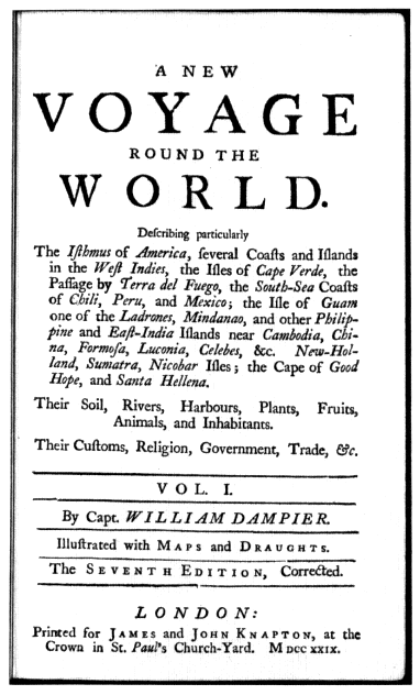
Figure 2.1.
Title page of Dampier's New Voyage . . . , 7th ed. 1729),
p. 3. (Reproduced courtesy of the Bancroft Library.)
Figure 2.2.
Halley's "New and Correct Sea-Chart of the Whole World" (1702). (Reproduced courtesy of the Bancroft Library.)
ralty and the Royal Society, a relationship which reached proper consummation in the Pacific voyages of George III's reign. Although there was originally some intention of reaching "the East Indies or South Seas," Halley's voyages took him no further than the South Atlantic, and the largest blank space on his magnificent world map of 1702 showing magnetic variation was the Pacific (Figure 2.2). As he explained: "I durst not presume to describe the like Curves in the South Sea wanting accounts thereof."[5] Accounts or no accounts, the region was no longer quite terra incognita . The seas beyond Cape Horn were not simply the haunts of buccaneers and adventurers; they also provided the setting for some of the most popular fiction and satire of the period—from Crusoe to Gulliver. After the disillusionment of the South Sea Bubble, activity both practical and literary slumped. Indeed Defoe complained that it was "as if we had done our utmost, were fully satisfied with what we have, that the enterprising Genius was buried with the old Discoverers, and there was neither Room in the World nor Inclination in our People to look any further."[6]
Revival came with the heightening of international tension in the 1740s. A naval expedition commanded by Christopher Middleton sailed for Hudson Bay in 1741 in an unsuccessful attempt to find a Northwest Passage—a venture explained in part by a determination to thwart French expansion in the western interior of North America, in part by a hope of striking at Spain's Pacific possessions from the rear. But above all there was Anson's voyage, that melodramatic episode of wartime disaster and heroism which brought back memories of Drake and half-forgotten feats of arms against the Spain of Philip II. The official narrative of the expedition became a bestseller among travel accounts. It was more than a tale of treasure seeking on the high seas, though this no doubt was the prime reason for its popularity. At one level it was designed to encourage "the more important purposes of navigation, commerce, and national interest,"[7] while at another it made an appeal to the imagination, with reminders
of Crusoe's island and Rousseau's Nouvelle-Héloïse .[8] It strengthened the hold of tropical island fantasies on the European consciousness, a continuing fascination which was to last into the nineteenth century with Melville, Stevenson, and Gauguin.[9]
As considerations of geographical science, government strategy, and mercantile acquisitiveness combined in pointing to the exploration of the Pacific as one of the most important global objectives left to Europeans, so in Paris in 1756 Charles de Brosses published the first collection of voyages devoted exclusively to the Pacific, Histoire des navigations aux terres australes . Plagiarized by John Callender in his English edition, confidently retitled Terra Australis Cognita , this work contained accounts of the main Pacific expeditions from Magellan to Anson. Reading these pages confirms that the earlier voyages had produced as much confusion as enlightenment. Islands had been sighted and resighted, identified and then lost again; distant volcanic peaks had been mistaken for continental ranges; straits had become bays, and bays straits. The map of the Pacific was dotted with island groups whose names and positions changed with the whims of cartographical fashion, and it was scarred with squiggles of coastline which hinted at intriguing but still undiscovered lands of continental dimensions. As the astronomer William Wales tersely remarked during the course of Cook's second voyage, "I firmly believe Islands have been greatly multiplied, and Much Confusion has arisen in the Geography of these seas from a desire of being thought the first discoverers of any land that has been seen."[10] If the geography of the Pacific was uncertain and fanciful, so too was knowledge of its inhabitants. The observations of the explorers were usually hasty and superficial, often the result of only a few days', sometimes only a few hours', stay. Encounters varied from violent to friendly, but misunderstanding was more common than comprehension, and all too often contact ended with the blast of cannon or musket on one side and a shower of stones and arrows on the other.
The Seven Years' War put an end to schemes for Pacific exploration, but in both Britain and France official discovery expeditions were mounted soon after the conclusion of peace in 1763. The first Pacific expedition in the new era of oceanic exploration was that of Commodore John Byron in 1764—a false start in many ways, for despite his comprehensive instructions and his assurance to the Admiralty that he intended to cross the Pacific "by a new track" Byron followed the customary route west-northwest from the Strait of Magellan and consequently made no discoveries of note. His rediscovery and annexation of the Falklands had a political rather than a geographical significance, and that he completed his circumnavigation in well under two years showed his inability to distinguish between an explorer and a record breaker.[11]
In 1766 two further vessels were fitted out under Captain Wallis and Lieutenant Carteret, who were ordered to search for the great unknown continent in more southerly latitudes. After a hard passage through the Strait of Magellan the ships were separated and made individual voyages. Carteret proved an enterprising commander and crossed the Pacific farther south than any other explorer had done, thus making considerable inroads into the conjectural southern continent. He also rediscovered, though he did not identify, the Solomon Islands almost two centuries after they had first been sighted by the Spaniards. Wallis, by contrast, showed little initiative in his track across the ocean, but his voyage was marked by a chance discovery whose emotional impact was out of all proportion to its geographical significance, for in June 1767 the crew sighted, and landed at, Tahiti. It was the first of those meetings between sailors and Polynesian women which were to stamp an erotic imprint upon England's image of the South Seas. To the breaking surf, the palm-fringed beaches, and the gentle climate were added sensuous overtones—of welcoming, garlanded women. When Bougainville's ships reached Tahiti the following year, reactions were even more effusive and extravagant. The island was
named New Cythera by some of the French after Aphrodite's island, and Tahiti long remained a symbol of the romance of the Pacific islands in defiance of those cautionary voices which pointed to the darker side of life there.
Despite these additions by British and French explorers to knowledge of the island groups of the South Pacific, little progress had been made toward solving the crucial issue of terra australis , though hopes had been raised with the claimed sighting by Wallis's crew of "the tops of several mountains the Extreems bearing from South to S.W. upwards of twenty Leagues," just south of Tahiti.[12] The lands east of New Holland remained marked on the maps as they appeared after the Dutch discoveries of the previous century—in effect, swirling question marks (Figure 2.3). Yet within a few years there was no longer any doubt. The South Pacific took shape on the maps in much the same form it has today, and the man responsible for this leap in knowledge, and for much else, was James Cook. His three voyages, following each other in quick succession, revealed the Pacific to Europe in a way no previous explorations had done. As the books, maps, and views came off the presses—not only in England but in France, Holland, Germany, and Italy as well—Cook became a figure of European renown. Other explorers were in the Pacific during the years that Cook's ships were out, but attention was focused on the methodical, comprehensive explorations of the remarkable Englishman.
Lieutenant Cook, as he was on the first voyage, had taken part in the surveying of the St. Lawrence River during Wolfe's campaign, and between 1763 and 1767 he had made detailed charts of the fog-shrouded coastline of Newfoundland. He had studied, in practical fashion, mathematics and astronomy, and in contrast to some of his predecessors in the Pacific he possessed the technical skills needed to make an effective explorer. The next few years were to show that in addition he was gifted with those less tangible qualities of leadership, determination, and judgment which were to make him the outstanding explorer of the eighteenth century. As he once wrote, it was his ambi-
Figure 2.3.
The Pacific before Cook: Bougainville's track, 1767-1768. From
"Dévelopement de la Route des Vaisseaux du Roy . . ." in L. A.
de Bougainville, Voyage autour du Monde (1771). (Reproduced
courtesy of the Bancroft Library.)
tion not only to go "farther than any man has been before me, but as far as I think it possible for man to go."[13] Supported by an Admiralty willing to allow detailed publication of the expeditions' findings, Cook and his officers were able to give a fuller picture of the Pacific than had emerged during the previous two centuries and more of sporadic, often secretive exploration. As recently as Bougainville's voyage, the published narrative suppressed much in the way of precise observation, so that it was, as Carteret put it, "more amusing to the landsmen than usefull to the Seaman."[14]
Cook's instructions of 1768—more detailed than those of Byron or Wallis—were to report on all aspects of new lands discovered and to bring back specimens, drawings, and surveys. Joseph Banks followed the precedent set by the French (Bougainville had on board the astronomer Veron and the naturalist Commerson) to argue that artists and scientists should accompany the discovery expeditions. Though the scientific equipment seems primitive by modern standards, the ships were in eighteenth-century terms floating laboratories. The Admiralty took advantage of the length of the voyages to put on board a whole range of experimental equipment and foodstuffs—from a device for distilling fresh water from sea water to carrot marmalade. Even Dr. Johnson, no enthusiast for oceanic discovery, had called for voyagers with a scientific turn of mind, intent on "every object of curiosity, and at leisure for the most minute remarks."[15] Shortly before the expedition sailed, the president of the Royal Society, Lord Morton, appealed to Cook and Banks for "the utmost patience and forbearance with respect to the natives of the several lands where the ship may touch," and he went on to encourage them "to observe the genius, temper, disposition and number of the natives."[16] Understandably, Cook felt more at ease in describing the geography of the Pacific than its peoples. However difficult to follow an intricate coastline might be, it could be traced, surveyed, pinned down on a chart—and there it would remain, unvarying
in outline over the years. Investigation of the human population of these areas had no such firm basis—not only was there among the different peoples of the Pacific no fundamental similarity of culture or language, there was no accepted method of categorization and classification. Though more serious in intent than their predecessors, Cook and his companions had no scientific base from which to operate. Simple stereotypes of noble primitives, hazy ideas of Rousseauistic philosophy, a nodding acquaintance with some of the deist literature of the day, had little relevance to the problems of understanding which confronted the explorers.[17]
These problems were the more difficult to solve because of the strained nature of the contact. The Pacific navigators of the period were for the most part moderate and humane commanders—by earlier standards remarkably so. Nevertheless the Europeans were intruders, emerging by the score from their great vessel anchored in some island bay, atua or "men from the sky," appearing and disappearing without warning, often violating sacrosanct customs and sacred ground. Over the encounters between voyagers and islanders hung an inescapable tension, sometimes dissipated by individual contacts and trade which offered benefits to both sides, but on other occasions erupting into violence. In the long term, the introduction of venereal disease, alcohol, and firearms brought a depressing and familiar train of consequences: sickness, demoralization, depopulation. It was these voyages which helped give birth to the new disciplines of ethnology and anthropology, but as Malinowski pointed out more than fifty years ago, "ethnology is in a sadly ludicrous, not to say tragic, position, that at the very moment when it begins to put its workshop in order . . . the material of its study melts away with hopeless rapidity."[18]
This was all in the future when Cook, still unknown outside a narrow circle of naval men, left England in 1768 in the Endeavour for his first Pacific voyage. His vessel was not the usual neat naval sloop or fast frigate but a bluff-bowed
Whitby collier chosen for her strength, shallow draft, and storage capacity. Although Cook wrote that she was "the first ship of the kind so imploy'd," there had been earlier attempts by the Navy Board to match the vessel with the mission. Halley's Paramore was a pink with capacious storage and little draft, while Middleton's Furnace bound for the ice of Hudson Bay had started life as a bomb vessel with stout timbers designed to withstand the battering recoil of a heavy mortar. Although Cook's ship was to change, the type was not; the Resolution of the second and third voyages was of the same build and even came from the same shipyard as the Endeavour , of which Cook wrote: "It was to these Properties in her those on board owe their Preservation. Hence I was enabled to prosecute Discoveries in those Seas so much longer than any other Man ever did or could do."[19]
He sailed first to Tahiti to carry out those astronomical observations which were the ostensible reason for the expedition before he turned south where, his instructions told him, "there is reason to imagine that a Continent or Land of great extent, may be found."[20] But he reached latitude 40° south without sighting land. and he noted that the long rolling swell coming from the south argued against the existence of any landmass in that direction. He then turned west to New Zealand, whose coast he mapped in a little over six months by means of a superb running survey from the sea which showed beyond doubt that the two islands were not part of any continent (Figure 2.4). From there Cook went well beyond his instructions as he pointed the Endeavour toward a region of mystery: the unexplored eastern parts of New Holland. Cook reached Australian shores just north of Van Diemen's Land and slowly coasted northward, mapping as he went. After a hair-raising escape from the dangers of the Great Barrier Reef he went on to sail through Torres Strait, thus settling the dispute as to whether New Holland and New Guinea were joined.
Cook had carried out his instructions and more—an explorer who simply followed orders would never accom-
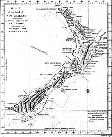
Figure 2.4.
James Cook: chart of New Zealand (1770), from John Hawkesworth,
ed., An Account of a Voyage round the world . . . (London, 1773).
plish great things, he later told a French inquirer.[21] With only one ship he had put more than 5,000 miles of previously unknown coastline on the map. The twin islands of New Zealand, the east coast of Australia, and Torres Strait had at last emerged from the mists of uncertainty to be precisely placed on the map. On the negative significance of the voyage as far as it related to the great southern continent, Cook was emphatic and skeptical: "I do not believe
any such thing exists unless in a high latitude . . . hanging Clowds and a thick horizon are certainly no known Signs of a Continent."[22]
This feat of detailed exploration had been accomplished without the loss of a single man from scurvy— most of the forty-one deaths on the voyage came from malaria and dysentery picked up at Batavia on the homeward journey. The work of specialists has corrected the popular view that Cook was responsible for discovering and enforcing the cure for scurvy on long sea voyages. His approach was rather that of the blunderbuss, as Sir James Watt has put it.[23] Even so, there remains an outline of truth in the conclusion of a contributor to The Medical and Physical Journal in 1799 that Cook "proved to the world the possibility of carrying a ship's crew through a variety of climates, for the space of near four years, without losing one man by disease; a circumstance which added more to his fame, and is supposed to have given a more useful lesson to maritime nations, than all the discoveries he ever made."[24]
The public saw the first voyage through the eyes of John Hawkesworth, who fused the separate journals of Cook and Banks into a single narrative to make the Endeavour expedition the resounding climax to his Voyages of 1773, which took in also the accounts of Byron, Wallis, and Carteret. An editor of literary rather than nautical expertise, Hawkesworth inserted reflective and philosophical passages, switched locations and opinions, idealized the commanders and their crews, and generally made frequent and sometimes substantive changes to the journals. Publication led to dispute and controversy in which Hawkesworth was attacked for the work's frank descriptions of Polynesian sexual customs, for skepticism about the "particular interposition of Providence," and for technical inaccuracies.[25] Doubts were expressed about the authenticity of the text—summed up by Boswell when he remarked to Cook that Hawkesworth "has used your narrative as a London tavern keeper does wine. He has brewed it."[26] The ensuing stir no doubt persuaded Cook and his suc-
cessors to keep publication of their later journals out of the clutches of literary gentlemen, but there can be no doubting the impact and popularity of Hawkesworth's Voyages . The book soon went into other editions and other languages, and an analysis of borrowings from a major lending library of this period shows that of all works held by the library, Hawkesworth was the most in demand.[27] As one newspaper commented, "It may be called a real authentic Account of a new World, such as no European could have figured in his own Imagination."[28]
Cook was to read and be irritated by Hawkesworth's Voyages , but not until two years after its publication. For by 1773 he was in the Pacific again. On his first voyage Cook had lopped a considerable slice off the supposed continent of the south, but there remained vast unexplored stretches in the high latitudes of the Atlantic, Pacific, and Indian oceans where land might yet be found. Pressure in Britain for another voyage mounted as reports came in that the French were again sending expeditions to the Pacific: four in fact visited the southern seas, hunting for islands and continents, between 1770 and 1773. So in 1772 Cook left England to search once more for the great southern continent, carrying on board chronometers, one of which was Kendall's copy of John Harrison's masterpiece, his fourth marine timekeeper. The instrument proved itself by keeping accurate time throughout the buffeting of the long voyage (see Figure 5.4), and one of the most persistent problems of oceanic navigation had been overcome. Much of Cook's achievement would have been impossible without the developments in navigational science and instrument making of his age—we have come a long way from the mariner's traditional three L's of Lead, Latitude, and Lookout.[29] Equipped with chronometers and improved sextants, navigators would be able to find both longitude and latitude with an accuracy sufficient for all practical purposes.
Cook's second Pacific expedition was arguably the greatest, most perfect, of seaborne voyages of discovery. In his three years away he disposed of the conjectural southern
continent, reached closer to the South Pole than any man before him, and touched on a multitude of lands—New Zealand and Tahiti again and for the first time Easter Island, the Marquesas, New Caledonia, the New Hebrides, and South Georgia. In doing so he confirmed, located, and connected many of the uncertain discoveries of earlier explorers which had brought so much confusion to the map of the Pacific. In high latitudes he crossed and recrossed the Antarctic Circle in a series of long, methodical sweeps. At his farthest he reached latitude 71° south before being stopped by the ice barrier which encircles the immense continent of the south. This was not the fertile land of the theorists' dreams but the frozen Antarctic—in Cook's words, "a Country doomed by Nature never once to feel the warmth of the Suns rays, but to lie for ever buried under everlasting snow and ice."[30] With him this time sailed that learned if awkward man, J. R. Forster, and his son George, and the painter William Hodges, whose luminous, sun-drenched landscapes evoked the South Seas as no artist had done before. The published records of the voyage were fuller and weightier than before. Cook's own journal was issued in 1777 as his Voyage Towards the South Pole , a mighty affair of over seven hundred pages; a lively account by George Forster, A Voyage Round the World , was published in two volumes a few weeks before the appearance of Cook's book; then in 1778 appeared J. R. Forster's scholarly, sometimes portentous, Observations Made During a Voyage Round the World , four hundred pages of which were taken up with "Remarks on the Human Species in the South-Sea Isles." The accounts and maps furnished conclusive proof that the populous terra australis of tradition did not exist and that exploitation of the Pacific would be pursued on a more modest scale than that envisaged by a long line of geographers and economists.
There was, thought Cook, little more to do in the South Pacific: "I flater my self that the intention of the Voyage has in every respect been fully Answered, the Southern Hemisphere sufficiently explored and a final end
put to the searching after a Southern Continent, which has at times ingrossed the attention of some of the Maritime Powers for near two Centuries past and the Geographers of all ages."[31] There was, Beaglehole has written, "something almost cruelly final" about the great voyage.[32] Cook's third and final voyage, then, had its own logic in that it took him to the North Pacific in an effort to solve another perplexing and long-standing geographical mystery: the existence of a Northwest Passage. The eighteenth-century explorations of the North Pacific before Cook had brought considerable advances in Europe's knowledge of that remote area, but also much uncertainty and speculation. At the beginning of the century no European knew what lay between California and Kamchatka. The trend of the Pacific coast of America north of Cape Blanco in latitude 43° north was unknown; how far eastward Asia stretched from the peninsula of Kamchatka was equally doubtful. In the intervening 5,000 miles there might be ocean or land, islands or continents, a land bridge between Asia and America, or the entrances to the Northwest and Northeast Passages. Slowly and hesitantly the Russians, hampered by enormous problems of logistics, began to resolve the puzzle through the expeditions of Bering and his successors. But the failure to publish the working charts of the Russian explorers, and the eagerness of speculative geographers to fill the void with their own eccentric creations, brought mystification rather than illumination to the scene. The Spaniards, too, moved north from Lower California in the 1760s and 1770s and reached, fleetingly, Alaska; but again little was known of their rather fragmentary discoveries at the time.
In taking the unfrequented route from Tahiti to the northwest coast of America, Cook made the major, and for himself fatal, discovery of the Hawaiian Islands before turning to the main task. The summer of 1778 he spent engaged in hazardous exploration along the Alaskan coast, searching in vain for the strait leading to an ice-free Arctic Ocean indicated on the maps of the theoretical
geographers. No such passage was found before Bering Strait was reached, and after only a week's sailing through that narrow opening Cook found his way blocked by a massive wall of ice grinding down upon his ships. He had been imposed upon to the world's advantage, Beaglehole has written,[33] and the results of this single season of exploration were indeed impressive. Although unaware of the insular nature of much of the coastline he was sailing along, Cook charted the main outline of America's shores from Mount St. Elias to Bering Strait, determined the shape of the Alaskan peninsula, and touched on the coast of modern British Columbia. He closed the gap between the Russian and Spanish probes. The maps brought home by Cook's officers after his death, and published with the official account of the voyage in 1784, showed the reality of his achievement. In outline, at least, the shape and position of the northwest coast of America were known, and for the first time the region takes recognizable form on the maps (Figure 2.5).[34]
On his three voyages Cook had established the salient features of the Pacific. Much remained to be done, but in the way of defining detail rather than in solving major geographical problems. There were further voyages of exploration to the Pacific before the end of the century: Vancouver's painstaking survey of the northwest American coast which corrected and completed Cook's chart, the ambitious Spanish venture under Malaspina (few of whose journals were ever published), and D'Entrecasteaux's search expedition for the ill-fated La Pérouse. It was Cook's men who dominated the English voyages to the Pacific, whether for exploration or trade: Bligh, Dixon, Portlock, Colnett, Riou, Hergest, and above all Vancouver had graduated in the most demanding of training schools. As William Windham remarked to James Burney on hearing of Bligh's incredible open-boat voyage after the Bounty mutiny, "But what officers you are! you men of Captain Cook; you rise upon us in every trial."[35] Cook's own reputation after his death "was submitted quite consciously
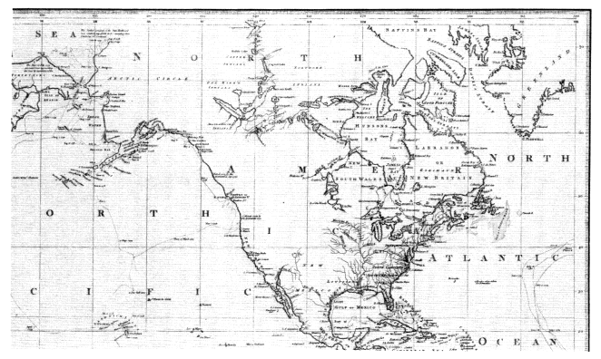
Figure 2.5.
Henry Roberts: detail from his "Chart exhibiting the Discoveries Made by Capt. James Cook"
(1784). (Reproduced courtesy of the Bancroft Library.)
and deliberately to a heroizing process, not by his fellow voyagers but by academicians, poets, and artists whose imaginations had been gripped by the magnitude of his achievement."[36] He was, Bernard Smith continues, "a new kind of hero for a new time": secular, humane, scientific, professional.
George Forster took the significance of the explorations a stage further when he wrote in 1782, "What Cook has added to the mass of our knowledge is such that it will strike deep roots and long have the most decisive influence on the activities of men."[37] Some indication of this legacy could be seen in the Pacific in the aftermath of Cook's voyages. Inevitably the tasks and achievements of his successors appeared more mundane, and their voyages were rivaled by the appearance of trading, missionary, and settlement enterprises—for as Forster has said, the roots were striking deep. By the end of the century there were British settlements in New South Wales; Nootka had taken on a new significance, not simply Cook's old watering place on the northwest coast of America but a center of international dispute; the first missionaries had reached Tahiti; and everywhere the vessels of the traders and whalers were following the explorers' tracks.
We return to a summary of the English achievement, inevitably, by way of Cook. His enduring memorial was inscribed on the map of the Pacific, those now familiar coastal outlines which demonstrated the amazing growth in Europe's knowledge that took place between the 1760s and the 1780s. As James King exulted after the third voyage, "The Grand bounds of the four Quarters of the Globe are known."[38] But there was more to the achievement than the accumulation of geographical knowledge. There was, if it is not too grand a term, a new methodology. It was European rather than narrowly English in scope, but for more than one reason its clearest manifestation in this period came by way of Cook's voyages. Boswell hinted at it when he observed of the explorer that he had "a ballance in his mind for truth as nice as scales for weighing
a guinea."[39] It was the insistent determination to show things as they were and to dispel myths and illusions by way of empirical observation and prompt publication. This is the keynote of the journals of Cook and his successors—and the indignation which had greeted Hawkesworth's free adaptations revealed something of this "dispassionate investigation of the truth," as Vancouver termed it.[40] Ice-free northwest passages, fertile southern continents, and Patagonian giants had no place in this approach. Scholars might carp at the incomplete nature of the observations, particularly those relating to natural science, but there was now more precision and less fiction about the accounts. As Anders Sparrman, who was with Cook on his second voyage, wrote: "Men with one foot, indeed, Cyclops, Syrens, Troglodytes, and such like imaginary beings, have almost entirely disappeared."[41]
Not all was smooth sailing of course. Many of the natural history observations and specimens brought back in such profusion from the Pacific remained unpublished and unrecorded. It was a backward step when Cook on his third voyage, and then Vancouver on his great survey, set their minds against the presence of independent scientific "gentlemen" on board their ships; for whatever problems of personality and priorities they posed, Banks and Solander, the Forsters and Sparrman, had added much to the sum of human knowledge. There is an unpleasing edge to the satisfaction with which the naval explorers contraverted the enthusiastic but sometimes naive geographers of their day—the "theoretical navigators," the "hypothetical projectors," the purveyors of "vague and improbable stories." Vanity, even a touch of arrogance, are present, though surely more excusable than usual, for Cook and his officers were consciously setting new standards in the extent and thoroughness of their surveying operations. As Cook wrote of his chart of the North Island of New Zealand on the first voyage: "I believe that this Island will never be found to differ materialy from the figure I have given it."[42] There is a sense of permanence
here, of posterity even, a sense of the triumph of human willpower aided by science over nature in all its forms. The "impediments" (to use one of Cook's favorite words) of ice, fog, tempest, and reef were treated with a seaman's respect but were not allowed to distract from the obsessive determination to explore, chart, and survey. A new dimension had emerged in British seaborne endeavor. It was to lead to that sustained effort of marine surveying which by the mid-nineteenth century had given reality to the words somewhat prematurely used by Sir John Pringle, president of the Royal Society, when he said of Cook on the occasion of the award of the society's Copley Medal to him that the explorer had "fixed the bounds of the habitable earth as well as those of the navigable ocean."[43]
III
The Men from Across La Manche: French Voyages, 1660-1790
Seymour Chapin
Enormous contrasts can be drawn about conditions in France between the opening and closing dates of this survey. No matter where one looks, those hundred and thirty years resulted in alterations of considerable significance. In the political arena, the year 1660 saw Louis XIV take the decision to be his own first minister and, with that, to begin the rise of the absolute monarchy to its zenith. By 1790, however, the process of limiting the monarchy's power was already well under way at the hands of the National Constituent Assembly, and the republican sentiment that was to bring its complete downfall was at least in its embryonic stage. Socially in 1660 France was a hierarchically organized state in which all individuals were defined by the order to which they belonged. By 1790, however, the concept of orders had been replaced by that of la patrie . Economically France was, in 1660, on the verge of becoming—thanks to Colbert—the most thoroughgoing mercantilistic nation in Europe. By 1790, however, the stage had been set for at least the beginnings of a substitu-
tion of a free-enterprise, laissez-faire system for the previous Colbertism. One could doubtless evoke many other such broad examples, but it seems preferable to come quickly to the specific subjects of this study: scientific and geographical discovery.
This is obviously not the place to attempt even the most cursory summary of one hundred and thirty years of scientific development—especially these years which, after all, saw the dilettante savant converted into the professional scientist. That comment will, however, allow one to offer at least one general contrast to parallel those already made, since the principal agency of that transformation was the Académie Royale des Sciences. Thus the year 1660 found France six years from the creation of that central and well-subsidized institution for the promotion of scientific research. The year 1790, on the other hand, saw the French nation only three years away from destroying that academy, which it may be argued had lived out most of its truly useful existence. A multitude of sciences had progressed greatly under its aegis—to the point, in fact, where other, more specialized, centers had emerged to provide new foci and new support.[1] Several of these sciences and institutions had important roles to play in scientific and geographical expeditions. We shall be concerned here with a few of them. I should like to stress at the outset, however, that my emphasis will be upon such matters as astronomy, navigation, geodesy, and cartography and not at all upon the rather separate though very significant tradition of voyaging in the interests of natural history.[2]
Coming now to geography, one might offer several broad contrasts between French presences on the globe in 1660 and those in 1790. Overseas, France in 1660 was well established in the West at those rapids in the St. Lawrence River that Cartier had ironically named La Chine. By 1790, however, that Canadian springboard into Louisiana had passed into English hands while Louisiana itself had been divided between Spain and the young United States. In the East there was, in 1660, virtually nothing French be-
yond the Cape of Good Hope. And France's subsequent Indian Ocean presence had again diminished by 1790. Beyond there, or from around Cape Horn, Frenchmen had not passed—except as sailors on the ships of Magellan and others—by 1660. By 1790, however, they had left their mark—and their markers of possession—on a significant number of Pacific locations and were exploring the possibilities of a fur trade between the northwest coast of North America and La Chine the country.[3] Finally, one might conclude this set of contrasts by pointing to the fact that France itself had undergone considerable change during this period, adding large territories on its east by military, legal, and diplomatic action while losing lands on its west to the Atlantic Ocean.
This latter loss was the result of scientifically based mapping operations and can, thereby, serve to get us on with our subject—after two general remarks. The first is simply a disclaimer: the survey I shall be presenting makes no pretense to being definitive; indeed, it will probably appear rather selective. The reason for that brings me to my second observation: while it has become almost commonplace to point out that exploration in the eighteenth century became more scientific as the century progressed, that view is based far more upon the English experience than upon the French. Thus some effort at a demonstration of this point and, more specifically, of a contention that the French were more scientific all along will be one of my major concerns— an objective that has, naturally, somewhat controlled my choice of examples.
In 1663 an account of a French voyage of the early sixteenth century was published. In the early summer of 1503, a ship named L'Espoir , under the command of a Captain Gonneville, left Normandy and sailed south into the Atlantic. The following November, when somewhere in the vicinity of the Cape of Good Hope, she encountered violent storms and was blown off course. In early January 1504, L'Espoir reached a land where her crew, well treated by the natives, was able to repair the ship and lay in stores
for the return trip. When the ship finally arrived back in France in the spring of 1505, she carried on board the son of a local king of what came to be known as Gonneville's Land. It was a descendant of that passenger, Jean Paulmier de Courtonne, canon of St. Peter's cathedral in Lisieux, who published the 1663 account of the voyage of L'Espoir , accompanied by a plea for a missionary expedition to his people.[4]
It would be tempting to see the appearance of this pamphlet, a second printing of which was issued in 1664, as at least a partial motivation for the founding in that year of the Compagnie des Indes Orientales. Such would not seem to be at all the case, however, for two major reasons. First, the location of Gonneville's Land was unknown, for the captain's report contained neither bearings of any kind nor any estimates of either latitude or longitude. It was generally assumed that it must lie somewhere in the southern ocean, but precise guesses ranged widely and the whole affair was attended with such vagueness that this mysterious region had to wait until the next century to have its real impact. The second reason is simply that since 1604 there had appeared no less than four French companies which had proposed to establish commerce with the East Indies, but they had profited from their privileges only to send isolated ships to distant parts and to found on Madagascar (sometimes suggested as the actual landfall of Gonneville) a colony that was on the point of extinction by 1664.[5] The company that Colbert then founded under the special protection of Louis XIV aimed at reversing that pattern of failure.
That the new association seemed destined to a brilliant future was a product of its being part and parcel of Colbert's whole economic program. That plan, which gave due consideration to foreign commerce, tariffs, the merchant marine, and the navy, was colored by his hostility to the English and Dutch—especially the latter, a hostility which had its origins in mercantilist principles.[6]
Of particular interest here is that Colbert's program also
predisposed the French to take a great interest in the marine clocks of the Dutch scientist Christian Huygens. Having converted Galileo's discovery of the isochronism of the pendulum into an accurate timepiece in 1656,[7] Huygens had, in 1662, developed a marine variation employing a short pendulum which had subsequently been subjected to tests at sea with the aid of the English. News of this device having come to Colbert through one of his advisers, the new director of France's economic life was determined to secure its advantages for his nation. Accordingly, Huygens was lured to Paris in 1665.[8]
About a year after his arrival there he became one of the original members of the Académie Royale des Sciences, the creation of which was yet another reflection of Colbert's sweeping program aimed at establishing France's economic preeminence. Thus the Académie was to be the government's select body of consultative experts. They were to engage, for example, in a complete description of the arts and crafts in France aimed at introducing the benefits of scientific theory into the practices of the workshops. Of far greater importance to present purposes, they were to play an important role in achieving another of Colbert's broad goals: the exact mapping of his monarch's kingdom.[9]
That aim fitted in very well with the extensive astronomical program proposed for the Académie during its earliest sessions by Adrien Auzout, including a call for the creation of a royal observatory in Paris. And it was undoubtedly that same desire which brought new additions into the Académie. One of these, Jean Picard, was probably the closest approximation to a "professional" astronomer then to be found in France.[10] The other addition of significance had to be imported into that nation. This was Giovanni Domenico Cassini, whose tables of the motions of Jupiter's satellites—published in Bologna in 1668—had, because they were accurate enough to predict the eclipses of those bodies, finally rendered practicable Galileo's idea for reading them as the hands of a celestial
clock in the determination of longitudinal differences.[11] Small wonder that Cassini was invited to enjoy a large pension from the Sun King on the condition of taking up residence in Paris, where he assumed membership in the Académie and a leading role in the affairs of the observatory then being constructed.
As successful as it was for utilization on land, the technique of Jupiter's satellites was not applicable at sea— largely because of the difficulty of making precise observations through a long telescope on the deck of a swaying ship. But determining longitude at sea was, as we have seen, a major concern in France at this time.[12] Indeed, one of the activities called for by Auzout as early as January 1667 was for the sending of a scientific expedition to Madagascar. The memoir in which he spelled out its manifold aims is the first clear statement of what constitutes a truly "scientific expedition" as opposed to a broad but ill-defined voyage of collection. It has appropriately been said that the carefully planned journey "by a trained scientist for the investigation of significant problems or phenomena was a remarkable innovation"[13] it should be emphasized, in keeping with my earlier contention, that it was an innovation which appeared in the Paris Académie des Sciences within three weeks of its official beginning. One of the goals of this first suggested program was, as would be expected, the testing of Huygens' marine clocks. And although the full Madagascar expedition had to be postponed because of political and economic considerations, Colbert pushed ahead with more restricted and utilitarian voyages.[14] Thus during 1668 and 1669 two voyages to test the clocks were made in the Mediterranean with one of the Académie's assistants, a M. Delavoye, in charge of the instruments. The first test produced quite unsatisfactory results—for which Huygens partially blamed Delavoye's handling—but the second greatly encouraged all involved. Indeed it now seemed vital to send the clocks on a more extensive voyage, and the Madagascar possibility surfaced once again. That was not destined to come about, but its
place was taken, in 1670, by a voyage to Acadia, perhaps thought to be a more appropriate destination—thanks to its east-west rather than primarily north-south orientation—for attempts at longitude determination. I say attempts because, as things developed, this voyage was to test two methods for achieving that goal, precisely the two methods that were ultimately to prove successful a hundred years later: the chronometer and lunar-distance methods. They were far from successful in 1670. Thus the clocks, now confided to Jean Richer, another of the Académie's students, had been stopped by an encounter with a storm shortly after the ship's departure from La Rochelle, while no records at all remain of the efforts of a M. Deshayes to employ the technique known as lunar distances.
The situation was quite different on land. There the academicians—especially in the person of Picard—were carrying through a revolution in observational astronomy made possible by Huygens' astronomical pendulum clock, the filar micrometer perfected (if not invented) by Auzout, and the application of telescopes to large-scale graduated instruments appropriate for the measure of small angles.[15] It was with this equipment that Picard undertook to measure the distance between two localities approximately on the meridian of Paris, to determine the differences in their latitudes, and to deduce from those results the length of a degree of meridian. That eminently successful arc measure, marked by a precision thirty to forty times greater than any previously achieved, became the basis on which the desired rectification of French cartography could be— and was—carried out.[16]
The Académie also continued its interest in expeditions abroad. Thus, in July 1671, Picard traveled to Denmark for the purpose of establishing the exact location of Tycho Brahe's observatory of Uraniborg and the longitudinal separation of that site from Paris in order to be able to utilize the Danish astronomer's star catalog effectively. And in September of that same year Richer was dispatched to Cayenne to conduct many of the astronomical observa-
tions originally slated for Madagascar but also to take advantage of the proximity that Mars would have to Earth in 1672 in order to deduce, by means of corresponding observations made by Cassini in Paris, a new and improved figure for the parallax of the sun. The dimensions of the solar system were to be improved along with those of France. One important outcome of the Richer expedition, to which we shall return momentarily, was that he found it necessary to shorten a seconds pendulum that had been accurately adjusted in Paris.[17]
All of this new information—especially the new determinations of latitude and longitude for hundreds of locales—was placed by Cassini upon the large world map that he created at the Royal Observatory. That institution was also the scene of other important works. Thus, for example, it was there that Ole Roemer, who had so impressed Picard while assisting him at Uraniborg that the Frenchman had brought him back to Paris, engaged in his study of the eclipses of Jupiter's satellites that led him to enunciate, in 1676, the finite velocity of light and provide a figure for it.[18] Interestingly, Roemer also contributed to the ever increasing precision of observation through work on the epicycloidal form of the teeth of clock driving wheels.[19] That effort, which found immediate use in improved pendulum clocks, also had applicability for spring-driven clocks which even Huygens was beginning to realize would have to be the basis for effective seagoing timekeepers.[20] Another product of the observatory was the publication of an annual ephemeris, the Connaissance des temps , beginning with a volume devoted to the year 1679.[21]
The result of all this activity was a remarkable improvement in maps and the manner of making them. Indeed, the creation of scientific cartography seems clearly to be a French contribution of the late 1660s and 1670s. This was to be the process that shrank France in the West, although that was actually done separately from the work of the Académie by a group of engineers, whose isolated works
were, however, coordinated by the Académie and furnished information to become publishable in atlas form as Le Neptune François .[22]
In the 1680s this thrust toward scientific locating was continued both in France and overseas. One instance of the latter was the expansion of this activity to China. When Father Fontenay, a Jesuit professor of mathematics at the Collège Louis le Grand who was well aware of the work of Cassini and his colleagues, was then preparing to go there, he volunteered to make as many observations as he could undertake without interfering with his missionary duties. He was duly trained at that observatory before his departure.[23] At the same time, the Académie was organizing another expedition to the West. Thus in the spring of 1682, two of His Majesty's engineers for hydrography, Messrs. Varin and Deshayes, joined by a M. De Glos, a young man trained (as were they) by Cassini, departed from Gorée, a small island off Cape Verde on the west coast of Africa, where a French colony had recently been established by the Compagnie du Sénégal et Côtes d'Afrique. From there they sailed to the West Indies where they spent the better part of a year in extensive observations. Certainly their talents could have been put to good use by René-Robert Cavelier Sieur de La Salle, who had descended the Mississippi to its mouth in 1681, returned to France, and won support for an expedition to plant a colony there.[24] He overshot that destination by some 400 miles, however, and landed in what is now western Texas. Clearly a Cassinitrained scientist might have enabled him to avoid the disaster that ultimately befell the entire undertaking.
The La Salle episode reminds us that various commercial and expansionary developments were not at all associated with the movement being dealt with here. To cite but a few examples, one can point to the expansion from Madagascar into the Mascareines with the founding of centers on the Ile de France and the lie de Bourbon and the further establishment, from there, of a French presence in India. In fact the expansion went beyond there,
for the Jesuits were followed into China by traders, who, naturally, came to be organized in mercantilistic France as the Compagnie de Chine.[25] Moreover, there occurred also a French penetration into the southern ocean across the Pacific when, after the Dutch wars of 1672-1678, French corsairs joined the pirates of the Caribbean in attacking the rich and ill-defended South American colonies along the Pacific coast. That penetration greatly escalated after 1698 and took a new turn, becoming almost legal, with the placing of a Bourbon on the Spanish throne in 1700.[26]
We return to our dominant theme by observing that the War of Spanish Succession which resulted from that action provided an opportunity for French scientists to pay visits to areas previously closed to them. Thus, in 1707, Louis Feuillet—who had earlier accompanied Jacques Cassini, the second member of that astronomical dynasty, on a voyage to the Levant and was later sent to the Caribbean, the aim of both journeys being astronomical observations and the determination of longitudes—was dispatched to the South Seas with instructions to carry out a scientific survey of the Pacific coast and to fix the exact longitudes of its principal parts. Four years later, Amedée François Frézier left to do more of the same, although this time with certain political undertones and with some important Atlantic coast work—such as a survey of Le Maire Strait—on the way. His map of South America has been called "the most accurate and reliable which had so far been drawn."[27]
It was an incident of this same war—namely, the wreck in the Scilly Islands of four ships with the loss of two thousand men of Admiral Shovel's fleet—that gave a new urgency to the search for a solution to the problem of determining longitude at sea. The most famous response to this disaster was the passage of the British act of Parliament in 1714 that provided for a "public reward for such person or persons as shall discover the Longitude" and created the Board of Longitude to administer the distribution of funds.[28] Of equal importance for our purpose,
however, was a parallel development in France—namely, the creation of two prize programs to be developed and directed by the Académie des Sciences on the basis of funds bequeathed to it by one Rouillé de Meslay.[29] The second of these programs was to reward the finding of longitude at sea and discoveries useful to navigation and great voyages. As such, it was to be responsible for a good deal of the work—particularly the construction of marine clocks— that we shall be dealing with here.[30]
Before continuing with the longitude theme, however, we should note another problem that burst upon the scientific scene in that same second decade of the eighteenth century: the puzzle that appeared with Richer's shortening of his seconds pendulum. The need for that action was not immediately explained. Indeed, it was not even accepted by all interested parties—Cassini, for example, was inclined to think that Richer had been mistaken or careless. When the subsequent expedition from Gorée reported the same necessity, however, the search for an explanation became rather pressing. In the interim between those voyages, Huygens had published his epochal Horologium oscillatorium , which provided an equation for the duration of an oscillation of a pendulum in terms of its length and its weight considered as a combination of attraction and centrifugal force.[31] It now was realized, therefore, that the alterations in length must have been necessitated by a change in weight. How was this possible? The answer was soon forthcoming in Newton's monumental Principia , which appeared in 1687 and gave to the world the great principle of universal gravitation. In it, Newton postulated, without demonstration, that the form of equilibrium of a fluid homogeneous mass, subject to the law of attraction and rotating about an axis, is an ellipsoid of revolution about that axis, flattened at the poles.[32] In other words, the earth has the shape of an oblate spheroid, a conclusion with which Huygens agreed in his 1690 work on the cause of weight, even though he did not admit the reciprocal at-
traction of all particles of matter and found a lesser degree of flattening at the poles (or, the same thing in reverse, the bulging of the equator).
Thus by the end of the seventeenth century agreement had been reached as to the oblateness of the earth but not its extent. Operations were then under way, however, which were to contradict the idea of oblateness itself. As early as 1683 it had been decided to extend the arc measured by Picard in both directions. This work, begun by the first Cassini and others, had been interrupted. It was resumed in 1700, however, and carried to completion in 1718 by Jacques Cassini, who published the results of these new measures in 1720.[33]
If the earth has the form of an oblate spheroid, the length of one degree of latitude ought to increase as one moves from the equator toward the poles. In the measure undertaken in France, therefore, a northern extension of the same amplitude as Picard's arc ought to have been slightly longer than the original arc, which, in turn, ought to have exceeded in length a southern extension. The figures published by Jacques Cassini, however, indicated an opposite relationship. Having found that the most southerly portion of the total arc had the greatest length, Cassini and a group of followers maintained that the earth had the shape of a prolate spheroid—elongated rather than flattened at the poles.
It has recently been shown that the dispute between the proponents of oblate and prolate spheroids, known respectively as the Newtonians and the Cassinians, was not simply "a skirmish in the battle between Cartesians and Newtonians" as it had usually been represented—an observation that should have been obvious from the outset when one considers that Huygens' support of oblateness was, after all, derived from Cartesian principles.[34] The new and richer context for the debate has made much more of the fundamental split between solutions from theory and those from observation. That the evidence from
the latter was suspect was first pointed out in 1720 by Joseph Nicolas Delisle, the occupant of a chair of mathematics at the Collège Royal. Delisle set forth reservations about what one could infer about the earth's shape from any local measurements, even those associated with his suggestion for a different approach to the problem—namely, to substitute a measure of a degree of longitude along a parallel to the equator for the measurement of latitudinal lengths.
The memoir in which Delisle enunciated these considerations was not made public at the time of its writing. Nor, in fact, did it come to light for some time thereafter, an outcome that stemmed from his acceptance of an offer from Peter the Great to found an observatory and an associated school of astronomy in Russia. Planned for four years, Delisle's stay in Russia stretched into a twenty-two-year period. While there, incidentally, he and his students engaged in geodetic and cartographic ventures throughout the country, the results of which were intended for a projected but unrealized large-scale and accurate map of Russia.[35] In any event, given his absence from Paris it fell by default to others to carry out or at least to publicize his suggestions. They—particularly Pierre Louis Moreau de Maupertuis—did so in 1733 on the basis of a small book published in Italy in 1729 by Giovanni, the Marquis Poleni, holder of the chair of mathematics at the University of Padua. Like Delisle's unpublished memoir, that booklet (and Maupertuis) urged the utilization of longitudinal measures. Maupertuis read his paper to the Académie when Cassini was away—engaged in the fieldwork necessary to trace across France the arc of the great circle perpendicular to the meridian through Paris. Reporting on this project at a public meeting of the Académie a few months later, Cassini not only insinuated that he had himself arrived at the idea of using longitudinal lengths to determine the earth's shape but that the work already accomplished had again vindicated his prolate spheroid. Delisle,
incidentally, reclaimed his priority by finally printing his ideas in 1737. Considerably before then, however, a solution to the dispute was being sought in another direction.
The real problem with the evidence of the extended measure, as pointed out by Newton himself in the 1726 third edition of his Principia , was that the small differences in length involved could have resulted simply from errors in the operations. One proposed solution to that difficulty was simply to measure degrees of latitude considerably distant from one another. Thus, in 1735, the Académie resolved to send an expedition to measure a degree of latitude near the equator and another to do the same near the pole. Shortly thereafter, two groups of academicians left France; one went to Peru, the other to Lapland.
The expedition to Lapland did not in fact leave until 1736, almost a year after the other. It returned, however, in 1737—seven years before the Peruvian expedition. The account of this northern undertaking was published in 1738 by Maupertuis, who had both promoted and headed it. The arc measured by this expedition was found to be considerably longer than that measured by Picard (Figure 3.1). No wonder that Maupertuis, for a frontispiece to his account, had himself painted bedecked in furs and holding in his hands a globe of the earth that he was squeezing flat at the poles (for another depiction of Maupertuis from his book, see Figure 3.2).[36]
The value of the Lapland degree invalidated the re-suits proclaimed after the prolongation of Picard's arc and necessitated a remeasure of the meridian of Paris. This project was undertaken in 1739 and 1740 under the auspices of the Académie and featured the work of the Abbé Nicolas-Louis de Lacaille and the third member of the Cassini dynasty to be so involved, César-François Cassini de Thury as he liked to fashion himself. The new meridian, known as the Méridienne vérifiée from the title of Cassini III's book describing the operations, reversed the earlier findings and erased any doubts which might have remained.[37] Thus, in 1740, the question was definitely de-
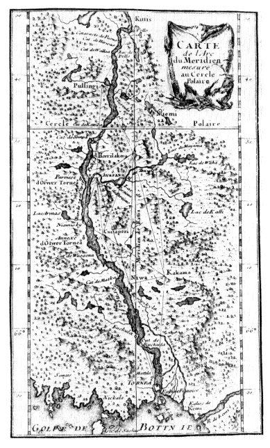
Figure 3.1.
Foldout map following p. 184 in M. de Maupertuis,
La figure de la terre . . . (Paris, 1738).
Figure 3.2.
Depiction of Maupertuis moving from one station to another in Lapland.
From M. de Maupertuis, La figure de la terre . . . (Paris, 1738).
cided in favor of the Newtonian theory. The results soon to be brought back from Peru were going to provide further proof of the oblateness of the earth.
As indicated earlier, the Peruvian expedition left France in 1735. It was not until 1744, however, that the first of its members reappeared in Paris. There were several reasons for that long delay, the first of which was simply the difficulty of the operations themselves. Another reason was the friction among those involved.
The leader of the expedition was Louis Godin, who had addressed himself to its object immediately following Maupertuis's memoir and subsequently suggested the equatorial venture.[38] Following those operations he stayed on, as a professor of mathematics at the University of San Marcos, until 1751. Despite later claims that he was working on it, Godin never published his account of the voyage.
Another member of the expedition was Charles-Marie de La Condamine, who in June 1733 had discussed instrumentation to go with Godin's ideas. He returned to France by the longest and most dangerous route, the Amazon. After reaching the Atlantic he went to Cayenne where he repeated the observations of Richer that had initiated the problem more than seventy years earlier. Back in Paris he published, in 1751, a day-by-day account of the expedition
which served as a kind of introduction to the detailed treatment of the geodetic operations which he brought out later that same year. It is rather ironic that, thanks to "his amiable nature and his talent as a writer," La Condamine has received the major part of the credit for the success of the expedition when he was, in fact, a less gifted astronomer than Godin and a less reliable mathematician than the venture's third member, Pierre Bouguer,[39] who was in fact, for our purposes, its most important collaborator.
The son of a royal professor of hydrography, Bouguer was a prodigy who at the age of fifteen, at the death of his father, applied for and obtained the professorship. He quickly became "the leading French theoretical authority on all things nautical," winning Meslay prizes in 1727, 1729, and 1731 on the subjects of the masting of ships, the best way of observing the altitudes of stars at sea, and the observation at sea of the magnetic declination.[40] Becoming an associate geometrician in the Académie in 1731, a most unusual appointment, he seemed a natural choice to accompany Godin and La Condamine. In Peru he engaged in a number of investigations beyond the geodetical work itself. He also, as has been implied, entered into arguments with his colleagues. The first of the three to return to France, he also was the first to set forth his account of the expedition. That publication occurred in 1749,[41] but he continued thereafter to launch a number of polemics, which need not concern us, against La Condamine.
Always good with instruments, in 1748 Bouguer invented the heliometer, a device capable of accurately measuring such small arcs as those involved in determining the diameter of the sun.[42] In 1752 he was named an honorary member of the Académie de Marine established in that year,[43] while in the following year he brought out his Traité de navigation . Although warmly lauded in a report presented to that naval academy, the Traité was written more for scientists than for sailors. It was, however, to be greatly improved upon in that regard in a new edition brought out by Lacaille in 1760, as we shall see shortly.[44]
The new Académie de Marine was a significant creation. It was composed of a liberal cross section of people concerned with naval affairs: officers from the rank of ensign through squadron chief, engineers who dealt with fortifications, artillery, and the various activities of the Dépôt des Cartes et Plans, shipbuilders and pursers, professors of hydrography in certain ports of France, and instructors in mathematics in some of those same places, but mainly those (and especially several Jesuits) associated with the schools devoted to the training of future naval officers, the specially favored Gardes de la Marines.[45] Its works were to be as broad as its membership, starting with the idea, so typical of the eighteenth century, of preparing a dictionary of all nautical terms and concerns. Another of its functions, as suggested by the case of Bouguer's Traité , was to undertake the review of relevant books. Nor were books the only printed objects that came under its scrutiny. Its concern with a mappemonde sent to it by Delisle in 1753 is of special interest.
Delisle had returned to France in 1747, bringing with him vast amounts of geographical and astronomical material. Because of its great value, the French government purchased this collection by giving Delisle a life annuity, an observatory at the Hôtel de Cluny in Paris, and the title of astronome de la marine to go with it. Although he undertook various works in that capacity, he particularly concerned himself with developing the idea, first put forward by Halley, of utilizing the transits of Mercury and Venus across the face of the sun to determine a more accurate figure for solar parallax. His mappemonde was devoted to showing the best locations for observing the transit of Mercury in May 1753. The Académie de Marine was very much interested in it and the phenomenon but was unable to send any expeditions to observe it.
This new institution was also concerned with the tools of astronomical observation. Thus, for example, in 1754 one of its members presented a paper on Hadley's octant which was extensively commented upon by another mem-
ber with a view toward improving the English instruments. Beyond such specific interests, the Académie wanted its own observatory at Brest. In fact, it devoted some time in 1754 to examining a plan for such provided by Pierre-Charles Lemonnier, who had accompanied Maupertuis to Lapland but was more noted for the observations he undertook in his observatory in Paris in the Capucin monastery on Rue St.-Honoré. These were important because they were made with the best instruments then in France, Lemonnier having initiated the practice of acquiring superior large-scale apparatus from English instrument makers and then undertaking to describe them in the volume devoted to astronomical instruments in the Académie des Sciences' Description des arts et métiers .[46] More important for our purposes, however, was Lemonnier's advocacy of a new technique for determining longitude at sea—namely, the method of horary angles of the moon. The major convert to this idea was Alexandre-Guy Pingré a member of the congregation of Ste.-Geneviève in Paris and an assiduous calculator who had been named a correspondent of Lemonnier in the Académie des Sciences in 1753. The following year he prepared a kind of nautical almanac under the title of Etat du ciel which set forth the technique of horary angles.[47] Though praised within the Académie de Marine, the astronomers of the Académie des Sciences found fault with it because of several difficulties and uncertainties.
Chief among these critics was Lacaille, professor of mathematics at the Collège Mazarin where he had an observatory in which he carried out an extensive observational program with much smaller instruments than those of Lemonnier but which, thanks to great care and effort, produced both greater and more accurate results—as shown, among other places, in the ten-year ephemeris that he published for the period 1745 through 1754. Lacaille undertook an expedition to the Cape of Good Hope in 1751. Though primarily intended to expand upon Halley's earlier catalog of southern stars (which it did with
enormous success), the voyage had other goals as well. Since one of these objectives was for a more precise determination of lunar parallax, Lacaille's expedition to the tip of Africa was accompanied by the dispatch of an observer to Berlin, located on the same meridian, to make simultaneous observations. This interest in the moon led Lacaille to examine its use for determining longitude at sea. Unlike Lemonnier, Lacaille reverted to the older idea of lunar distances, and, in fact, he provided a successful demonstration of its use on his return voyage to France.[48] Once back, he addressed himself to the preparation of a new ten-year ephemeris. This time, however, he also made it into a weapon to propagandize for the lunar-distance technique, setting forth explanations of all the necessary calculations and providing a kind of almanac for use at sea in listing the distances from the moon to the sun and a few selected stars for four-hour periods.[49] Subsequently this was one of the key elements that he added to the new edition of Bouguer's Traité de navigation in 1760. Curiously, neither of these works appears to have come before the Académie de Marine, perhaps because, beginning in 1756, its meetings began to suffer from the inroads of the Seven Years' War.
It was about two years later that the editorship of the Connaissance des temps came open. Since this position was given only to associate members of the Académie des Sciences, one obvious candidate for the position was Pingré, who had become an associé libre —the only sort of membership available to regular clerics—in 1756.[50] Rather than giving Pingré the post, however, the Académie, perhaps with the connivance of the navy, awarded it instead to Joseph-Jérôme Lefrançais de Lalande.
Having been sent to Paris to pursue legal studies, Lalande had, in 1749, obtained lodgings in the Hôtel de Cluny.[51] There, of course, he came into contact with De-lisle and was gradually but irretrievably drawn into astronomy, availing himself of courses in that subject taught at the Collège Royal by both Delisle and Lemonnier. He sub-
sequently came also under the influence of Lacaille and, in fact, was his corresponding observer in Berlin. That expedition was followed by other successes—including, near the end of the 1750s, the provision of data to Alexis-Claude Clairaut, the third and final French member of the Lapland expedition and later France's leading theoretical astronomer, for his calculations on the return of Halley's comet, the publication of a new and improved edition of that Englishman's planetary tables, and, increasingly, work with Delisle on the preparation of a mappemonde for the upcoming transit of Venus, which he had come to consider far more appropriate than Mercury's transit for determining parallax.
The transits of Venus, in 1761 and 1769, became the occasions for numerous expeditions, English as well as French, in various parts of the world. Although of great intrinsic interest for scientific voyaging generally, and even of specific interest for geography in their precise latitudinal and longitudinal determinations of their observational locales, these many expeditions, which did not result in the posing of new questions like those arising out of Richer's Cayenne venture, will be touched upon only as they involve other matters of more direct concern to us. Since they have been more than adequately treated by Harry Woolf, there is no need to incorporate them here except to insist that it was Lalande who undertook to analyze the results of all the observations.[52] Far more important for our purposes, however, was his assumption of the editorship of the Connaissance des temps in 1759.
Though Lalande later said that Pingré was denied that post because of his religious affiliation (adding, with uncharacteristic modesty, that Pingré would have done a superior job with it),[53] Lalande was probably chosen because of his known attachment to the method of lunar distances. Certainly he did show himself a proponent of that technique as he undertook to introduce numerous changes into the publication. First he separated from the annual publication all the information and calculations that did not
have to be repeated annually. These he collected and published in a separate book which could be used to accompany the ephemerides for any individual year.[54] Included there were all the instructions necessary to determine longitude by means of lunar distances. Having streamlined the Connaissance des temps , Lalande was now free to add to it current articles in astronomy as well as reviews of new books—thus converting it from a simple ephemeris into what deserves to be called the first specialized scientific journal.[55]
With these accomplishments behind him—as well as having obtained the reversion of Delisle's chair at the Collège Royal, where he began to lecture in 1762—it was as a rather well-known figure that Lalande visited London in 1763, arriving there even before the final acceptance of the peace ending the Seven Years' War.[56] Though not intended for that purpose, his voyage wound up having significance for its connection with the longitude problem. Thus Lalande came to be associated with the effort then under way to have John Harrison reveal the mechanism of his famous No. 4 chronometer that had just returned from a transatlantic voyage during which it had performed well enough to win the highest reward offered by the Act of 1714. He was also made aware of the opposition of several English astronomers to the possibility of awarding that prize to a mere mechanical device. Their desire, instead, was to perfect and reward the technique of lunar distances. That was perhaps especially true of Nevil Maskelyne, who became England's Astronomer Royal in 1765. Rather like Lacaille earlier, Maskelyne had gone to the Southern Hemisphere in 1761—specifically to the island of Saint Helena to observe the transit of Venus—and had used the occasion to demonstrate the usefulness of "lunars" using some of Lacaille's own precepts. Indeed, thanks to the fact that he had been able to utilize new and improved tables of the moon's motions sent to the Board of Longitude by the German astronomer Tobias Mayer, his demonstration was even more effective. As with Lacaille's Ephemerides ,
he had then forcefully recommended the use of the technique in the British Mariner's Guide that he published in 1763.[57]
Lalande's 1763 trip to London can be used as a point of departure for saying something further about the French contributions to the solutions of the longitude problem. One might look first at the matter of the marine clock. I have no intention of attempting to list every French contribution to horology from Roemer's work on. That would involve, among other things, a look at the efforts of Henri Sully and Julien Le Roy in the 1730s and 1740s. Instead, I want to come directly into the 1760s and look, especially, at the work of two men.[58]
One of them, Ferdinand Berthoud, was not actually a Frenchman. Born in Neuchâtel, Berthoud had gone to Paris in 1745, at the age of eighteen, in order to complete his horological studies. Having done so, he then stayed on and gave enough examples of his abilities to earn a considerable reputation. His interest in using these talents in a marine direction manifested itself as early as 20 November 1754 when he deposited at the Académie des Sciences, in the customary manner for establishing priority, a package containing a description of a new marine clock. That early description was followed, at the end of 1760, by a sealed envelope containing a memoir exposing the principles on which he had just built his first example. That memoir was continued in a second some two and a half months later. Small wonder, therefore, that he was selected as the clockmaker to accompany Charles-Etienne-Louis Camus, a member of both the Académie des Sciences and the Académie de Marine, to London to join Lalande in examining Harrison's chef-d'oeuvre.[59] Upon his return from that disappointing venture, he found himself engaged in an intense competition with Pierre Le Roy, a native French clockmaker.
The son of the earlier-mentioned Julien, Le Roy had first contemplated a marine clock at almost the same time
as Berthoud. In fact, his first description was deposited at the Académie less than one month after that of Berthoud, and, like him, he had subsequently undertaken to convert plans into actualities. Apparently upset that Berthoud had been chosen to go to London and thus, presumably, had been granted priority of discovery, Le Roy asked the Académie to open his description on 26 June 1763. Back from London, Berthoud responded in kind on 13 July. This first round thus went to Berthoud, who followed up that success by building several new models.
Berthoud seems to have had enough confidence in his fourth construction to turn the device over to the Académie, which, in turn, ordered it to be tried on board a ship. That was done in the roadstead at Brest in the fall of 1764. On board to carry out the tests were Henri-Louise Duhamel du Monceau—an honorary member of the Académie de Marine and, in Paris, the navy's inspector general and a working member of the Académie des Sciences— and Jean-Baptiste l'Abbé Chappe d'Auteroche, who had entered that institution as an assistant astronomer in 1759 when Lalande had been promoted to the associate level. In their view the results of these tests were far from satisfying. Meanwhile, Le Roy too had been busy. He had submitted a large marine clock to the Académie before the end of 1763, and in the following year he presented a smaller one whose goings were watched for more than a year by Lemonnier although it was not—owing to the lack of funds—subjected to trial at sea.
It was undoubtedly because of all this activity that the Académie was led to propose, as a topic for its Meslay prize in 1767, the best manner of determining time at sea. Le Roy offered this competition a clock that seemed to embody excellent qualities, but it went unrewarded when the judges decided that the prize could not be awarded without a seagoing test.[60] François-César Le Tellier, the marquis de Courtanvaux, an honorary of the Académie and, like many such, a patron of the sciences, then undertook to arrange such a test. Accordingly, Le Roy set out on an ex-
pedition around the North Sea with two clocks which were to be watched by Charles Messier, who, after simply keeping Delisle's observational registers at the Cluny observatory for several years, had succeeded to the use of his instruments there in 1761. Delisle's title of naval astronomer, however, had fallen to Pingré, who was now assigned the task of making the necessary calculations for this test. In slightly over three months on board L'Aurore , Le Roy's clocks performed quite well.[61]
Berthoud had been using that time to improve his devices. In 1768 he delivered one to Chappe, who, having observed the Venus transit of 1761 in Siberia, was then leaving to observe the transit of 1769 at the tip of Baja California. More important, Berthoud delivered two others into the hands of a young naval officer, Charles-Pierre d'Eveux de Fleurieu, who, with Pingré, was to give them an extensive transatlantic test that would include a stop at Santo Domingo for Pingré to view the transit of Venus. The almost yearlong voyage of the Isis held out great hope for Berthoud's clocks.[62]
This voyage was a product of a new initiative in the naval ministry associated with the duc de Choiseul's 1766 decision to turn those affairs, in which his own ideas had generated much opposition among the rouge , or noble officers of the navy, over to his cousin, the duc de Praslin. Abandoning the more radical projects entertained by his predecessor, Praslin simply reorganized such institutions as the Gardes-Marines and the Académie de Marine while undertaking to encourage the maritime revival of France through careful appointments and selected expeditions.[63]
For 1769 the Académie des Sciences renewed its 1767 Meslay subject with the offer of a double prize. Le Roy's submissions obtained that reward after again being put to a sea test in which Jean Dominique Cassini, the fourth member of that dynasty, served as the scientific observer.[64] Another good performance set the stage for a head-to-head competition between the clocks of Le Roy and those of Berthoud. The result, in 1771-1772, was a several-
month transatlantic voyage of the frigate La Flore . On board to deal with the clocks were Pingré and Jean-Charles le chevalier de Borda, a product of training in the famous military engineering school at Mézières but brought into the navy by Praslin and one of the many new members, along with such people as Lalande, named to the Académie de Marine in its 1769 reorganization.[65] Owing to an accident that befell the Le Roy clocks, a strict comparison did not result. Rather, the examiners simply concluded that marine clocks merited the confidence of navigators.[66]
One further confrontation between Le Roy and Berthoud failed to materialize. When the Académie des Sciences decided to reoffer a double Meslay prize for 1773 for the same subject as 1769, Berthoud, who had by then been named horloger mécanicien de la marine , declined to submit any work from his hand because of his status as official provider of marine clocks. Le Roy, however, did. He must have considered his winning somewhat hollow, though, for he shortly thereafter abandoned his work on marine timekeepers. He was subsequently given an annual pension to compensate him for the expenses of his research, but, apparently bitter over Berthoud's title, he did not pursue his investigations.
One may conveniently close off these considerations with the comment that, regardless of which man may have had more right on his side in this squabble, the modern marine chronometer, according to Gould's classic study, was derived far more from these French workers than from Harrison.[67] The same claim cannot be made about the competing lunar-distance technique for determining longitude at sea, even though Lacaille's work was a kind of watershed in revitalizing that approach. Still, the French efforts in this direction even after Maskelyne deserve at least some mention.
That Englishman's demonstration of the practicability of "lunars" with the first tables received from Mayer was greatly improved by what he was able to do with a second and superior set sent in 1763 by Mayer's widow.[68] That
compilation, indeed, became the basis upon which Maskelyne began the publication of the Nautical Almanac in 1766. The French were quick to recognize the usefulness of that publication. The Académie de Marine immediately pronounced itself in favor of lunar distances and, desiring that French seamen should have an equivalent guide, published tables and instructions to that end in 1772. At about the same time it undertook to translate the Almanac into French every year and to publish it one month later than its appearance in English. Moreover, as might be expected, the Connaissance des temps was enlisted in the same cause. Lalande, who had read memoirs suggesting that the approach could be expanded upon by adding distances between the moon and both Saturn and Venus, undertook to incorporate the distances listed in the Almanac —but not his own proposed distances—into his astronomical journal beginning with the issue for 1774.
Actually, Lalande had concerned himself with spreading the use of "lunars" even before Maskelyne began his annual almanac. Thus in 1764 he again advocated the technique in his famous text, L'Astronomie , while there then emerged from the Collège Royal one Pierre-Antoine Véron, whom he had carefully trained in its application.[69] Véron, in turn, imparted his knowledge to the French navy in the person of Charles-François-Phillippe de Charnières, upon whom hinged its subsequent development. In 1767, Charnières published a memoir describing his training expedition with Véron and both the advantages and the relative ease of the "lunars" approach.[70] When Lalande later listed this work in his Bibliographie astronomique he commented that Véron, in this voyage, had repaid to France "everything that the chair of astronomy had cost since its foundation."[71] Charnières brought out two further works, in 1768 and 1772, which dealt with "lunars" generally but also included descriptions of an instrument, adapted from Bouguer's heliometer, that he considered more appropriate than English octants for observing distances at sea.[72] The idea for this mégamètre, as he called the device, had
been given him by Véron, but it seems never to have been used by any others. Such was not the case with the reflecting circle, an instrument originally conceived by Mayer in the early 1750s but subjected to considerable improvement by Borda in the mid-1770s.[73] We shall return to that device shortly, but first we must conclude this account of longitude determination.
The technique of lunar distances was important in the first major French penetration of the Pacific Ocean. Véron, after all, accompanied Louis-Antoine, comte de Bougainville, on his circumnavigation of the globe between 1766 and 1769.[74] Bougainville was an important personage in the shift of focus of French expeditions after the Seven Years' War, a conflict that had stripped France of its overseas empire except for the small toeholds that Choiseul had been able to maintain with a view toward resuming the struggle at some future time. Bougainville, who, as Montcalm's aide, had had to negotiate the surrender of Quebec, was anxious to play some role in a French resurgence. His first idea was to plant a colony in the Malouines (Falkland Islands), which he did, at his own expense, early in 1764. Challenged by both the English and the Spanish, he subsequently negotiated the placing of that settlement under the sovereignty of the latter. That was accomplished in the early stages of a far more extensive venture—for as a consolation to Bougainville, Praslin granted him the right to undertake a voyage around the world during the course of which he could seek new areas to exploit in the vast reaches of the Pacific.
Thanks to the voyage of Gonneville, the French could claim some sort of a basis, however tenuous, for a right to such—or, at least, to lands associated with the supposed southern continent. That had been done, in fact, in 1738 when Lozier Bouvet had persuaded the French East India Company to commission him to follow the old captain's route for the discovery of lands which would be ideally suited both as a supply stop for company ships bound for India as well as for trade with South America.[75] Although
he did not find Gonneville's Land, he encountered a great deal of ice—then thought to be an indication that land was near—and discovered, on New Year's Day 1739, a cape that he believed to be attached to the southern continent. His desire to pursue that beginning with a far more ambitious expedition found no favor with the East India Company, however, and the dot of land in the South Atlantic that has come to bear the name of Bouvet Island quickly receded into relative obscurity.
The entire subject of the antipodal continent—whether Gonneville's Land, Bouvet's cape, or something else—began to become a significant element in European thought when Maupertuis, in 1752, called Frederick the Great's attention to the unexplored parts of the Southern Hemisphere in a Lettre sur le progrès des sciences . That work inspired the famous Histoire of the Président de Brosses that has been briefly but admirably described by Glyndwr Williams.[76] More than any other single work, de Brosses's Histoire replaced American exoticism, which had been in the process of becoming jaded in any event, with "the oceanic mirage, or more exactly the mirage of southern lands."[77]
This is not the place to consider the literary outcomes of that new orientation. Suffice it to say here that Bougainville's account of Tahiti as an earthly paradise was, quite naturally, a big element of that new orientation—as well, of course, as his bringing back of a Tahitian to Paris. Thanks to his many discussions with the latter, Bougainville himself came to recognize some of the social problems that existed in his Nouvelle-Cythère, but that did not prevent such philosophes as Diderot from undertaking, in his supplement to Bougainville's Voyage , to make it into a state of nature where, according to the prevailing theory derived from Condillac, man could be perfected through wise laws, education, and all the other tools so dear to the eighteenth-century Enlightenment.
Tahiti was the high point of Bougainville's voyage (Figure 3.3). He continued the well-worn westward route
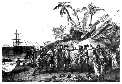
Figure 3.3.
"Bougainville abordant à Taiti (îles Marquises)" from Léon Guérin,
Les navigateurs français: historie des navigations, découvertes
et colonisations françaises (Paris, 1846), facing p. 448.
thereafter, recognizing the Samoan Islands without stopping there, coming across the New Hebrides and guessing them to be the terra australis discovered by Quiros in 1606, avoiding the Great Barrier Reef, seeing various Solomon islands, and then entering the channel separating Nouvelle-Bretagne from Nouvelle-Irelande. There he found two excellent harbors, which he named Choiseul and Praslin, but found also native hostility and little provisioning. The latter points made it necessary for him to be provisioned by the Dutch in Molucca.
This entire course was, naturally, charted on a map which was not really very accurate. The more detailed maps of such harbors as Choiseul and Praslin were much better, however. And, in fact, Véron's more accurate determination of the position of several islands—accomplished, incidentally, with the aid of his mégamètre—was one of the basic contributions of the venture. Curiously, Bougainville, who was usually careful to point out the discrepancies
between his own "dead-reckoned" figures and those of Véron, states that the latter were arrived at by means of the method of horary angles rather than that of lunar distances.[78]
Bougainville returned to France in 1769—the year when, as we have seen, several English and French scientists were voyaging to observe the transit of Venus. To those names already mentioned, one must now add another of particular importance to this series. This, of course, is Captain James Cook, the publicized reason for whose voyage to Tahiti was to observe that phenomenon. His secret orders to search for the southern continent were not revealed until one hundred and sixty years later.[79]
For our purposes the significance of Cook's voyage was its generation of French responses. There were four of these between 1769 and 1773. Two of them need not really detain us. The voyages of Jean François de Surville and Marc-Joseph Marion-Dufresne were, after all, largely commercial ventures launched by the East India Company and stimulated in part by the vigor that Pierre Poivre, Praslin's appointment to the position of Intendant of the Mascareines, had brought to that area in the second half of the 1760s.[80] Neither voyage carried significant scientists or scientific equipment. Nevertheless, Surville's voyage did help to establish the position of the Solomon Islands with more precision. Marion-Dufresne's, on the other hand, accomplished little more than a slight setback for the noble savage idea when, after having begun as an effort to return Bougainville's Tahitian to his homeland, it ended in providing a human dinner for the fierce Maoris of New Zealand.
The two voyages of Yves-Joseph de Kerguelen-Tremerec deserve slightly more consideration even though they never entered into the Pacific per se. The first of his expeditions left France in May 1771.[81] On board as its astronomer was Alexis Rochon, a native of Brest, a seasoned voyager and chartmaker, and a recent addition to the reorganized Académie de Marine. Unfortunately for
Kerguelen, he had a falling-out with the astronomer and his positioning of the island he found in the southern Indian Ocean early in 1772—which he subsequently presented as Gonneville's Land found—was egregiously bad. Rochon, incidentally, had in the meantime been denied the right to sail with Marion-Dufresne and had, instead, given himself over to some exploring on his own, especially of Madagascar.[82] One interesting outcome of those travels was that, having advocated an improvement in Bouguer's heliometer, he now found and brought back to France some rock crystal with which he subsequently constructed a prismatic eyepiece for use on such instruments.[83]
As to Kerguelen's second voyage, to which he persuaded a rather reluctant French government, he was more fortunate in scientific aid. His astronomer was Joseph Lepaute d'Agelet, a rising Lalande student who had been placed in Lacaille's former observatory by that mentor, who also now provided him with an aide in the person of an even younger student named Mersay.[84] Though the expedition itself was largely a fiasco, the astronomers did manage to correct the earlier positioning of Kerguelen Island.[85]
The disappointing results of all these voyages and the American War of Independence brought about a hiatus in the launching of further French expeditions. Cook, of course, was very busy with his third voyage and, interestingly, was untouched by the war since French ships were specifically instructed to leave him alone.
The return of peace initiated a resumption of French activities in the Pacific. Indeed, they were now brought to a new level—in fact to a kind of climax—in the expedition of two ships, the Boussole and the Astrolabe , that left Brest on 1 August 1785 and were scheduled to return there four years later after circumnavigating the earth. They were under the command of Jean-François Galoup de Lapérouse, who had distinguished himself in American waters during the war and was now rewarded with the chance to sail in Cook's wake. The outcome is well known because the expedition—whose major geographical gift to pos-
terity was the exploration of the northeast Pacific, especially the seas around China and Japan—owes its fame in part to its ill fate, for it vanished in the South Pacific.[86] It is probably equally true to say, however, that its renown has stemmed from its characterization as a great scientific expedition.[87]
Some fifteen years ago I undertook to demonstrate that this characterization is misleading insofar as the primary motive for the voyage was a set of political and economic considerations growing out of a continuing competition for empire between England and France.[88] In fact, I showed that one of the clearest reasons for emphasizing the expedition's scientific missions was the hope that this would encourage favorable reception of the frigates in essentially foreign parts and waters—that they would be looked upon as had the ships of Cook earlier. That deception, incidentally, did not delude the English or even their recently independent American cousins. Although I do not now wish to disavow this interpretation, which, in fact, has since come to be the most widely held view,[89] I should insist upon the very real scientific aims and contributions of this undertaking.
Each of the ships carried several scientists as well as the tools of their trade. For our purposes I need mention only the astronomers. One of them, on the Boussole with Lapérouse, was the d'Agelet who had accompanied Kerguelen's second voyage. The other—like d'Agelet a professor of mathematics at the Ecole Militaire in Paris—was Louis Monge, younger brother of the more famous Gaspard, inventor of descriptive geometry at Mézières. Since he soon left the expedition when illness forced him to return to France, his astronomical function was assumed by Paul-Antoine de Langle, the expedition's second-in-command, director of the Académie de Marine, and a competent observer. The fact that such could be said of many French naval officers at this time might be considered an index of the general improvement of that branch and, more specifically, of the spread of astronomical knowledge there.
The most important works that these men engaged in were, for our purposes, the collection of pendulum observations made in a wide variety of latitudes with a view toward shedding further light on the shape of the earth—or at least bringing about better agreement between the figures for oblateness derived from arc measures and those obtained from gravity measurements. More important in the light of our earlier concerns, the expedition provided a setting for a thorough testing of the competing techniques of lunar distances and utilization of chronometers for determining longitude at sea. Furthermore, the expedition even provided, in that connection, a stage on which competing English and French devices could be set against one another, English octants against Borda's new reflecting circles, English chronometers versus Berthoud's timekeepers.
With that observation it seems well to recall by way of conclusion that a dual testing of longitude-determination techniques had been a project of the infant Académie des Sciences some one hundred and twenty years earlier. The specific attempt to carry it out had then failed as miserably as Lapérouse was to succeed brilliantly. The significant feature of the early effort, however, was not that it failed but that it represented an actualization of the new concept of the scientific expedition. The hundred and twenty years that separated Richer and Deshayes from d'Agelet and de Langle saw that technique employed to determine the size of the solar system and the shape of the earth as well as to develop methods for determining longitude and apply them on a worldwide scale. These were accomplishments that any nation could be proud of.
IV
Literary Responses to the Eighteenth-Century Voyages
Charles L. Batten, Jr.
By the expression "literary responses" in my title, I mean accounts written by travelers themselves. Although this study focuses on English travelers, I must stress that travel literature was a truly international genre during the eighteenth century: French and German voyages and travels usually appeared in English almost as quickly as they were initially published. Since these accounts are essentially nonfictional, they tend to receive short shrift from literary types—and I am the token literary type in this volume of essays. In focusing on the accounts of travelers themselves, my study is not , for example, going to be about how playwrights (like John Dryden) borrowed settings and names of characters from travelers, or how poets (like Samuel Taylor Coleridge) borrowed situations and descriptions from travelers, or how novelists (like Tobias Smollett) borrowed conflicts and narrative structures from travelers. Rather, my aim here is to look at the accounts of travelers as literature per se. Eighteenth-century critical opinion, as we shall see shortly, amply justifies this approach.
By the expression "eighteenth-century" in my title, I mean very roughly the hundred years that separate William Dampier's setting sail for Jamaica in 1679 (described at the very beginning of his New Voyage Round the World ) and the return to England of Captain James Cook's third voyage in 1779—alas without Captain Cook on board. At the beginning of this hundred-year period, the map of the world contained many blank areas, mainly in or adjoining the Pacific Ocean. When Dampier conducted his first voyage, "nearly half the surface of the globe we inhabit" was, in the words of Cook's editor John Douglas, "hid in obscurity and confusion."[1] Incidentally, the blank areas on the globe are where Jonathan Swift situated Lilliput, Brobdingnag, Laputa, Balnibarbi, Glubbdubdrib, Luggnagg, the land of the Houyhnhnms, and the like.
The reasons for these blank areas are quite simple: since 50 miles was the average day's sea journey, the time consumed in searching out "remote nations of the world"—to use Swift's expression—was immense, rather like trying to catch a dust mote floating in a not-so-pacific bathtub. Moreover, trade winds obliged most ships to follow roughly the same routes across the Pacific. Things began to change in 1699, when the British government put Dampier in charge of one of the first expeditions ever sent primarily to acquire new knowledge. On Dampier's first voyage, he was a privateer (to use the polite term), a pirate (to use the blunt one). On his second voyage, he was the leader of a scientific expedition. Things changed even more in 1763, when the Peace of Paris concluded the Seven Years' War and ushered in an unparalleled era of exploration and discovery. It removed the so-called legitimate motives for privateering and, in so doing, reduced the dangers of nonmilitary navigation. In the year following the Peace of Paris, England sent Captain John Byron to explore the Falkland Islands in the South Atlantic and other archipelagoes in the Pacific; three years after the peace pact, Captain Samuel Wallis circumnavigated the globe; four years after the peace pact, Cook embarked on his first voy-
age. As the result of such undertakings—especially Cook's three voyages—the blank areas on the globe were reduced by 1784 to what John Douglas called "minutiae." It is tempting—though of course fruitless—to speculate where Swift would have had to locate Lilliput, Brobdingnag, Laputa, Balnibarbi, Glubbdubdrib, Luggnagg, and the land of the Houyhnhnms if he had written Gulliver's Travels after Cook's third voyage.
When I use the expression voyages of discovery, I primarily mean travels undertaken on ships aimed at discovering either new lands or new characteristics of previously discovered lands. That, after all, is the focus of this volume. Yet if we look—as I propose—at the literary responses to these voyages of discovery, we must avoid artificial distinctions based solely on subject matter. For the eighteenth-century Englishman, any foreign discovery necessarily involved some kind of sea voyage, at least until 1785 when the first balloon crossed the English Channel. And as is the case with Richard Lassels' Voyage of Italy (1670), the word "voyage" sometimes denoted travel in general rather than shipboard travel in particular. But more important there was little difference during the century concerning how an author wrote about discoveries made, for example, in far-off Tahiti and in nearby France. Daniel Defoe surely used techniques learned from travelers to distant lands when he wrote his Tour Thro' the Whole Island of Great Britain (1724-1727).
I apologize for this lengthy definition of terms in my title. By way of extenuation, I can point out that Charles Darwin also had trouble with titles. It took him no less than four published tries to come up with The Voyage of the Beagle . His first title was the agonizingly ponderous Narrative of the Surveying Voyage of His Majesty's Ships Adventure and Beagle, Between the Years 1826 a 1836, Describing Their Examination of the Southern Shores of South America, and the Beagle's Circumnavigation of the Globe .
Samuel Johnson makes the following comment in his
advertisement to John Newbery's The World Displayed (1760-1761):
Curiosity is seldom so powerfully excited, or so amply gratified, as by the faithful relations of Voyages and Travels. The different Appearances of Nature, and the various Customs of Men, the gradual Discovery of the World, and the Accidents and Hardships of a naval Life, all concur to fill the Mind with Expectation and Wonder; . . . the Student follows the Traveller from Country to Country, and retains the situation of Places by recounting his Adventures.
This praise of voyages and travels has a curiously hollow ring to our modern ears. It sounds like a glorification of castor oil, or cold showers, or mastering classical Greek. Any teacher who has attempted to lead twentieth-century undergraduates through the intricacies of eighteenth-century travel accounts knows he has built the makings of a rebellion into his syllabus. Even Henry Fielding's Journal of a Voyage to Lisbon (1755), Tobias Smollett's Travels Through France and Italy (1766), and Dr. Johnson's own Journey to the Western Islands of Scotland (1775)—by anyone's measure some of the most "literary" of the century's travel accounts—evoke boredom at best, outrage at worst, among most modern students.
But any of us who examines how eighteenth-century travel accounts have fared at the hands of critics and historians recognizes that a failure to appreciate them for what they are is scarcely an undergraduate phenomenon. Someone like Hans-Joachim Possin, for example, identifies what he calls "das Thema des Reisens in der englischen Literatur des 18. Jahrhunderts." According to Possin, the theme that runs through all eighteenth-century travel literature is that of "the exemplary quest" in which the hero or narrator searches "for possible ways and means of self-knowledge and self-realization." This quest involves a "dynamic and dialectic process of struggling between the idealistic yearnings of a passionate imagination and the realistic, empirical findings of a moralistically tempered
intelligence." And all of this is "cast into the narrative pattern of a journey." Consequently, such components of travel accounts as "style, plot, [and] the character of the narrator-traveler bear a remarkably close relationship" to those that occur in "strictly fictional" works.[2] Such a definition—which incidentally enables Possin to lump together such generically disparate works as Bunyan's Pilgrim's Progress , Fielding's Tom Jones , Johnson's Rasselas , and Smollett's Travels —implies that the reader will encounter some rather exciting narrative and psychological material in travel accounts. From such a critical perspective, the travel account indeed seems virtually a subspecies of the Bildungsroman .
In a similar vein, Sondra Rosenberg claims that in form eighteenth-century voyages and travels most resemble picaresque novels:
Like the hero of that genre, the hero of the travel book is an outsider in the world in which he finds himself. He has no roots in the culture he is in. Both he and the picaro try to come to terms with the society they are in. For the picaro, coming to terms means being fully accepted by the society as a working, productive member of it . . . or, failing to do so, by dying. . . . For the hero of the travel book, coming to terms does not mean becoming part of the culture, but rather understanding it and de fining its limits. [3]
Such a view then leads Rosenberg to argue that Fielding's Journal of a Voyage to Lisbon must be at least partly a "parody of voyage literature"[4] since it is so boring and so unlike a picaresque novel.
I believe that Possin and Rosenberg are seriously mistaken and—more important—that their mistakes reflect the way many twentieth-century readers usually approach the kind of books that Dampier, Cook, and Hawkesworth wrote. Possin and Rosenberg are looking in the wrong places to locate the appeal of eighteenth-century travel accounts. In form, eighteenth-century voyages and travels
are neither Bildungsromanen nor picaresque novels. They lack psychological development and sustained narrative interest. To read them as novels is inevitably to read them as either failed novels or parodies.
My aim here is not to define the generic form of eigh-teenth-century travel accounts. I have attempted to do that elsewhere.[5] While they may look like autobiographies, their primary subject matter is the countries visited—not the experiences of the traveler. When a traveler mentions his experiences, they must always be subservient in importance to the countries being described. For the most part, a traveler's experiences enable him to organize his observations and reflections concerning the countries he visited. If a traveler relates too much about himself, he leaves himself open to charges that he is egotistical; if he relates too little about himself, he leaves himself open to charges that he never visited the countries he describes.
Nor is it my aim here to prove that travel accounts constituted one of the century's most popular literary genres—indeed, some have claimed they were second only to novels.[6] Others have satisfactorily performed that task.[7] A word of caution, however, is in order. This popularity scarcely means that the century unanimously approved of all voyages and travels. Readers often damned specific accounts as being dull, egotistical, trivial, repetitive, plagiarized, dishonest, and the like. (Fielding, indeed, claimed that virtually all travel accounts were deficient in their execution.) But while the century may have damned particular accounts, it almost unanimously approved of their general literary goals. The major exception to this approval is Jonathan Swift, but more about him later.
My aim here is to argue the following thesis: central to most eighteenth-century accounts of voyages and travels—and to the popularity they enjoyed—is the concept of the Scientific Hero. The hero, however, is not in the travel accounts—as Possin and Rosenberg would have it. If the traveler described himself as a hero per se, his account
would be dismissed as a novel, as a romance, or as an act of pure egotism. As I argue in the first part of this study, the "heroic" dimension of the eighteenth-century traveler is largely supplied by extraliterary means. It comes not so much from what the traveler says about himself in his account as it does from the way eighteenth-century readers felt about travelers in general and from what they discovered by reputation concerning certain travelers in particular. As I shall argue in the second part of this essay, the "scientific" dimension of the traveler is largely supplied by literary means. It comes from how the traveler experimentally examines the various characteristics of the countries he describes. Finally, by way of conclusion, I shall suggest some ways in which this concept of the Scientific Hero might help us better understand Swift's goals in Gulliver's Travels . Most of the century glorified the Scientific Hero; Swift satirized him.
The Traveler As Hero
The eighteenth century was by all accounts the age of travel, and the traveler tended to be one of the century's cultural heroes. Travel often served as a rite of passage for the Englishman. Throughout the century, completion of the Grand Tour gave him credentials as a man of learning and cultural polish. And toward the end of the century, completion of the Petit Tour—that is, travels in England and sometimes in Scotland and Wales—increasingly gave him credentials as a man of taste and sensitivity for nature. Chevalier Dennis de Coetlogon seems not to have indulged in hyperbole when he claimedn 1795 that "the English Nation is more inclined to Travelling than any other in Europe ."[8] The English "Milord" of the eighteenth century was as ubiquitous as today's Middle Eastern sheik or Japanese businessman, and most foreigners seemed to think that he carried almost as much money with him.
Figure 4.1.
William Bunbury: Tour to Foreign Parts (1778). (Figures 4.1-4.4
reproduced courtesy of the University Research Library,
University of California, Los Angeles.)
The century's satirists could scarcely have made such fun of travelers if traveling had not been so popular and had not served such an important cultural function. William Bunbury's Tour to Foreign Parts shows a young Englishman on his Grand Tour in France (see Figure 4.1).[9] The tutor (or rather the "bear-leader," as wags liked to call him) stands behind him. The proprietor of La Grenouille Traiteur—or "The Inn of the Treacherous Frog"—stands in front of him, bill of fare extended. One wonders if chicken or cat will grace the young gentleman's dinner table. In any event, his vacant smile gives us no doubt concerning the amount of learning and cultural polish he will acquire on his Grand Tour. In a similar satiric vein, Thomas Rowlandson's Dr. Syntax Copying the Wit of the Window shows an Englishman gathering supposedly valuable information while on his Petit Tour.[10] This information involves
romantic verses, like the following ones, scratched on the windows of inns:
I hither came down
From fair London town
With Lucy so mild and so kind;
But Lucy grew cool,
And call'd me a fool,
So I started and left her behind.
But the eighteenth-century Englishman's itch for travel extended far beyond the confines of the Grand or Petit Tour. The amateur Went to France or rural England; the professional went to the Cape of Good Hope or Java. He might be a seaman, a merchant, a missionary, or—especially toward the end of the century—a naturalist. These travelers to far-off regions tended to suffer less severe treatment from satirists. Their tales might certainly be doubted, but they were more often lionized by polite society.
A brief look at Captain Cook shows the extent to which a traveler could become a cultural hero—imbued with personality traits and heroic actions far transcending anything described on the pages of his journals. To be certain, Cook had the good sense to be murdered by a South Sea islander: dead men make better myths than live ones. Cook's death elevated him to the heights of national hero, and there was no need to remind oneself of the petty reasons for Cook's argument with the natives. But better yet, Cook's subsequent apotheosis elevated him to the status of a secular god. Figure 4.2 is based on a backdrop De Loutherbourg constructed for The Death of Captain Cook; A Grand Serious-Pantomimic-Ballet . . . As Performed at the Theatre-Royal, Covent Garden (1789).[11] In this popular pantomime, Cook's death results from a love triangle among the natives in which he tries to operate as a kind of divine mediator. And to move from the sublime to the mundane, by the beginning of the nineteenth century Englishmen
Figure 4.2.
De Loutherbourg: The Apotheosis of Captain Cook (broadside, 1794).
could purchase porcelain figurines of Captain Cook to decorate their tables and mantles.
But Cook, of course, was a cultural hero long before his death. The force of his personality and the exciting stories he told in person (rather than on the pages of his journal) were enough to make a strong impression on his hearers. James Boswell, for example, reports Cook's dinner conversation in the following fashion:
He gave me a distinct account of a New Zealander eating human flesh in his presence and in that of many more aboard, so that the fact of cannibals is now certainly known. We talked of having some men of inquiry left for three years at each of the islands of Otaheite, New Zealand, and Nova Caledonia, so as to learn the language and . . . bring home a full account of all that can be known of people in a state so different from ours.
On the basis of such tales, Boswell confesses he "felt a stirring . . . to go upon such an undertaking." But he then added, in typical Boswellian fashion, that he would sail with Cook if the government granted him "a handsome pension for life."[12]
As a result of such "public appearances," travelers often imparted a different kind of information than was contained on the pages of the accounts they published. Thus it was not uncommon during the eighteenth century to read between the lines, filling in facts supplied elsewhere by the traveler at some dinner party or by common rumor. John, Durant Breval earned a place among Alexander Pope's dunces for telling stories of how he had helped a nun escape from a convent in Milan, where she was confined against her will. But no such story appears in Breval's Remarks on Several Parts of Europe (1726, 1738). While a tale like that would increase a traveler's fame at dinner parties and in coffee houses, it would scarcely serve as a decorous or relevant topic to be treated in a published travel account. In a similar vein, James Bruce got himself into serious trouble by telling anecdotes prior to publishing his
Travels to Discover the Source of the Nile (1790). After journeying through Abyssinia in search of the Nile's headwaters, Bruce greeted London society in 1774 with the seemingly preposterous claim that he had eaten raw meat cut from live cows. For many hearers, this true story sounded too much like a lie, the kind that Psalmanazar had told at the beginning of the century. And if Bruce lied about eating raw flesh, perhaps he even lied about traveling to Abyssinia.
Eighteenth-century travelers often went to great extremes to call public attention to themselves. By no standard a shy man, James Boswell returned from his Grand Tour with many stories, with plans to publish his Account of Corsica (1768), and with a flashy Corsican costume. Boswell undoubtedly saw this costume as a way to garner public attention—a kind of advertising hype for himself and his travel account. Indeed, he succeeded so well that twenty-five years after his return to England he was still known as "Corsica Boswell." Figure 4.3 shows Boswell as he appeared at Garrick's famous Shakespeare Jubilee in September 1769. Unfortunately, Boswell had left his original Corsican costume at home in Edinburgh, so for this occasion he had to search out the necessary components to replicate it in London. Some he made on purpose, others he borrowed.[13] The London Magazine published this picture of Boswell along with the following detailed description:
He wore a short, dark-coloured coat of coarse cloath, scarlet breeches, and white spatter-dashes, his cap or bonnet was of black cloth; on the front of it was embroidered, in gold letters, VIVA LA LIBERTA; and on one side of it was a handsome blue feather and cockade, so that it had an elegant, as well as a warlike appearance. On the breast of his coat was sewed a Moor's head, the crest of Corsica surrounded with branches of laurel. He had also a cartridge-pouch, into which was stuck a stiletto, and on his left side a pistol was hung from the belt of his cartridge-pouch. He had a fusee slung across his shoulder, wore no powder in his hair, but had it platted, at its full length, with a knot of blue ribbon at the end of it. He had by way of a staff a very curious vine. . . He wore no mask, saying it was not proper for a gallant Corsican.[14]
Figure 4.3.
James Boswell in the London Magazine (Sept. 1769), p. 455.
Chances are that Boswell wrote this detailed description specifically for inclusion in the London Magazine .
When Pierre Maupertuis returned from his expedition to Lapland in 1736, he brought back his heavy fur clothing but one-upped Boswell by also bringing back two Lapp girls. Maupertuis's Figure of the Earth (1738) never mentions these girls.[15] After all, they had nothing to do with the goal of his expedition, which was to measure the length of a degree along the meridian in an attempt to determine whether Newton had been correct in claiming the earth was flattened at the poles. Indeed, Maupertuis refuses even to describe his shipwreck on the way home because it does not "belong to the present Subject" of his book.[16] Maupertuis undoubtedly had many reasons for transporting these girls to Paris. They were curiosities, much like the inscriptions and antiquarian artifacts brought back by travelers to Italy and much like the plants and insects brought back by travelers to the New World. But they also helped make Maupertuis famous. He might be a rather anonymous person in his travel account, but he had no intention of remaining anonymous in the salons of Paris. Voltaire originally celebrated Maupertuis and his fellow voyagers by saying:
Heroes of science, hail! like Argonauts ye brave
The dangers of far climes, the perils of the wave;
Your measurements exact and arduous give birth
To the true knowledge of the figure of the earth.[17]
In a subsequent edition of this poem, Voltaire changed his tune by trivializing Maupertuis's achievements: a "measurement, Lapp girls, and other curious things."[18]
And, finally, when Dampier brought back Prince Giolo (or Prince Jeoly) from his first voyage, his main purpose seems to have been merely financial: he would earn money displaying this tattooed South Sea islander much as Glumdalclitch's father made money showing Gulliver in Brobdingnag. Dampier's descriptions of Giolo in A New Voyage
are straightforward, matter-of-fact, and unromantic. By contrast, the Londoners to whom Dampier sold Giolo came up with advertising copy that could serve as the basis of an exciting romance. A broadside owned by the Clark Library claims that Prince Giolo was shipwrecked in a violent tempest, taken prisoner on the coast of Mindanao, and then sold to foreigners bound for Europe. It tells us that except for face, hands, and feet, Giolo's entire body is painted. On his back parts, for example, could be seen "a lively representation of one quarter part of the World" with "the Artick and Tropic Circles center[ed] in the North Pole of his Neck." Why go to the expense of sending mariners to chart the Pacific when it had already been done for us on Giolo's back? This broadside also tells us that the painting on Giolo's body made him invulnerable to "all sorts of the most venomous, pernicious Creatures [that] can be found; such as Snakes, Scorpions, Vipers, and Centapees."[19]
This is the stuff romances are made of. But Dampier's New Voyage —like most eighteenth-century travel accounts —is not the stuff romances are made of unless one reads between the lines. And to read between the lines requires the reader's imaginative involvement—an involvement that glorifies the traveler and, I think, projects the reader into the traveler's situation.
The Traveler As Scientist
But why, aside from his own self-advertising, did the eighteenth-century traveler—and by extension the eighteenth-century travel writer—develop into this kind of cultural hero? After all, travelers are no longer cultural heroes, unless they happen to find themselves in novel conveyances like space capsules circling the moon or one-man sailboats circling the globe. And travel accounts no longer form a major branch of literature, except in the eyes of a very few readers, most of whom happen to be planning their own trips.
Voyages of discovery—at least as conceived of in the eighteenth century—are but rarely possible in the twentieth century. Going to Anacapa Island recently, my family found coreopsus plants, Indian middens, and a butterfly that lives nowhere else in the world. We saw exciting things, but we discovered nothing. Others had already seen, described, and explained everything we encountered. But had we been an eighteenth-century family, even with our deficient twentieth-century educations, we could have discovered something on Anacapa and, better yet, published a description of it. If the eighteenth century is the age of traveling for discovery, the twentieth century is—alas—the age of tourism. Discovery has largely disappeared; sightseeing has taken its place.
Essential to discovery in any age is not only the possibility for true novelty but also a scientific spirit, the kind that Jean d'Alembert describes as ruling his century:
Our century is called . . . the century of philosophy par excellence. . . . If one considers without bias the present state of our knowledge, one cannot deny that philosophy among us has shown progress. Natural science from day to day accumulates new riches. . . . The true system of the world has been recognized, developed, and perfected. . . . In short, from the earth to Saturn, from the history of the heavens to that of insects, natural philosophy has been revolutionized.[20]
In a similar vein, James Keir claimed in 1789 that "the diffusion of a general knowledge, and of a taste for science, over all classes of men, in every nation of Europe, or of European origin, seems to be the characteristic feature of the present age."[21]
"To know how to travel well," said Chevalier de Coetlogon, is "a very great Science" and "in great measure the Source of all other Sciences."[22] One of my colleagues at UCLA has claimed that during the hundred years between 1680 and 1780, science and literature were as close in their ultimate aims as they have ever been.[23] This is especially true for eighteenth-century travel literature. The scientific spirit that sent travelers in search of new discoveries and
inspired them to write about those discoveries also sent readers in search of new travel accounts to peruse. And these readers were not merely ones we would call "scientific types" in the twentieth century. William Wordsworth, for example, wrote the following request to James Webbe Tobin in 1798:
I have written 1300 lines of a poem [i.e., The Recluse ] in which I contrive to convey most of the knowledge of which I am possessed. My object is to give pictures of Nature, Man, and Society. Indeed I know not any thing which will not come within the scope of my plan. . . . If you could collect for me any books of travels you would render me an essential service, as without much of such reading my present labours cannot be brought to a conclusion.[24]
Wordsworth is scarcely famous for his unbridled love of all things scientific; for him, "we murder to dissect." Yet Wordsworth's letter implies that in subject matter and ultimate goal—if not in form—little difference existed between his projected poem and the travel accounts he was planning to read.
It would be folly to claim that the scientific mood of the eighteenth century was caused by the Royal Society. But the Royal Society certainly captured this mood and in so doing helped propagate it. A major part of the society's work involved investigating foreign lands. As Thomas Sprat indicates in his famous History (1667), the Royal Society undertook a four-part approach to such research, employing fellows to examine treatises already written concerning foreign countries, to interview "seamen, travellers, trades-men, and merchants," to compose questions that remained to be answered about foreign countries, and to send these questions to correspondents in the remote corners of the world.[25] Indeed, the Royal Society's thirst for discovering foreign parts smacked of enthusiasm: "Almost as much space of Ground remains still in the dark, as was fully known in the times of the Assyrian , or Persian Monarchy . So that without assuming the vain prophetic spirit . . . we may
foretell, that the Discovery of another new World " is still at hand.[26] To achieve these discoveries, the Royal Society was not slow in publishing its "Directions for Sea-men, Bound for Far Voyages." These initial directions largely involved straightforward record keeping. They instructed travelers to measure depths, register weather, plot coastlines, collect seawater, and the like. The purposes for such directions were similarly straightforward: to attain its ends, the Royal Society must "study Nature rather than Books , and from the Observations, made of such Phaenomena and Effects She [i.e., Nature] presents, to compose such a History of Her, as may hereafter serve to build a Solid and Useful Philosophy upon."[27] The Royal Society expanded these directions, before long issuing specific inquiries for travelers bound to such places as Suratte, Persia, Virginia, the Bermudas, Guiana, Brazil, and Turkey.[28] And in the spirit of the Royal Society, that archdeist John Toland published a series of "Queries fit to be sent to any curious and intelligent Christians, residing or travelling in Mahometan countries; with proper directions and cautions in order to procure satisfactory answers."[29]
Even in their most superficial characteristics, many eighteenth-century travel accounts display a fairly obvious influence by the Royal Society. Dampier's New Voyage was dedicated to the Royal Society—something that Swift could scarcely have failed to notice. Cook's voyages were sent out by the Royal Society. William Halifax's travel account was published in the society's Transactions . Smollett's Travels contains a register of the weather—the kind of record the Royal Society had requested travelers to keep as early as 1666.[30] Addison's Remarks on Italy contains acoustical experiments conducted in the neighborhood of Milan—the kind of experiments the Royal Society liked to print in its Transactions . This list could easily continue.
The scientific spirit meant that travelers investigated the entire range of nature: they looked for and attempted to describe anything that was not already known involving in-
animate nature, plants, animals, and men. The title page of Dampier's New Voyage (see Figure 2.1) proclaims that it describes such disparate subjects as "Soil, Rivers, Harbours, Plants, Fruits, Animals . . . Inhabitants . . . Customs, Religion, Government, Trade, &c." Similarly, the title page of Smollett's Travels promises observations on "Character, Customs, Religion, Government, Police, Commerce, Arts, and Antiquities" with "a particular Description of the Town, Territory, and Climate of Nice."
The eyes of travel writers were on the physical representations in front of them, rather than on the classics or the Bible.[31] At least implicitly, travelers found themselves—whether they knew it or not—on the Moderns' side in the old Ancients versus Moderns dispute.[32] Their appeal was to experience, not authority. As the English editor of Anders Sparrman's Voyage to the Cape of Good Hope said in 1785, "every authentic and well written book of voyages and travels is, in fact, a treatise of experimental philosophy."[33]
The scientific goals of travelers and travel writers tended to be practical or theoretical, or in some cases both. The practical ones involved promoting trade, colonizing foreign lands, discovering new foods, finding useful minerals, learning new crafts, and the like. It is in this vein that Dampier claims he had "a hearty Zeal for the promoting of useful knowledge, and of any thing that may never so remotely tend" to his country's "advantage."[34] Travelers with a theoretical goal tended to assume with Pope that all of nature (be it inanimate, vegetative, animal, or human) is essentially uniform: "All Nature is but Art unknown to thee." As Hume pointed out, "Should a traveller . . . bring us an account of men, wholly different from any with whom we were ever acquainted . . . we should immediately prove him a liar, with the same certainty as if he had stuffed his narrative with stories of centaurs and dragons, miracles and prodigies."[35] Such a uniform view of nature does not mean the traveler should stay at home; rather it means that he should search out new bits of information that can
modify his larger view of nature. Although nature does not change, man's view of it does. And for this reason the century's great thinkers—men like Adam Smith, David Hume, and John Locke—combed travel accounts to support the theories they were developing.
Travel accounts thus served as storehouses for vast amounts of information. Some travelers seemed largely happy with collecting new information; others seemed primarily interested in synthesizing and explaining the information they collected. The first group focused on what Locke called "observations," the second on what he called "reflections." The great collections of travels—especially the Churchills'—served as forerunners of the encyclopedias.[36] And in an age when indexes were rare, travel accounts quite frequently contained extremely thorough ones.
While eighteenth-century travelers looked for anything new in the wide range of nature, their scientific investigations in such areas as geology and human nature posed some of the strongest challenges to conventional thinking. (England had to wait until the nineteenth century for Darwin's investigations to pose similar challenges to its views on flora and fauna.) In dealing with both geology and human nature, travel writers tended to be experimental philosophers; in so doing, they captured the scientific spirit of the century and the scientific interests of its readers.
The Scientific Approach to Geology
Patrick Brydone's Tour Through Sicily and Malta (1773) was one of the century's most popular travel accounts. Roughly a quarter of the way through his Tour , Brydone begins his description of Mount Etna, a description that incidentally struck most eighteenth-century reviewers as the most interesting part of his book. At the base of Etna, a Signor Recupero led Brydone and his fellow travelers to a deep well
where they could observe many layers of lava, each covered with a considerable amount of soil. By examining these layers, this clergyman had reasoned as follows: "If it requires two thousand years or upwards, to form but a scanty soil on the surface of a lava, there must have been more than that space of time betwixt each of the eruptions which have formed these strata." Counting these strata, Recupero had calculated that lava had been flowing from Etna for at least fourteen thousand years.
While this may strike us as good scientific reasoning, Brydone and Recupero both knew that it flew in the face of Archbishop Ussher's calculation that the world began in the year 4004 B.C. More important, Ussher had based his calculation on biblical rather than geological inquiry. Thus Brydone hastens to add: "Recupero tells me he is exceedingly embarrassed, by these discoveries. . . . That Moses hangs like a dead weight upon him, and blunts all his zeal for inquiry. . . . What do you think of these sentiments from a Roman Catholic divine?—The bishop . . . has already warned him to be upon his guard: and not to pretend to be a better historian than Moses."[37] Here Brydone seems primarily interested in poking fun at those silly Italian Roman Catholics. Elsewhere in his Tour , however, he comes out firmly on the side of Recupero's scientific method. Thus while ascending Etna, Brydone marvels at how smoke and heat are still evident from an eruption that occurred some four years earlier. This leads him to a scientific reflection: "There is an easy method of calculating the time that bodies take to cool:—Sir Isaac Newton, I think, in his account of the comet of 1680, supposes the times to be the squares of their diameters; and finding that a solid ball of metal of two inches, made red hot, required upwards of an hour to become perfectly cold, made the calculation from that to a body of the diameter of the earth, and found it would require upwards to twenty thousand years."[38]
In calculating that the world is at least twenty thousand years old—and not six thousand according to Ussher—
Brydone gets himself into serious trouble with some of his orthodox English readers. Johnson and Boswell both found fault with its "antimosaical" attitudes; Johnson thought Brydone would have been a better travel writer if he had been "more attentive to the Bible."[39] But that would have been fundamentally antithetical to the scientific spirit of Brydone's account.
The Scientific Approach to Human Nature
Investigations by eighteenth-century travel writers into the science of human nature are clearly more typical, far-reaching, and influential than those into geology. Their research into human nature marks the beginnings of modern social sciences. As Peter Gay has pointed out, "Whether realistic, embroidered, or imaginary, whether on ship or in the libraries, travel was the school of comparison, and travellers' reports were the ancestors of treatises on cultural anthropology and political sociology. It led to the attempt on the part of Western man to discover the position of his own civilization and the nature of humanity by pitting his own against other cultures."[40] The eighteenth-century travel account thus served as a "museum, in which specimens of every variety of human nature" were studied.[41] This museum, however, could always be misused. Dr. Johnson, for example, attacks Montesquieu for supporting his strange opinions by describing practices "of Japan or of some other distant country, of which he knows nothing."[42]
Some travelers spent their efforts attempting to define national characteristics. This was especially true for travelers on the Grand Tour, from whom we typically learn that Englishmen are serious and morose, Scotsmen proud and overbearing, Irishmen fortune-hunters, Frenchmen fops, Spaniards grave, Russians bearish, Italians effeminate, and the like.[43] And it is in this tradition that Smollett
encapsulates his experiments with French human nature in the following splenetic passage from his Travels Through France and Italy :
If a Frenchman is admitted into your family, and distinguished by repeated marks of your friendship and regard, the first return he makes for your civilities is to make love to your wife, if she is handsome; if not, to your sister, or daughter, or niece. If he suffers a repulse from your wife, or attempts in vain to debauch your sister, or your daughter, or your niece, he will, rather than not play the traitor to his gallantry, make his addresses to your grandmother, and ten to one, but in one shape or another, he will find means to ruin the peace of a family, in which he has been so kindly entertained.[44]
Travelers to places farther away than Italy and Spain tended to focus their scientific attention on more generalized questions concerning human nature. As Pope said, "The proper study of Mankind is Man." In so doing, they often tried to confirm, or in some cases reject, two of the century's more common myths: the Noble Savage and the Chinese Sage.
Omai was one of the eighteenth century's most noble savages. He came to England on board Captain Furneaux's ship after Cook's second voyage. London fell in love with Omai: He was genteel, polite, likable, and could even beat Giuseppe Baretti at chess. To top it all off, he came from the South Seas where summer was perpetual, sex spontaneous, and hard work unnecessary.
Here is the stuff of romance, but here too is the stuff of scientific argument. What is man? Is he essentially good, as suggested by popular views of Omai? Or is he essentially bad, as suggested by orthodox Christian thought? The argument between Shaftesburians and Hobbesians entered the pages of virtually every travel account dealing with the South Seas. If Western man is evil, why is that so? Denis Diderot's Supplement to Bougainville's Voyage suggested that Western society, and especially Christian sexual morality, was to blame. Dr. Johnson, of course, said poppycock.[45]
The Chinese Sage posed similar problems. While the Noble Savage was uneducated and simple, the Chinese Sage was enlightened and sophisticated. Moreover, his enlightenment came from Confucius, who in many respects sounded suspiciously like Jesus. As a myth, the Chinese Sage certainly dates back to the Jesuit missionaries who tried to convert China using what the eighteenth-century Englishman saw as a clever brand of natural religion. Jesuit failures dated from the intervention of the pope in such free thought. In any event, by the time Johnson translated Father Jerome Lobo's Voyage to Abyssinia in 1735, the concept of the Chinese Sage had become so standard that Johnson could show his orthodox credentials by claiming that his readers would find on his pages no "romantic absurdities" such as "Chinese perfectly polite and completely skilled in all sciences."[46]
The discovery of this well-organized, advanced culture that knew nothing of the Christian message proved a trauma to the orthodox, a delight to the liberal. Leibniz, for example, could claim that the Chinese should send missionaries to instruct Europe in natural philosophy just as Europe had sent missionaries to instruct China in revealed religion.[47] And Hume could claim that the Chinese literati were "the only regular body of deists in the universe."[48] Some travelers and some philosophers using their accounts even went so far as to claim that the Chinese wrote a universal language, having escaped the curse of Babel.[49] For a century interested in all things universal, this was heady stuff indeed.
But in his investigations of the Noble Savage and the Chinese Sage, the Englishman ultimately was not concerned primarily with people who lived either in the South Pacific or the Orient. Rather, his main scientific interest lay in discovering something about himself—his own religion, society, sciences. Actual travelers who voyaged to the South Pacific and the fireside travelers who studied their accounts made comparisons between themselves and the people they either saw or read about. This was essential to
the scientific method. Dr. Johnson indeed sees this kind of comparison as a psychological justification for the popularity of travel literature. Our pleasure in reading about foreign countries, he says, "arises from a Comparison which every Reader naturally makes . . . between the Countries with which he is acquainted, and that which the author displays to his Imagination." As a consequence, this pleasure "varies according to the Likeness or Dissimilitude of the Manners of the two Nations. Any Custom or law unheard or unthought of before, strikes us with that surprise which is the effect of Novelty." By contrast, a custom or law similar to our own "pleases us, because it flatters our Self-love, by showing us that our Opinions are approved by the General Concurrence of Mankind."[50]
Such comparisons became the basis not merely for travel accounts but also for many of the century's satiric attacks on its own society. Non fictional travel accounts find Occidentals observing Orientals; fictional accounts often find Orientals observing Occidentals. In William Hogarth's Credulity, Superstition, and Fanaticism , which probably dates from 1759, we see an English church infected with religious frenzy. The clergyman thunders so loud he breaks the sounding board. His dislodged wig reveals a Jesuit in disguise; his opened gown reveals a harlequin in disguise. He is surrounded by fanatics like Mrs. Toft—who convinced the king's physician she had given birth to rabbits—and he is inspired by Wesley's sermons. The enthusiast at the far left shows that Jews are not immune to such frenzy. But outside the window we see the Turk calmly smoking his pipe. Nothing needs to be said; the comparison tells it all. Hogarth is not praising Islam; rather, he is attacking the excesses of Christianity.
A number of influences undoubtedly stand behind this picture. Hogarth may have been thinking of his friend Henry Fielding's latitudinarian sentiments. In Joseph Andrews , Parson Adams says that "a virtuous and good Turk " is "more acceptable in the sight of their Creator, than a
vicious and wicked Christian, tho' his Faith was as perfectly Orthodox as St. Paul's himself."[51] Hogarth may have been thinking of travel accounts like Sir Paul Rycaut's Present State of the Ottoman Empire (1668) and Lancelot Addison's West Barbary (1671), both of which attempt to dispel European views of Muslims as "Barbarous, Rude, and Savage."[52] Hogarth may have been thinking of satires like Letters Writ by a Turkish Spy or Persian Letters , both of which use a foreign traveler to dissect the follies of Parisian society. In any event, the inquisitive and irreverent attitude Hogarth expresses here is firmly in the tradition of the eighteenth-century scientific traveler.
Conclusion
Few readers have failed to see Gulliver's Travels as at least partially a parody of travel accounts. It opens with a satiric jab at Gulliver's "cousin Dampier," and Book II gives us an unintelligible passage of nautical jargon lifted from Samuel Sturmy's Mariners Magazine . In addition, few readers—especially since Marjorie Hope Nicolson's work on Book III—have failed to see that Gulliver's Travels is at least partially an attack on scientific experimentation. The Laputans are so wrapped up in the kind of speculative and experimental philosophy undertaken by the Royal Society that practical considerations have utterly left their heads.
To come up with easy answers concerning Gulliver's Travels is to miss the rich complexity of its satire and artistry. Nevertheless, if we regard Gulliver as a Scientific Traveler from the very beginning of Gulliver's Travels , we recognize two things: The parody of travel accounts is not restricted merely to individual passages, and the satire on the scientific method and its attendant reliance upon reason is not restricted merely to Books III and IV.
Swift's feelings concerning the Royal Society and the new experimental method must have been deep-seated
and in some ways prophetic. His Erastian views led him to regret that the Test Act did not apply to membership in the Royal Society. But more important, he must have seen travel accounts as instruments of the Royal Society. Relying as they did upon the scientific method, they would lead travelers and readers away from issues of morality and orthodoxy. Poring over the book of nature meant slighting the book of God. Swift might well have agreed with Henry Stubbe, who believed that "studying of natural philosophy and mathematics was a ready method to introduce scepticism at least, if not atheism, into the world."[53]
Gulliver is a Scientific Traveler throughout Gulliver's Travels . In Part I, he dissects Lilliputian society. We of course know that Lilliput equals England, but he does not. In Part II, he dissects Brobdingnagian society—comparing it with his own and finding it deficient. We of course know that Gulliver is to a large extent wrong. In Part II he also dissects giant wasps, and like a good member of the Royal Society he presents their stingers to Gresham College. He also carefully examines the breasts of the giant Brobdingnagian women. Figure 4.4 might be called a "centerfold" from the Philosophical Transactions of the Royal Society ;[54] it is meant to illustrate "An Account of a Very Sudden and Excessive Swelling of a Woman's Breasts." Chances are slight that this particular picture influenced Gulliver's Travels ; chances are great, however, that such preoccupation with scientific inquiry did.
So far I have suggested that Gulliver is first and foremost a Scientific Traveler. But unlike Dampier, Boswell, and Cook, he is no hero. As we saw in the first part of this study, the returning traveler was usually feted and dined; Gulliver, however, refuses to eat with humans unless his nose is stuffed with rue, lavender, or tobacco. In Gulliver's desire to become totally rational, he has become irrational. The scientific method of Gulliver—which most of the century's travel accounts glorified and which Swift detested—has to a large extent led to this insanity. Dampier and
Figure 4.4.
"An Account of a Very Sudden and Excessive Swelling of a
Woman's Breasts," Philosophical Transactions of the
Royal Society (17 Oct. 1669), plate facing p. 1041.
Gulliver both undertake voyages of discovery. Dampier is the age's Scientific Hero; Gulliver is Swift's Scientific Antihero.
V
Navigation and Astronomy in the Voyages
Derek Howse
In this study I shall first deal with the state of navigation at the beginning of the eighteenth century and the state at the end. This period saw many advances in navigation, particularly in the field of finding longitude, advances which, though they were used by explorers of all nations at the end of the eighteenth century, did not become normal practice at sea until the nineteenth. After navigation I shall deal with astronomy—astronomy as practiced by explorers —as well as what was done in meteorology, geomagnetism, tides, and the measurement of gravity.
Navigation: The Early Years
At the beginning of the eighteenth century, navigation was dominated by what the navigators themselves called "the three L's"—the lead , for measuring the depth of water; latitude , which was comparatively easy to find by measuring the sun's height above the horizon or that of the Pole Star;
and lookout , the need for which is self-evident. To these ought, perhaps, to be added one more L and two C's—the log , for measuring the ship's speed through the water; the compass to steer by and to take bearings with; and the chart to show where one has come from and where one is going, as well as the dangers on the way.
The state of the art at that time is conveniently summarized on the title page of John Seller's Practical Navigation of 1669 (Figure 5.1), which shows two navigators of the time with the tools of their trade—a cross staff to find latitude by observations of Polaris; two versions of the back-staff to find latitude by observations of the sun at noon; an azimuth compass for finding magnetic variation, generally by bearings of the sun near sunrise or sunset; a steering compass ; a nocturnal for finding the time by night; a portable universal equinoctial sundial for finding the time by day; a simple wooden quadrant for measuring altitudes; and, of course, a book of charts . There is no lead or log here, but Figure 5.2 shows a navigator of about eighty years later with a Hadley quadrant for latitude—of which more anon—and an English log and a compass at his feet. It shows also his logboard, the second and third columns giving the hourly log reading in knots and fathoms.
We have mentioned finding latitude, time, and magnetic variation, but not, you will notice, finding longitude—be-cause at that time it could not be done at sea. From the time he saw his last land—his departure fix—until he made a landfall, the navigator had to keep track of his progress by "dead reckoning," that is, by making the best estimate of his course and speed made good over the ground, hour by hour, watch by watch, day by day. He would take into account the courses steered by compass, the speeds measured by log, the magnetic variation, the leeway, the currents (tidal and otherwise), and add to these his own experience as to how the ship's course and speed were affected by wind and sea. At noon every day, he would work out his "day's run" from these data, resolve that into its north-south and east-west components, and

Figure 5.1.
Title page of John Seller's Practical Navigation [1669]. The navigator
on the left is holding a cross staff, the navigator on the right a backstaff,
with another version on the table beside him. Azimuth compasses
are on the table left center and center, steering compass right; nocturnal
hanging left, portable equinoctial sundial hanging right with quadrant
above; atlas of sea charts (Seller's own English Pilot) on table center
bottom. (Reproduced courtesy of National Maritime Museum, London.)
Figure 5.2.
A master's mate observing with a Hadley quadrant. On the ground,
left to right, lead and line, log reel with line leading to log ship, and
azimuth compass. The log board has the standard headings:
H[our]; K[nots]; F[athoms]; Course; Wind; Remark[s]. From the title
page of the manuscript "A book of Drafts and Remarks . . . by
Archibald Hamilton, late master's mate, of his majesty's ship St Ann.
1763" (NMM Ms NVP/11). (Reproduced courtesy of the National
Maritime Museum, London.)
compute his daily noon position in latitude and longitude. If the weather was clear at the critical moment of noon, he could check his dead-reckoning latitude—his "latitude by account"—against his latitude by meridian altitude. But it was not possible to check the longitude in the same way and, as such errors are cumulative, after a long ocean voyage the dead-reckoning longitude might be many hundreds of miles in error, sometimes with disastrous results.
These restrictions imposed a navigating strategy known as "running down the latitude" which can best be explained by taking a real-life example. On 5 November 1681, the buccaneer ship Trinity sailed for the West Indies from southern Chile, missed the entrance of the Strait of Magellan, rounded Cape Horn at a distance of some 250 miles (reaching a latitude of 58°23' south), and sailed up the center of the South Atlantic until the latitude of Barbados (13°10' north) was reached on 18 January 1682. Then she turned west, keeping in the same latitude. Ten days later, an hour before daybreak on the morning of 28 January—nearly three months and 9,000 miles after leaving Chile—they sighted the island of Barbados on the port bow at a distance of two and a half leagues.[1] A quite remarkable feat of navigation which proved that the strategy really worked!
The Longitude
The theory of finding longitude astronomically has been well known since classical times. This concept is inexorably bound up with the rotation of the earth on its axis—one complete revolution (360 degrees) in a day, 15 degrees in an hour. To find the difference of longitude between the meridian of the place you are and some reference or "prime meridian"—shall we call that Greenwich from now on, though it was not so used until the 1770s?—all you need to know is your own local time (which could be symbolized by a sundial) and the local time on the prime meridian at that very same moment (which could be symbolized

Figure 5.3.
How the angular distance from sun to moon changes in six hours. Quantities
are for 1 October 1772 (rounded off) from the Nautical Almanac table reproduced
in Figure 5.6.
by a chronometer showing Greenwich time). The difference between these two times—say one hour or 15 degrees—is the difference of longitude.
This sounds easy. Certainly finding one's own local time astronomically is not difficult, though something a bit more refined than a sundial is needed. The difficult part is knowing Greenwich time at that same instant. The simplest method is for the ship to have some kind of timekeeper which always keeps Greenwich time—that was in fact the ultimate solution, as we shall see—but producing such a machine, capable of keeping accurate time for months, even years, in every climate and in a ship which rolls, heaves, and pitches, was no easy task.
In the seventeenth and early eighteenth centuries, the astronomical longitude-finding method which seemed to have the most promise depended upon the fact that the moon moves comparatively fast against the background of the stars—approximately its own diameter (1 degree) in one hour (Figure 5.3). Think of the moon as the hand of a clock and the sun and stars as time markers on the clock dial. Johann Werner had suggested as long ago as 1514 that angular distances between the moon and these time markers—the sun and the brighter stars in the zodiac—could be used to give Greenwich time. But this would only
be useful if these lunar distances, as they came to be called, could be predicted accurately several months—even years—ahead, so that the navigator could have them before he started his voyage.
The snag was that the going of that moon clock is highly irregular and, in the seventeenth century, neither the laws governing the moon's apparent motion nor the relative positions of the star time markers one with another were known to the required accuracy. It was to provide these very data that Charles II specifically founded his Royal Observatory at Greenwich in 1675, directing his 27-year-old royal astronomer John Flamsteed "forthwith to apply himself with the most exact care and diligence to the rectifying the tables of the motions of the heavens, and the places of the fixed stars, so as to find the so-much-desired longitude of places for perfecting the art of navigation."[2]
After forty years' labor, Flamsteed's star catalog was published posthumously in 1725, providing one ingredient of the lunar-distance package at sea—a frame of reference against which to measure the moon's position (in King Charles's words, "the places of the fixed stars"). The second ingredient, the king's "rectifying the tables of the motions of the heavens," was not yet complete though well on the way. There was a third ingredient—an angle-measuring instrument of the required accuracy—but that was not available either.
It is worth noting that Edmond Halley—who was to continue Flamsteed's work at Greenwich—made two Atlantic voyages in a naval vessel called the Paramore between 1698 and 1700 "to improve the knowledge of the Longitude and variations of the Compass."[3] These are said to be the first sea voyages undertaken with a purely scientific object.
The Longitude Act, 1714
In 1707, Admiral Sir Clowdisley Shovel, with twenty-one ships of the Royal Navy, was returning from Gibraltar to England. On 22 October, having had observations for lati-
tude the previous day—here is one of the L's—and satisfied by soundings—here is the lead, another L—that they were at the mouth of the English Channel and clear of all danger, the fleet ran to the eastward in thick weather. At 7:30 that evening, five ships struck the rocks of the Gilstone Ledges in the Scilly Isles. This disaster—four ships were lost with nearly two thousand men—was a profound shock to the British public. And there had been several other maritime disasters recently, though none of the same magnitude.
In fact, the Shovel disaster was caused as much by bad charts as by bad navigation. Even if there had been a method of finding longitude, the shipwrecks would probably still have occurred. Nevertheless, the disaster's very magnitude made such an impression on the British public that they became more than ever receptive to any measure which might make navigation safer—and in the 1710s, "discovering the longitude" seemed to hold the key.
In 1714, a book called A New Method of Discovering the Longitude both at Sea and Land was published. In it the mathematicians William Whiston and Humphrey Ditton made a proposal that vessels should be moored in known positions at intervals along the trade routes, each fitted with a mortar which would, every midnight by Peak of Tenerife time, fire a projectile vertically which would burst at precisely 6,440 feet. Though the subject of great mirth among members of Swift and Pope's Scriblerus Club, this proposal was nevertheless taken seriously by some people and Whiston and Ditton presented a petition to Parliament asking for a reward. This was followed a month later by another petition, this time by sea captains and merchants, asking Parliament to give serious attention to the longitude problem.
Taking only a month to pass through all its parliamentary stages, "An Act for Providing a Publick Reward for such Persons or Persons as shall Discover the Longitude at Sea" was given the Royal Assent by Queen Anne on 20 July 1714, only twelve days before her death. Rewards of unprecedented magnitude were offered: £10,000 to the
discoverer of a method which determined the longitude to 60 geographical miles (96 kilometers), £15,000 if accurate to 40 miles (64 kilometers), £20,000 if accurate to 30 miles (48 kilometers). The method had to be proved to be "practicable and useful at sea" on a voyage to the West Indies. Commissioners—later to be called the Board of Longitude-were appointed to administer these provisions. The Astronomer Royal was ex officio a member of the board. The provisions were to apply to all who qualified, regardless of nationality.
Twenty thousand pounds of the 1720s is probably equivalent to a million pounds or more today—a prize indeed, which was to stimulate many advances in astronomy, navigation, mathematics, and horology over the next hundred years, just as Parliament hoped. The immediate effect was the publication of a welter of pamphlets by hopeful inventors, none of whom was successful and many of whom were cranks. Indeed, "finding the longitude," coupled with "squaring the circle" (for which the board received many suggestions quite unconnected with longitude), passed into the English language as expressing something which, if not downright impossible, was at least extremely difficult to achieve.
The Invention of the Reflecting Quadrant
The next development was a fundamental one, though not stimulated directly by the Longitude Act. This was the invention of the double-reflection quadrant which, when developed into the sextant twenty-five years later, was to make possible the measurement of lunar distances to the required precision at sea. (With a quadrant measuring to 90 degrees, lunar observations with the sun are possible only on eight days each lunar month; with a sextant measuring to 120 degrees, sun-moon observations are possible on fifteen or sixteen days out of the twenty-nine each
month.) Surprisingly, in 1731 the basic idea came to two people quite independently on either side of the Atlantic: In England, the inventor was John Hadley, vice-president of the Royal Society; in America, it was Thomas Godfrey, glazier, self-taught astronomer, and friend of Benjamin Franklin, from Philadelphia. The Royal Society investigated the claims of both parties and came to the conclusion that this was indeed a near-simultaneous invention by both Hadley and Godfrey. Nevertheless, to many generations of seamen the instrument came to be known as Hadley's quadrant—or just plain "Hadley." Poor Godfrey!
The Nautical Almanac
Two of the three ingredients of the lunar-distance solution were now available to the required accuracy: Flamsteed had provided the star catalog, Hadley and Godfrey the measuring instrument. All that the navigator now needed were predictions of the moon's position in lunar-distance form. This required an accurate knowledge of the laws governing the moon's motion and, throughout the early eighteenth century, the world's best mathematicians turned their minds to the problem, using observational data provided by the world's best astronomers—men such as Newton, Halley, Lemonnier, Bradley, Cassini de Thury, D'Alembert, and Clairaut.
The person who finally produced lunar tables of the required accuracy was the German astronomer Tobias Mayer, using equations produced by the Swiss mathematician Leonhard Euler. Both men subsequently received awards, though not of the highest amounts. In 1755, the Astronomer Royal James Bradley compared Mayer's tables with his own observations at Greenwich and found them sufficiently accurate to determine the moon's place to 75 arc-seconds and consequently the longitude to about half a degree. Due to the constraints imposed by the Seven Years' War, the sea trials carried out by Captain Campbell in
1757-1758 were inconclusive so far as the tables were concerned, though they did lead to the invention of the nautical sextant we know today.
It was not until 1761 that Mayer's tables were properly tested at sea—by Nevil Maskelyne, the future Astronomer Royal, on voyages to and from Saint Helena where the Royal Society had sent him to observe the transit of Venus that year. He took some very successful lunar-distance observations, generally to a positional accuracy of better than one degree. Immediately after his return, he published his British Mariner's Guide , explaining lunar-distance observations to seamen in simple terms, using a method devised by the French astronomer Abbé Nicolas-Louis Lacaille. In his voyage to Barbados in 1763 to try out Harrison's watch (of which more anon), Maskelyne once again proved the worth of Mayer's tables.
In January 1765, only a month or so after returning from Barbados, Maskelyne was appointed Astronomer Royal at the age of thirty-three. His first act was to persuade the Board of Longitude that a nautical ephemeris must be published soon. Planned and executed by Maskelyne with characteristic energy, The Nautical Almanac and Astronomical Ephemeris for the Year 1767 was published in November 1766 and this remarkable publication has continued annually until the present day.
Any navigator using Maskelyne's nautical almanac to find longitude—and a very high proportion of deep-sea navigators of all nations did so—must end up with an answer based on the meridian of Greenwich. Indeed, from 1774 to 1788 this applied even to those using the official French almanac Connaissance des temps where, with Maskelyne's agreement and assistance, the British lunar-distance tables were reprinted verbatim—but with a note that the idea had come from a Frenchman, Lacaille. The other tables in the French almanac were based on the meridian of Paris.
The navigator, having obtained a Greenwich-based longitude, needed to plot his position on a chart. So map and
chart publishers the world over began to provide longitude graduations based on the meridian of Greenwich. When in 1884, at the International Meridian Conference in Washington, D.C., the need came to agree internationally upon a prime meridian for longitude and time, it was Greenwich that was chosen—rather than, say, Paris—be-cause by that time nearly three-quarters of all the world's shipping tonnage was using charts based on Greenwich. And this chain of events started in 1766 with Maskelyne's first Nautical Almanac .
The Marine Chronometer
The ultimate solution of the longitude problem (before the electronic age, that is) proved not to be lunar observations but the marine chronometer. Providing its error is known or can be estimated, this device will provide Greenwich time with no computation. All that one then requires in order to discover the longitude is an altitude observation of the sun or a star at least two hours before or after meridian passage in order to find local time. The difference between the local time just found and Greenwich time indicated by the chronometer (corrected for its known or estimated error) then gives the longitude—the whole operation is known as "longitude by chronometer."
As this volume is primarily about exploration, I shall not recount the long story of how the highest award was made—eventually—to John Harrison for his fourth timekeeper, a large silver watch. Suffice it to say that it was on Cook's second voyage (1772-1775) that it was eventually proved that a longitude timekeeper was a practical possibility. In Cook's two ships were four longitude watches—Larcum Kendall's copy of the prizewinner, made to the Board of Longitude's order in case the latter's success had been a fluke, and three submitted by John Arnold.[4] Near the end of his three-year voyage, Cook wrote to the Secretary of the Admiralty as follows: "Mr Kendals Watch has

Figure 5.4.
Performance of timekeepers on Cook's second voyage. The rectangles
represent the periods when the rates of the timekeepers were checked
ashore, the width indicating the number of days' readings, the height
the range of values obtained. The curve is drawn through the mean
of the rates found at each place. The temperatures are the mean of
those recorded.
exceeded the expectations of its most zealous Advocate and by being now and then corrected by lunar observations [Cook had the new nautical almanac] has been our faithfull guide through all the vicissitudes of climates."[5] Its performance can be judged from the graphs in Figures 5.4 and 5.5, which show its rate of going on every occasion the astronomers landed their instruments during Cook's second and third voyages.
Explorers' Observations at Sea
Let us now leave the general history of navigation and consider some examples specifically connected with exploration. The importance of Captain Cook's three voyages in

Figure 5.5.
Performance of timekeepers on Cook's third voyage.
the history of science was largely the result of scientific bodies such as the Royal Society and the Board of Longitude being allowed to take an active part in the planning, execution, and analysis of the voyages, giving a model on which to base the scientific organization of so many future voyages, both British and foreign. These were the first British voyages to carry trained astronomers, naturalists, and artists to observe and record what they saw. The astronomers were provided with the best instruments that money could buy, many of which, being public property, were used again in subsequent voyages by Vancouver, Flinders, and others. A few still survive.
The scientific results of these voyages were published by the Board of Longitude, and it is from these that I shall take most of my examples.[6] Let us first look at the observations made at sea. Every day at noon, weather permitting, meridian altitudes of the sun would be observed with the sextant to find latitude. We know that in Cook's ships several officers would do this together, both as training for the officers and to increase precision. A similar ritual has survived in many ships to modern times. Among the secondary aims of Cook's last two voyages was to try out the newfangled longitude timekeepers. At sea, a longitude-by-watch observation would be taken morning and afternoon if there were no clouds.
Now let us turn to lunar-distance observations—or "lunars" as they were familiarly called. One of the most practical features of the new almanac was a table giving predicted lunar distances from the sun and zodiacal stars every three hours throughout the year, a feature suggested by Lacaille to cut down the arithmetical work done by navigators (Figure 5.6). And so it proved: the time taken to work out a sight and obtain a longitude was cut from over four hours to an hour or so.
Now to the navigator's procedure. Essentially he needed to measure the angular distance between the moon and (in the case of Figure 5.7) a star. But it is also necessary to

Figure 5.6.
Lunar-distance tables from The Nautical Almanac and Astronomical
Ephemeris for the year 1772. Published by order of the Commissioners
of Longitude (London, 1770). The quantities in Figure 5.3 come from
this table. (Reproduced courtesy of the National Maritime Museum, London.)

Figure 5.7.
Lunar-distance observations showing the three near-simultaneous
observations required to find longitude by lunar distance: (1) the
angular distance between the moon and a selected star (or the sun);
(2) the altitude of the moon above the horizon; and (3) the altitude
of the star or sun above the horizon.
Figure 5.8.
Lunar-distance observations taken on board the Resolution off the
Hawaiian Islands a week or so after the death of Cook. The penultimate
columns indicate the observers (C = Clerke, who took command of the
Resolution after Cook's death; K = Lieutenant James King, who ultimately
took command of the expedition after Clerke's death some months later)
and the sextants used (the makers being B = John Bird, D = Peter Dollond,
R = Jesse Ramsden). From the published astronomical observations,
Cooke, King, and Bayly, Original Astronomical Observations,
p. 156. (Reproduced courtesy of the Bancroft Library.)
measure the altitudes of the two bodies as nearly simultaneously as possible in order to correct for parallax and refraction. The lunar distances predicted in the almanac assume the observer is at the center of the earth. In fact the observer is some feet above the earth's surface, and, furthermore, both bodies appear too high because of atmospheric refraction, the amounts depending upon their respective altitudes—the lower the altitude, the more the refraction. Both these effects had to be allowed for; indeed, "clearing the distance," as it was called, was the most

Figure 5.9.
Meteorological observations in the Discovery. Cook was murdered
on 14 February 1779. From Cooke, King, and Bayly, Original Astronomical
Observations, p. 332. (Reproduced courtesy of the Bancroft Library.)
laborious part of the whole computation.[7] If the sun or star was more than two hours from the meridian, then the altitude found at the same time as the lunar distance could be used to obtain local time—our symbolic sundial time. Otherwise, it was necessary to wait for the body to be on a suitable bearing, the time difference from the lunar observation being noted from a watch with a second hand. Figure 5.8 shows the results of a series of lunar observations on Cook's third voyage.
Other observations taken at sea included those for magnetic variation with an azimuth compass; meteorological observations with barometers and thermometers (Figure 5.9)—a primitive form of anemometer or wind gauge was taken but was not a great success; and the salinity of seawater with water sampler bottles and a hydrostatic balance (Figure 5.10).
Figure 5.10.
Salinity observations on board the Resolution. Those
in 1776 were made in the Atlantic when on passage from
Plymouth to the Cape of Good Hope, that in 1777 in the South
Pacific, those in 1778 in the North Pacific. From Cooke, King,
and Bayly, Original Astronomical Observations, p. 347. (Reproduced
courtesy of the Bancroft Library.)

Figure 5.11.
Diagram of the transit of Venus.
Observations Ashore
Now let us see what was done ashore in the physical sciences. Overtly at least, the prime purpose of Cook's first voyage was itself astronomical—participation in that vast international project, the observation of the transit of Venus on 3 June 1769, when astronomers from eight different nations traveled all over the globe, an operation as important and complex in the eighteenth century as was the International Geophysical Year in the twentieth.
Twice every 113 years, Venus passes directly between the earth and the sun and appears for a few hours silhouetted against the bright solar disk. Edmond Halley, of comet fame, pointed out in 1716 that observing such a transit could provide a method of measuring one of the fundamental units of astronomy, the distance of the earth from the sun.[8] As shown in Figure 5.11, an observer at A in the Northern Hemisphere would see Venus crossing the sun along track a to a '. An observer at B in the Southern Hemisphere would see Venus crossing the sun along track b to b '. If the angular distance PQ can be found, this will give a measure of the sun's distance, provided the geographical positions of A and B are accurately known.
Though Halley knew that he himself would not live to see the next pair of transits (in 1761 and 1769), he urged that every advantage should be taken of these opportunities and that observations should be planned for as many
different places as possible in order to mitigate against the effects of bad weather at any one place:
Therefore, I strongly urge diligent searchers of the Heavens (for whom, when I shall have ended my days, these sights are being kept in store) to bear in mind this injunction of mine and to apply themselves actively and with all their might to making the necessary observations. And I wish them luck and pray above all that they are not robbed of the hoped-for spectacle by the untimely gloom of a cloudy sky; but that at last they may gain undying glory and fame by confining the dimensions of the celestial orbits within the narrower limits.[9]
Halley's pleas did not fall on deaf ears. Many scientific expeditions were dispatched to remote parts of the world for the transits of 1761 and 1769, particularly by the British and French. Thus it was that, in 1768, Cook sailed on his first voyage to the South Sea as one of three British transit-of-Venus expeditions—the other two went to the North Cape of Norway (William Bayly and Jeremiah Dixon) and to Hudson's Bay, Canada (William Wales). In addition, the Royal Society sent Charles Mason to Northern Ireland and the Board of Longitude sent John Bradley to the Lizard in Cornwall, while the transit was observed in all European observatories (and a few in North America) where the sky was clear, including Greenwich. All were supplied with the same type of instruments, wherever possible by the same makers.
For the transit, Cook and his astronomer Charles Green set up an observatory on Point Venus at Matavai Bay on the north coast of Tahiti. The transit itself was observed—the thermometer was showing 119°F at the time—with a two-foot Gregorian reflecting telescope by James Short fitted with a micrometer for measuring small angles within the field of the telescope.
The local times of the various events during the observation—the first and last contacts of Venus with the sun's disk, for example—had to be known to the greatest possible accuracy, and all expeditions were supplied with astronomical regulator clocks by John Shelton. The clock
used by Cook in Tahiti had been used by Maskelyne in the 1761 transit of Venus in Saint Helena, had been to Barbados with him for the trials of the Harrison watch in 1763-1764, and had gone to Pennsylvania for determining the Mason-Dixon line in 1765-1767. After Cook returned, the same clock was used again by Maskelyne for his experiment for "weighing the earth" in Scotland in 1774; it went to New South Wales with Sir Thomas Brisbane in 1822-1823, to South Shields for pendulum experiments in 1854, to the top of Ben Nevis in Scotland in 1888-1904; today it is in the Royal Scottish Museum in Edinburgh. Other Shelton clocks went on Cook's last two voyages, to the Arctic with Parry and others (1818-1825), to the Antarctic with James Clark Ross (1839-1842), and to India for the Trigonometrical Survey (1865-1873); one went to its second transit of Venus with the U.S. expedition to New Zealand in 1882.[10]
The going of the clock (and of the watches on the second and third voyages) had to be checked every clear day by equal altitude observations of the sun morning and afternoon, the mean of which gave the moment of noon. This was done with an astronomical quadrant of one foot radius by John Bird. This—and I quote Cook's own words—"stood upon the head of a large cask fixed firm in the ground, and well filled with wet heavy sand" (Figure 5.12).[11]
The last requirement for the transit itself was an accurate geographical position. For latitude, the same astronomical quadrant was used to measure meridian zenith distances of the sun and stars. For longitude, lunar distances were observed with a Hadley sextant, using altitudes measured with the astronomical quadrant. And all these instruments had to be protected from the elements and the natives by one or more wood-and-canvas tent observatories and day-and-night sentries.
Cook and his astronomers used these same instruments to make other observations ashore on all the voyages, the precise times of which, when compared with the times of
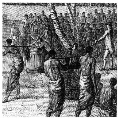
Figure 5.12.
An astronomical quadrant in use (1777). The astronomer William
Bayly can be seen taking an observation of the sun with his
quadrant, which is placed on a cask filled with wet sand. Detail from
a view at Anamooka, Friendly Islands, engraved by W. Byrne after
John Webber. (Reproduced courtesy of the National Maritime
Museum, London.)
those same phenomena at Greenwich, gave longitude determinations. These were observations of the eclipses of Jupiter's satellites, of solar and lunar eclipses, of occultations of stars passing behind the moon, and of the transit of Mercury—none of which occur very often but the Greenwich times of which were predicted in the almanac. And, of course, there might be comets; although they could not be predicted, the measurement of their position was important to astronomy.
Finally, Cook and his officers made many nonastronomical observations ashore. First there were the meteorological and magnetic observations as at sea but with the addition of observations for magnetic dip with a dip circle. Incidentally, it is an early example of international scientific cooperation that, in 1785 in an interval between wars, the British Board of Longitude lent two of the dip circles used on Cook's third voyage to La Pérouse. (These were never seen again.) Then there were the observations of the tides—how long before or after the moon crossed the meridian did high water occur, what was the magnitude of the rise and fall, and how did that magnitude vary between spring and neap tides? From the amount of clock gained or lost at Tahiti compared with its performance at Greenwich, Maskelyne found that the force of gravity at Tahiti was 99.7 percent of its amount at Greenwich. Incidentally, it was principally these ongoing gravity measurements which caused these transit-of-Venus clocks to travel the world so extensively during the next hundred years or so, all with the object of determining precisely the "figure of the earth"—the amount it is flattened at the poles.[12]
Conclusion
I have used Cook's voyages to provide my examples largely because they are the best documented. But other explorers, British, French, and Spanish, used the same methods and instruments. Charles Darwin said of Cook's surveying and mapping that "he added a hemisphere to the civilized world." No less important was the wealth of other scientific data and specimens—on a scale never before equaled, particularly in natural history—that he and his shipmates brought back. The careful planning, execution, and subsequent publication of this vast volume of data did an enormous amount for the advancement of science generally and was as important in its own way as were the geographical discoveries.
VI
The Sailor's Perspective: British Naval Topographic Artists
John O. Sands
In a world littered with travel guides, cruising guides, and literature on exotic places of all sorts, a world defined by gas company roadmaps, nautical charts, and satellite photographs, it is difficult to believe that the state of our geographical knowledge has not always been so complete. Today we take it for granted that the extent of the world is essentially well defined—that while we may not personally have a specific piece of information immediately at hand, "they" have the answers if answers are needed. In fact, the knowledge of the world we take for granted is a rather recent phenomenon, the result of meticulous observations by hundreds of individuals, observations eventually assembled into a relatively complete picture. The effort to gather this information in a systematic fashion began to take shape in the eighteenth century. As one aspect of that effort, a number of countries sought to ensure that their naval officers could provide accurate geographical reports. The skills thus acquired occasionally developed to the point that what had begun as strict documentary recording eventually blossomed into full-blown artistic abilities.
The classic explorer of the eighteenth century, and the one who seized the imagination of the public at large, was Captain James Cook. At a time when British supremacy on the seas was unchallenged, when colonial expansion was both acceptable and desirable, and when the scientific attitudes of the age of reason were becoming firmly entrenched, Cook undertook the exploration of virtually half the world. His work was by no means the first major British exploration, but rather the capstone of a long and vital period of discovery. His experience and accomplishments were the result of groundwork laid by his predecessors, the consequence of abilities that had been consciously developed in British naval officers. When he set sail from Deptford, England, on 21 July 1768, Cook was under orders to proceed to the newly discovered Tahiti to observe the transit of Venus, due to occur in 1769. The scientific goal of the mission was to compare the time of this occurrence at various places on the globe, thus enabling the calculation, through triangulation, of the distance between the earth and the sun. This official task was to prove the least of the voyage's accomplishments, however.
When Cook sailed, he carried with him, as was often the case, secret instructions. These additional orders outlined a much broader task for his voyage, a task that far outweighed in importance the initial purpose of the trip. His orders read in part:
You are to employ yourself diligently in exploring as great an extent of the coast as you can; carefully observing the true situation thereof both in latitude and longitude, the variation of the needle, bearings of headlands, height, direction, and course of the tides and currents, depths and soundings of the sea, shoals, rocks, etc., and also surveying and making charts, and taking views of such bays, harbours and parts of the coast as may be useful to navigation.[1]
Here was work for which Cook was suited, work for which he had been specifically chosen. He had been seventeen years a merchant seaman and was responsible for outstanding survey work in Newfoundland and the St. Law-
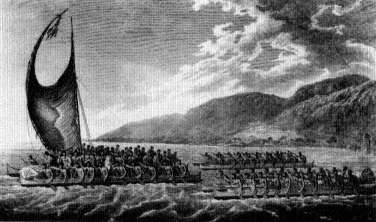
Figure 6.1.
The engraved plates that resulted from Cook's voyages were
ostensibly devoted to the geography of the area, but many,
such as this one, were clearly more involved with native populations.
Plate 61 from the atlas accompanying James Cook, A Voyage
to the Pacific ocean (London, 1785). (Figures 6.1-6.6 reproduced courtesy
of the Mariners' Museum, Newport News, Virginia.)
rence, vital areas during the recent conflict with France. He was thus peculiarly able to undertake the required survey work, which he did during the course of three voyages made before his death in 1779.
It is a tribute to Cook, and to the curiosity of the time, that these voyages became the major scientific event of the last half of the eighteenth century. Cook, and the scientists and artists who accompanied him, assembled huge collections of specimens of all sorts, huge amounts of data on the lands they explored, and some of the first and most reliable information on the people they encountered. The general fascination with the native populations, however, was rivaled by the interest in the new botanical species being discovered. While many of the "views" taken on the voyage ostensibly represent topographical features, they are dominated by the plants, people, boats, and life-styles of the islands (Figure 6.1). Having exploration and documentation as a principal goal, it was natural that Cook
should have carried with him some of the best scientific and artistic talent then available. It is interesting to compare the original drawings, some extremely detailed, with the printed versions prepared by the engravers of the day. The engravers felt no compunction about altering the landscape to suit their fancy, and more than one tree or building had its form and species changed in the process. As one engraver pirated views from another, details were even further watered down, until the subject that the general public finally saw bore little resemblance to the original drawing. This in no way diminished the scientific value of the information that was gathered, however; even today, much of the original data is the most reliable information available on the natives of the Pacific.
This problem of the reliability of published sources was by no means new in Cook's time but was a difficulty with which the scientific and technical world had long wrestled. Rarely did the publishers of maps and geographical views have any experience outside their studios. Their works were typically based on the observations of others, and often they were published in secondhand form at best. While the comparison of various plagiarized maps and charts makes amusing study for the twentieth-century collector, the permutations and errors that crept in during this process were anything but amusing to the professional mariner of the day. His life was likely to depend on those maps, and inaccuracies could spell disaster. Further, the changes in scale and physical orientation that the engraver often introduced for reasons of design might well render the view totally useless for any but decorative purposes. The inconsistencies of scale might be immediately evident, but to know that something is wrong and to know what is actually right are two separate matters. It was for this reason that the British Admiralty adopted, out of necessity, the practice of training its officers in the art of careful observation. It was a skill that was to stand them in good stead.
The training of young men for naval service had long been undertaken through the same system of appren-
ticeship that prevailed on land. A youth of twelve or thirteen came on shipboard as a cabin boy and through experience and study advanced to the rank of midshipman. This was officially a student rank, and though midshipmen had the authority of junior grade officers, they were still expected to carry on formal studies. It was through this avenue that virtually all the naval officers of the eighteenth century entered the service, and their training was similar in many ways. It cannot be said in good conscience, however, that a ship was the most savory place for a boy to spend these formative years. Writing in the mid-nineteenth century, the founders of the Floating School of Baltimore, a training school for merchant mariners, described the problem thusly:
As an apprentice, the boy may be taught to hand, reef, steer, etc ., as the sailors term the labors; but in the companionship of his instructors he is at the same time influenced by the evil examples continually before him, and through their agency induced into the formation of habits peculiar to their mode of life. Familiarity with vice, at such a period of life, is almost the sure fore-shadowing of the career of crime and the infamy that follows it, in which so many pursue the way of ruin and wretchedness. It must be an extraordinary lad, that, under the circumstances, could pursue his way unharmed through the contaminating agencies surrounding him. The rock of intemperance, upon which so many hundreds and thousands founder, is in his way, and for him to escape it is next thing to an impossibility.[2]
Recognizing the risks described here—and the lack of consistency that resulted from training by many masters aboard many ships—naval authorities in most of the major countries set out to establish training schools for their naval officers. There they received uniform instruction in the various areas judged critical to their future careers at sea. Thus in the school established in 1715 for the Sons of Seamen, at the Royal Hospital for Seamen at Greenwich, England, the boys
are instructed in the principles of Religion by the Chaplains, and in Writing, Arithmetic and Navigation by a School Master appointed for that purpose; who also instructs those in Drawing who shew a genius
for it. . . . All the Boys attend the Directors, once a year to be viewed, when they bring specimens of their several performances; and three of them who produce the best Drawings after nature, done by themselves, are allowed the following premiums, according to their respective degrees of merit, viz.
A Hadley's Quadrant | 1st Prize |
A Case of Mathematical Instruments | 2nd Ditto |
Robertson's Treatise on Navigation | 3rd Ditto |
The nature of the prizes makes it clear that the drawings were not intended as mere amusement but were integral to the preparation the boys were receiving for their careers at sea. Their training in a school was just the beginning, of course; they still needed the practical experience of serving aboard a ship. Thus they were "bound out for seven years, to the sea-service only, for the better improvement of their talents, and that they may become able Seamen and good Artists."[3]
The concern that the British showed for training in the arts was shared by other nations. In 1781 the Dutch established their Marine School at Amsterdam with a similar curriculum:
The instruction consists in a course of the study of navigation, including the elementary principles of algebra and geometry: of erect angled trigonometry and the appropriate parts of astronomy; in the teaching and daily practicing—in the working and manoeuverings of a ship; in rowing; bodily exercise, and the use of firearms; also in the knowledge of the Netherlands, French, English, and German languages; in history and geography. The art of drawing in its varieties is taught, as a matter of encouragement to those who, in other respects, satisfactorily perform their duties, and have the necessary talent for it.[4]
While the classes in drawing may have been something of a luxury for the Dutch, the British continued to emphasize them in the curriculum. John Thomas Serres taught the drawing classes at the Chelsea Naval School and in 1805 published Liber Nauticus, and Instructor in the Art of Marine Drawing . This set of two volumes of plates was intended to assist the student of marine art in achieving the technical expertise necessary to execute credible works. Serres had
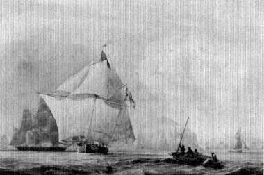
Figure 6.2.
This 1802 watercolor of the Queen Charlotte, a coastal passenger
boat connecting London with the outlying cities, suggests the
versatility of artists like J. C. Schetky.
succeeded his father as marine painter to George III and was also appointed marine draftsman to the Board of Admiralty. In this latter role he was assigned to survey work around the European coasts, recording landfalls and headlands. These drawings were published in an 1801 coast pilot entitled The Little Sea Torch , containing text translated from a French sailing guide and views by Serres. Even at this late date the artist fell victim to the engraver. Among the lovely views and charts is a chart of the Mediterranean at Gibraltar—backwards. The post of marine painter to His Majesty seems to have been reserved for professors of drawing in naval schools. In 1811 John Christian Schetky was appointed to teach drawing at the Royal Naval Academy in Portsmouth, England. He held that post for twenty-five years, exhibited regularly at the Royal Academy, and served concurrently as marine painter to King George IV (Figure 6.2). Thus the ability to draw and render topographical features became a firmly established aspect of the training received by virtually every naval cadet until
the mid-nineteenth century at least. In fact, as late as the Second World War midshipmen in the German navy were still required to execute a drawing of the harbor they had entered before they could go on shore leave.
In light of the widespread nature of this training, it might be supposed that the bookshelves of the world would be groaning under the weight of the volumes of drawings that must have been produced. In fact, most were of the mediocre quality so frequently produced in school situations and met their deserved fate. Nonetheless, a significant body of extant material suggests the nature of this program and indicates the general character of the works undertaken by these seamen-artists. The typical drawing is a small but accurate watercolor elevation of the headland or point marking the entrance to a major harbor or bay. These were not designed to be decorative but functional. At a time when seamen could not depend on finding a published guide to the area they were entering, it was cheap insurance to sketch and keep a picture of the headland for future reference. It was from such sketches and surveys taken on the site that J. F. W. DesBarres was able to publish his monumental work, the Atlantic Neptune . This extraordinary collection of charts and views of the North American coast, published at the time of the American Revolution, made widely available reliable information for the first time in over two hundred years of settlement (Figure 6.3). Like Captain Cook, however, DesBarres was obliged to base much of his work on surveys that he himself made. His training and that of his assistants? They were naval officers, of course, though he was himself a military engineer.
It is not surprising that the topographical view of the headland was sometimes further developed into an artistic view of the harbor and the city where the ship had moored. After months at sea, the visual variety of hills, houses, and church steeples must have come as welcome relief to the weary eye of the sailor. Frequently, in a bound volume or sketchbook, the city and harbor views are interspersed

Figure 6.3.
The entrance to Louisburg, on the eastern end of Nova Scotia,
is shown in this plate from the Atlantic Neptune. A skilled engraver
could do wonders for an otherwise dull scene. "The Entrance to
Louisbourg Harbour, on the Island of Cape Breton," published
11 February 1779, by J. F. W. DesBarres for the Atlantic Neptune.
with the more simplistic images of landfalls. Such is the case with a book of drawings thought to have been executed by John Davis while he served as a midshipman aboard either HMS Norwich or Success . In 1756, these two small vessels sailed from the Caribbean north to Nova Scotia, calling at several ports along the way. The drawings that survive are bound in a volume that includes unfinished sketches as well as finished and colored works. It was clearly an exercise book, and some of the drawings were apparently intended for later removal or recopying. In any event, the views of the landfalls, headlands, and landmarks one expects to find are interspersed with finished views of harbors and towns that the vessels visited. From the latter-day Cap Haitien, in what was then Saint Domingue, to the Chesapeake Bay and finally to Halifax in Nova Scotia, Davis meticulously rendered the towns he saw (Figure 6.4). In some cases, these are the earliest or only known views of these towns and thus of great importance for historical reasons. While it seems unlikely that they were of any particular value to the Admiralty at the time they were drawn, the careful skills of observation that went into the creation of the works makes them much more reli-
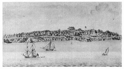
Figure 6.4.
HMS Norwich and Success are depicted in front of Yorktown, Virginia.
This 1756 view by John Davis, a midshipman serving aboard one of them,
is the earliest view of the town known to exist and is shown to be
quite accurate by surviving buildings and archaeological work.
able than the common artistic sketch of indeterminate origin.
It was not always the midshipmen who took pen or brush in hand. Often a senior officer, perhaps even the captain, who had earlier developed some facility with drawing, continued to record the passing scene after the scholastic requirement to do so had passed. Such was the case with Nicholas Pocock. He went to sea and, though a merchant seaman, early developed the meticulous habit of recording what went on around him. When he assumed his own command in 1767, he even went so far as to keep a daily illustrated logbook of his voyages. It might have been sufficient to record the headlands he encountered, but instead he amplified the record by illustrating the appearance of his ship, and the sails she had set, every day. Thus the required data on the state of the wind and the sea, the course and the distance made good, are enlivened by a small vi-gnette of the ship with her studding sails set as she works her way across the ocean in the trade winds (Figure 6.5).
Figure 6.5.
Nicholas Pocock enlivened the otherwise boring days of sailing in
the trade winds by showing his brig Minerva in the logbook as
she appeared each day. His early training did not allow him to ignore
the topographical views, and he included the headlands he encountered.
Upon arrival, Pocock also set himself to record the harbors where he called, again with all the meticulous detail of a trained observer (Figure 6.6). In Pocock's case, the appeal of the land and the palette eventually outweighed that of the sea. In 1780 he submitted a painting to the Royal Academy and, receiving encouragement from Sir Joshua Reynolds, decided to swallow the anchor and come ashore. With his special expertise, however, he devoted the remainder of his life to the depiction of seafaring matters. His paintings of naval battles had an air of authenticity born of direct experience.
Though well known, Pocock was not alone. Thomas Luny, for example, retired from a naval career because of crippling arthritis. Although he continued to paint ship portraits and naval battles, his disability was at times so great that he had to strap his brush to his hand. Thomas

Figure 6.6.
Having arrived in Fredericksted, St. Croix, Pocock could exercise
his full abilities by painting both the harbor and its denizens.
Buttersworth entered the Royal Navy as an enlisted man in 1795 and was appointed to the rank of midshipman in 1800. Wounded and released from service, he continued to paint nautical scenes and naval battles for the remainder of his life. As in the other cases, the freedom of working ashore allowed him to expand beyond simple watercolors to undertake oil paintings as well. Buttersworth also trained his son, James, who eventually surpassed his father's ability and immigrated to the United States where he was renowned for many years as a marine painter. Such family connections were not unheard of. John Cleveley, the younger, was one of a family of marine artists who painted in and around Deptford, near London, during the last half of the eighteenth century. His father served as a shipyard carpenter and commenced a family tradition that was carried on by his sons. It was this same continuity resulting from widespread family involvement that enabled the famous Roux family of Marseilles to dominate the market for ship portraits from the Mediterranean for over seventy years.
Other sailors chose to continue their careers, but in the process they left behind fascinating documents of their times and their travels. They made observations of their surroundings while they could, and these again constitute rare records of frequently remote and ill-documented events and places. It was not uncommon, for instance, for a sailor-artist to record the native small craft he encountered in his peregrinations—frequently in detail, often engaged in their workaday activities. As many of these water-craft have long since disappeared, there is an obvious value to the record thus created. All too often, though, the drawings are unsigned or signed with names lost in obscurity. It takes dogged research to discover even the most rudimentary information about these men who served in a career that by its nature led to anonymity for all but the most illustrious.
Often it is the view that is remembered. Occasionally it is the artist who is remembered because of the views. Such was the case with William Webley, a British naval officer long since forgotten until a volume of his watercolors was discovered and eventually acquired by the Lily Lambert McCarthy Foundation. Webley had the great good fortune to have been in the right place at the right time. Thus these drawings not only illuminate the interesting career of this previously unknown officer but also shed light on the naval events in which he was engaged—an eyewitness view of the Age of Nelson.
As so often happens, William Webley entered the Royal Navy at just the wrong time for career advancement. When he enlisted at the age of sixteen, in 1780, the American Revolution was winding down. Nothing spells disaster for a promising naval career like peace, and Webley was just getting started when the British entered a prolonged period of relative tranquillity. The young Webley was assigned to the somewhat mundane but vital business of coastal survey work off the coast of Africa. It was almost certainly during this period that the young midshipman began to draw, both as a part of his training and as his
work. It was not until 1789 that his naval career came into its first flower, however. In that year he was appointed midshipman aboard HMS Salisbury , a fourth-rate ship of fifty guns; a year later he was promoted to the rank of lieutenant. The Salisbury was commanded by Captain Edward Pellew, who cut a fine figure both professionally and socially. In emulation, a number of the junior officers, including Webley, concentrated on refining their style, dress, and etiquette as they thought befitted their station. Others on board ridiculed these dandies as only fit to be housed in a glass case and thus unfit to perform the duties of their profession. In turn, Webley and his friends proudly pronounced themselves members of the Glass Cases Club, while they derided their associates as the Rough and Ugly. It was a matter of considerable pride to Webley that he and his friends were able to maintain rigid standards of decorum while clearly excelling in their work as well. Webley described the Glass Cases Club in a phrase fitted to the temper of his times: "All who composed that gallant little band, died admirals, having faithfully served their country."
Throughout a naval career that lasted until 1825, Webley continued to execute watercolor drawings of the events around him. These he kept as a record for his family, and in later years they were assembled with his descriptive notes. And what events they were. He served with Lord Nelson at Tenerife—indeed, his small watercolors are the only known record of that disastrous and ill-considered action in which Nelson lost his right arm. He was again with Nelson when he turned the tables at the Battle of the Nile. Here the master tactician managed to decimate the French fleet, leaving Napoleon and his army stranded in Egypt. This brilliant victory was achieved during a battle fought at night, which gave more than the usual artistic interest to the scene. The death knell was sounded on the hopes of the French when their flagship, the immense L'Orient of one hundred and twenty guns, exploded at 10:00 P.M. This huge explosion rained burning wood and rope on both fleets and made such a noise that the entire battle stopped

Figure 6.7.
William Webley, serving as first lieutenant aboard HMS Zealous,
made this record of the Battle of the Nile, 1798, just as the French
flagship L'Orient was exploding. Haste in painting may excuse lack
of detail in the work; an eyewitness view of such an event by a trained
observer is a rare thing indeed. (Reproduced courtesy of the Lily Lambert
McCarthy Foundation.)
for nearly ten minutes. Both sides were so stunned by the event that they were unable to continue fighting. It was this moment that Webley chose to record (Figure 6.7). While his watercolor may not be the most artistically accomplished work ever produced of the event, it has the strength and direct appeal of the eyewitness view.
It is clear from the Webley collection that a brotherhood of sorts existed among naval officers, even those of opposing sides. Webley served at the Battle of the Nile aboard HMS Zealous as first lieutenant. Zealous was among the first ships to engage the enemy, and she was able to secure the almost immediate surrender of her assigned target, the French ship Guerrière . When the captured French officers were brought aboard Zealous , Webley soon discovered that one of his prisoners was interested in watercolor drawing. We do not know his name, but we do know that Webley provided him with brush and colors to record the scene.
The Frenchman painted a very credible representation of the defeat of his ship, a drawing he presented to Webley as a gesture of appreciation for a fellow artist. The common bond of training, experience, and interest outweighed whatever political differences may have separated the seamen who only hours before had been engaged in mortal combat.
The practice of recording topographical scenes began in the navy as a matter of necessity—born of the grave realization that the very lives of those involved might someday depend on the accuracy of a simple sketch taken as the setting sun illuminated some landmark. The practice was formalized, systematized, taught, and eventually became an enforced part of every naval officer's training. For many it was, no doubt, a chore. But for others the practice of drawing became a subject of lifelong fascination and entertainment. For us, the drawings constitute a record unequaled for accuracy and breadth of vision—a truly unparalleled look into the past.
Notes
I Seapower and Science: The Motives for Pacific Exploration
1. Regarding the publication of the various collected and foreign-language editions of Dampier's voyages see Joseph C. Shipman, William Dampier: Seaman-Scientist (Lawrence, Kansas, 1962), pp. 2-4. Dampier's influence on Defoe is readily traceable; see Oskar H. K. Spate, The Pacific Since Magellan , Vol. II: Monopolists and Freebooters (Minneapolis, 1983), pp. 156-158: "No fewer than eight of Defoe's narratives are in-
Page 43
debted to Dampier, on whom he relies more than any other travel writer" (p. 157). Spate's fine work (the first two volumes, now published, carry the story down to the mid-eighteenth century) is the best introduction to the political history of the Pacific.
2. See generally Glyndwr Williams, "'The Inexhaustible Fountain of Gold': English Projects and Ventures in the South Seas, 1670-1750," in John E. Flint and G. Williams, eds., Perspectives of Empire: Essays Presented to Gerald S. Graham (London, 1973), pp. 27-53.
3. Joseph Conrad, "Geography and Some Explorers," in Last Essays , ed. Richard Curie (London, 1926), p. 10.
4. To understand Cook's conception of how he would be rewarded, one must understand the process of advancement in the Royal Navy. It was difficult for an officer to gain promotion in peacetime unless he had good connections and good luck. When Cook returned from his first voyage he was raised in rank to commander. After the second voyage he was made captain of a ship of the line which was about to be decommissioned, so the appointment was clearly contrived by the Admiralty for the purpose of giving him post, i.e., captain's rank. Almost simultaneously he was made a captain of Greenwich Hospital, a billet for deserving retired officers which paid a nice pension, but Cook took it on the clear understanding that he had not retired. See J. C. Beaglehole, The Life of Captain James Cook (Stanford, 1974), pp. 275-276, 444.
5. On Dampier's instructions see note 77 below. The quotation from John Maynard Keynes is found in Essays in Persuasion (London, 1931), p. 62. Keynes wrote this in 1921 when he was most disgusted and despairing over the conduct of the allied nations.
6. These underlying motives are shaped in any particular epoch by society's conception of the uses of exploration. A list of goals might include national or monarchical prestige; religious mission; science (pure lust for knowledge); commercially useful information; development of opportunities for commercial poaching, predatory expeditions of war, or human exploitation; and lucre (by seizure or mining). This list would pertain as readily to private as to public ventures. The main public or governmental concern would center on national self-preservation through various means—for instance, enhanced treasury revenue, increased prosperity (and hence taxable and loanable funds), enhancement of strategic knowledge or skills useful in combat (such as seamanship) among the populace, or enlargement of the nation's affiliated population through colonization. Additional benefits, of course, could include augmented pools of patronage and kindred opportunities for politicians.
7. Fernand Braudel, "The Expansion of Europe and the 'Longue Durée,'" in H. L. Wesseling, Expansion and Reaction (Leiden, 1978), pp. 17-27.
8. Oskar H. K. Spate, The Pacific Since Magellan , Vol. I: The Spanish
Page 44
Lake (Minneapolis, 1979), p. 58. There was a certain continuity. Although Magellan's voyage was in the service of Spain, he was Portuguese and had participated in the conquest of Malacca (ibid., p. 34).
9. The geographical and economic nature of things dictated that this Indies trade which centered on Manila, though it proved to be of some value to New Spain and was not without impact on commerce in the Pacific basin, could scarcely have any effect on the economy of Old Spain.
10. See generally T. Bentley Duncan, Atlantic Islands: Madeira, the Azores and the Cape Verdes in Seventeenth-Century Commerce and Navigation (Chicago, 1972), especially chap. 2.
11. See J. H. Parry, The Discovery of the Sea (Berkeley and Los Angeles, 1981), pp. 243, 253-257.
12. See Brett Hilder, The Voyage of Torres (St. Lucia, Queensland, 1980), p. 135: "As the discoveries made by Torres were thought to have a possible value to the enemies of Spain, his letter to the king was filed away out of sight. To historians seeking to tie the voyage of Torres into the wider perspectives of European expansion and world politics, there are no dividends. Nor were the results of the voyage of any help to exploration, colonization, trade, or navigation at the time. Torres's only reward was the belated naming of the strait after him, a well-deserved honour, as he was the first man to pass through it and no one was to follow him until Cook in 1770."
13. Spate, Monopolists , pp. 25-26. Bartolomé and Gonzalo Garcia de Nodal were Galicians who had amply demonstrated their abilities in the Spanish navy. Spate remarks that the conduct of this voyage of exploration "was a model of decision and efficiency." It is perhaps symbolic that they subsequently served in the Atlantic silver convoys (where they lost their lives in a hurricane).
14. Reluctantly from Madrid's point of view; Spanish Americans had a different perspective. A brief summation of the extent of the initial enthusiasm may be found in G. V. Scammell, The World Encompassed: The First European Maritime Empires, c. 800-1650 (Berkeley and Los Angeles, 1981), pp. 320, 328-329. For a brief sketch of the eighteenth-century history of the Manila galleon, see Spate, Monopolists , pp. 281-283.
15. From the preamble of the instructions given to Tasman, 13 August 1642, printed in J. E. Heeres, "His Life and Labours," in Abel Janszoon Tasman's Journal (Amsterdam, 1898), p. 128. See also the resolution taken by the officials at Batavia on 1 August (p. 131). On the probing voyages that the company did undertake in the 1620s and 1630s, see pp. 88-104, 147-148.
16. From the letter of 12 December 1742 from Batavia to Amsterdam explaining the purposes of the voyages (ibid., pp. 137-139). See also Andrew Sharp, The Voyages of Abel Janszoon Tasman (Oxford, 1968), pp. 30-39. At this time the Dutch called Australia the Southland; within
Page 45
a generation they would call it New Holland. It was still called New Holland in the time of Captain Cook.
17. Report from Batavia to the directors at Amsterdam dated 23 December 1644. I have preferred Sharp's translation here (ibid., p. 317).
18. Heeres, "His Life," p. 115, n. 4.
19. Charles de Brosses, Histoire des navigations aux terres australes (1756; reprinted Amsterdam and New York, 1967), Vol. I, pp. 8-9: "Si elle [une riche compagnie] agit, c'est avec des vûes particulières: c'est dans l'esperance d'un grand profit facile á faire. Si les premières tentatives n' ont aucun fruit, bientôt rebutée par la dépense & par les obstacles, elle se renferme dans les branches de son commerce accoutumé" (p. 9).
20. J. C. Beaglehole, The Exploration of the Pacific , 3rd ed. (London, 1966), p. 162.
21. The views at Batavia and Amsterdam were sharply divergent in the 1640s. The governor and councillors at Batavia wrote (12 December 1642): "We are sadly deficient in what would be required [proper ships] for the discovery of unknown countries and for the seeking of fresh trade-markets, on both which points, as aforesaid, a great deal more might be done" (Heeres, "His Life," p. 138). The directors wrote (9 September 1645): "The Company has now made a sufficient number of discoveries for maintaining its trade, provided the latter be carried on with success" (ibid., p. 115, n. 4).
22. The Dutch had high hopes in 1640 of replacing the Portuguese in Japan, but within a year or two all Dutch merchants in Japan were forcibly confined to a tiny island in Nagasaki harbor where they were able to conduct only a very limited trade. The Japanese policy of seclusion had already been implemented when the directors wrote their "wet blanket" letter to Batavia in 1645; it would appear that they did not yet know the true facts. Taiwan was lost to Chinese forces in 1662. See Spate, Monopolists , pp. 73-84.
23. See, generally, Kenneth R. Andrews, The Spanish Caribbean: Trade and Plunder 1530-1630 (New Haven, 1978).
24. In the sixteenth century the danger of meeting a Spanish patrol was greater. Apparently Sir Francis Drake chose to return to England by circumnavigation in 1578 because, having plundered Spanish vessels in the Pacific, he dared not try to leave the ocean by returning southward and through the Strait of Magellan; so he sought a Northwest Passage and, failing to find anything promising, set his course westward across the ocean. See Kenneth R. Andrews, "Drake and South America," in Norman J. W. Thrower, ed., Sir Francis Drake and the Famous Voyage, 1577-1580 (Berkeley and Los Angeles, 1984), p. 51.
25. For the discovery and use of the island of Juan Fernández, see Spate, Spanish Lake , pp. 117-119.
26. Anson realized his mistake upon sighting the coast of Chile, which he dared not touch despite the desperate state of health of his
Page 46
crews; so he reversed course and eventually reached the island. For the Spanish occupation, see Spate, Spanish Lake , p. 119.
27. William Dampier, A Voyage to New Holland , edited by James A. Williamson (London, 1939), pp. 136-137. For Dampier's wariness of the Dutch during his first voyage to the area (as a buccaneer), see Christopher Lloyd, William Dampier (London, 1966), pp. 54-62.
28. Afterward the East India Company directors were forced by litigation to make restitution. See Andrew Sharp, The Journal of Jacob Roggeveen (Oxford, 1970), pp. 166-177. The governor-general and council at Batavia, when they ruled that his voyage constituted an encroachment upon the company's monopoly, had recourse to the precedents established when Jacob Le Maire's ships and goods were similarly arrested in 1615. The two cases, however, were quite different. Le Maire had intended to break the company's monopoly by exploiting a possible loophole in its charter. The company had been granted exclusive rights in waters west of the Strait of Magellan ; Le Maire reasoned that if he reached the East Indies by a different route—he was the first to sail round Cape Horn—he could legitimately trade. His claim to be seeking new lands was not false, but neither was it the main point, and the seizure of his ships and goods when he began to trade in the East Indies was not entirely without justification. Nevertheless, upon suit by Le Maire's father in an Amsterdam court, the company was required to give compensation.
29. On Sir Joseph Banks and botanical projects, see David Mackay, "A Presiding Genius of Exploration: Banks, Cook, and Empire, 1767-1805," in Robin Fisher and Hugh Johnston, eds., Captain Cook and His Times (Seattle, 1979), pp. 21-39, especially p. 28.
30. On the commercial and imperial motives, see Raymond H. Fisher, Bering's Voyages: Whither and Why (Seattle, 1977), chap. 7; see also Raisa V. Makarova, Russians on the Pacific, 1743-1799 , translated and edited by Richard A. Pierce and Alton S. Donnelly (Kingston, Ont., 1975). The question of the scientific objective of Bering's first voyage is discussed in note 78 below.
31. It seemed possible in the early 1760s to expand trade with China by establishing a company entrepôt on an island in the Sulu Sea (off the northeast point of Borneo). The scheme was launched by Alexander Dalrymple. The idea was to encourage Chinese merchants to come there as they did to Manila. Whatever its merits, it failed under the mismanagement of another person. See Howard T. Fry, Alexander Dalrymple (1737-1808) and the Expansion of British Trade (London, 1970), pp. 36-93. In the following decades the main concern of the company was to establish a reliable and efficient gateway to the South China Sea by means of a defensible place that would give shelter and aid to the company's vessels and perhaps also serve as an entrepôt. The island of Rhio (Riau) near the Malacca Straits was most coveted, but the Dutch would
Page 47
not give it up. Eventually Singapore filled the bill. See John Ehrman, The Younger Pitt: The Years of Acclaim (London, 1969), chap. 14.
32. John Dunmore, French Explorers in the Pacific , Vol. I: The Eighteenth Century (Oxford, 1965), p. 13.
33. An Account of the Several Voyages to the South and North . . . By Sir John Narborough . . . [et al.] (1694; reprinted Amsterdam and New York, 1969), pp. 10-11.
34. Spate, Monopolists , pp. 51-53. In the long run, Chile did prove to be a chink in the imperial-commercial armor. See T. W. Keeble, Commercial Relations Between British Overseas Territories and South America, 1806-1914 (London, 1970), especially p. 1, n. 2.
35. Quoted by J. H. Parry, Trade and Dominion: The European Overseas Empires in the Eighteenth Century (New York, 1971), p. 20. Sharp was rewarded with a Royal Navy captain's commission by Charles II, though officially his voyage had been completely illicit.
36. Actually, Dutch threats in the earlier seventeenth century had moved the viceroyalty of Peru to take defensive measures; see Peter T. Bradley, "The Defence of Peru (1600-1648)," Ibero-Amerikanisches Archiv 2 (2) (1976): 79-111.
37. Captain Edward Cooke, A Voyage to the South Sea, and Round the World . . . 1708, 9, 10, 11 (1712; reprinted New York, 1969), p. 3 of dedication (to Robert Harley, Earl of Oxford, lord high treasurer). This was a competing account of Woodes Rogers' voyage.
38. On English propaganda and enterprise concerning the South Seas in this period, see Williams, "'Inexhaustible Fountain.'"
39. Geoffrey J. Walker, Spanish Politics and Imperial Trade 1700-1789 (Bloomington, 1979), p. 22; Spate, Monopolists , pp. 180-182.
40. Spate, Monopolists , pp. 189-194. Everyone has relied on the table and descriptive lists of M. E. W. Dahlgren, "Voyages Français à destination de la Mer du Sud avant Bougainville," Nouvelles Archives des Missions Scientifiques et Litteraires 14 (1907): 446-551. It does not appear that every sailing actually reached the Pacific.
41. Henry Kamen, The War of Succession in Spain, 1700-15 (Bloomington, 1969), pp. 149-150. As Kamen comments: "Such deception was so transparent that it is difficult to see whom the French government was trying to delude."
42. Rejecting the pleas of the merchants of Saint-Malo, the French government undertook the painful task of squelching it.
43. Its statistical importance is displayed by a table in Stetson Conn, Gibraltar in British Diplomacy in the Eighteenth Century (New Haven, 1942), p. 267. See also Ralph Davis, "English Foreign Trade, 1700-1774," in W. E. Minchinton, ed., The Growth of English Overseas Trade in the Seventeenth and Eighteenth Centuries (London, 1969), p. 119.
44. Jean O. McLachlan (Lindsay), Trade and Peace with Old Spain, 1667-1750 (Cambridge, 1940), p. 18: "The trade to Old Spain pro-
Page 48
vided a supply of vitally necessary bullion, a market for the staple English products, a source both of valuable raw materials and of cheap popular luxuries, and, moreover, was not monopolised by any company.'' On Portugal, see H. E. S. Fisher, The Portugal Trade: A Study of Anglo-Portuguese Commerce 1700-1770 (London, 1971).
45. On the cancellation of the projected voyage of 1749, see Robert E. Gallagher, ed., Byron's Journal of His Circumnavigation 1764-1766 (Cambridge, 1964), pp. xxxvii-viii.
46. There are some figures on Spanish trade and its decline in Conn, Gibraltar , p. 267. On the decline of Portuguese trade, which was absolute in this period, see Fisher, Portugal Trade , chap. 2.
47. Spate, Monopolists , pp. 110-111. As he remarks, "There seems to be some tendency to take things both ways."
48. Braudel, "Expansion of Europe," p. 18. He was speaking of the longue durée , but his ideas clearly apply here to the period from 1500 to 1800. Only sixteenth-century Spain and seventeenth-century England provide any support for his argument and even there the support is only partial. The French consistently gave more effort overseas to trade and fishing; the Dutch "building" effort in America was almost nil. As for the English in the seventeenth century, it should be remembered that the East India Company was launched about the same time as the Virginia Company and that the English traders were evicted from the Spice Islands in the 1620s by the Dutch. Dutch expansion hardly suits Braudel's formula at all, though he contrived to make it seem so by reference to the abortive Dutch effort in Brazil. Finally, the period from 1714 to about 1760 has been rightly termed the period of "salutory neglect" in British North America.
49. Vincent T. Harlow, The Founding of the Second British Empire, 1763-1793 , Vol. I: Discovery and Revolution (London, 1952), pp. 59-60.
50. Harlow presented his point somewhat differently in another passage. Before 1763, he wrote, "the energies of the British were heavily engaged in defending their positions against the French in Europe, America and India. Until that issue was decided, further ambitions were beyond the horizon" (ibid., p. 17). Once again one must ask whether statesmen really believed that on all three of these continents the "issue was decided" by 1763. On this matter see also Glyndwr Williams, The Expansion of Europe in the Eighteenth Century: Overseas Rivalry, Discovery and Exploitation (London, 1966), pp. 96-97. (Chapter 7 of his book provides a good, brief introduction to the opening of the Pacific.)
51. The interpretive framework is set forth in Harlow's first two chapters. Chapter 3 is entitled "The Swing to the East." The quotation is on pp. 10-11.
52. D. L. Mackay, "Direction and Purpose in British Imperial Policy, 1783-1801," Historical Journal 17 (1974): 487.
53. See especially Peter Marshall, "The First and Second British Empires: A Question of Demarcation," History 49 (Feb. 1964): 13-23. Marshall answered the case statistically and by a survey of policy decisions. David Mackay has concluded that the whole notion of a conscious directional shift of policy is mistaken: "There was not within the governmental bodies . . . [any locus] capable of sustained conceptualization that Harlow's themes imply or necessitate. . . . The machinery of colonial administration was such that no new philosophy of empire, no coherent, forward-looking policy emerged. . . . [T]he government had no clear ideas as to overall direction and purpose in imperial policy. This is not to suggest that a pattern is not discernible; but the pattern reveals itself only to the historian. It was not deliberately planned." See "Direction and Purpose," pp. 500-501; see also Mackay's earlier study, ''British Interest in the Southern Oceans, 1782-1794," New Zealand Journal of History 3 (1969): 142. I should add here that I feel the same admiration which other scholars have expressed for the range and depth of Harlow's contribution.
54. I shall leave aside the intricate question of why the British, by treaty, gave back Havana and Manila (commerce) and kept or accepted Canada and Florida (dominion).
55. See Stephen Saunders Webb, The Governors-General: The English Army and the Definition of the Empire, 1569-1681 (Chapel Hill, 1979).
56. My view is based on what moved the English taxpayer to open his purse. In the long run that was decisive. I therefore focus upon the mother country's declared interest (declared by government and by public debate): to nurture and defend maritime capacity and commerce. For that there was public support; for defending or extending overseas dominion per se, almost never. Webb should be given credit for calling attention to the semi-hidden agenda, but I cannot agree that it should be given primacy. T. R. Reese's comment has a bearing here: "The cry that 'we prefer trade to dominion' is significant, but the two activities are not easily dissociated. From the very beginning British maritime activity had nourished both trade and colonization, the one being the complement of the other." See Trevor Richard Reese, "The Origins of Colonial American and New South Wales: An Essay on British Imperial Policy in the Eighteenth Century," Australian Journal of Politics and History 7 (Nov. 1961): 195.
57. Harlow could not ignore the fact that Indian dominion expanded after 1760. In fact, Alexander Dalrymple (whom he often cites) observed the trend at the time: "But the East-India Company are too much engaged in territorial dominion to think of commerce and discovery" (p. xxvi of the introduction to Dalrymple, An Historical Collection of the Several Voyages and Discoveries in the South Pacific Ocean [1770; reprinted Amsterdam and New York, 1967]). Harlow explained this fact
Page 50
away by saying that it arose from the need to keep the French from getting the upper hand in the subcontinent. He did not raise the further question of why this was considered a necessity, nor did he give much attention to the growing influence of those in Britain who were prepared to see the question of Eastern trade mainly in the light of maintaining dominion in India. (The China trade provided a solution to the problem of making adequate returns to English shareholders back home without impoverishing Bengal by exporting hard money from there.) See Ehrman, Younger Pitt , chaps. 14 and 15. See also Alan Frost, ''Botany Bay: A Further Comment," Australian Economic History Review 17 (1977): 64-77. On trade to Southeast Asia, see generally D. K. Bassett, British Trade Policy in Indonesia and Malaysia in the Late Eighteenth Century (Hull, 1971), especially chap. 1.
58. See Marshall, "First and Second," p. 23.
59. Harlow, Founding , I, 3-4, 37.
60. On American absorption of "the widening range" of British manufactured goods at this time, see Davis, "English Foreign Trade, 1700-1774," pp. 105-117. Dalrymple's argument here is sophisticated. It lays out a scenario wherein American colonial interests, during a trade depression, would be able to put pressure on Parliament through the clamorous "distress of the industrious manufacturer" of Great Britain; see p. xxvii of Dalrymple, Historical Collection .
61. Dalrymple, Historical Collection , p. xxviii.
62. Harlow, Founding , I, 3: "Scientific and industrial development at home, and the possession of decisive superiority at sea, naturally led a self-confident island people to search the oceans for new markets."
63. Byron's instructions did not specify that he should go in search of new lands to the westward; he did that on his own. He was ordered to go first to the Falklands, which he did, then to search for a northwest passage from the Pacific side, which he did not do. Evidently, the reason he did not was rather "Byronic." See Gallagher, Byron's Journal , pp. xliii-lviii. He was in fact the poet's grandfather. On Anson's views see ibid., p. xxxvii; on Egmont's, see pp. xxxix-xl, 160-163.
64. The best evidence of the continued importance of the Navigation Acts to British policy in this period was the government's pertinacious retention of them in the British West Indies after American independence, where they faced practically insurmountable difficulties.
65. By accenting the positive commercial prospects that came to a degree of fruition in the nineteenth century Harlow's interpretation obscured the pressing concerns of eighteenth-century statesmen that were the main motivating force behind the exploratory thrust. Harlow recognized that seapower considerations were among the motivations, but he placed his emphasis on commercial reorientation. General historians have tended to remain under his influence, but quite a few specialized studies have strongly dissented.
Page 51
J. H. Parry's general study followed Harlow only halfway. Parry offered the outline of Harlow's account, yet elsewhere he laid stress on the noncommercial flavor of the voyages. The latter point Parry hammered home by remarking that "even after Cook's second voyage had shown that the Pacific had relatively little to offer in the way of commercial advantage, there was no immediate slackening of interest" ( Trade and Dominion , pp. 244, 256).
Dalrymple too might have disagreed with Harlow's emphasis, but it is not easy to ascertain Dalrymple's position; his expansive views did not deign to put objectives in rank order. Still, one notes that the last paragraph of Dalrymple's introduction deals with seapower. Britain, he said, could not afford to let any "competitors . . . gain the superiority at sea. . . . [I]f other nations are negligently permitted to extend their navigation to remote parts," and to gain thereby "commerce and power," it would certainly reveal the ''worthlessness of ministers" who allowed it to happen ( Historical Collection , p. xxx).
66. Alan Frost, in an appendix to Convicts and Empire: A Naval Question, 1776-1811 (Oxford, 1980), has set forth a comprehensive case against commercial motivation (pp. 185-195) in which he pays special attention to the monopoly rights of the British East India and South Sea companies. The aim of the book is to emphasize the role of naval power in the decision. Although I believe this aim is broadly correct, I doubt whether so much stress should be laid on the hope that New South Wales (and nearby Norfolk Island) could provide naval stores for refitting ships that operated in the Indian Ocean.
There can be no doubt that the British government in the mid-1780s was searching for more than just a place to dump convicts, though the disposition of the convicts was indisputably an urgent problem; the initial idea was to have them settle a way station near the Cape of Good Hope, but no suitable spot could be found. As well, the idea that a base in New South Wales might prove useful to the navy notwithstanding its apparently useless location was probably in the minds of those who made the decision. For its greatest strategic importance related to a contingency which was better left unstated by officialdom even in confidential memoranda—namely the possibility that the Dutch East Indies would fall under French control. Since this did not happen—Pitt's administration took strong measures to thwart French ambitions in the Netherlands in the 1780s—the contingency now seems a bit unreal. But it was real enough then. On these points see Frost, Convicts and Empire , chaps. 6, 7, and 8; Mackay, "British Interest," pp. 126-134. We may note that James Matra did not shy away from stating that the place had its uses against the Dutch East Indies, Manila, or Spanish America, "if we were at war with Holland or Spain" (Reese, "Origins," p. 193). As for naval stores, it should be realized that a base was first a reliable place for water, shelter, and "refreshment" (capable of supplying fresh food so
Page 52
that crews could recover their health) and second a place for performing ship repairs—in that order. The history of overseas bases generally bears this out. The essential point was to have a friendly population ashore, in a defensible location, which could grow or stock the necessary fresh provisions. A means of obtaining cordage, canvas, or spars from local resources was an attractive bonus but rarely decisive.
67. De Brosses, Histoire , pp. iii-iv.
68. For a brief discussion of De Brosses and Bougainville see A. Carey Taylor, "Charles de Brosses, the Man Behind Cook," in The Opening of the Pacific: Image and Reality , National Maritime Museum Monographs, no. 2 (1971). Bougainville's first voyage was financed by a syndicate of merchants from Saint-Malo plus his personal funds. The cost was reimbursed by the courts of France and Spain after the French gave over their claim to the Falklands to the Spanish. The second voyage was financed by the French government; its instructions mentioned precious metals and spices and the hope that he would find "some island close to the Chinese coast, which could be used as a commercial centre for the Compagnie des Indes for trade with China." See Dunmore, French Explorers , I, 63-64, 67. For further information on Bougainville's role in trying to secure East Indian spices, see Helen Wallis, ed., Carteret's Voyage Round the World, 1766-1769 (Cambridge, 1965), I, 96.
Commercial motives were central to the next French Pacific venture, commanded by Jean de Surville (1769-1770); it was backed by a syndicate hoping to exploit opportunities arising from the collapse of the Compagnie des Indes. Surville wished to discover important islands in the Pacific before the British claimed them. See Dunmore, French Explorers , I, 114-126; see also Dunmore, ed., The Expedition of the St. Jean-Baptiste to the Pacific (Cambridge, 1981), pp. 15-29.
69. Captain George Shelvocke, A Voyage Round the World by the Way of the Great South Sea, Perform'd in the Years 1719, 20, 21, 22 . . . (1726; reprinted Amsterdam and New York, 1971), p. ii.
70. See O. H. K. Spate, "De Lozier Bouvet and Mercantilist Expansion in the Pacific in 1740," in John Parker, ed., Merchants and Scholars (Minneapolis, 1965), especially pp. 238-240. Bouvet's proposals were addressed to the minister of marine and the Compagnie des Indes. He never got sponsorship for this voyage. His voyage of 1737 had been in search of a way station near one of the cape routes.
71. See Wallis, Carteret's Voyage , I, 4-18, II, 298, 322.
72. Taylor, "Charles de Brosses," p. 13. Taylor notes that Spanish pressure had inhibited Egmont in 1766.
73. Warren L. Cook, Flood Tide of Empire: Spain and the Pacific Northwest, 1543-1819 (New Haven, 1973), pp. 47-54; Donald D. Brand, "Geographical Exploration by the Spaniards," in Herman R. Friis, The Pacific Basin (New York, 1967), pp. 138-139; Williams, Expansion of Europe , pp. 172-173.
74. The quotation is the last paragraph of the "Booksellers Preface of Introduction" (p. xxix) to An Account of the Several Voyages to the South and North . . . , cited in note 33 above. The printers were Samuel Smith and Benjamin Walford. I have omitted the copious italics of the original.
75. The Royal Society's efforts to encourage oceanographic research date almost from its foundation. But it had to rely on voluntary experiments and reports of ships' officers and issued standing instructions to them for guidance. Regarding these Directions , issued to guide seamen (masters, pilots, and "other fit persons") in the endeavor, see Margaret Deacon, Scientists and the Sea, 1650-1900: A Study of Marine Science (London, 1971), chap. 4.
76. The Board of Longitude was also authorized to give grants in aid of promising research on this problem to anyone who qualified, regardless of nationality, and did so.
77. There can be no controversy about the character of Halley's voyages. See Norman J. W. Thrower, ed., The Three Voyages of Edmond Halley in the "Paramore," 1698-1701 (Cambridge, 1981), pp. 29-49. As for Dampier's, of course there was the usual hope that he might find spices and other valuable commodities, but the case for science rests on two strong points: (1) his proven reputation as a scientific observer and reporter, which seems to be what gained him sponsorship in the first place; (2) the latitude of his instructions. Dampier had asked for a free hand as to what areas he should probe, and essentially he got it. The Admiralty's instructions mentioned that since the king was "at great charge" in fitting out the expedition, he should try to discover things that "may tend to the advantage of the Nation"—not at all confining. See John Masefield, ed., Captain William Dampier: Dampier's Voyages (Edinburgh and New York, 1906), II, 335. On the first point see Shipman, William Dampier , p. 8, and Deacon, Scientists and the Sea , p. 171; both emphasize the high quality of Dampier's "Discourse of Winds, Breezes, Storms, Tides and Currents," which must have been seen by the Admiralty or other influential persons before its publication in 1699.
78. Although Roggeveen's voyage sought terra australis incognita , it is obvious that commerce was the chief object and its backing was commercial. There is no question that Bering's second voyage (1741) was undertaken for the purpose of imperial and commercial expansion, but until fairly recently his first voyage (1728), through the Bering Strait, was accounted a voyage of scientific-geographical inspiration. Taking his cue from certain Soviet scholars, Raymond Fisher has called the traditional interpretation into question. One must read the whole book to gather in the full force of a convincing argument; its central hinge is that Bering learned in Siberia, probably at Yakutsk, geographical information not known at St. Petersburg when his instructions were drawn
Page 54
up; consequently he sailed northward from Kamchatka toward America instead of eastward. It suited the imperial government's interests to let the scientific interpretation of the voyage's motives enjoy credence. One result of the misinterpretation was that many historians were led to consider the instructions for the second voyage "a mistake" because they were not properly designed to settle the geographical question of the true configuration of the Arctic Ocean in that region—whereas, if Fisher is right, the instructions for the first voyage had been faulty and the second voyage was designed to redress the fault ( Bering's Voyages , especially pp. 73-80, 144-146, 151).
79. See Glyndwr Williams, "Seamen and Philosophers in the South Seas in the Age of Captain Cook," Mariner's Mirror 65 (1979): 4: "The motives for the Pacific expeditions after 1763 were not simply, or even primarily, scientific." A large proportion of the scientific equipment (other than that provided for the astronomers) which went on Cook's first voyage was paid for privately by Sir Joseph Banks, though, as Beaglehole observes, certainly not at a cost of £10,000. On the second voyage Banks overdid it and overestimated his influence too; there was a quarrel, the Admiralty at length stood firm, and he did not embark. See Harry Woolf, The Transits of Venus (Princeton, 1959), p. 168; Beaglehole, Life of Cook , pp. 146-147, 293-297, 303.
80. Beaglehole, Life of Cook , p. 484.
81. Mackay, "A Presiding Genius," especially pp. 23, 30.
82. Jean Mayer's comment is apt: "Les expéditions sont donc portées par tout un courant des opinions publiques savantes: l'Europe éclairée approuve chaudement le but fixé: 'parvenir á la parfaite connaissance du globe.' . . . Le mot de 'science' est devenu l'une des clefs de l'Europe." See Mayer, "Le Contexte des grands voyages d'exploration du XVIII e siècle," in L'Importance de l'exploration maritime au siècle des lumières: table ronde , edited by M. Mollat and E. Taillemite (Paris, 1982), p. 38.
83. De Brosses and Dalrymple are interesting in this connection. Both needed the concern for enlarged commerce and maritime power to sustain their advocacy (and seem to have sincerely sought those goals), yet both disliked commercial views. The commercial views they claimed to dislike, however, were the narrow ones of the countinghouse and the careful calculation of profits. Against these they set the bold, the imaginative, and the honorable—"militant geography" joined to militant commerce.
84. Quoted by Mackay, "A Presiding Genius," p. 30. According to Mackay, Sir Joseph favored occupying "the whole coast of Africa from Arguin to Sierra Leone."
85. The British compound of motives during this decade of transition is captured nicely by the preambles to the secret instructions which were given by the Admiralty to the commanders of the expeditions of the 1760s. Any one of these will suffice; the same components are set
Page 55
down, though in permutated order, in all of them. The opening lines of Cook's secret instructions, dated 30 July 1768, were: "Whereas the making Discoverys of Countries hitherto unknown, and Attaining a Knowledge of distant Parts which though formerly discover'd have yet been but imperfectly explored, will redound greatly to the Honour of this Nation as a Maritime Power, as well as the Dignity of the Crown of Great Britain, and may tend greatly to the advancement of the Trade and Navigation thereof" (Beaglehole, Life of Cook , p. 148). The next line directed him to look for terra australis incognita . (Cook's overt instructions dealt of course with the transit of Venus.) Byron's secret instructions may be compared; see Gallagher, Byron's Journal , p. 3.
The high-sounding formula was dropped in the instructions for Cook's second and third voyages. Their preambles were brief and businesslike, indeed almost nonexistent. Was the merit of exploration now considered self-evident? The instructions of 25 June 1772 began, "Whereas several important Discoveries have been made in the Southern Hemisphere [by specified preceding British voyages]" and then went straight to the point. Printed in J. C. Beaglehole, The Journals of Captain James Cook on His Voyages of Discovery (Cambridge, 1961), Vol. II, p. clxvii. For the instructions of 6 July 1776, see Vol. III (1967), p. ccxx.
86. Woolf, Transits , p. 83. When the Royal Society, realizing that its budget would not enable it to do what was needed, approached the government concerning the transit of 1761, the earl of Macclesfield wrote a letter of support which stressed national reputation: "And it might afford too just ground to Foreigners for reproaching this Nation in general," if the project were not supported. Macclesfield went on to make an interesting reflection on public versus private sponsorship of science: "But were the Royal Society in a much more affluent State, it would surely tend more to the honour of his Majesty and of the Nation in general, that an Expense of this sort, designed to promote Science and to answer the general Expectation of the World, should not be born by any particular Set of Private Persons" (ibid.). For the 1769 transit the society's memorial to the king said: "It would cast Dishonour upon them [the British nation] should they neglect to have correct observations made of this Important Phenomenon" (Royal Society Council Minutes, vol. 5, fol. 293, 15 February 1768).
87. A succinct account of Cook's navigational and other equipment may be found in J. C. Beaglehole, "Eighteenth Century Science and the Voyages of Discovery," New Zealand Journal of History 3 (1969): 115-118.
II The Achievement of the English Voyages, 1650-1800
1. O. H. K. Spate, The Pacific Since Magellan , Vol. II: Monopolists and Freebooters (London and Canberra, 1983), p. vii.
2. Ibid., especially chap. 6, and Glyndwr Williams, "'The Inexhaustible Fountain of Gold': English Projects and Ventures in the South Seas, 1670-1750," in John E. Flint and Glyndwr Williams, Perspectives of Empire (London, 1973), pp. 27-53.
3. William Dampier, A New Voyage Round the World , edited by A. Gray (1697; London, 1937), pp. 312-313; A Voyage to New Holland , edited by J. A. Williamson (1703; London, 1939), pp. 102-103; see also Glyndwr Williams, "'Far More Happier Than We Europeans': Reactions to the Australian Aborigines on Cook's Voyage," Historical Studies 20 (1981): 499-512.
4. Norman J. W. Thrower, ed., The Three Voyages of Edmond Halley in the "Paramore" 1698-1701 (London, 1981), pp. 268-269.
5. Ibid., p. 60.
4. Norman J. W. Thrower, ed., The Three Voyages of Edmond Halley in the "Paramore" 1698-1701 (London, 1981), pp. 268-269.
5. Ibid., p. 60.
6. Daniel Defoe, A Plan of the English Commerce , 2nd ed. (London, 1720), p. xiv.
7. See Michèle Duchet, Anthropologie et histoire au siècle des lumières (Paris, 1971), pp. 60, 108.
8. Richard Walter and Benjamin Robins, A Voyage Round the Worm . . . by George Anson (London, 1748), introduction.
9. See Gavan Daws, A Dream of Islands (New York, 1980).
10. J. C. Beaglehole, ed., The Journals of Captain James Cook: The Voyage of the "Resolution" and "Adventure" 1772-1775 (Cambridge, 1961), p. 381n.
11. See Robert E. Gallagher, ed., Byron's Journal of His Circumnavigation 1764-1766 (Cambridge, 1964).
12. Hugh Carrington, ed., The Discovery of Tahiti . . . (London, 1948), p. 135.
13. Beaglehole, Voyage of the "Resolution" and "Adventure, " p. 322.
14. Helen Wallis, ed., Carteret's Voyage Round the World 1766-1769 (Cambridge, 1965), I, p. 96.
15. Quoted in T.M. Curley, Samuel Johnson and the Age of Travel (Athens, Ga., 1976), p. 66.
16. J. C. Beaglehole, ed., The Journals of Captain James Cook: The Voyage of the "Endeavour" 1768-1771 (Cambridge, 1955), p. 514.
17. I have expanded on this point in P.J. Marshall and Glyndwr Williams, The Great Map of Mankind: British Perceptions of the World in the Age of Enlightenment (London, 1982), especially chap. 9.
18. Bronislaw Malinowski, Argonauts of the Western Pacific (New York, 1932), foreword.
19. J. C. Beaglehole, The Life of Captain James Cook (London, 1974), p. 280.
20. Beaglehole, Voyage of the "Endeavour, " p. cclxxxii.
21. Beaglehole, Voyage of the "Resolution" and "Adventure, " p. 695.
22. Beaglehole, Voyage of the "Endeavour, " p. 289.
23. See "Medical Aspects and Consequences of Cook's Voyages," in Robin Fisher and Hugh Johnston, eds., Captain Cook and His Times (Vancouver and London, 1979), pp. 129-157.
24. Ibid., p. 129.
23. See "Medical Aspects and Consequences of Cook's Voyages," in Robin Fisher and Hugh Johnston, eds., Captain Cook and His Times (Vancouver and London, 1979), pp. 129-157.
24. Ibid., p. 129.
25. On all these issues see the recent, authoritative biography by John Lawrence Abbott, John Hawkesworth: Eighteenth-Century Man of Letters (Madison, 1982), chap. 7.
26. Quoted in Beaglehole, Life , p. 458.
27. See Paul Kaufman, Borrowings from the Bristol Library 1773-1784 (Charlottesville, Va., 1960).
28. Quoted in Helen Wallis's "Conclusion" to Hugh Cobbe, ed., Cook's Voyages and Peoples of the Pacific (London, 1979), p. 130.
29. See Beaglehole, Life , p. 702.
30. Beaglehole, Voyage of the "Resolution" and "Adventure, " p. 638.
31. Ibid., p. 643.
30. Beaglehole, Voyage of the "Resolution" and "Adventure, " p. 638.
31. Ibid., p. 643.
32. Beaglehole, Life , p. 443.
33. Ibid., p. 633.
32. Beaglehole, Life , p. 443.
33. Ibid., p. 633.
34. See J.C. Beaglehole, ed., The Journals of Captain James Cook: The Voyage of the "Resolution" and "Discovery" 1776-1780 (Cambridge, 1967); see also Glyndwr Williams, "Myth and Reality: James Cook and
Page 80
the Theoretical Geography of Northwest America," in Fisher and Johnston, Captain Cook and His Times , pp. 59-79.
35. Quoted in Beaglehole, Voyage of the "Endeavour, " p. cxxii.
36. Bernard Smith, "Cook's Posthumous Reputation," in Fisher and Johnston, Captain Cook and His Times , p. 161.
37. Quoted in Michael E. Hoare, "Two Centuries' Perceptions of James Cook: George Forster to Beaglehole," in Fisher and Johnston, Captain Cook and His Times , p. 212.
38. Beaglehole, Voyage of the "Resolution" and "Discovery, " p. 1436.
39. Quoted in Beaglehole, Life , p. 451.
40. George Vancouver, A Voyage of Discovery to the North Pacific Ocean (London, 1798), I, vi.
41. Anders Sparrman, A Voyage to the Cape of Good Hope (London, 1785), p. xv.
42. Beaglehole, Voyage of the "Endeavour, " pp. 275-276.
43. Quoted in Alan Frost, "New Geographical Perspectives and the Emergence of the Romantic Imagination," in Fisher and Johnston, Captain Cook and HIS Times , p. 6.
III The Men from Across La Manche: French Voyages, 1660-1790
1. There are a number of accounts of the creation of the Académie, but one can most profitably cite only René Taton, Les origines de l'Académie royale des sciences (Conférence donnée au Palais de la Découverte le 15 mai 1965; Université de Paris: Histoire des sciences, série D. 105).
Page 115
For the entire history of that institution, see Roger Hahn, The Anatomy of a Scientific Institution: The Paris Academy of Sciences, 1666-1803 (Berkeley and Los Angeles, 1971). On the matter of its possibly declining usefulness, see Seymour L. Chapin, ''The Academy of Sciences During the Eighteenth Century: An Astronomical Appraisal." French Historical Studies 5 (1968): 371-404.
2. Although there is no single work which treats that tradition completely, the last two volumes of Alfred Lacroix's Figures de savants (Paris, 1932-1938) are most useful since, after starting with a sketch of the Académie, they continue the biographical approach of the first two volumes but with the special goal revealed in the subtitle L'Académie des sciences et l'étude de la France d'outre-mer de la fin du XVII c siècle au début de XIX e . From 1914 until his death in 1948, Lacroix served as the Académie's permanent secretary.
3. There may have been a French circumnavigation of the earth in the first decade of the seventeenth century, but there is a great deal of doubt about such a voyage. See Ch. de la Roncière, Histoire de la marine française (Paris, 1898-1932), IV, 288, and John Dunmore, French Explorers in the Pacific , Vol. I: The Eighteenth Century (New York, 1965). Both of these books are important for the subject of this study. Other works of more general significance—because of their wider scope—include Edward Heawood, A History of Geographical Discovery in the Seventeenth and Eighteenth Centuries (New York, 1965); J. C. Beaglehole, The Exploration of the Pacific (Stanford, 1966); Christopher Lloyd, Pacific Horizons: The Exploration of the Pacific Before Captain Cook (London, 1946); J. H. Parry, Trade and Dominion: The European Overseas Empires in the Eighteenth Century (New York, 1971); and P. J. Marshall and Glyndwr Williams, The Great Map of Mankind: Perceptions of New Worlds in the Age of Enlightenment (Cambridge, Mass., 1982). More specific studies are cited at the appropriate places.
4. Mémoire touchant l'établissement d'une mission chrestienne dans le troisième monde autrement appelé la Terre Australe, Méridionale, Antartique et inconnue, dédiez à notre S. Père le Pape Alexandre VII, par un ecclésiastique originaire de cette mesme terre . For good brief accounts, see de la Roncière, Histoire de la marine française , III, 133-137, and Dunmore, French Explorers , pp. 4-7.
5. On those earlier efforts and France's relations with Madagascar, see Jules Sottas, Histoire de la Compagnie royale des Indes Orientales, 1664-1719 (Paris, 1905).
6. On Colbert's economic program see Charles Woolsey Cole, Colbert and a Century of French Mercantilism (New York, 1939).
7. The basic source for these developments are his Horologium of 1658, his Horologium oscillatorium . . . of 1673, and his correspondence and papers; all are available in the Oeuvres complétes de Christian Huygens publiées par la Société hollandaise des sciences (La Haye, 1888-1950). A
Page 116
short but reliable older study of Huygens is A. E. Bell's Christian Huygens and the Development of Science in the Seventeenth Century . It has recently been importantly updated by the publication of the proceedings of two symposia held in 1979 to mark the 350th anniversary of his birth: H. J. M. Bos and others, eds., Studies on Christiaan Huygens (Lisse, 1980) and Huygens et la France (Paris, 1982).
8. For his dealings with French scientists and his involvement in the foundation and direction of the Académie, see the older H. L. Brugmans, Le séjour de Christian Huygens à Paris et ses relations avec les milieux scientifiques français (Paris, 1935), and the newer study by Roger Hahn, "Huygens in France," in the first of the symposia cited in the previous note.
9. Perhaps the best general treatment of Colbert's cartographical goals remains Lloyd A. Brown's The Story of Maps (Boston, 1949).
10. On Picard's scientific competence see John W. Olmsted, "Recherches sur la biographie d'un astronome et géodésien méconnu: Jean Picard (1620-1682)," Revue d'histoire des sciences 29 (1976): 213-222, and, more important, the same author's "The Problem of Jean Picard's Membership in the Académie Royale des Sciences, 1666-1667," which appeared in the proceedings of a Picard symposium held in Paris in 1982. See Guy Picolet, ed., Jean Picard et les débuts de l'astronomie de précision au XVII e siècle (Paris, 1987).
11. Galileo's concept had early been put to an unsuccessful test by his French contemporary, Peiresc. See Seymour L. Chapin, "An Early Bureau of Longitude: Peiresc in Provence," Navigation 4 (2) (June 1954): 59-66, and "The Astronomical Activities of Nicolas Claude Fabri de Peiresc," Isis 48 (1957): 13-29. Cassini's 1668 publication was the Ephemerides Bononienses mediceorum syderum, ex hypothesibus et tabulis Joan. Domin. Cassini .
12. There are a number of useful surveys of this general subject, of which the following, in addition to Brown's study cited in note 9, represent a judicious selection: F. Marguet, Histoire générale de la navigation du XV e au XX e siècle (Paris, 1931); Seymour L. Chapin, "A Survey of the Efforts to Determine Longitude at Sea," Navigation 3 (6-8) (1952-1953): 188-191, 242-249, 296-303; Edmond Guyot, Histoire de la détermination des longitudes , edited by Chambre Suisse de l'Horlogerie (La Chaux-de-Fonds, 1955); E. G. R. Taylor, The Haven-Finding Art: A History of Navigation from Odysseus to Captain Cook (London, 1956); Eric G. Forbes, The Birth of Scientific Navigation: The Solving in the 18th Century of the Problem of Finding Longitude at Sea (Greenwich, 1974); Derek Howse, Greenwich Time and the Discovery of the Longitude (New York, 1980).
13. The ground-breaking study of this important distinction, and the source of the cited quotation, is John W. Olmsted, "The Scientific Expedition of Jean Richer to Cayenne," Isis 34 (1942): 117-128.
14. For the planned Madagascar expedition, the more limited out-
Page 117
comes, and the resultant voyage to Acadia, see John W. Olmsted, ''The Voyage of Jean Richer to Acadia in 1670: A Study in the Relations of Science and Navigation Under Colbert," Proceedings of the American Philosophical Society 104 (6) (December 1960): 612-634.
15. On the last of these developments, see John W. Olmsted, "The Application of Telescopes to Astronomical Instruments: A Study in Historical Method," Isis 40 (1949): 214-225. For an older survey of these developments see G. Bigourdan, Histoire de l'astronomie d'observation et des observatoires en France. Première partie: De l'origine à la fondation de l'observatoire de Paris (Paris, 1918), especially pp. 118-144; for a newer one see Robert M. McKeon, Etablissement de l'astronomie de précision et oeuvre d'Adrien Auzout (Paris, 1965).
16. Picard's famous Mesure de la terre , originally published in 1671, was several times reprinted. For details see the bibliography of the article on Picard by Juliette Taton and René Taton in the Dictionary of Scientific Biography , X, pp. 595-597. The Dictionary will hereafter be cited, as has become customary usage, as DSB . See also L. Gallois, "L'Académie des sciences et les origines de la carte de Cassini," Annales de géographie 18 (1909): 193-204; René Taton, "Jean Picard et la mesure de l'arc de méridien Paris-Amiens," Colloques internationaux du Centre National de la Recherche Scientifique 590 (1980): 349-361; and, in addition to Lloyd Brown's book cited in note 9, his Jean Dominique Cassini and HIS World Map of 1696 (Ann Arbor, 1941).
17. See the Olmsted article cited in note 13 above. For the later developments, see pages 91-93.
18. On Roemer and his work, see I. B. Cohen, "Roemer and the First Determination of the Velocity of Light," Isis 31 (1940): 327-379; the article by Zdenek Kopal in DSB , XI, 525-527; and the proceedings of a symposium held in Paris in 1976 to commemorate the 300th anniversary of his great discovery, Roemer et la vitesse de la lumière (Paris, 1978).
19. For Roemer's contribution in a large-scale study of the general subject, see L. Defossez, Les savants du XVII e siècle et la mesure du temps (Lausanne, 1946). For briefer indications see Maurice Daumas, Les instruments scientifiques aux XVII e et XVIII e siècles (Paris, 1953).
20. It is entirely possible, of course, that he may have been anticipated in that realization—and perhaps even in a construction—by Robert Hooke, although his claim to have done so (as with so many other of his ideas and inventions) was a matter of warm dispute. For a brief account see Margaret 'Espinasse, Robert Hooke (Berkeley and Los Angeles, 1962), pp. 61-71.
21. Although it has been virtually universally stated that this set of annual tables was initiated by Picard, the article by the Tatons (see note 16) makes it clear that the first volumes were published by one Joachim Dalencé.
22. On this collection of maps see Howard M. Chapin, "The French Neptune and Its Various Editions," American Book Collector (Metuchen, N.J.) 2 (1932): 16-19.
23. On Father Fontenay and the expedition about to be discussed, see Brown, Jean Dominique Cassini . . ., pp. 42-44. On the Jesuit effort in general see le Père Guy Tachard, Voyage de Siam, des Pères Jésuites, envoyez par le Roy aux Indes à la Chine. Avec leurs observations astronomiques, et leur remarques de physique, de géographie, d'hydrographie et d'histoire (Paris, 1686).
24. For a brief but accurate treatment of La Salle, see Heawood, A History of Geographical Discovery , pp. 109-117, which treatment, in fact, has been conveniently reprinted as "The French in Inland America" in Robert G. Albion, ed., Exploration and Discovery (New York, 1965), pp. 69-79.
25. On the further development of the East India Company's holdings, trade, and fleet, see Henry Weber, La compagnie française des Indes, 1604-1875 (Paris, 1904). On the China Company see Charles Woolsey Cole, French Mercantilism 1683-1700 (New York, 1965), chap. 1.
26. The most detailed account of that development remains E. W. Dahlgren, Les relations commerciales et maritimes entre la France et les côtes de l'océan Pacifique (commencement du XVIII e siècle) (Paris, 1909). Although it is designated vol. I, no other volumes seem to have appeared.
27. See Dunmore, French Explorers in the Pacific , pp. 26-31, for good brief treatments of Feuillet and Frézier; the quotation appears on p. 30. A fuller study of the first, there spelled Feuillée, is available in Lacroix, Figures de savants , III, 15-21.
28. The original of the act, 12 Anne, Cap. 15, may be consulted in The Statutes at Large (arranged and edited by Danby Pickering), XIII, 116-118. It has been extensively quoted in most of the works cited in note 12 above, to which there might now be usefully added the classic Rupert T. Gould, The Marine Chronometer, Its History and Development (London, 1923).
29. For Meslay's will and the prize programs and winners, see Ernest Maindron, Les fondations de prix à l'Académie des sciences. Les lauréats de l'Académie 1714-1880 (Paris, 1881), pp. 13-22. It has often been mistakenly stated that the Meslay prizes were a reaction to the English offer when, in fact, they antedated it by about two months. See, for example, Taylor, The Haven-Finding Art , pp. 253-254.
30. The 100,000 livres that the regent of France offered to have the Académie give to the discoverer of the longitude was never put at the disposition of that illustrious institution. See Maindron, Fondations , p. 23, in contradistinction to the usual suggestions.
31. The equation was as follows:

32. He further stated that the force of gravity increases from the equator to the poles proportional to the square of the sines of latitude. See his Proposition XIX, Problem III, and his Proposition XX, Problem
Page 119
IV, in Book III ( The System of the World ) of the Principia . In the paperback version from the University of California Press (1962), Book III makes up Vol. II of Andrew Motte's 1729 English translation as revised and explained by Florian Cajori.
33. Under the title of De la grandeur et de figure de la terre . The dispute about to be discussed has been treated many times, beginning with J. B. J. Delambre's Grandeur et figure de la terre (Paris, 1912). Much of it may be found in histories of geodesy, perhaps the most convenient of which is Georges Perrier, Petite histoire de la géodéie (Paris, 1939). More germane to this study, as well as being more closely related to its time period, is the large, instructive, but ill-organized work of Isaac Todhunter: A History of the Mathematical Theories of Attraction and of the Figure of the Earth (London, 1873). I used all of these sources in preparing a brief article on the 1735 expeditions and a library display of primary works dealing with this subject; see "Expeditions of the French Academy of Sciences, 1735," Navigation 3 (1952): 120-122, and "The Size and Shape of the World: A Catalogue of an Exhibition from the Collection of Robert B. Honeyman, Jr.," UCLA Library Occasional Papers 6 (1957). See also the more recent, popular, but accurate Tom B. Jones, The Figure of the Earth (Lawrence, Kans., 1967).
34. John Greenberg, "Geodesy in Paris in the 1730's and the Paduan Connection," Historical Studies in the Physical Sciences 13 (1903): 239-260. The older view—stemming ultimately from the Cartesian-Newtonian dichotomy presented in Voltaire's Philosophical Letters —was first developed significantly in Pierre Brunet, L'Introduction des théories de Newton en France au XVIII siècle avant 1938 (Paris, 1931). That dichotomy itself has been under attack for well over a decade by Henry Guerlac and his students. Thus the persistence of Cartesianism was clearly demonstrated in Thomas L. Hankins, Jean D'Alembert: Science and the Enlightenment (New York, 1970), while Guerlac's own studies have shown the difficulties in the very term "Newtonianism." See especially his recent Newton on the Continent (Ithaca, 1981).
35. For a convenient study of Delisle with a full listing of his own works as well as secondary accounts—including those detailing his efforts in Russia—see my article in DSB , IV, 22-25. It perhaps should be remarked that his contemporaries called him Delisle le jeune or le cadet to distinguish him from his older brother and Académie confrère, Guillaume l'aine , who after early tutoring from Cassini had undertaken (according to Brown, The Story of Maps , pp. 242-243) "a complete reform of a system of geography that had been in force since the second century" and very nearly accomplished it. There was also a still younger brother, Louis, who accompanied Jean to Russia and was known as Delisle de la Croyère.
36. La figure de la terre, determinée par les observations . . . faites par ordre du roy au cercle polaire (Paris, 1738).
37. A fuller title of the work is as follows: La méidienne de l'Obser-
Page 120
vatoire Royal de Paris, vérifiée dans toute l'étendue du royaume par de nouvelles observations. Pour en déduire la vraye grandeur des degrés de la terre, tant en longitude qu'en latitude, et pour y assujettir toutes les opérations géométriques faites par ordre du roi, pour lever une carte générale de la France. . . . Suite des Mémoires de l'Académie Royale des Sciences, MDCCXL (Paris, 1744).
38. On Godin and his works, see my article in DSB , V, 434-436.
39. This judgment was put forward in the DSB article on La Condamine by Yves Laissus; see XV (Supplement I), pp. 269-273. The two mentioned works by La Condamine were his Journal du voyage fait par ordre du roi, à l'équateur, servant d'introduction historique à la mesure des trois premiers degrés du méridien (Paris, 1751) and his Mesure des trois premiers degrés du méridien dans l'hémisphere autral, tirée des observations de Mrs de l'Académie Royale des Sciences, envoyés par le roi sous l'équateur (Paris, 1751).
40. See "Bouguer" in DSB , II, 343-344, by W. E. Knowles Middleton.
41. La figure de la terre, determinée par les observations de Messieurs De la Condamine et Bouguer, de l'Académie Royale des Sciences, envoyés par order du Roy au Pérou pour observer aux environs de l'équateur . . .
42. Bouguer's invention was subsequently challenged from England, but he did not really enter into a priority controversy. See the note by the editor in J. B. J. Delambre, Histoire de l'astronomie au dixhuitième siécle (Paris, 1827), pp. 349-350, and the fuller recent study by Danielle Fauque, "Les origines de l'héliometre," Revue d'histoire des sciences 36 (1983): 153-171.
43. The fundamental work on this institution remains A. Doneaud du Plan's L'Académie Royale de Marine, 1752-1793 (Paris, 1882). That separate version was published as an abstract in the Revue maritime et coloniale, 1878-1882 . Unfortunately, the version that I have employed was provided by Inter Library Loan directly from the numbers of that Revue but without indications of years. Since it appeared in a considerable number of small segments, however, it has seemed appropriate to provide the title of the segment being cited and the most logical guess as to the sequential year of the Revue in which it appeared.
44. Although the Traité appeared at the beginning of 1753, the report on it had been read at the Académie's meeting of 23 November 1752. See, in the preceding, the first segment, "L'Académie de Marine de 1752 à 1765," part I of which deals with the "Fondation de l'Académie" and part II with the "Années 1752 et 1753." See the Revue maritime et coloniale , 1878, especially pp. 490-491. On the later edition, see page 100 below.
45. Roger Hahn, "L'enseignement scientifique des gardes de la marine au XVIII e siècle," in René Taton, ed., Enseignement et diffusion des sciences en France au XVIII e siècle (Paris, 1964), pp. 547-558.
46. The title of his contribution was Description et usage des principaux instruments d'astronomie (Paris, 1774). On that general collection, which
Page 121
was being revived in the second half of the eighteenth century, see Arthur B. Cole and George B. Watts, The Handicrafts of France, as Recorded in the Description des arts et métiers, 1761-1788 (Boston, 1952). An excellent brief discussion of the revival, set in the larger context of science and technology in France at that time, may be found in Charles Coulston Gillispie, Science and Polity in France at the End of the Old Regime (Princeton, 1980), especially pp. 344-355. On Lemonnier, see the article by Thomas L. Hankins in DSB , VIII, 178-180; Delambre, Histoire de l'astronomie , pp. 179-237; and J.J.L. de Lalande, Bibliographie astronomique avec l'histoire de l'astronomie depuis 1721 jusqu'à 1802 (Paris, 1803), pp. 819-826.
47. Although dealt with by Delambre, Lalande, and Lacroix (III, 177-184) among others, this eort by Pingré has been best treated in Angus Armitage, "The Pilgrimage of Pingré, an Astronomer-Monk of Eighteenth Century France," Annals of Science 9 (1953): 52-54.
48. Actually, before returning to France, Lacaille was instructed to establish accurately the position of the lies de France and Bourbon, and it was on his voyage to the first of these sites that he used the lunardistance technique. See his posthumously published Journal historique du voyage fait au Cap de Bonne-Esperance (Paris, 1776), which contains an extensive anonymous (actually written by l'abbé Claude Carlier) discours historique on his life and writings, especially pp. 65, 101, and 195-196. A very important part of his work at the cape was, of course, the measure of most of a degree of the meridian there, an almost herculean task the outcome of which supported the hypothesis of the prolate spheroid. In addition to the discours historique , important works on Lacaille are Delambre, Histoire de l'astronomie , pp. 457-542; Lacroix, Figures de savants , III, 161-165; Angus Armitage, "The astronomical work of Nicolas-Louis de Lacaille," Annals of Science 12 (1956): 165-191; and Owen Gingerich's article in DSB , VII, 542-545.
49. Ephémérides des mouvemens célestes pour dix années, depuis 1755 jusqu'en 1765 et pour le méridien de la ville de Paris. Où l'on trouve les longitudes et les latitudes des planètes . . . et généralement tousles calculs qui sont nécessaires pour connoitre l'état actuel du ciel et pour faciliter les observations astronomiques. . . . Pour servir de suite aux Ephémérides de M. Desplaces. Par M. de la Caille, de l'Académie Royale des Sciences, Professeur de Mathématiques au Collège Mazarin. Tome Quatrième (Paris, 1755). See pp. xxx-xliv, "Avertissement sur le discours suivant, au sujet de la manière de déterminer sur merles longitudes par les observations de la lune."
50. This according to Article XII of the Académie's règlement of 1699, the first official bylaws of that institution. For that document see Ernest Maindron, L'Académie des sciences (Paris, 1888), pp. 18-24. A recent study of the 1699 developments was a paper presented by Stewart Saunders to the Society of French Historical Studies at Bloomington, Indiana, on 14 March 1981: "The Reorganization of the Paris Academy
Page 122
in 1699." On the various editors of the Connaissance des temps , although erroneously naming Picard its first, see Delambre, Histoire de l'astronomie , pp. 250, 339, 554, 607, 608, 752, 754, 758, 766.
51. On Lalande, see Delambre, Histoire de l'astronomie , pp. 547-621, and Thomas L. Hankins' article in DSB , VII, 579-582. Hankins' bibliography contains several other useful sources.
52. Harry Woolf, The Transits of Venus: A Study of Eighteenth Century Science (Princeton, 1959).
53. So he said in the eulogy of Pingré that he placed in his history of astronomy for 1796, the year of his death. See Lalande, Bibliographie astronomique , pp. 774-775.
54. This was his Exposition du calcul astronomique (Paris, 1762).
55. This has not been generally recognized; the honor has usually been assigned elsewhere, frequently to Lorenz Crell's Chemisches Journal begun in 1778. See, for example, Douglas McKie, "The Scientific Journal from 1665 to 1798," Philosophical Magazine (July 1940): 122-132, and David A. Kronick, A History of Scientific and Technical Periodicals: The Origins and Development of the Scientific and Technological Press, 1665-1790 (New York, 1962).
56. Seymour L. Chapin, "Lalande and the Longitude: A Little Known London Voyage of 1763," Notes and Records of the Royal Society of London 32 (1978): 165-180.
57. The first significant analysis of Maskelyne's works was that in Delambre, Histoire de l'astronomie , pp. 623-634; both it and the recent article by Eric G. Forbes, DSB , IX, 162-164, have now been supplanted by Derek Howse's Nevil Maskelyne: The Seaman's Astronomer (Cambridge, 1989).
58. Almost all of the works cited in note 12 above include some treatment of the chronometer developments about to be discussed, but the works of Guyot and Fayet are particularly important in this regard. To them there should be added Gould's classic study, The Marine Chronometer . Some elsewhere unmentioned materials may also be found occasionally in the work of Doneaud du Plan.
59. On Camus, see my article in DSB , III, 38-40. To have him "joining" Lalande is not technically correct, since the latter had never been officially named to this task by the Académie; see the article cited in note 56. On Harrison, see, in addition to Gould, the more recent and more biographical work of Humphrey Quill, John Harrison, the Man Who Found Longitude (London, 1966).
60. That such was necessary was the result of the phraseology of the prize program itself: "Déterminer la meilleure manière de mesurer le tems à la mer en exigeant comme une condition essentielle que les montres, pendules ou instruments qu'on pourra présenter pour cet objet ayent subi à la mer des épreuves suffisantes et constatées par des témoignages authentiques"; Maindron, Fondations , p. 21.
61. A succinct account of the attempts of Mess. Harrison and LeRoy, for
Page 123
finding the longitude at sea, and of the proofs made of their works. By M. LeRoy . . . . To which is prefixed, a summary of the Marquis de Courtanvaut's voyage, for the trial of certain instruments (London, 1768). For the original of the latter: Journal du voyage de M. le marquis de Courtanvaux, sur le frégate Aurore, pour essayer, par ordre de l'Académie, plusieurs instrumens relatifs à la longitude; mis en ordre par M. Pingé, chanoine régulier de Sainte-Geneviève, nommé par l'Académie pour coopérer à la vérification desdits instrumens, de concert avec M. Messier (Paris, 1768).
62. The account of the voyage of Chappe, who died at the site of his observations, was subsequently brought out by Cassini IV; see Jean Chappe d'Auteroche, Voyage en Californie, pour l'observation du passage de Vénus sur le disque du soleil le 3 juin 1769 . . . (Paris, 1772). Fleurieu's account was published in 1773: Voyage fait par ordre du roi, en I768 et 1769, en différents parties du monde, pour éprouver en met les horloges marine, par M. d'Eveux de Fleurieu . Berthoud drew up his own memoir, which was read to both the Académie des Sciences and the Académie de Marine in July 1769 and then inserted into volume I of the Mémoires manuscrits of the latter. "Sur la manière dont on peut faire l'épreuve d'une horloge marine pour s'assurer de la confiance que l'on doit avoir en elle pour la détermination des longitudes en mer." See Doneaud du Plan's section VII, "L'Académie royale de marine en 1769," Revue maritime et coloniale , 1879, especially pp. 344-345.
63. See especially Doneaud du Plan's section VI, "Réconstitution de l'Académie," Revue maritime et coloniale , 1879, pp. 323-337. See also the Hahn article cited in note 45.
64. Leroy drew up a full description of one of the tested clocks in his Mémoire sur la meilleure manière de mesurer le terns en mer, qui a remporté le prix double au jugement de l'Académie royale des Sciences. Contenant description de la montre à longitudes, presentée à Sa Majesté le 5 Août 1766 (Paris, 1770). On the sea test, see Jean Dominique Cassini, Voyage fait par ordre du roi, en 1768, pour éprouver les montres marines inventée par M. Leroy . . . (Paris, 1770).
65. On Borda, see Jean Mascart, La vie et les travaux du Chevalier Jean-Charles de la Borda (1733-1799): épisodes de la vie scientifique au XVIII e siècle (Paris and Lyon, 1919). Although Gillispie (see note 46) has recently warned that this book is unreliable in detail, I have not found it such, while C. Stewart Gillmor's article on Borda in DSB , II, 299-300, characterizes it only as "a massive 800-page study."
66. Jean René Antonie Verdun de la Grenne, Voyage fait par ordre du roi, en 1771 et 1772; par MM. de Verdun, de Borda et Pingré (Paris, 1778).
67. Gould, Marine Chronometer , p. 83.
68. Although treated in all the standard histories of astronomy, the study of Mayer's work has been placed on a whole new basis in the many contributions of Eric Forbes. In addition to that cited in note 12, see his Euler-Mayer Correspondence (1751-1755): A New Perspective on Eighteenth-
Page 124
Century Advances in the Lunar Theory (New York, 1971); Tobias Mayer's Opera Inedita: The First Translation of the Lichtenberg Edition of 1775 (New York, 1971); and the more recent and much needed full biography, Tobias Mayer (1723-62): Pioneer of Enlightened Science in Germany (Göttingen, 1980).
69. He did so in its final pages, including there a comparison with Pingré's approach: J.J. de Lalande, Astronomie (Paris, 1764), II, 1534-1544.
70. Mémoire sur l'observation des longitudes en mer publié par ordre du roi (Paris, 1767).
71. Lalande, Bibliographie , pp. 497-498.
72. See his Experiences sur les longitudes, faites à la mer en 1767 et 1768, publié par ordre du roi (Paris, 1768) and Théorie et pratique des longitudes en mer, publié . . . (Paris, 1772). Although Lalande credits Véron with the idea of this instrument ( Bibliographie , p. 502), Lemonnier does not mention Véron in a contemporary work which also treats of the French marine watches, errors that he claims to have found in Lacaille's edition of Bouguer's Trâité de navigation , and several other matters of interest to this study: Astronomie nautique lunaire, où l'on traite de la longitude et de la latitude en mer . . . suivies d'autres tables des mouvemens du Soleil et des étoiles fixes, auxquelles la Lune sera compareé dans les voyages de long cours (Paris, 1771).
73. For an appreciation of the reflecting circle see the works by Forbes cited in note 68, the Mascart work in note 65, and J. B. J. Delambre, Grandeur et figure de la terre (Paris, 1912).
74. For convenience I have used a readily available reprint of the early English version of this famous expedition: Lewis de Bougainville, A Voyage Round the World Performed by Order of His Most Christian Majesty in the Years 1766, 1767, 1768, and 1769 (translated by John Reinhold Forster, London, 1772; republished in 1967 by the Gregg Press, Ridgewood, N.J.). Though Bougainville's voyage has been frequently dealt with—as, for example, in the several works cited above in note 3—it has only recently received the truly scholarly treatment it deserves: Bougainville et ses compagnons autour du monde. Journaux de navigation établis et commentés par Etienne Taillemite (Paris, 1977). M. Taillemite, head curator at the National Archives, has even more recently placed that voyage in a larger context in "The French Contribution to the Discovery of the Pacific" (which begins with Bougainville), a paper presented to the International Congress of Maritime Museums at its 1981 conference in Paris. I should like to thank Derek Howse for providing me with copies of that brief but splendid offering and of the two commentaries made on it at that meeting.
75. For a brief treatment of the Bouvet venture, see Beaglehole, Exploration of the Pacific , pp. 186-187, and Oliver E. Allen and the edito of Time-Life Books, The Pacific Navigators (Alexandria, Va., 1980), es-
Page 125
pecially p. 78. The latter work is notable for a large number of fascinating illustrations, a comment that applies equally to Taillemite's study. Bouvet, incidentally, was a competitor of Bougainville for the voyage of circumnavigation in the 1760s.
76. See p. 62 above; Charles de Brosses, Histoire des navigations aux terres australes (Paris, 1756). On de Brosses and his influence, see Alan Carey Taylor, Le Président de Brosses et l'Australie (Paris, 1937).
77. Denis Diderot, Supplément au voyage de Bougainville, publié d'après le manuscrit de Léningrad avec une introduction et des notes par Gilbert Chinard (Baltimore, 1935), p. 15. Chinard's introduction and notes provide the essential basis for the next paragraph as well.
78. At least in the English translation. See, for example, Bougainville, Voyage , p. 242. In his own log, however, it is clear that lunar distances were being employed since he usually provides the name of star that Verron (his spelling) was observing; Taillemite, Bougainville , passim.
79. For the orders themselves, see ''Instructions to Captain Cook for His Three Voyages," The Naval Miscellany , III (edited by W. G. Perrin for the Navy Records Society as vol. LXIII of that society's Publications , 1928), pp. 341-364; for a balanced use of them, see John M. Ward, "British Policy in the Exploration of the South Pacific, 1699-1793," Royal Australian Historical Society 33 (pt. 1) (1929): 25-49.
80. For good brief accounts of the voyages, see Dunmore, French Explorers in the Pacific , 114-195; for Poivre's many activities, see Lacroix, Figures de savants , III, 191-213.
81. The account of Kerguelen's voyages in Dunmore (pp. 196-249) is marred by a serious error; see note 85 below. For a fuller and more recent account, see Maurice Raymond (Amiral) de Brossard, Kerguelen: le découvreur et ses îles (Paris, 1970-1971).
82. A Voyage to Madagascar, and the East Indies. By the Abbé Rochon, member of the Academy of Sciences of Paris. . . . Translated from the French. Illustrated with an accurate map . . . To which is added, a memoir on the Chinese trade (London, 1792).
83. On that invention, which became the subject of a lively priority contest between Rochon, Boscovich, and Maskelyne, see the former's Recueil de mémoires sur la mécanique et la physique (Paris, 1783). For a good summary, see the long note by the editor in Delambre, Histoire , pp. 645-652.
84. Dunmore first stated that Lepante [ sic ] d'Agelet was replaced by Mersay as the expedition's astronomer, but he later referred to him as the occupant of that position; see n. 3 on p. 220 and p. 259. See also the following note.
85. Mersay threw himself overboard in an apparent fit of delirium on the return voyage. Dunmore (p. 235) states that thereafter "the estimates of longitude became extremely unreliable." Inasmuch as d'Agelet
Page 126
was still on board—and in view of the fact that the ship also carried a Berthoud chronometer—there would seem to be no obvious reason for this alleged loss of reliability.
86. Despite its untimely end, an official account of the voyage was drawn up on the basis of materials sent back to France from the Kamchatka peninsula and from Australia's Botany Bay: Voyage de La Pérouse autour du monde, publié conformément au décret du 22 avril 1791, et rédigé par M. L. A. Milet-Mureau (Paris, 1797). The first of the four volumes contains the editor's preface and the various instructions, the following two are Lapérouse's account, and the last consists of the astronomical observations. There are diverse spellings of the name Lapérouse, but that adopted here is his own. A new edition of the middle two volumes of the Voyage was brought out by the Club des Libraires de France in 1965; it is recommended for its preface and postface by Contre-amiral de Brossard, who reconstructs the route of the expedition after it left Botany Bay and recounts his own finding of the wreckage of the Boussole in 1964.
87. In addition to the picture presented by the editor of the Voyage , other early accounts insisted upon that same image. This was true, for example, of the reports made to Napoleon on the sciences by Delambre and Cuvier: J. B. J. Delambre, Rapport historique sur les progrès des sciences mathématiques depuis 1789, et sur leur état actuel (Paris, 1810), especially p. 210, and Georges Cuvier, Rapport historique sur les progrès des sciences naturelles . . . (Paris, 1810), especially p. 267. Understandably, the Irishman who found its wreckage in 1827 called it "the most important scientific expedition that ever sailed from Europe." See Peter Dillon, Narrative and Successful Result of a Voyage in the South Seas, Performed by Order of the Government of British India, to Ascertain the Actual Fate of LaPérouse's Expedition (London, 1829), especially p. ix. Dillon, who found only the hulk of the Astrolabe , commanded by de Langle, was followed shortly by J. S. C. Dumont d'Urville, who raised a monument to the expedition on Vanikoro Island, the site of its demise. See Voyage de la corvette l'Astrolabe éxécute par ordre du roi, pendant les années 1826, 1827, 1828, 1829, sous le Commandant de M.J. Dumont D'Urville (Paris, 1830-1835). Among the more recent "scientific" treatments, One may include the work of a descendant of the expedition's second-in-command, Fleuriot de Langle, La Tragique expédition de LaPérouse et Langle (Paris, 1940); Dunmore, French Explorers in the Pacific , pp. 250-282; and Ernest S. Dodge, Beyond the Capes: Pacific Exploration from Captain Cook to the Challenger, 1776-1877 (Boston, 1971), pp. 30-42.
88. Seymour L. Chapin, "Scientific Profit from the Profit Motive: The Case of the LaPerouse Expedition," Actes du XII e Congrès International d'Histoire des Sciences (Paris, 1971), XI, 45-49.
89. A convenient source for the French—and American—exemptions regarding Cook is the chapter entitled "Benjamin Franklin's Pass-
Page 127
port'' in Sir Gavin de Beer, The Sciences Were Never at War (New York, 1960), pp. 26-28. On the matter of nondelusion in the case of Lapérouse, see, for the attitude of the English ambassador in Paris, Oscar Browning, ed., Dispatches from Paris , Vol. I: ( 1784-1787 ) (London, 1909), pp. 52-53; for Jefferson's skepticism, his order to John Paul Jones to investigate, and the latter's report, see J.P. Boyd, ed., The Papers of Thomas Jefferson , Vol. VIII: ( 25 February to 31 October 1785 ) (Princeton, 1953), pp. 339, 587-588, 592-593. On the matter of the prevalence of the "competition" view, it would appear, for example, that Glyndwr Williams would now be willing to subscribe to it rather than insisting, as he did at an earlier time in the context of Pacific exploration generally, that "attempts to separate the various strands of motive are probably more misleading than helpful." See his Expansion of Europe in the Eighteenth Century: Overseas Rivalry, Discovery, and Exploration (New York, 1967).
IV Literary Responses to the Eighteenth-Century Voyages
1. Preface to A Voyage to the Pacific Ocean . . . for Making Discoveries in the Northern Hemisphere (London, 1784).
2. Hans-Joachim Possin, Reisen und Literatur (Tübingen, 1972), p. 258; see also p. 236.
3. Sondra Rosenberg, ''Travel Literature and the Picaresque Novel," Enlightenment Essays 2 (1971): 40.
4. Ibid., p. 46.
3. Sondra Rosenberg, ''Travel Literature and the Picaresque Novel," Enlightenment Essays 2 (1971): 40.
4. Ibid., p. 46.
5. Charles L. Batten, Jr., Pleasurable Instruction: Form and Convention in Eighteenth-Century Travel Literature (Berkeley and Los Angeles, 1978).
6. See, for example, "Preface by the Editor," Travels of Carl Philipp Moritz in England in 1782 , introduction by P. E. Matheson (London, 1926), p. 3.
7. See, for example, J. H. Plumb, England in the Eighteenth Century (Baltimore, 1963), p. 30; Percy G. Adams, Travelers and Travel Liars: 1660-1800 (Berkeley and Los Angeles, 1962), passim.
8. Chevalier Dennis de Coetlogon, "Travelling," An Universal History of Arts and Sciences (London, 1795), II, no pagination.
9. See Catalogue of Prints and Drawings in the British Museum , IV, 798-799.
10. See William Combe, Dr. Syntax's Tour in Search of the Picturesque (London, 1812), plate facing p. 16.
11. Figure 4.2 is titled "The Apotheosis of Captain Cook. From a Design of P. J. De Loutherbourg. The View of Karakakooa Bay is from a Drawing by John Webber, R.A. (the last he made) in the collection of Mr. G. Baker, 20 January 1794."
12. James Boswell, Boswell: The Ominous Years, 1774-1776 , edited by Charles Ryskamp and Frederick A. Pottle (New York, 1963), p. 341.
13. He tells us he bought his "most curious staff in a shop in Cheap-side: a very handsome vine with the root uppermost, and upon it a bird, very well carved"; see James Boswell, Boswell in Search of a Wife: 1766-1769 , edited by Frank Brady and Frederick A. Pottle (New York, 1956), p. 274.
14. London Magazine 38 (Sept. 1769): 455.
15. At the beginning of his journey, Maupertuis does describe two Lapp girls who showed him how to use smoke as a defense from flies; see Pierre Louis Moreau de Maupertuis, Figure of the Earth, Determined from Observations Made by Order of the French King, at the Polar Circle (Lon-
Page 157
don, 1738), p. 43. Perhaps Maupertuis expected his readers to associate these girls with the two he brought with him.
16. Ibid., p. 103.
15. At the beginning of his journey, Maupertuis does describe two Lapp girls who showed him how to use smoke as a defense from flies; see Pierre Louis Moreau de Maupertuis, Figure of the Earth, Determined from Observations Made by Order of the French King, at the Polar Circle (Lon-
16. Ibid., p. 103.
17. Quoted in Preserved Smith, The Enlightenment: 1687-1776 (New York, 1962), p. 91.
18. Ibid., p. 126.
17. Quoted in Preserved Smith, The Enlightenment: 1687-1776 (New York, 1962), p. 91.
18. Ibid., p. 126.
19. Prince Giolo Son of the King of Moangis or Gilolo: Lying Under the Aequator in Long. of 152 Deg. 30 Min. a Fruitful Island Abounding with Rich Spices and Other Valuable Commodities (London, 1692?). Giolo is also described in Thomas Hyde, An Account of the Famous Prince Giolo (London, 1692), and he is alluded to in William Congreve, Love for Love (1695), act III.
20. Quoted by Ernst Cassirer, The Philosophy of the Enlightenment , translated by Fritz C. A. Koelln and James P. Pettegrove (Boston, 1951), p. 3.
21. James Keir, Dictionary of Chemistry (1789), quoted in W. H. G. Armytage, "The Technological Imperative," The Eighteenth Century: Europe in the Age of the Enlightenment (New York, 1969), p. 96.
22. De Coetlogon, "Travelling."
23. George Rousseau, "Science and the Discovery of the Imagination in Enlightened England," Eighteenth-Century Studies 3 (1969): 109.
24. The Letters of William and Dorothy Wordsworth , 2nd ed., edited by Ernest de Selincourt (Oxford, 1967), I, 212.
25. Thomas Sprat, History of the Royal-Society of London, for the Improving of Natural Knowledge (London, 1667), p. 155. To show the society's "way of Inquiring, and giving Rules for direction," Sprat produces "a few Instances . . . from whose exactness it may be ghess'd [ sic ], how all the rest are performed" (p. 157). These instances include "Answers return'd by Sir Piliberto Vernatti Resident in Batavia in Java Major, to certain Inquiries sent thither by Order of the Royal Society, and recommended by Sir Robert Moray'' (pp. 158-172) and "A Relation of the Pico Teneriffe. Receiv'd from some considerable Merchants and Men Worthy of Credit, who went to the Top of it" (pp. 200-213).
26. Ibid., p. 382.
27. "Directions for Sea-men, Bound for Far Voyages," Philosophical Transactions 1 (8) (8 Jan. 1665/1666): 140.
26. Ibid., p. 382.
27. "Directions for Sea-men, Bound for Far Voyages," Philosophical Transactions 1 (8) (8 Jan. 1665/1666): 140.
28. See, for example, Philosophical Transactions 1 (9) (12 Feb. 1665/ 1666): 147; 1 (11) (2 April 1666): 186-189; 1 (20) (17 Dec. 1666): 360-362; 2 (23) (11 March 1666/1667): 415-422. The degree to which the Royal Society's instructions had been expanded and augmented can be seen by looking at Awnsham and John Churchill, A Collection of Voyages and Travels (London, 1752), VII, lii-lviii.
29. These are appended with separate pagination at the end of John Toland, Nazarenus; or, Jewish, Gentile, and Mahometan Christianity. Containing the History of the Antient Gospel of Barnabas (London, 1718).
30. See, for example, Francesco Cordasco, ''Smollett's 'Register of the Weather,'" Notes and Queries 194 (1949): 163.
31. As an example of the declining influence exerted by classics on the sciences, the sixteenth century published eighty-nine editions of Pliny, the seventeenth century forty-three, and the eighteenth century only nineteen; see E. W. Gudgen, "Pliny's 'Historia Naturalis': The Most Popular Natural History Ever Published," Isis 6 (1924): 273ff.
32. See, for example, Victor Harris, All Coherence Gone (Chicago, 1949), p. 72.
33. Anders Sparrman, A Voyage to the Cape of Good Hope (London, 1785), I, iii-iv.
34. William Dampier, A New Voyage Round the World , introductions by Albert Gray and Percy G. Adams (New York, 1968), p. 1.
35. David Hume, An Enquiry Concerning Human Understanding , sec. 8, pt. 1, par. 65.
36. See note 28 above.
37. Patrick Brydone, A Tour Through Sicily and Malta (London, 1780), I, 92-93.
38. Ibid., pp. 124-126.
37. Patrick Brydone, A Tour Through Sicily and Malta (London, 1780), I, 92-93.
38. Ibid., pp. 124-126.
39. James Boswell, The Life of Samuel Johnson (Oxford, 1934) II, 467-468; III, 356.
40. Peter Gay, The Enlightenment: An Interpretation (New York, 1969), II, 319.
41. Sir James Macintosh, The Law of Nature and Nations (1798), quoted in Gay, The Enlightenment , II, 320.
42. Boswell, Life of Johnson , V, 209.
43. See, for example, Francis Osborne, Advice to a Son , introduction by Edward Abbott Parry (London, 1896), p. 62.
44. Tobias Smollett, Travels Through France and Italy , introduction by James Morris (Fontwell, Sussex, 1969), letter VII.
45. Andrew Kippis claimed that Cook's voyages had led to "the study of human nature, in situations various, interesting and uncommon" since the people who populated the South Pacific, uninformed as they were "by science and unimproved by education . . . could not but afford many subjects of speculation to an inquisitive and philosophical mind"; see Andrew Kippis, The Life of Captain James Cook (London, 1788), p. 497.
46. Jerome Lobo, A Voyage to Abyssinia (London, 1735), p. viii.
47. Concerning the idealization of the Chinese, see Donald F. Lach, "Leibniz and China," Journal of the History of Ideas 6 (1945): 436-455.
48. Quoted in William W. Appleton, A Cycle of Cathay: The Chinese Vogue in England During the Seventeenth and Eighteenth Centuries (New York, 1951), p. 50.
49. Ibid., pp. 27-36.
48. Quoted in William W. Appleton, A Cycle of Cathay: The Chinese Vogue in England During the Seventeenth and Eighteenth Centuries (New York, 1951), p. 50.
49. Ibid., pp. 27-36.
50. Samuel Johnson, "Review of Du Halde's Description of China," Gentleman's Magazine 8 (1738): 365.
51. Henry Fielding, Joseph Andrews , edited by Martin C. Battestin (Middletown, Conn., 1967), bk. I, chap. 17.
52. Lancelot Addison, West Barbary; or, A Short Narrative of the Resolutions in the Kingdoms of Fez and Morocco (Oxford, 1671), sig. a2r.
53. William Wotton, Reflections upon Ancient and Modern Learning (1694); cited in Irene Simon, ed., Neo-Classical Criticism: 1660-1800 (Columbia, S.C., 1971), p. 89.
54. Philosophical Transactions 4 (52) (17 Oct. 1669) plate facing p. 1041.
V Navigation and Astronomy in the Voyages
1. Derek Howse and Norman J. W. Thrower, A Buccaneer's Atlas: Basil Ringrose's South Sea Waggoner (Berkeley and Los Angeles, forthcoming).
2. Royal Warrant, 4 March 1674-1675, copies in PRO State Papers Domestic 29/368, fol. 299, and 44, p. 10.
3. Board of Admiralty to Halley [15 October 1698], PRO ADM. 2/25, pp. 155-156, quoted in full in Norman J. W. Thrower (ed.), The Three Voyages of Edmond Halley in the "Paramore" 1698-1701 (London, 1981).
4. In the early days, these instruments were known variously as "timekeepers," "watches," or "watch machines," often prefixed by the words "marine,'' "box," or ''pocket." The term chronometer began to come into use about 1780.
5. Cook to Secretary of the Admiralty, Table Bay, 22 March 1775, quoted in full in J. C. Beaglehole (ed.), The Journals of Captain Cook (London, 1961), II, 691-693.
6. William Wales and William Bayly, The Original Astronomical Observations Made . . . in the Years 1772, 1773, 1774, and 1775 . . . (London, 1777); and James Cooke [ sic ], James King, and William Bayly, The Original Astronomical Observations Made . . . in the Years 1776, 1777, 1778, 1779, and 1780 . . . (London, 1782).
7. Full instructions for computing lunar observations and all the necessary permanent tables are contained in Tables Requisite to be used with the Nautical Ephemeris for finding the Latitude and Longitude at Sea , 2nd ed., edited by Nevil Maskelyne (London, 1781). The instructions were written by William Wales, astronomer in the Resolution on Cook's second voyage and later master of the Mathematical School at Christ's Hospital.
8. Edmond Halley, "Methodus singularis qua Solis Parallaxis sive distantia à Terra, ope Veneris intra Solem conspiciendae, tuto determinari poterit," Philosophical Transactions of the Royal Society 29 (1716): 454 ff.
9. Halley quoted (without source) in Angus Armitage, Edmond Halley (London and Edinburgh, 1966), p. 104.
10. Derek Howse and Beresford Hutchinson, "The Saga of the Shelton Clocks," Antiquarian Horology (1969): 281-298.
11. "Observations made, by appointment of the Royal Society, at King George's Island in the South Sea; by Mr. Charles Green, formerly Assistant at the Royal Observatory at Greenwich, and Lieut. James Cook, of his Majesty's Ship the Endeavour," Philosophical Transactions of the Royal Society 61 (1771): 398.
12. Howse and Hutchinson, "Saga."
VI The Sailor's Perspective: British Naval Topographic Artists
1. Anthony Murray-Oliver (comp.), Captain Cook's Artists in the Pacific 1769-1779 (Christchurch, N.Z., 1969), p. xiv.
2. A Brief History of the Establishment of the Floating School of the City of Baltimore (Baltimore, 1860), p. 7.
3. John Cooke and John Maule, An Historical Account of the Royal Hospital for Seamen at Greenwich (London, 1789), pp. 126-127.
4. Floating School , p. 27.
Index
A
Académie de Marine, 97 , 98 -99, 100 , 103 , 104 , 105 , 106 , 107 , 111 , 113
Académie des Sciences, 82 , 85 , 87 , 94 , 97 , 99 , 100 , 103 , 104 , 115 nnl,2;
and cartography, 88 -89;
and determination of longitude, 86 , 114 , 118 n30;
and Meslay prize, 91 , 105 , 106
Acadia (Nova Scotia), 87 , 193
Acapulco, 21
Addison, Joseph: Remarks on Italy , 145
Addison, Lancelot: West Barbary , 153
Africa, 89 , 100 , 197
Alaska, 73 -74
Aleutian Islands, 19
Amazon, 96
Anne (queen of England), 167
Anson, Commodore George, 15 , 22 , 32 , 35 , 36 , 45 n26, 58 , 61 , 62
Antarctic, 1 , 72 , 181
Anthropology, 41 , 67 , 149
Arctic, 1 , 54 n78, 73 , 181
Arnold, John, 171
Artists, topographic, 185 -200
Asiento privilege, 22
Astrolabe (ship), 112
Astronomers Royal, 168 , 169 , 170
Astronomy, 82 , 85 , 87 -88, 90 , 93 , 98 -99, 100 -102, 107 , 113 , 160 -183. See also Longitude, determination of; Navigation
Australia, 10 , 11 , 15 , 33 -34, 44 n16, 57 , 58 , 68 -69, 126 n86
Auzout, Adrien, 85 , 86 , 87
B
Bacon, Francis, 5
Banks, Sir Joseph, 18 , 40 , 54 nn79,84, 58 , 66 , 70 , 77
Barbados, 164 , 170 , 181
Baretti, Giuseppe, 150
Batavia, 10 , 11 , 16 -17, 44 nn15,16, 45 nn21,22, 46 n28, 70
Battle of Tenerife, 198
Battle of the Nile, 198 -199
Bayly, William, 180
Beaglehole, J. C., 39 , 54 n79, 73 , 74
Beauchesne, 22
Bering, Vitus, 2 , 19 , 46 n30, 53 n78, 73
Bering Strait, 53 n78, 74
Berlin, 100 , 101
Berthoud, Ferdinand, 103 , 104 , 105 , 106 , 114 , 123 n62, 126 n85
Bird, John, 181
Bligh, Captain William, 74
Board of Admiralty, 36 , 58 , 61 , 188 , 191
Board of Longitude, 39 , 53 n76, 90 , 102 , 168 , 170 , 171 , 174 , 180 , 183
Borda, Jean-Charles le chevalier de, 106 , 108 , 114
Boswell, James, 70 , 76 -77, 138 , 139 , 149 , 154 ;
Account of Corsica , 139 -141
Bougainville, Louis Antoine de, 2 , 34 , 35 , 36 , 39 , 41 , 42 , 52 n68, 63 , 66 , 108 , 109 , 110 -111;
Voyage , 109 , 124 nn74,75, 150
Bouguer, Pierre, 97 , 107 , 112 , 120 n42;
Traité de navigation , 97 , 98 , 100 , 124 n72
Bounty mutiny, 74
Boussole (ship), 112 , 113 , 126 n86
Bouvet, De Lozier, 35 , 52 n70, 108 , 124 n75
Bouvet Island, 109
Bradley, James, 169 , 180
Brahe, Tycho, 87
Braudel, Fernand, 5 , 27 , 48 n48
Brazil, 25 , 48 n48
Breval, John Durant: Remarks on Several Parts of Europe , 138
Brisbane, Sir Thomas, 181
British East India Company, 19 , 28 , 30 , 48 n48
Brouwer, Hendrick, 20
Bruce, James: Travels to Discover the Source of the Nile , 138 -139
Brydone, Patrick: Tour Through Sicily and Malta , 147 -149
Buccaneering, 21 , 58 , 61
Bunbury, William: Tour to Foreign Parts , 135
Bunyan, John: Pilgrim's Progress , 132
Burney, James, 74
Buttersworth, James, 196
Buttersworth, Thomas, 193 -196
Byron, John, 32 , 34 -35, 50 n63, 63 , 66 , 70 , 129
C
Cabot, John, 28
Cádiz, 25
California, 37 , 56 -57, 73 , 105
Callender, John: Terra Australis Cognita , 62
Campbell, Captain John, 169 -170
Camus, Charles-Etienne-Louis, 103
Cape Blanco, 73
Cape Horn, 14 , 15 , 23 , 32 , 46 n28, 57 , 61 , 83 , 164
Cape of Good Hope, 51 n66, 83 , 99 , 136
Cape Verde, 89
Cap Haitien (Saint Dominique), 193
Caribbean, 13 , 17 , 25 , 90 , 193
Carteret, Philip, 32 , 35 , 63 , 66 , 70
Cartesianism, 92 , 119 n34
Cartier, Jacques, 82
Cartography, 82 , 87 , 88 -89, 93 , 188
Cassini, Giovanni Domenico, 85 -86, 88 , 89 , 91 , 92
Cassini, Jacques, 90 , 92 , 93
Cassini, Jean Dominique, 105
Cassini de Thury, César-François, 94 , 169 ;
Méridienne vérifiée , 94
Cavendish, Thomas, 57
Cayenne, 87 , 96 , 101
Chamillart, Michel, 23
Chappe, d'Auteroche, Jean-Baptiste l'Abbé, 104 , 105 , 123 n62
Charles II (king of England), 21 , 47 n35, 166
Charles III (king of Spain), 26
Charnières, Charles-Frantçois- Phillippe de, 107
Chelsea Naval School, 190
Chesapeake Bay, 193
Chile, 10 , 11 , 32 , 45 n26, 58 , 164
China, 18 , 19 , 20 , 46 n31, 50 n57, 151 ;
and France, 58 , 83 , 89 , 90 , 113
Choiseul, duc de, 37 , 105 , 108 , 110
Christianity, 7 , 151 , 152
Chronometer, marine, 171 -172
Clairaut, Alexis-Claude, 101 , 169
Cleveley, John, 196
Coetlogon, Chevalier Dennis de, 134
Colbert, Jean-Baptiste, 81 -82, 84 -85, 86
Coleridge, Samuel Taylor, 128
Collège Louis le Grand, 89
Collège Mazarin, 99
Collège Royal, 93 , 100 , 102 , 107
Columbus, Christopher, 3 , 6 , 7 , 28
Colnett, James, 74
Commerson, Philibert de, 66
Compagnie de la Chine, 22 , 90
Compagnie de la Mer Pacifique (or Mer du Sud), 22
Compagnie des Indes, 52 n68, 84
Compagnie du Sénégal et Côtes d'Afrique, 89
Condillac, Etienne de, 109
Confucius, 151
Connaissance des temps , 88 , 100 , 101 , 102 , 107 , 170
Conrad, Joseph, 3 , 39
Cook, Captain James, 2 , 3 , 4 , 32 , 35 , 44 n12, 45 n16, 66 -78, 113 , 158 n45;
in Australia, 58 ;
books of, 132 ;
crew of, 74 , 187 -188;
first voyage of, 36 , 39 , 129 -130, 179 , 180 ;
importance of voyages of, 64 , 173 -174, 183 , 186 -187;
murder of, 136 ;
as national hero, 136 -138, 154 ;
promotions of, 43 ;
and Royal Society, 145 ;
scientific equipment of, 41 , 54 n79, 55 n87, 174 , 180 -183;
scientific observations of, 42 , 174 , 180 -183, 192 ;
second voyage of, 51 n65, 62 , 71 -73, 77 , 150 , 171 , 184 n7;
secret instructions of, 55 n85, 111 , 186 ;
third voyage of, 73 -74, 77 , 112 , 129 , 130 , 177 , 183 ;
Voyage Towards the South Pole , 72
Cooke, Edward, 21 , 47 n37
Cortés, Hernán, 6
D
d'Agelet, Joseph Lepaute, 112 , 113 , 114 , 125 n85
d'Alembert, Jean, 143 , 169
Dalrymple, Alexander, 31 -32, 34 , 46 n31, 49 n57, 50 n60, 51 n65, 54 n83
Dampier, William, 2 , 4 , 16 , 38 -39, 53 n77, 58 , 132 , 153 , 154 ;
as buccaneer, 21 , 46 n27;
New Voyage Round the World , 129 , 141 -142, 145 , 146 ;
as Scientific Hero, 156
Darien scheme, 21
Darwin, Charles, 147 , 183 ;
The Voyage of the Beagle , 130
Davis, John, 193 , 194
de Brosses, Charles, 11 , 34 , 54 n83;
Histoire des Navigations aux terres australes , 34 , 45 n19, 62 , 109
Defoe, Daniel: Robinson Crusoe , 1 , 2 , 15 , 61 , 62 ;
Tour Thro' the Whole Island of Great Britain , 130
De Glos, M., 89
Delavoye, M., 86
Delisle, Joseph Nicolas, 93 -94, 98 , 100 , 101 , 102 , 105 , 119 n35
De Loutherbourg: The Death of Captain Cook: A Grand Serious-Pantomime-Ballet , 136
Denmark, 87
D'Entrecasteaux, Joseph-Antoine Bruni, 74
Dépôt des Cartes et Plans, 98
Des Barres, J. F. W.: Atlantic Neptune , 192
Description des arts et métiers , 99
Deshayes, M., 87 , 89 , 114
Diderot, Denis, 109 ;
Supplement to Bougainville's Voyage , 150
Ditton, Humphrey, 167
Dixon, Jeremiah, 180
Douglas, John, 129 , 130
Drake, Sir Francis, 45 n24, 57 , 61
Dryden, John, 128
Dutch East India Company, 9 , 11 , 12 , 13 , 14 , 16 , 17 , 27 , 28 , 30 , 46 n28
Dutch Marine School (Amsterdam), 190
Dutch Republic, 9 -12, 13 , 15 -16, 18 , 45 n21, 22 , 48 n48, 51 n66, 57 , 64 , 110 ;
and Australia, 44 n16;
wars of 1672-1678, 90
Dutch West India Company, 11 -12, 16 , 20
E
Easter Island, 72
Egmont, Earl of, 32 , 36
Endeavour (ship), 58 , 67 -68, 70
England, 1 -2, 4 , 19 -22;
achievement of voyages of (1650-1800), 56 -78;
colonies of, 13 , 76 ;
exploration in Pacific, 20 -21, 26 , 27 -37;
and France, 33 , 34 , 35 , 36 , 37 , 61 , 113 ;
as leading naval power, 32 , 51 n65;
and science, 37 -38;
and Spain, 15 , 24 -27, 36 , 61 ;
trade with American colonies, 33
Enlightenment, 34 , 40 , 42 , 109
Euler, Leonhard, 169
Exploration, Pacific: commencement of second age of, 27 -42;
cost of, 33 ;
diversions and deterrents (1640s-1760s), 12 -27;
first age of (1510-1640s), 6 -12;
goals of, 43 n6, 54 nn79,82,85;
and native populations, 67 , 187 , 188 . See also Navigation; individual countries
F
Falkland (or Malvinas) Islands, 15 , 26 , 32 , 34 , 36 , 37 , 50 n63, 52 n68, 63 , 108 , 129
Ferdinand II (king of Spain), 6
Ferdinand VI (king of Spain), 26
Feuillet, Louis, 90
Fielding, Henry, 133 ;
Joseph Andrews , 152 ;
Journal of a Voyage to Lisbon , 131 , 132 ;
Tom Jones , 132
Fisher, Raymond, 53 n78
Flamsteed, John, 166 , 169
Fleurieu, Charles-Pierre d'Eveux de, 105
Fleury, Cardinal, 24
Flinders, Matthew, 174
Floating School of Baltimore, 189
Fontenay, Father, 89
Forster, George, 72 , 76 , 77 ;
A Voyage Round the World , 72
Forster, J. R., 72 , 77 ;
Observations Made During a Voyage Round the World , 72
France, 13 , 27 , 37 , 48 n48, 50 n57, 81 -114;
and China, 20 , 58 ;
and Dutch Republic, 84 ;
and England, 33 , 34 , 35 , 36 , 37 , 84 , 113 , 198 ;
expeditions from, 22 -23, 63 , 66 , 71 , 81 -114;
and Spain, 22 -23, 24 -25, 37
Franklin, Benjamin, 169
Frederick the Great, 109
French East India Company, 108 , 109 , 111
Frézier, Amedée François, 90
Frost, Alan, 51 n66
Furnace (ship), 68
Furneaux, Captain, 150
G
Galileo, 85 -86, 116 n11
Gauguin, Eugène Henri Paul, 62
Gay, Peter, 149
Geodesy, 82 , 97
Geography, 82 , 101 , 119 n35, 185 , 190 . See also Cartography
Geology, 147 -149
Geomagnetism, 160 , 183
George III (king of England), 61 , 191
George IV (king of England), 191
Gibraltar, 25 , 166 , 191
Giolo, Prince (Prince Jeoly), 141 -142, 157 n19
Glass Cases Club, 198
Godfrey, Thomas, 169
Godin, Louis, 96 , 97
Gonneville, Captain, 83 -84, 108
Gonneville's Land, 84 , 109 , 112
Gould, Rupert T., 106
Grand Tour, 134 , 135 , 136 , 139 , 149
Gravity, measurement of, 160
Great Barrier Reef, 68 , 110
Green, Charles, 180
Greenwich, 164 , 165 , 166 , 169 , 170 , 171 , 180 , 183
Guam, 7
Guerrière (ship), 199
H
Hadley, John, 98 -99, 161 , 163 , 169 , 181 , 190
Hakluyt, Richard, 57
Halifax, William, 145
Halley, Edmond, 38 , 53 n77, 58 , 61 , 68 , 98 , 99 , 101 , 166 , 169 , 179 -180
Harlow, Vincent, 28 -32, 48 n50, 49 nn53,57, 50 nn62,65
Harrison, John, 71 , 102 , 103 , 106 , 170 , 171 , 181
Hawaiian Islands, 73
Hawkins, Richard, 58
Hawksworth, John, 70 , 132 ;
Voyages , 69 , 70 -71, 77
Hergest, Richard, 74
Hodges, William, 72
Hogarth, William, Credulity, Superstition, and Fanaticism , 152 -153
Hooke, Robert, 117 n20
Horology, 103 -106, 168 , 171 , 180 -181, 183 , 184 n4. See also Navigation
Hôtel de Cluny (Paris), 98 , 100 , 105
Hudson, Henry, 3
Hudson Bay, 61 , 68 , 180
Hume, David, 146 , 147 , 151
Huygens, Christian, 85 , 86 , 87 , 88 , 92 ;
Horologium oscillatorium , 91
Hydrography, 97 -98
I
Imperialism, 34 , 40 , 49 n53
India, 11 , 13 , 18 , 19 , 20 , 30 , 50 n57, 89 , 108 , 181
Indian Ocean, 6 , 10 , 83 , 112
Indonesia, 6 , 9
International Meridian Conference (Washington, D.C., 1884), 171
Isabella (queen of Spain), 6
Isis (ship), 105
J
Jamaica, 129
Japan, 11 , 12 , 17 -18, 19 , 45 n22, 56 , 113 , 149
Jesuits, 89 , 90 , 98 , 151 , 152
Johnson, Samuel, 66 , 130 -131, 149 , 150 , 151 , 152 ;
Journey to the Western Islands of Scotland , 131 ;
Rasselas , 132
Juan Fernáindez, island of, 15 , 45 n25
K
Kamchatka, 19 , 54 n78, 73 , 126 n86
Keir, James, 143
Kendall, Larcum, 71 , 171 -172
Kerguelen Island, 112
Kerguelen-Tremerec, Yves- Joseph de, 111 -112, 113
Keynes, John Maynard, 4 , 43 n5
King, James, 76
L
Lacaille, Abbé Nicolas-Louis de, 94 , 97 , 99 , 100 , 101 , 102 , 106 , 112 , 121 n48, 170 , 174 ;
Ephemerides , 102 -103
La Condamine, Charles-Marie de, 96 -97
La Flore (ship), 106
Lalande, Joseph-Jérôme Lefrançais de, 100 , 101 -102, 103 , 104 , 106 , 107 , 112 , 124 n72;
Bibliographie astronomique , 107 ;
L'Astronomie , 107
Langle, Paul-Antoine de, 113 , 114
Lapérouse, Jean-Françoup de, 74 , 112 , 113 , 114 , 126 nn86,87, 183
Lapland, 94 , 96 , 99 , 101 , 141
La Rochelle, 22 , 87
La Salle, René-Robert Cavelier Sieur de, 89
Lassels, Richard: Voyage of Italy , 130
Latitude, 160 , 161 , 164 , 181
L'Aurore (ship), 105
Leibniz, Gottfried Wilhelm, 151
Le Maire, Jacob, 14 , 46 n28
Le Maire Strait, 90
Lemonnier, Pierre-Charles, 99 , 100 , 104 , 124 n72, 169
Le Neptune François , 89
Le Roy, Julien, 103
Le Roy, Pierre, 103 -104, 104 -105, 106
L'Espoir (ship), 83 -84
Le Tellier, François-César (marquis de Courtanvaux), 104
Letters Writ by a Turkish Spy , 153
The Little Sea Torch , 191
Lobo, Father Jerome: Voyage to Abyssinia , 151
Locke, John, 147
Longitude, determination of, 86 -88, 90 -91, 93 , 99 -114, 118 n30, 160 , 161 , 164 -183
Longitude Act (1714), 102 , 166 -168
L'Orient (ship), 198 -199
Louis XIV (king of France), 22 , 37 , 81 , 84
Louisburg, 193
Luny, Thomas, 195
M
Macclesfield, Earl of, 55 n86
Mackay, David, 49 n53
Madagascar, 84 , 86 , 88 , 89 , 112
Madeira, 7
Magellan, Ferdinand, 6 , 7 , 14 , 44 n8, 56 , 62 , 83
Malacca, 44 n8, 46 n31
Malaspina, 74
Malinowski, Bronislaw, 67
Mariana Islands, 7
Marion-Dufresne, Marc-Joseph, 111 , 112
Marquesas Islands, 72
Marshall, Peter, 49 n53
Mascareine Islands, 89 , 111
Maskelyne, Nevil, 102 , 106 , 170 , 181 , 183 ;
British Mariner's Guide , 103 , 170 ;
Nautical Almanac , 107 , 170 , 171
Mason, Charles, 180
Mason-Dixon line, 181
Mathematics, 97 , 168 , 169
Matra, James, 51 n66
Maupertuis, Pierre Louis Moreau de, 93 , 94 , 96 , 99 , 109 , 141 ,
156 n15;
Figure of the Earth , 141 ;
Lettre sur le progrès des sciences , 109
Mayer, Jean, 54 n82
Mayer, Tobias, 102 -103, 106 , 108 , 169 , 170
Medical and Physical Journal , 70
Melville, Herman, 62
Mendaña, Alvaro de, 7 , 8
Mersay, 113 , 125 nn84,85
Meslay, Rouillé de, 91
Meslay prize, 97 , 104 , 105 , 106 , 118 n29, 122 n60
Messier, Charles, 105
Meteorology, 160 , 183
Mexico, 6 , 58
Mézières, 106 , 113
Middleton, Christopher, 61 , 68
Minorca, 25
Mississippi River, 89
Moluccas, 13 , 110
Monceau, Henri-Louise Duhamel du, 104
Monge, Gaspard, 113
Monge, Louis, 113
Montcalm, marquis de, 108
Montesquieu, Charles-Louis de Secondat, 149
Morton, Lord, 66
Mount Etna, 147 -148
Mount St. Elias, 74
N
Napoleon, 198
Narborough, Captain John, 20 -21, 58
National Constituent Assembly (France), 81
Navigation, 4 , 23 , 82 , 91 , 97 ;
in early years, 160 -64;
instruments of, 160 -61, 168 -69, 171 -72, 174 , 180 -83;
research on, 21 , 35 , 38 , 58 , 61 , 71 ;
study of, 189 -90. See also Longitude, determination of; Technology
Navigation Acts, 33 , 50 n64
Nelson, Lord, 197 , 198
Newbery, John: The World Displayed , 131
New Caledonia, 72
Newfoundland, 64 , 186
New Guinea, 7 , 57 , 68
New Hebrides, 72 , 110
New Holland, 64 , 68
A New Method of Discovering the Longitude both at Sea and Land (Whiston and Ditton), 167
New South Wales, 33 -34, 51 n66, 76 , 181 . See also Australia
New Spain, 6 , 11
Newton, Isaac, 91 , 92 , 141 , 148 , 169 ;
Principia , 91 , 94 , 96 , 118 n32
New Zealand, 57 , 68 , 69 , 72 , 77 , 111 , 138 , 181
Nicolson, Marjorie Hope, 153
Nodal, Bartolomé de, 3 , 9 , 44 n13
Nodal, Gonzalo Garcia de, 3 , 9 , 44 n13
Nootka, 76
Northwest Passage, 15 , 39 , 45 n24, 61 , 73
Norwich (ship), 193 , 194
Nova Scotia, see Acadia
O
Omai, 150
P
Pacific Ocean (South Seas, Mer du Sud, Mar del Sur), 1 -2;
English view of, 57 -58;
French in, 22 -23;
French and English avoidance of, 26 , 27 . See also Exploration; individual countries
Panama, 6 , 9
Paramore (ship), 58 , 68 , 166
Parry, J. H., 51 n65
Parry, Sir William, xi -xii, 181
Paulmier de Courtonne, Jean, 84
Pellew, Captain Edward, 198
Persian Letters (Montesquieu), 153
Peru, 7 , 8 , 9 , 20 , 21 , 22 , 24 , 37 , 47 n36, 58 , 94 , 96 , 97
Peter the Great, 19 , 93
Philippine Islands, 6 , 8 -9, 18 , 21 , 22 , 44 n9, 49 n54
Philip II, 61
Picard, Jean, 85 , 87 , 88 , 92 , 94 , 117 nn16,21
Pingré, Alexandre-Guy, 99 , 100 , 101 , 105 , 106 , 122 n53;
Etat du ciel , 99
Pitt, William, 26 , 51 n66
Pocock, Nicholas, 194 -195, 196
Poivre, Pierre, 111
Poleni, Giovanni, marquis de, 93
Politics, great-power, 4 -5, 35 -37, 42
Polynesia, 63 , 70
Pope, Alexander, 138 , 150 , 167
Portugal, 6 , 25 , 44 n8, 45 n22
Possin, Hans-Joachim, 131 -132, 133
Praslin, duc de, 105 , 106 , 108 , 110 , 111
Principall Navigations (Hakluyt), 57
Pringle, John, 78
Psalmanazar, George, 139
Ptolemy, 57
Purchas, Samuel, 57
Q
Quadrant, Hadley's, 168 -169, 190
Quebec, surrender of, 108
Quiros, 7 , 8 , 110
R
Reese, Trevor Richard, 49 n56
Resolution (ship), 68 , 184 n7
Reynolds, Joshua, 195
Richer, Jean, 87 , 88 , 91 , 96 , 101 , 114
Rochon, Alexis, 111 -112
Roemer, Ole, 88 , 103
Rogers, Woodes, 58
Roggeveen, Jacob, 2 , 16 , 23 , 46 n28, 53 n78
Rosenberg, Sondra, 132 , 133
Ross, James Clark, 181
Rousseau, Jean-Jacques: La Nouvelle-Héloïe , 62
Roux family, 196
Rowlandson, Thomas: Dr. Syntax Copying the Wit of the Window , 135
Royal Hospital for Seamen (Greenwich), 189 -190
Royal Naval Academy (Ports- mouth), 191
Royal Navy, 4 , 32 , 33 , 43 n4, 166 , 188 -190
Royal Observatory (Greenwich), 38 , 88 , 166
Royal Scottish Museum (Edinburgh), 181
Royal Society, 38 , 144 -145, 153 , 154 , 169 , 174 ;
and Admiralty, 61 ;
and Captain Cook, 66 , 78 ;
support for voyages, 36 , 40 , 41 , 53 n75, 55 n86, 170 , 180
Russia, 18 -19, 37 , 73 , 74 , 93
Rycaut, Sir Paul: Present State of the Ottoman Empire , 153
S
Saint Helena, 102 , 170 , 181
St. Lawrence River, 64 , 82 , 186 -187
Saint-Malo, 22 , 23 , 28 , 47 n42, 52 n68
Salisbury (ship), 198
Samoan Islands, 110
Santo Domingo, 105
Schetky, John Christian, 191
Science: vs. acquisitiveness, 3 , 86 ;
and classics, 158 n31;
and expeditions, 86 -114, 183 ;
and human nature, 149 -53;
and seapower, 1 -42;
and travel literature, 133 , 134 , 142 -47. See also Astronomy; Navigation
Scientific Hero, 133 , 134 -47, 156
Scilly Islands, 90 , 167
Sellers, John: Practical Navigation , 161 , 162
Serres, John Thomas, 190 -191;
Liber Nauticus and Instructor in the Art of Marine Drawing , 190
Seven Years' War, 26 , 63 , 100 , 102 , 108 , 129 , 169
Sharp, Bartholemew, 21 , 47 n35
Shelton, John, 180 -181
Shelvocke, Captain George, 35 , 58
Short, James, 180
Shovel, Admiral Sir Clowdisley, 90 , 166
Siberia, 19 , 53 n78, 105
Silver, 7 , 8 -9, 11 , 20 , 22 , 44 n13
Smith, Adam, 147 ;
The Wealth of Nations , 42
Smith, Bernard, 76
Smollett, Tobias, 128 ;
Travels Through France and Italy , 131 , 132 , 145 , 146 , 149 -150
Solander, Daniel, 77
Solomon Islands, 63 , 110 , 111
South America, 13 , 18 , 20 , 25 , 27 , 57 , 90 , 108
South Georgia, 72
Spain, 6 -12, 13 , 14 , 15 , 44 n9, 47 n44;
and England, 24 -27, 36 , 57 ;
and France, 22 -23, 24 , 90 , 108 ;
and the Pacific, 17 , 18 , 20 , 21 , 27 , 73 , 74 ;
and United States, 82
Spate, Oskar H. K., 27 , 44 n13, 56
Spice Islands, 13 , 18 , 19 , 48 n48
South Sea Bubble, 61
Sparrman, Anders, 77 ;
Voyage to the Cape of Good Hope , 146
Sprat, Thomas: History of the Royal Society of London , 144 , 157 n25
Stevenson, Robert Louis, 62
Strait of Magellan, 45 n24, 46 n28, 58 , 63 , 164
Stubbe, Henry, 154
Sturmy, Samuel: Mariners Magazine , 153
Success (ship), 193 , 194
Sully, Henri, 103
Surville, Jean François de, 52 n68, 111
Swift, Jonathan, 1 , 133 , 145 , 167 ;
Gulliver's Travels , 2 , 61 , 129 , 130 , 134 , 141 , 153 -154, 156
T
Tahiti, 41 , 63 -64, 76 , 109 , 130 , 183 ;
Captain Cook in, 68 , 72 , 73 , 111 , 180 , 181 , 186
Taijouan (Taiwan), 11 , 12 , 45 n22
Tasman, 10 , 15 , 56
Tasmania, 57
Taylor, A. C., 36
Technology, 41 , 42 , 54 n79, 71 . See also Navigation
Tides, observation of, 160 , 183
Tierra del Fuego, 9
Timor, 16
Tobin, James Webbe, 144
Toland, John, 145
Torres, 3 , 7 , 8 , 9 , 44 n12
Torres Strait, 68 , 69
Trade, 8 -9, 17 -20, 29 -30, 31 , 33 , 49 nn56,57. See also individual countries
Travelers: as heroes, 134 -142;
as scientists, 142 -147, 153 , 154
Treaty of Tordesillas (1494), 5
Trigonometrical Survey, 181
Trinity (ship), 164
U
Ussher, Archbishop, 148
V
Vancouver, 74 , 77 , 174
Van Diemen, Anthony, 10
Varin, M., 89
Venus, transits of, 36 , 39 , 55 n85,
Venus (continued )
101 , 102 , 105 , 111 , 170 , 179 -181, 183 , 186
Vergennes, 37
Véron, Pierre-Antoine, 66 , 107 , 108 , 110 , 111 , 124 n72, 125 n78
Verrazano, 3
Voltaire, 141
W
Wales, William, 62 , 180 , 184 n7
Wallis, Samuel, 32 , 35 , 36 , 63 , 64 , 66 , 70 , 129
Walpole, Sir Robert, 24 , 26
War of Independence, American, 112 , 197
War of the Spanish Succession, 21 -22, 90
Watt, Sir James, 70
Webley, William, 197 -200
Werner, Johann, 165
West Indies, 13 , 89 , 164 , 168
Whiston, William, 167
Williams, Glyndwr, 54 n79, 109 , 127 n89
William III (king of England), 16 , 38
Windham, William, 74
Wolfe, Major-General James, 64
WooIf, Harry, 101
Wordsworth, William, 144
Z
Zealous (ship), 199
Compositor: | G&S Typesetters, Inc. |
Printer: | Malloy Lithographing, Inc. |
Binder: | John H. Dekker & Sons |
Text: | 11/13 Baskerville |
Display: | Baskerville |
1. Regarding the publication of the various collected and foreign-language editions of Dampier's voyages see Joseph C. Shipman, William Dampier: Seaman-Scientist (Lawrence, Kansas, 1962), pp. 2-4. Dampier's influence on Defoe is readily traceable; see Oskar H. K. Spate, The Pacific Since Magellan , Vol. II: Monopolists and Freebooters (Minneapolis, 1983), pp. 156-158: "No fewer than eight of Defoe's narratives are in-
debted to Dampier, on whom he relies more than any other travel writer" (p. 157). Spate's fine work (the first two volumes, now published, carry the story down to the mid-eighteenth century) is the best introduction to the political history of the Pacific.
2. See generally Glyndwr Williams, "'The Inexhaustible Fountain of Gold': English Projects and Ventures in the South Seas, 1670-1750," in John E. Flint and G. Williams, eds., Perspectives of Empire: Essays Presented to Gerald S. Graham (London, 1973), pp. 27-53.
3. Joseph Conrad, "Geography and Some Explorers," in Last Essays , ed. Richard Curie (London, 1926), p. 10.
4. To understand Cook's conception of how he would be rewarded, one must understand the process of advancement in the Royal Navy. It was difficult for an officer to gain promotion in peacetime unless he had good connections and good luck. When Cook returned from his first voyage he was raised in rank to commander. After the second voyage he was made captain of a ship of the line which was about to be decommissioned, so the appointment was clearly contrived by the Admiralty for the purpose of giving him post, i.e., captain's rank. Almost simultaneously he was made a captain of Greenwich Hospital, a billet for deserving retired officers which paid a nice pension, but Cook took it on the clear understanding that he had not retired. See J. C. Beaglehole, The Life of Captain James Cook (Stanford, 1974), pp. 275-276, 444.
5. On Dampier's instructions see note 77 below. The quotation from John Maynard Keynes is found in Essays in Persuasion (London, 1931), p. 62. Keynes wrote this in 1921 when he was most disgusted and despairing over the conduct of the allied nations.
6. These underlying motives are shaped in any particular epoch by society's conception of the uses of exploration. A list of goals might include national or monarchical prestige; religious mission; science (pure lust for knowledge); commercially useful information; development of opportunities for commercial poaching, predatory expeditions of war, or human exploitation; and lucre (by seizure or mining). This list would pertain as readily to private as to public ventures. The main public or governmental concern would center on national self-preservation through various means—for instance, enhanced treasury revenue, increased prosperity (and hence taxable and loanable funds), enhancement of strategic knowledge or skills useful in combat (such as seamanship) among the populace, or enlargement of the nation's affiliated population through colonization. Additional benefits, of course, could include augmented pools of patronage and kindred opportunities for politicians.
7. Fernand Braudel, "The Expansion of Europe and the 'Longue Durée,'" in H. L. Wesseling, Expansion and Reaction (Leiden, 1978), pp. 17-27.
8. Oskar H. K. Spate, The Pacific Since Magellan , Vol. I: The Spanish
Lake (Minneapolis, 1979), p. 58. There was a certain continuity. Although Magellan's voyage was in the service of Spain, he was Portuguese and had participated in the conquest of Malacca (ibid., p. 34).
9. The geographical and economic nature of things dictated that this Indies trade which centered on Manila, though it proved to be of some value to New Spain and was not without impact on commerce in the Pacific basin, could scarcely have any effect on the economy of Old Spain.
10. See generally T. Bentley Duncan, Atlantic Islands: Madeira, the Azores and the Cape Verdes in Seventeenth-Century Commerce and Navigation (Chicago, 1972), especially chap. 2.
11. See J. H. Parry, The Discovery of the Sea (Berkeley and Los Angeles, 1981), pp. 243, 253-257.
12. See Brett Hilder, The Voyage of Torres (St. Lucia, Queensland, 1980), p. 135: "As the discoveries made by Torres were thought to have a possible value to the enemies of Spain, his letter to the king was filed away out of sight. To historians seeking to tie the voyage of Torres into the wider perspectives of European expansion and world politics, there are no dividends. Nor were the results of the voyage of any help to exploration, colonization, trade, or navigation at the time. Torres's only reward was the belated naming of the strait after him, a well-deserved honour, as he was the first man to pass through it and no one was to follow him until Cook in 1770."
13. Spate, Monopolists , pp. 25-26. Bartolomé and Gonzalo Garcia de Nodal were Galicians who had amply demonstrated their abilities in the Spanish navy. Spate remarks that the conduct of this voyage of exploration "was a model of decision and efficiency." It is perhaps symbolic that they subsequently served in the Atlantic silver convoys (where they lost their lives in a hurricane).
14. Reluctantly from Madrid's point of view; Spanish Americans had a different perspective. A brief summation of the extent of the initial enthusiasm may be found in G. V. Scammell, The World Encompassed: The First European Maritime Empires, c. 800-1650 (Berkeley and Los Angeles, 1981), pp. 320, 328-329. For a brief sketch of the eighteenth-century history of the Manila galleon, see Spate, Monopolists , pp. 281-283.
15. From the preamble of the instructions given to Tasman, 13 August 1642, printed in J. E. Heeres, "His Life and Labours," in Abel Janszoon Tasman's Journal (Amsterdam, 1898), p. 128. See also the resolution taken by the officials at Batavia on 1 August (p. 131). On the probing voyages that the company did undertake in the 1620s and 1630s, see pp. 88-104, 147-148.
16. From the letter of 12 December 1742 from Batavia to Amsterdam explaining the purposes of the voyages (ibid., pp. 137-139). See also Andrew Sharp, The Voyages of Abel Janszoon Tasman (Oxford, 1968), pp. 30-39. At this time the Dutch called Australia the Southland; within
a generation they would call it New Holland. It was still called New Holland in the time of Captain Cook.
17. Report from Batavia to the directors at Amsterdam dated 23 December 1644. I have preferred Sharp's translation here (ibid., p. 317).
18. Heeres, "His Life," p. 115, n. 4.
19. Charles de Brosses, Histoire des navigations aux terres australes (1756; reprinted Amsterdam and New York, 1967), Vol. I, pp. 8-9: "Si elle [une riche compagnie] agit, c'est avec des vûes particulières: c'est dans l'esperance d'un grand profit facile á faire. Si les premières tentatives n' ont aucun fruit, bientôt rebutée par la dépense & par les obstacles, elle se renferme dans les branches de son commerce accoutumé" (p. 9).
20. J. C. Beaglehole, The Exploration of the Pacific , 3rd ed. (London, 1966), p. 162.
21. The views at Batavia and Amsterdam were sharply divergent in the 1640s. The governor and councillors at Batavia wrote (12 December 1642): "We are sadly deficient in what would be required [proper ships] for the discovery of unknown countries and for the seeking of fresh trade-markets, on both which points, as aforesaid, a great deal more might be done" (Heeres, "His Life," p. 138). The directors wrote (9 September 1645): "The Company has now made a sufficient number of discoveries for maintaining its trade, provided the latter be carried on with success" (ibid., p. 115, n. 4).
20. J. C. Beaglehole, The Exploration of the Pacific , 3rd ed. (London, 1966), p. 162.
21. The views at Batavia and Amsterdam were sharply divergent in the 1640s. The governor and councillors at Batavia wrote (12 December 1642): "We are sadly deficient in what would be required [proper ships] for the discovery of unknown countries and for the seeking of fresh trade-markets, on both which points, as aforesaid, a great deal more might be done" (Heeres, "His Life," p. 138). The directors wrote (9 September 1645): "The Company has now made a sufficient number of discoveries for maintaining its trade, provided the latter be carried on with success" (ibid., p. 115, n. 4).
22. The Dutch had high hopes in 1640 of replacing the Portuguese in Japan, but within a year or two all Dutch merchants in Japan were forcibly confined to a tiny island in Nagasaki harbor where they were able to conduct only a very limited trade. The Japanese policy of seclusion had already been implemented when the directors wrote their "wet blanket" letter to Batavia in 1645; it would appear that they did not yet know the true facts. Taiwan was lost to Chinese forces in 1662. See Spate, Monopolists , pp. 73-84.
23. See, generally, Kenneth R. Andrews, The Spanish Caribbean: Trade and Plunder 1530-1630 (New Haven, 1978).
24. In the sixteenth century the danger of meeting a Spanish patrol was greater. Apparently Sir Francis Drake chose to return to England by circumnavigation in 1578 because, having plundered Spanish vessels in the Pacific, he dared not try to leave the ocean by returning southward and through the Strait of Magellan; so he sought a Northwest Passage and, failing to find anything promising, set his course westward across the ocean. See Kenneth R. Andrews, "Drake and South America," in Norman J. W. Thrower, ed., Sir Francis Drake and the Famous Voyage, 1577-1580 (Berkeley and Los Angeles, 1984), p. 51.
25. For the discovery and use of the island of Juan Fernández, see Spate, Spanish Lake , pp. 117-119.
26. Anson realized his mistake upon sighting the coast of Chile, which he dared not touch despite the desperate state of health of his
crews; so he reversed course and eventually reached the island. For the Spanish occupation, see Spate, Spanish Lake , p. 119.
27. William Dampier, A Voyage to New Holland , edited by James A. Williamson (London, 1939), pp. 136-137. For Dampier's wariness of the Dutch during his first voyage to the area (as a buccaneer), see Christopher Lloyd, William Dampier (London, 1966), pp. 54-62.
28. Afterward the East India Company directors were forced by litigation to make restitution. See Andrew Sharp, The Journal of Jacob Roggeveen (Oxford, 1970), pp. 166-177. The governor-general and council at Batavia, when they ruled that his voyage constituted an encroachment upon the company's monopoly, had recourse to the precedents established when Jacob Le Maire's ships and goods were similarly arrested in 1615. The two cases, however, were quite different. Le Maire had intended to break the company's monopoly by exploiting a possible loophole in its charter. The company had been granted exclusive rights in waters west of the Strait of Magellan ; Le Maire reasoned that if he reached the East Indies by a different route—he was the first to sail round Cape Horn—he could legitimately trade. His claim to be seeking new lands was not false, but neither was it the main point, and the seizure of his ships and goods when he began to trade in the East Indies was not entirely without justification. Nevertheless, upon suit by Le Maire's father in an Amsterdam court, the company was required to give compensation.
29. On Sir Joseph Banks and botanical projects, see David Mackay, "A Presiding Genius of Exploration: Banks, Cook, and Empire, 1767-1805," in Robin Fisher and Hugh Johnston, eds., Captain Cook and His Times (Seattle, 1979), pp. 21-39, especially p. 28.
30. On the commercial and imperial motives, see Raymond H. Fisher, Bering's Voyages: Whither and Why (Seattle, 1977), chap. 7; see also Raisa V. Makarova, Russians on the Pacific, 1743-1799 , translated and edited by Richard A. Pierce and Alton S. Donnelly (Kingston, Ont., 1975). The question of the scientific objective of Bering's first voyage is discussed in note 78 below.
31. It seemed possible in the early 1760s to expand trade with China by establishing a company entrepôt on an island in the Sulu Sea (off the northeast point of Borneo). The scheme was launched by Alexander Dalrymple. The idea was to encourage Chinese merchants to come there as they did to Manila. Whatever its merits, it failed under the mismanagement of another person. See Howard T. Fry, Alexander Dalrymple (1737-1808) and the Expansion of British Trade (London, 1970), pp. 36-93. In the following decades the main concern of the company was to establish a reliable and efficient gateway to the South China Sea by means of a defensible place that would give shelter and aid to the company's vessels and perhaps also serve as an entrepôt. The island of Rhio (Riau) near the Malacca Straits was most coveted, but the Dutch would
not give it up. Eventually Singapore filled the bill. See John Ehrman, The Younger Pitt: The Years of Acclaim (London, 1969), chap. 14.
32. John Dunmore, French Explorers in the Pacific , Vol. I: The Eighteenth Century (Oxford, 1965), p. 13.
33. An Account of the Several Voyages to the South and North . . . By Sir John Narborough . . . [et al.] (1694; reprinted Amsterdam and New York, 1969), pp. 10-11.
34. Spate, Monopolists , pp. 51-53. In the long run, Chile did prove to be a chink in the imperial-commercial armor. See T. W. Keeble, Commercial Relations Between British Overseas Territories and South America, 1806-1914 (London, 1970), especially p. 1, n. 2.
35. Quoted by J. H. Parry, Trade and Dominion: The European Overseas Empires in the Eighteenth Century (New York, 1971), p. 20. Sharp was rewarded with a Royal Navy captain's commission by Charles II, though officially his voyage had been completely illicit.
36. Actually, Dutch threats in the earlier seventeenth century had moved the viceroyalty of Peru to take defensive measures; see Peter T. Bradley, "The Defence of Peru (1600-1648)," Ibero-Amerikanisches Archiv 2 (2) (1976): 79-111.
37. Captain Edward Cooke, A Voyage to the South Sea, and Round the World . . . 1708, 9, 10, 11 (1712; reprinted New York, 1969), p. 3 of dedication (to Robert Harley, Earl of Oxford, lord high treasurer). This was a competing account of Woodes Rogers' voyage.
38. On English propaganda and enterprise concerning the South Seas in this period, see Williams, "'Inexhaustible Fountain.'"
39. Geoffrey J. Walker, Spanish Politics and Imperial Trade 1700-1789 (Bloomington, 1979), p. 22; Spate, Monopolists , pp. 180-182.
40. Spate, Monopolists , pp. 189-194. Everyone has relied on the table and descriptive lists of M. E. W. Dahlgren, "Voyages Français à destination de la Mer du Sud avant Bougainville," Nouvelles Archives des Missions Scientifiques et Litteraires 14 (1907): 446-551. It does not appear that every sailing actually reached the Pacific.
41. Henry Kamen, The War of Succession in Spain, 1700-15 (Bloomington, 1969), pp. 149-150. As Kamen comments: "Such deception was so transparent that it is difficult to see whom the French government was trying to delude."
42. Rejecting the pleas of the merchants of Saint-Malo, the French government undertook the painful task of squelching it.
43. Its statistical importance is displayed by a table in Stetson Conn, Gibraltar in British Diplomacy in the Eighteenth Century (New Haven, 1942), p. 267. See also Ralph Davis, "English Foreign Trade, 1700-1774," in W. E. Minchinton, ed., The Growth of English Overseas Trade in the Seventeenth and Eighteenth Centuries (London, 1969), p. 119.
44. Jean O. McLachlan (Lindsay), Trade and Peace with Old Spain, 1667-1750 (Cambridge, 1940), p. 18: "The trade to Old Spain pro-
vided a supply of vitally necessary bullion, a market for the staple English products, a source both of valuable raw materials and of cheap popular luxuries, and, moreover, was not monopolised by any company." On Portugal, see H. E. S. Fisher, The Portugal Trade: A Study of Anglo-Portuguese Commerce 1700-1770 (London, 1971).
45. On the cancellation of the projected voyage of 1749, see Robert E. Gallagher, ed., Byron's Journal of His Circumnavigation 1764-1766 (Cambridge, 1964), pp. xxxvii-viii.
46. There are some figures on Spanish trade and its decline in Conn, Gibraltar , p. 267. On the decline of Portuguese trade, which was absolute in this period, see Fisher, Portugal Trade , chap. 2.
47. Spate, Monopolists , pp. 110-111. As he remarks, "There seems to be some tendency to take things both ways."
48. Braudel, "Expansion of Europe," p. 18. He was speaking of the longue durée , but his ideas clearly apply here to the period from 1500 to 1800. Only sixteenth-century Spain and seventeenth-century England provide any support for his argument and even there the support is only partial. The French consistently gave more effort overseas to trade and fishing; the Dutch "building" effort in America was almost nil. As for the English in the seventeenth century, it should be remembered that the East India Company was launched about the same time as the Virginia Company and that the English traders were evicted from the Spice Islands in the 1620s by the Dutch. Dutch expansion hardly suits Braudel's formula at all, though he contrived to make it seem so by reference to the abortive Dutch effort in Brazil. Finally, the period from 1714 to about 1760 has been rightly termed the period of "salutory neglect" in British North America.
49. Vincent T. Harlow, The Founding of the Second British Empire, 1763-1793 , Vol. I: Discovery and Revolution (London, 1952), pp. 59-60.
50. Harlow presented his point somewhat differently in another passage. Before 1763, he wrote, "the energies of the British were heavily engaged in defending their positions against the French in Europe, America and India. Until that issue was decided, further ambitions were beyond the horizon" (ibid., p. 17). Once again one must ask whether statesmen really believed that on all three of these continents the "issue was decided" by 1763. On this matter see also Glyndwr Williams, The Expansion of Europe in the Eighteenth Century: Overseas Rivalry, Discovery and Exploitation (London, 1966), pp. 96-97. (Chapter 7 of his book provides a good, brief introduction to the opening of the Pacific.)
51. The interpretive framework is set forth in Harlow's first two chapters. Chapter 3 is entitled "The Swing to the East." The quotation is on pp. 10-11.
52. D. L. Mackay, "Direction and Purpose in British Imperial Policy, 1783-1801," Historical Journal 17 (1974): 487.
53. See especially Peter Marshall, "The First and Second British Empires: A Question of Demarcation," History 49 (Feb. 1964): 13-23. Marshall answered the case statistically and by a survey of policy decisions. David Mackay has concluded that the whole notion of a conscious directional shift of policy is mistaken: "There was not within the governmental bodies . . . [any locus] capable of sustained conceptualization that Harlow's themes imply or necessitate. . . . The machinery of colonial administration was such that no new philosophy of empire, no coherent, forward-looking policy emerged. . . . [T]he government had no clear ideas as to overall direction and purpose in imperial policy. This is not to suggest that a pattern is not discernible; but the pattern reveals itself only to the historian. It was not deliberately planned." See "Direction and Purpose," pp. 500-501; see also Mackay's earlier study, "British Interest in the Southern Oceans, 1782-1794," New Zealand Journal of History 3 (1969): 142. I should add here that I feel the same admiration which other scholars have expressed for the range and depth of Harlow's contribution.
54. I shall leave aside the intricate question of why the British, by treaty, gave back Havana and Manila (commerce) and kept or accepted Canada and Florida (dominion).
55. See Stephen Saunders Webb, The Governors-General: The English Army and the Definition of the Empire, 1569-1681 (Chapel Hill, 1979).
56. My view is based on what moved the English taxpayer to open his purse. In the long run that was decisive. I therefore focus upon the mother country's declared interest (declared by government and by public debate): to nurture and defend maritime capacity and commerce. For that there was public support; for defending or extending overseas dominion per se, almost never. Webb should be given credit for calling attention to the semi-hidden agenda, but I cannot agree that it should be given primacy. T. R. Reese's comment has a bearing here: "The cry that 'we prefer trade to dominion' is significant, but the two activities are not easily dissociated. From the very beginning British maritime activity had nourished both trade and colonization, the one being the complement of the other." See Trevor Richard Reese, "The Origins of Colonial American and New South Wales: An Essay on British Imperial Policy in the Eighteenth Century," Australian Journal of Politics and History 7 (Nov. 1961): 195.
57. Harlow could not ignore the fact that Indian dominion expanded after 1760. In fact, Alexander Dalrymple (whom he often cites) observed the trend at the time: "But the East-India Company are too much engaged in territorial dominion to think of commerce and discovery" (p. xxvi of the introduction to Dalrymple, An Historical Collection of the Several Voyages and Discoveries in the South Pacific Ocean [1770; reprinted Amsterdam and New York, 1967]). Harlow explained this fact
away by saying that it arose from the need to keep the French from getting the upper hand in the subcontinent. He did not raise the further question of why this was considered a necessity, nor did he give much attention to the growing influence of those in Britain who were prepared to see the question of Eastern trade mainly in the light of maintaining dominion in India. (The China trade provided a solution to the problem of making adequate returns to English shareholders back home without impoverishing Bengal by exporting hard money from there.) See Ehrman, Younger Pitt , chaps. 14 and 15. See also Alan Frost, "Botany Bay: A Further Comment," Australian Economic History Review 17 (1977): 64-77. On trade to Southeast Asia, see generally D. K. Bassett, British Trade Policy in Indonesia and Malaysia in the Late Eighteenth Century (Hull, 1971), especially chap. 1.
58. See Marshall, "First and Second," p. 23.
59. Harlow, Founding , I, 3-4, 37.
60. On American absorption of "the widening range" of British manufactured goods at this time, see Davis, "English Foreign Trade, 1700-1774," pp. 105-117. Dalrymple's argument here is sophisticated. It lays out a scenario wherein American colonial interests, during a trade depression, would be able to put pressure on Parliament through the clamorous "distress of the industrious manufacturer" of Great Britain; see p. xxvii of Dalrymple, Historical Collection .
61. Dalrymple, Historical Collection , p. xxviii.
62. Harlow, Founding , I, 3: "Scientific and industrial development at home, and the possession of decisive superiority at sea, naturally led a self-confident island people to search the oceans for new markets."
63. Byron's instructions did not specify that he should go in search of new lands to the westward; he did that on his own. He was ordered to go first to the Falklands, which he did, then to search for a northwest passage from the Pacific side, which he did not do. Evidently, the reason he did not was rather "Byronic." See Gallagher, Byron's Journal , pp. xliii-lviii. He was in fact the poet's grandfather. On Anson's views see ibid., p. xxxvii; on Egmont's, see pp. xxxix-xl, 160-163.
62. Harlow, Founding , I, 3: "Scientific and industrial development at home, and the possession of decisive superiority at sea, naturally led a self-confident island people to search the oceans for new markets."
63. Byron's instructions did not specify that he should go in search of new lands to the westward; he did that on his own. He was ordered to go first to the Falklands, which he did, then to search for a northwest passage from the Pacific side, which he did not do. Evidently, the reason he did not was rather "Byronic." See Gallagher, Byron's Journal , pp. xliii-lviii. He was in fact the poet's grandfather. On Anson's views see ibid., p. xxxvii; on Egmont's, see pp. xxxix-xl, 160-163.
64. The best evidence of the continued importance of the Navigation Acts to British policy in this period was the government's pertinacious retention of them in the British West Indies after American independence, where they faced practically insurmountable difficulties.
65. By accenting the positive commercial prospects that came to a degree of fruition in the nineteenth century Harlow's interpretation obscured the pressing concerns of eighteenth-century statesmen that were the main motivating force behind the exploratory thrust. Harlow recognized that seapower considerations were among the motivations, but he placed his emphasis on commercial reorientation. General historians have tended to remain under his influence, but quite a few specialized studies have strongly dissented.
J. H. Parry's general study followed Harlow only halfway. Parry offered the outline of Harlow's account, yet elsewhere he laid stress on the noncommercial flavor of the voyages. The latter point Parry hammered home by remarking that "even after Cook's second voyage had shown that the Pacific had relatively little to offer in the way of commercial advantage, there was no immediate slackening of interest" (Trade and Dominion , pp. 244, 256).
Dalrymple too might have disagreed with Harlow's emphasis, but it is not easy to ascertain Dalrymple's position; his expansive views did not deign to put objectives in rank order. Still, one notes that the last paragraph of Dalrymple's introduction deals with seapower. Britain, he said, could not afford to let any "competitors . . . gain the superiority at sea. . . . [I]f other nations are negligently permitted to extend their navigation to remote parts," and to gain thereby "commerce and power," it would certainly reveal the "worthlessness of ministers" who allowed it to happen (Historical Collection , p. xxx).
66. Alan Frost, in an appendix to Convicts and Empire: A Naval Question, 1776-1811 (Oxford, 1980), has set forth a comprehensive case against commercial motivation (pp. 185-195) in which he pays special attention to the monopoly rights of the British East India and South Sea companies. The aim of the book is to emphasize the role of naval power in the decision. Although I believe this aim is broadly correct, I doubt whether so much stress should be laid on the hope that New South Wales (and nearby Norfolk Island) could provide naval stores for refitting ships that operated in the Indian Ocean.
There can be no doubt that the British government in the mid-1780s was searching for more than just a place to dump convicts, though the disposition of the convicts was indisputably an urgent problem; the initial idea was to have them settle a way station near the Cape of Good Hope, but no suitable spot could be found. As well, the idea that a base in New South Wales might prove useful to the navy notwithstanding its apparently useless location was probably in the minds of those who made the decision. For its greatest strategic importance related to a contingency which was better left unstated by officialdom even in confidential memoranda—namely the possibility that the Dutch East Indies would fall under French control. Since this did not happen—Pitt's administration took strong measures to thwart French ambitions in the Netherlands in the 1780s—the contingency now seems a bit unreal. But it was real enough then. On these points see Frost, Convicts and Empire , chaps. 6, 7, and 8; Mackay, "British Interest," pp. 126-134. We may note that James Matra did not shy away from stating that the place had its uses against the Dutch East Indies, Manila, or Spanish America, "if we were at war with Holland or Spain" (Reese, "Origins," p. 193). As for naval stores, it should be realized that a base was first a reliable place for water, shelter, and "refreshment" (capable of supplying fresh food so
that crews could recover their health) and second a place for performing ship repairs—in that order. The history of overseas bases generally bears this out. The essential point was to have a friendly population ashore, in a defensible location, which could grow or stock the necessary fresh provisions. A means of obtaining cordage, canvas, or spars from local resources was an attractive bonus but rarely decisive.
67. De Brosses, Histoire , pp. iii-iv.
68. For a brief discussion of De Brosses and Bougainville see A. Carey Taylor, "Charles de Brosses, the Man Behind Cook," in The Opening of the Pacific: Image and Reality , National Maritime Museum Monographs, no. 2 (1971). Bougainville's first voyage was financed by a syndicate of merchants from Saint-Malo plus his personal funds. The cost was reimbursed by the courts of France and Spain after the French gave over their claim to the Falklands to the Spanish. The second voyage was financed by the French government; its instructions mentioned precious metals and spices and the hope that he would find "some island close to the Chinese coast, which could be used as a commercial centre for the Compagnie des Indes for trade with China." See Dunmore, French Explorers , I, 63-64, 67. For further information on Bougainville's role in trying to secure East Indian spices, see Helen Wallis, ed., Carteret's Voyage Round the World, 1766-1769 (Cambridge, 1965), I, 96.
Commercial motives were central to the next French Pacific venture, commanded by Jean de Surville (1769-1770); it was backed by a syndicate hoping to exploit opportunities arising from the collapse of the Compagnie des Indes. Surville wished to discover important islands in the Pacific before the British claimed them. See Dunmore, French Explorers , I, 114-126; see also Dunmore, ed., The Expedition of the St. Jean-Baptiste to the Pacific (Cambridge, 1981), pp. 15-29.
69. Captain George Shelvocke, A Voyage Round the World by the Way of the Great South Sea, Perform'd in the Years 1719, 20, 21, 22 . . . (1726; reprinted Amsterdam and New York, 1971), p. ii.
70. See O. H. K. Spate, "De Lozier Bouvet and Mercantilist Expansion in the Pacific in 1740," in John Parker, ed., Merchants and Scholars (Minneapolis, 1965), especially pp. 238-240. Bouvet's proposals were addressed to the minister of marine and the Compagnie des Indes. He never got sponsorship for this voyage. His voyage of 1737 had been in search of a way station near one of the cape routes.
71. See Wallis, Carteret's Voyage , I, 4-18, II, 298, 322.
72. Taylor, "Charles de Brosses," p. 13. Taylor notes that Spanish pressure had inhibited Egmont in 1766.
73. Warren L. Cook, Flood Tide of Empire: Spain and the Pacific Northwest, 1543-1819 (New Haven, 1973), pp. 47-54; Donald D. Brand, "Geographical Exploration by the Spaniards," in Herman R. Friis, The Pacific Basin (New York, 1967), pp. 138-139; Williams, Expansion of Europe , pp. 172-173.
74. The quotation is the last paragraph of the "Booksellers Preface of Introduction" (p. xxix) to An Account of the Several Voyages to the South and North . . . , cited in note 33 above. The printers were Samuel Smith and Benjamin Walford. I have omitted the copious italics of the original.
75. The Royal Society's efforts to encourage oceanographic research date almost from its foundation. But it had to rely on voluntary experiments and reports of ships' officers and issued standing instructions to them for guidance. Regarding these Directions , issued to guide seamen (masters, pilots, and "other fit persons") in the endeavor, see Margaret Deacon, Scientists and the Sea, 1650-1900: A Study of Marine Science (London, 1971), chap. 4.
76. The Board of Longitude was also authorized to give grants in aid of promising research on this problem to anyone who qualified, regardless of nationality, and did so.
77. There can be no controversy about the character of Halley's voyages. See Norman J. W. Thrower, ed., The Three Voyages of Edmond Halley in the "Paramore," 1698-1701 (Cambridge, 1981), pp. 29-49. As for Dampier's, of course there was the usual hope that he might find spices and other valuable commodities, but the case for science rests on two strong points: (1) his proven reputation as a scientific observer and reporter, which seems to be what gained him sponsorship in the first place; (2) the latitude of his instructions. Dampier had asked for a free hand as to what areas he should probe, and essentially he got it. The Admiralty's instructions mentioned that since the king was "at great charge" in fitting out the expedition, he should try to discover things that "may tend to the advantage of the Nation"—not at all confining. See John Masefield, ed., Captain William Dampier: Dampier's Voyages (Edinburgh and New York, 1906), II, 335. On the first point see Shipman, William Dampier , p. 8, and Deacon, Scientists and the Sea , p. 171; both emphasize the high quality of Dampier's "Discourse of Winds, Breezes, Storms, Tides and Currents," which must have been seen by the Admiralty or other influential persons before its publication in 1699.
78. Although Roggeveen's voyage sought terra australis incognita , it is obvious that commerce was the chief object and its backing was commercial. There is no question that Bering's second voyage (1741) was undertaken for the purpose of imperial and commercial expansion, but until fairly recently his first voyage (1728), through the Bering Strait, was accounted a voyage of scientific-geographical inspiration. Taking his cue from certain Soviet scholars, Raymond Fisher has called the traditional interpretation into question. One must read the whole book to gather in the full force of a convincing argument; its central hinge is that Bering learned in Siberia, probably at Yakutsk, geographical information not known at St. Petersburg when his instructions were drawn
up; consequently he sailed northward from Kamchatka toward America instead of eastward. It suited the imperial government's interests to let the scientific interpretation of the voyage's motives enjoy credence. One result of the misinterpretation was that many historians were led to consider the instructions for the second voyage "a mistake" because they were not properly designed to settle the geographical question of the true configuration of the Arctic Ocean in that region—whereas, if Fisher is right, the instructions for the first voyage had been faulty and the second voyage was designed to redress the fault (Bering's Voyages , especially pp. 73-80, 144-146, 151).
79. See Glyndwr Williams, "Seamen and Philosophers in the South Seas in the Age of Captain Cook," Mariner's Mirror 65 (1979): 4: "The motives for the Pacific expeditions after 1763 were not simply, or even primarily, scientific." A large proportion of the scientific equipment (other than that provided for the astronomers) which went on Cook's first voyage was paid for privately by Sir Joseph Banks, though, as Beaglehole observes, certainly not at a cost of £10,000. On the second voyage Banks overdid it and overestimated his influence too; there was a quarrel, the Admiralty at length stood firm, and he did not embark. See Harry Woolf, The Transits of Venus (Princeton, 1959), p. 168; Beaglehole, Life of Cook , pp. 146-147, 293-297, 303.
80. Beaglehole, Life of Cook , p. 484.
81. Mackay, "A Presiding Genius," especially pp. 23, 30.
82. Jean Mayer's comment is apt: "Les expéditions sont donc portées par tout un courant des opinions publiques savantes: l'Europe éclairée approuve chaudement le but fixé: 'parvenir á la parfaite connaissance du globe.' . . . Le mot de 'science' est devenu l'une des clefs de l'Europe." See Mayer, "Le Contexte des grands voyages d'exploration du XVIIIe siècle," in L'Importance de l'exploration maritime au siècle des lumières: table ronde , edited by M. Mollat and E. Taillemite (Paris, 1982), p. 38.
83. De Brosses and Dalrymple are interesting in this connection. Both needed the concern for enlarged commerce and maritime power to sustain their advocacy (and seem to have sincerely sought those goals), yet both disliked commercial views. The commercial views they claimed to dislike, however, were the narrow ones of the countinghouse and the careful calculation of profits. Against these they set the bold, the imaginative, and the honorable—"militant geography" joined to militant commerce.
84. Quoted by Mackay, "A Presiding Genius," p. 30. According to Mackay, Sir Joseph favored occupying "the whole coast of Africa from Arguin to Sierra Leone."
85. The British compound of motives during this decade of transition is captured nicely by the preambles to the secret instructions which were given by the Admiralty to the commanders of the expeditions of the 1760s. Any one of these will suffice; the same components are set
down, though in permutated order, in all of them. The opening lines of Cook's secret instructions, dated 30 July 1768, were: "Whereas the making Discoverys of Countries hitherto unknown, and Attaining a Knowledge of distant Parts which though formerly discover'd have yet been but imperfectly explored, will redound greatly to the Honour of this Nation as a Maritime Power, as well as the Dignity of the Crown of Great Britain, and may tend greatly to the advancement of the Trade and Navigation thereof" (Beaglehole, Life of Cook , p. 148). The next line directed him to look for terra australis incognita . (Cook's overt instructions dealt of course with the transit of Venus.) Byron's secret instructions may be compared; see Gallagher, Byron's Journal , p. 3.
The high-sounding formula was dropped in the instructions for Cook's second and third voyages. Their preambles were brief and businesslike, indeed almost nonexistent. Was the merit of exploration now considered self-evident? The instructions of 25 June 1772 began, "Whereas several important Discoveries have been made in the Southern Hemisphere [by specified preceding British voyages]" and then went straight to the point. Printed in J. C. Beaglehole, The Journals of Captain James Cook on His Voyages of Discovery (Cambridge, 1961), Vol. II, p. clxvii. For the instructions of 6 July 1776, see Vol. III (1967), p. ccxx.
86. Woolf, Transits , p. 83. When the Royal Society, realizing that its budget would not enable it to do what was needed, approached the government concerning the transit of 1761, the earl of Macclesfield wrote a letter of support which stressed national reputation: "And it might afford too just ground to Foreigners for reproaching this Nation in general," if the project were not supported. Macclesfield went on to make an interesting reflection on public versus private sponsorship of science: "But were the Royal Society in a much more affluent State, it would surely tend more to the honour of his Majesty and of the Nation in general, that an Expense of this sort, designed to promote Science and to answer the general Expectation of the World, should not be born by any particular Set of Private Persons" (ibid.). For the 1769 transit the society's memorial to the king said: "It would cast Dishonour upon them [the British nation] should they neglect to have correct observations made of this Important Phenomenon" (Royal Society Council Minutes, vol. 5, fol. 293, 15 February 1768).
87. A succinct account of Cook's navigational and other equipment may be found in J. C. Beaglehole, "Eighteenth Century Science and the Voyages of Discovery," New Zealand Journal of History 3 (1969): 115-118.
1. O. H. K. Spate, The Pacific Since Magellan , Vol. II: Monopolists and Freebooters (London and Canberra, 1983), p. vii.
2. Ibid., especially chap. 6, and Glyndwr Williams, "'The Inexhaustible Fountain of Gold': English Projects and Ventures in the South Seas, 1670-1750," in John E. Flint and Glyndwr Williams, Perspectives of Empire (London, 1973), pp. 27-53.
3. William Dampier, A New Voyage Round the World , edited by A. Gray (1697; London, 1937), pp. 312-313; A Voyage to New Holland , edited by J. A. Williamson (1703; London, 1939), pp. 102-103; see also Glyndwr Williams, "'Far More Happier Than We Europeans': Reactions to the Australian Aborigines on Cook's Voyage," Historical Studies 20 (1981): 499-512.
4. Norman J. W. Thrower, ed., The Three Voyages of Edmond Halley in the "Paramore" 1698-1701 (London, 1981), pp. 268-269.
5. Ibid., p. 60.
4. Norman J. W. Thrower, ed., The Three Voyages of Edmond Halley in the "Paramore" 1698-1701 (London, 1981), pp. 268-269.
5. Ibid., p. 60.
6. Daniel Defoe, A Plan of the English Commerce , 2nd ed. (London, 1720), p. xiv.
7. See Michèle Duchet, Anthropologie et histoire au siècle des lumières (Paris, 1971), pp. 60, 108.
8. Richard Walter and Benjamin Robins, A Voyage Round the Worm . . . by George Anson (London, 1748), introduction.
9. See Gavan Daws, A Dream of Islands (New York, 1980).
10. J. C. Beaglehole, ed., The Journals of Captain James Cook: The Voyage of the "Resolution" and "Adventure" 1772-1775 (Cambridge, 1961), p. 381n.
11. See Robert E. Gallagher, ed., Byron's Journal of His Circumnavigation 1764-1766 (Cambridge, 1964).
12. Hugh Carrington, ed., The Discovery of Tahiti . . . (London, 1948), p. 135.
13. Beaglehole, Voyage of the "Resolution" and "Adventure, " p. 322.
14. Helen Wallis, ed., Carteret's Voyage Round the World 1766-1769 (Cambridge, 1965), I, p. 96.
15. Quoted in T.M. Curley, Samuel Johnson and the Age of Travel (Athens, Ga., 1976), p. 66.
16. J. C. Beaglehole, ed., The Journals of Captain James Cook: The Voyage of the "Endeavour" 1768-1771 (Cambridge, 1955), p. 514.
17. I have expanded on this point in P.J. Marshall and Glyndwr Williams, The Great Map of Mankind: British Perceptions of the World in the Age of Enlightenment (London, 1982), especially chap. 9.
18. Bronislaw Malinowski, Argonauts of the Western Pacific (New York, 1932), foreword.
19. J. C. Beaglehole, The Life of Captain James Cook (London, 1974), p. 280.
20. Beaglehole, Voyage of the "Endeavour, " p. cclxxxii.
21. Beaglehole, Voyage of the "Resolution" and "Adventure, " p. 695.
22. Beaglehole, Voyage of the "Endeavour, " p. 289.
23. See "Medical Aspects and Consequences of Cook's Voyages," in Robin Fisher and Hugh Johnston, eds., Captain Cook and His Times (Vancouver and London, 1979), pp. 129-157.
24. Ibid., p. 129.
23. See "Medical Aspects and Consequences of Cook's Voyages," in Robin Fisher and Hugh Johnston, eds., Captain Cook and His Times (Vancouver and London, 1979), pp. 129-157.
24. Ibid., p. 129.
25. On all these issues see the recent, authoritative biography by John Lawrence Abbott, John Hawkesworth: Eighteenth-Century Man of Letters (Madison, 1982), chap. 7.
26. Quoted in Beaglehole, Life , p. 458.
27. See Paul Kaufman, Borrowings from the Bristol Library 1773-1784 (Charlottesville, Va., 1960).
28. Quoted in Helen Wallis's "Conclusion" to Hugh Cobbe, ed., Cook's Voyages and Peoples of the Pacific (London, 1979), p. 130.
29. See Beaglehole, Life , p. 702.
30. Beaglehole, Voyage of the "Resolution" and "Adventure, " p. 638.
31. Ibid., p. 643.
30. Beaglehole, Voyage of the "Resolution" and "Adventure, " p. 638.
31. Ibid., p. 643.
32. Beaglehole, Life , p. 443.
33. Ibid., p. 633.
32. Beaglehole, Life , p. 443.
33. Ibid., p. 633.
34. See J.C. Beaglehole, ed., The Journals of Captain James Cook: The Voyage of the "Resolution" and "Discovery" 1776-1780 (Cambridge, 1967); see also Glyndwr Williams, "Myth and Reality: James Cook and
the Theoretical Geography of Northwest America," in Fisher and Johnston, Captain Cook and His Times , pp. 59-79.
35. Quoted in Beaglehole, Voyage of the "Endeavour, " p. cxxii.
36. Bernard Smith, "Cook's Posthumous Reputation," in Fisher and Johnston, Captain Cook and His Times , p. 161.
37. Quoted in Michael E. Hoare, "Two Centuries' Perceptions of James Cook: George Forster to Beaglehole," in Fisher and Johnston, Captain Cook and His Times , p. 212.
38. Beaglehole, Voyage of the "Resolution" and "Discovery, " p. 1436.
39. Quoted in Beaglehole, Life , p. 451.
40. George Vancouver, A Voyage of Discovery to the North Pacific Ocean (London, 1798), I, vi.
41. Anders Sparrman, A Voyage to the Cape of Good Hope (London, 1785), p. xv.
42. Beaglehole, Voyage of the "Endeavour, " pp. 275-276.
43. Quoted in Alan Frost, "New Geographical Perspectives and the Emergence of the Romantic Imagination," in Fisher and Johnston, Captain Cook and HIS Times , p. 6.
1. There are a number of accounts of the creation of the Académie, but one can most profitably cite only René Taton, Les origines de l'Académie royale des sciences (Conférence donnée au Palais de la Découverte le 15 mai 1965; Université de Paris: Histoire des sciences, série D. 105).
For the entire history of that institution, see Roger Hahn, The Anatomy of a Scientific Institution: The Paris Academy of Sciences, 1666-1803 (Berkeley and Los Angeles, 1971). On the matter of its possibly declining usefulness, see Seymour L. Chapin, "The Academy of Sciences During the Eighteenth Century: An Astronomical Appraisal." French Historical Studies 5 (1968): 371-404.
2. Although there is no single work which treats that tradition completely, the last two volumes of Alfred Lacroix's Figures de savants (Paris, 1932-1938) are most useful since, after starting with a sketch of the Académie, they continue the biographical approach of the first two volumes but with the special goal revealed in the subtitle L'Académie des sciences et l'étude de la France d'outre-mer de la fin du XVII c siècle au début de XIXe . From 1914 until his death in 1948, Lacroix served as the Académie's permanent secretary.
3. There may have been a French circumnavigation of the earth in the first decade of the seventeenth century, but there is a great deal of doubt about such a voyage. See Ch. de la Roncière, Histoire de la marine française (Paris, 1898-1932), IV, 288, and John Dunmore, French Explorers in the Pacific , Vol. I: The Eighteenth Century (New York, 1965). Both of these books are important for the subject of this study. Other works of more general significance—because of their wider scope—include Edward Heawood, A History of Geographical Discovery in the Seventeenth and Eighteenth Centuries (New York, 1965); J. C. Beaglehole, The Exploration of the Pacific (Stanford, 1966); Christopher Lloyd, Pacific Horizons: The Exploration of the Pacific Before Captain Cook (London, 1946); J. H. Parry, Trade and Dominion: The European Overseas Empires in the Eighteenth Century (New York, 1971); and P. J. Marshall and Glyndwr Williams, The Great Map of Mankind: Perceptions of New Worlds in the Age of Enlightenment (Cambridge, Mass., 1982). More specific studies are cited at the appropriate places.
4. Mémoire touchant l'établissement d'une mission chrestienne dans le troisième monde autrement appelé la Terre Australe, Méridionale, Antartique et inconnue, dédiez à notre S. Père le Pape Alexandre VII, par un ecclésiastique originaire de cette mesme terre . For good brief accounts, see de la Roncière, Histoire de la marine française , III, 133-137, and Dunmore, French Explorers , pp. 4-7.
5. On those earlier efforts and France's relations with Madagascar, see Jules Sottas, Histoire de la Compagnie royale des Indes Orientales, 1664-1719 (Paris, 1905).
6. On Colbert's economic program see Charles Woolsey Cole, Colbert and a Century of French Mercantilism (New York, 1939).
7. The basic source for these developments are his Horologium of 1658, his Horologium oscillatorium . . . of 1673, and his correspondence and papers; all are available in the Oeuvres complétes de Christian Huygens publiées par la Société hollandaise des sciences (La Haye, 1888-1950). A
short but reliable older study of Huygens is A. E. Bell's Christian Huygens and the Development of Science in the Seventeenth Century . It has recently been importantly updated by the publication of the proceedings of two symposia held in 1979 to mark the 350th anniversary of his birth: H. J. M. Bos and others, eds., Studies on Christiaan Huygens (Lisse, 1980) and Huygens et la France (Paris, 1982).
8. For his dealings with French scientists and his involvement in the foundation and direction of the Académie, see the older H. L. Brugmans, Le séjour de Christian Huygens à Paris et ses relations avec les milieux scientifiques français (Paris, 1935), and the newer study by Roger Hahn, "Huygens in France," in the first of the symposia cited in the previous note.
9. Perhaps the best general treatment of Colbert's cartographical goals remains Lloyd A. Brown's The Story of Maps (Boston, 1949).
10. On Picard's scientific competence see John W. Olmsted, "Recherches sur la biographie d'un astronome et géodésien méconnu: Jean Picard (1620-1682)," Revue d'histoire des sciences 29 (1976): 213-222, and, more important, the same author's "The Problem of Jean Picard's Membership in the Académie Royale des Sciences, 1666-1667," which appeared in the proceedings of a Picard symposium held in Paris in 1982. See Guy Picolet, ed., Jean Picard et les débuts de l'astronomie de précision au XVIIe siècle (Paris, 1987).
11. Galileo's concept had early been put to an unsuccessful test by his French contemporary, Peiresc. See Seymour L. Chapin, "An Early Bureau of Longitude: Peiresc in Provence," Navigation 4 (2) (June 1954): 59-66, and "The Astronomical Activities of Nicolas Claude Fabri de Peiresc," Isis 48 (1957): 13-29. Cassini's 1668 publication was the Ephemerides Bononienses mediceorum syderum, ex hypothesibus et tabulis Joan. Domin. Cassini .
12. There are a number of useful surveys of this general subject, of which the following, in addition to Brown's study cited in note 9, represent a judicious selection: F. Marguet, Histoire générale de la navigation du XVe au XXe siècle (Paris, 1931); Seymour L. Chapin, "A Survey of the Efforts to Determine Longitude at Sea," Navigation 3 (6-8) (1952-1953): 188-191, 242-249, 296-303; Edmond Guyot, Histoire de la détermination des longitudes , edited by Chambre Suisse de l'Horlogerie (La Chaux-de-Fonds, 1955); E. G. R. Taylor, The Haven-Finding Art: A History of Navigation from Odysseus to Captain Cook (London, 1956); Eric G. Forbes, The Birth of Scientific Navigation: The Solving in the 18th Century of the Problem of Finding Longitude at Sea (Greenwich, 1974); Derek Howse, Greenwich Time and the Discovery of the Longitude (New York, 1980).
13. The ground-breaking study of this important distinction, and the source of the cited quotation, is John W. Olmsted, "The Scientific Expedition of Jean Richer to Cayenne," Isis 34 (1942): 117-128.
14. For the planned Madagascar expedition, the more limited out-
comes, and the resultant voyage to Acadia, see John W. Olmsted, "The Voyage of Jean Richer to Acadia in 1670: A Study in the Relations of Science and Navigation Under Colbert," Proceedings of the American Philosophical Society 104 (6) (December 1960): 612-634.
15. On the last of these developments, see John W. Olmsted, "The Application of Telescopes to Astronomical Instruments: A Study in Historical Method," Isis 40 (1949): 214-225. For an older survey of these developments see G. Bigourdan, Histoire de l'astronomie d'observation et des observatoires en France. Première partie: De l'origine à la fondation de l'observatoire de Paris (Paris, 1918), especially pp. 118-144; for a newer one see Robert M. McKeon, Etablissement de l'astronomie de précision et oeuvre d'Adrien Auzout (Paris, 1965).
16. Picard's famous Mesure de la terre , originally published in 1671, was several times reprinted. For details see the bibliography of the article on Picard by Juliette Taton and René Taton in the Dictionary of Scientific Biography , X, pp. 595-597. The Dictionary will hereafter be cited, as has become customary usage, as DSB . See also L. Gallois, "L'Académie des sciences et les origines de la carte de Cassini," Annales de géographie 18 (1909): 193-204; René Taton, "Jean Picard et la mesure de l'arc de méridien Paris-Amiens," Colloques internationaux du Centre National de la Recherche Scientifique 590 (1980): 349-361; and, in addition to Lloyd Brown's book cited in note 9, his Jean Dominique Cassini and HIS World Map of 1696 (Ann Arbor, 1941).
17. See the Olmsted article cited in note 13 above. For the later developments, see pages 91-93.
18. On Roemer and his work, see I. B. Cohen, "Roemer and the First Determination of the Velocity of Light," Isis 31 (1940): 327-379; the article by Zdenek Kopal in DSB , XI, 525-527; and the proceedings of a symposium held in Paris in 1976 to commemorate the 300th anniversary of his great discovery, Roemer et la vitesse de la lumière (Paris, 1978).
19. For Roemer's contribution in a large-scale study of the general subject, see L. Defossez, Les savants du XVIIe siècle et la mesure du temps (Lausanne, 1946). For briefer indications see Maurice Daumas, Les instruments scientifiques aux XVIIe et XVIIIe siècles (Paris, 1953).
20. It is entirely possible, of course, that he may have been anticipated in that realization—and perhaps even in a construction—by Robert Hooke, although his claim to have done so (as with so many other of his ideas and inventions) was a matter of warm dispute. For a brief account see Margaret 'Espinasse, Robert Hooke (Berkeley and Los Angeles, 1962), pp. 61-71.
21. Although it has been virtually universally stated that this set of annual tables was initiated by Picard, the article by the Tatons (see note 16) makes it clear that the first volumes were published by one Joachim Dalencé.
22. On this collection of maps see Howard M. Chapin, "The French Neptune and Its Various Editions," American Book Collector (Metuchen, N.J.) 2 (1932): 16-19.
23. On Father Fontenay and the expedition about to be discussed, see Brown, Jean Dominique Cassini . . ., pp. 42-44. On the Jesuit effort in general see le Père Guy Tachard, Voyage de Siam, des Pères Jésuites, envoyez par le Roy aux Indes à la Chine. Avec leurs observations astronomiques, et leur remarques de physique, de géographie, d'hydrographie et d'histoire (Paris, 1686).
24. For a brief but accurate treatment of La Salle, see Heawood, A History of Geographical Discovery , pp. 109-117, which treatment, in fact, has been conveniently reprinted as "The French in Inland America" in Robert G. Albion, ed., Exploration and Discovery (New York, 1965), pp. 69-79.
25. On the further development of the East India Company's holdings, trade, and fleet, see Henry Weber, La compagnie française des Indes, 1604-1875 (Paris, 1904). On the China Company see Charles Woolsey Cole, French Mercantilism 1683-1700 (New York, 1965), chap. 1.
26. The most detailed account of that development remains E. W. Dahlgren, Les relations commerciales et maritimes entre la France et les côtes de l'océan Pacifique (commencement du XVIII e siècle) (Paris, 1909). Although it is designated vol. I, no other volumes seem to have appeared.
27. See Dunmore, French Explorers in the Pacific , pp. 26-31, for good brief treatments of Feuillet and Frézier; the quotation appears on p. 30. A fuller study of the first, there spelled Feuillée, is available in Lacroix, Figures de savants , III, 15-21.
28. The original of the act, 12 Anne, Cap. 15, may be consulted in The Statutes at Large (arranged and edited by Danby Pickering), XIII, 116-118. It has been extensively quoted in most of the works cited in note 12 above, to which there might now be usefully added the classic Rupert T. Gould, The Marine Chronometer, Its History and Development (London, 1923).
29. For Meslay's will and the prize programs and winners, see Ernest Maindron, Les fondations de prix à l'Académie des sciences. Les lauréats de l'Académie 1714-1880 (Paris, 1881), pp. 13-22. It has often been mistakenly stated that the Meslay prizes were a reaction to the English offer when, in fact, they antedated it by about two months. See, for example, Taylor, The Haven-Finding Art , pp. 253-254.
30. The 100,000 livres that the regent of France offered to have the Académie give to the discoverer of the longitude was never put at the disposition of that illustrious institution. See Maindron, Fondations , p. 23, in contradistinction to the usual suggestions.
31. The equation was as follows:
32. He further stated that the force of gravity increases from the equator to the poles proportional to the square of the sines of latitude. See his Proposition XIX, Problem III, and his Proposition XX, Problem
IV, in Book III (The System of the World ) of the Principia . In the paperback version from the University of California Press (1962), Book III makes up Vol. II of Andrew Motte's 1729 English translation as revised and explained by Florian Cajori.
33. Under the title of De la grandeur et de figure de la terre . The dispute about to be discussed has been treated many times, beginning with J. B. J. Delambre's Grandeur et figure de la terre (Paris, 1912). Much of it may be found in histories of geodesy, perhaps the most convenient of which is Georges Perrier, Petite histoire de la géodéie (Paris, 1939). More germane to this study, as well as being more closely related to its time period, is the large, instructive, but ill-organized work of Isaac Todhunter: A History of the Mathematical Theories of Attraction and of the Figure of the Earth (London, 1873). I used all of these sources in preparing a brief article on the 1735 expeditions and a library display of primary works dealing with this subject; see "Expeditions of the French Academy of Sciences, 1735," Navigation 3 (1952): 120-122, and "The Size and Shape of the World: A Catalogue of an Exhibition from the Collection of Robert B. Honeyman, Jr.," UCLA Library Occasional Papers 6 (1957). See also the more recent, popular, but accurate Tom B. Jones, The Figure of the Earth (Lawrence, Kans., 1967).
34. John Greenberg, "Geodesy in Paris in the 1730's and the Paduan Connection," Historical Studies in the Physical Sciences 13 (1903): 239-260. The older view—stemming ultimately from the Cartesian-Newtonian dichotomy presented in Voltaire's Philosophical Letters —was first developed significantly in Pierre Brunet, L'Introduction des théories de Newton en France au XVIII siècle avant 1938 (Paris, 1931). That dichotomy itself has been under attack for well over a decade by Henry Guerlac and his students. Thus the persistence of Cartesianism was clearly demonstrated in Thomas L. Hankins, Jean D'Alembert: Science and the Enlightenment (New York, 1970), while Guerlac's own studies have shown the difficulties in the very term "Newtonianism." See especially his recent Newton on the Continent (Ithaca, 1981).
35. For a convenient study of Delisle with a full listing of his own works as well as secondary accounts—including those detailing his efforts in Russia—see my article in DSB , IV, 22-25. It perhaps should be remarked that his contemporaries called him Delisle le jeune or le cadet to distinguish him from his older brother and Académie confrère, Guillaume l'aine , who after early tutoring from Cassini had undertaken (according to Brown, The Story of Maps , pp. 242-243) "a complete reform of a system of geography that had been in force since the second century" and very nearly accomplished it. There was also a still younger brother, Louis, who accompanied Jean to Russia and was known as Delisle de la Croyère.
36. La figure de la terre, determinée par les observations . . . faites par ordre du roy au cercle polaire (Paris, 1738).
37. A fuller title of the work is as follows: La méidienne de l'Obser-
vatoire Royal de Paris, vérifiée dans toute l'étendue du royaume par de nouvelles observations. Pour en déduire la vraye grandeur des degrés de la terre, tant en longitude qu'en latitude, et pour y assujettir toutes les opérations géométriques faites par ordre du roi, pour lever une carte générale de la France. . . . Suite des Mémoires de l'Académie Royale des Sciences, MDCCXL (Paris, 1744).
38. On Godin and his works, see my article in DSB , V, 434-436.
39. This judgment was put forward in the DSB article on La Condamine by Yves Laissus; see XV (Supplement I), pp. 269-273. The two mentioned works by La Condamine were his Journal du voyage fait par ordre du roi, à l'équateur, servant d'introduction historique à la mesure des trois premiers degrés du méridien (Paris, 1751) and his Mesure des trois premiers degrés du méridien dans l'hémisphere autral, tirée des observations de Mrs de l'Académie Royale des Sciences, envoyés par le roi sous l'équateur (Paris, 1751).
40. See "Bouguer" in DSB , II, 343-344, by W. E. Knowles Middleton.
41. La figure de la terre, determinée par les observations de Messieurs De la Condamine et Bouguer, de l'Académie Royale des Sciences, envoyés par order du Roy au Pérou pour observer aux environs de l'équateur . . .
42. Bouguer's invention was subsequently challenged from England, but he did not really enter into a priority controversy. See the note by the editor in J. B. J. Delambre, Histoire de l'astronomie au dixhuitième siécle (Paris, 1827), pp. 349-350, and the fuller recent study by Danielle Fauque, "Les origines de l'héliometre," Revue d'histoire des sciences 36 (1983): 153-171.
43. The fundamental work on this institution remains A. Doneaud du Plan's L'Académie Royale de Marine, 1752-1793 (Paris, 1882). That separate version was published as an abstract in the Revue maritime et coloniale, 1878-1882 . Unfortunately, the version that I have employed was provided by Inter Library Loan directly from the numbers of that Revue but without indications of years. Since it appeared in a considerable number of small segments, however, it has seemed appropriate to provide the title of the segment being cited and the most logical guess as to the sequential year of the Revue in which it appeared.
44. Although the Traité appeared at the beginning of 1753, the report on it had been read at the Académie's meeting of 23 November 1752. See, in the preceding, the first segment, "L'Académie de Marine de 1752 à 1765," part I of which deals with the "Fondation de l'Académie" and part II with the "Années 1752 et 1753." See the Revue maritime et coloniale , 1878, especially pp. 490-491. On the later edition, see page 100 below.
45. Roger Hahn, "L'enseignement scientifique des gardes de la marine au XVIIIe siècle," in René Taton, ed., Enseignement et diffusion des sciences en France au XVIIIe siècle (Paris, 1964), pp. 547-558.
46. The title of his contribution was Description et usage des principaux instruments d'astronomie (Paris, 1774). On that general collection, which
was being revived in the second half of the eighteenth century, see Arthur B. Cole and George B. Watts, The Handicrafts of France, as Recorded in the Description des arts et métiers, 1761-1788 (Boston, 1952). An excellent brief discussion of the revival, set in the larger context of science and technology in France at that time, may be found in Charles Coulston Gillispie, Science and Polity in France at the End of the Old Regime (Princeton, 1980), especially pp. 344-355. On Lemonnier, see the article by Thomas L. Hankins in DSB , VIII, 178-180; Delambre, Histoire de l'astronomie , pp. 179-237; and J.J.L. de Lalande, Bibliographie astronomique avec l'histoire de l'astronomie depuis 1721 jusqu'à 1802 (Paris, 1803), pp. 819-826.
47. Although dealt with by Delambre, Lalande, and Lacroix (III, 177-184) among others, this eort by Pingré has been best treated in Angus Armitage, "The Pilgrimage of Pingré, an Astronomer-Monk of Eighteenth Century France," Annals of Science 9 (1953): 52-54.
48. Actually, before returning to France, Lacaille was instructed to establish accurately the position of the lies de France and Bourbon, and it was on his voyage to the first of these sites that he used the lunardistance technique. See his posthumously published Journal historique du voyage fait au Cap de Bonne-Esperance (Paris, 1776), which contains an extensive anonymous (actually written by l'abbé Claude Carlier) discours historique on his life and writings, especially pp. 65, 101, and 195-196. A very important part of his work at the cape was, of course, the measure of most of a degree of the meridian there, an almost herculean task the outcome of which supported the hypothesis of the prolate spheroid. In addition to the discours historique , important works on Lacaille are Delambre, Histoire de l'astronomie , pp. 457-542; Lacroix, Figures de savants , III, 161-165; Angus Armitage, "The astronomical work of Nicolas-Louis de Lacaille," Annals of Science 12 (1956): 165-191; and Owen Gingerich's article in DSB , VII, 542-545.
49. Ephémérides des mouvemens célestes pour dix années, depuis 1755 jusqu'en 1765 et pour le méridien de la ville de Paris. Où l'on trouve les longitudes et les latitudes des planètes . . . et généralement tousles calculs qui sont nécessaires pour connoitre l'état actuel du ciel et pour faciliter les observations astronomiques. . . . Pour servir de suite aux Ephémérides de M. Desplaces. Par M. de la Caille, de l'Académie Royale des Sciences, Professeur de Mathématiques au Collège Mazarin. Tome Quatrième (Paris, 1755). See pp. xxx-xliv, "Avertissement sur le discours suivant, au sujet de la manière de déterminer sur merles longitudes par les observations de la lune."
50. This according to Article XII of the Académie's règlement of 1699, the first official bylaws of that institution. For that document see Ernest Maindron, L'Académie des sciences (Paris, 1888), pp. 18-24. A recent study of the 1699 developments was a paper presented by Stewart Saunders to the Society of French Historical Studies at Bloomington, Indiana, on 14 March 1981: "The Reorganization of the Paris Academy
in 1699." On the various editors of the Connaissance des temps , although erroneously naming Picard its first, see Delambre, Histoire de l'astronomie , pp. 250, 339, 554, 607, 608, 752, 754, 758, 766.
51. On Lalande, see Delambre, Histoire de l'astronomie , pp. 547-621, and Thomas L. Hankins' article in DSB , VII, 579-582. Hankins' bibliography contains several other useful sources.
52. Harry Woolf, The Transits of Venus: A Study of Eighteenth Century Science (Princeton, 1959).
53. So he said in the eulogy of Pingré that he placed in his history of astronomy for 1796, the year of his death. See Lalande, Bibliographie astronomique , pp. 774-775.
54. This was his Exposition du calcul astronomique (Paris, 1762).
55. This has not been generally recognized; the honor has usually been assigned elsewhere, frequently to Lorenz Crell's Chemisches Journal begun in 1778. See, for example, Douglas McKie, "The Scientific Journal from 1665 to 1798," Philosophical Magazine (July 1940): 122-132, and David A. Kronick, A History of Scientific and Technical Periodicals: The Origins and Development of the Scientific and Technological Press, 1665-1790 (New York, 1962).
56. Seymour L. Chapin, "Lalande and the Longitude: A Little Known London Voyage of 1763," Notes and Records of the Royal Society of London 32 (1978): 165-180.
57. The first significant analysis of Maskelyne's works was that in Delambre, Histoire de l'astronomie , pp. 623-634; both it and the recent article by Eric G. Forbes, DSB , IX, 162-164, have now been supplanted by Derek Howse's Nevil Maskelyne: The Seaman's Astronomer (Cambridge, 1989).
58. Almost all of the works cited in note 12 above include some treatment of the chronometer developments about to be discussed, but the works of Guyot and Fayet are particularly important in this regard. To them there should be added Gould's classic study, The Marine Chronometer . Some elsewhere unmentioned materials may also be found occasionally in the work of Doneaud du Plan.
59. On Camus, see my article in DSB , III, 38-40. To have him "joining" Lalande is not technically correct, since the latter had never been officially named to this task by the Académie; see the article cited in note 56. On Harrison, see, in addition to Gould, the more recent and more biographical work of Humphrey Quill, John Harrison, the Man Who Found Longitude (London, 1966).
60. That such was necessary was the result of the phraseology of the prize program itself: "Déterminer la meilleure manière de mesurer le tems à la mer en exigeant comme une condition essentielle que les montres, pendules ou instruments qu'on pourra présenter pour cet objet ayent subi à la mer des épreuves suffisantes et constatées par des témoignages authentiques"; Maindron, Fondations , p. 21.
61. A succinct account of the attempts of Mess. Harrison and LeRoy, for
finding the longitude at sea, and of the proofs made of their works. By M. LeRoy . . . . To which is prefixed, a summary of the Marquis de Courtanvaut's voyage, for the trial of certain instruments (London, 1768). For the original of the latter: Journal du voyage de M. le marquis de Courtanvaux, sur le frégate Aurore, pour essayer, par ordre de l'Académie, plusieurs instrumens relatifs à la longitude; mis en ordre par M. Pingé, chanoine régulier de Sainte-Geneviève, nommé par l'Académie pour coopérer à la vérification desdits instrumens, de concert avec M. Messier (Paris, 1768).
62. The account of the voyage of Chappe, who died at the site of his observations, was subsequently brought out by Cassini IV; see Jean Chappe d'Auteroche, Voyage en Californie, pour l'observation du passage de Vénus sur le disque du soleil le 3 juin 1769 . . . (Paris, 1772). Fleurieu's account was published in 1773: Voyage fait par ordre du roi, en I768 et 1769, en différents parties du monde, pour éprouver en met les horloges marine, par M. d'Eveux de Fleurieu . Berthoud drew up his own memoir, which was read to both the Académie des Sciences and the Académie de Marine in July 1769 and then inserted into volume I of the Mémoires manuscrits of the latter. "Sur la manière dont on peut faire l'épreuve d'une horloge marine pour s'assurer de la confiance que l'on doit avoir en elle pour la détermination des longitudes en mer." See Doneaud du Plan's section VII, "L'Académie royale de marine en 1769," Revue maritime et coloniale , 1879, especially pp. 344-345.
63. See especially Doneaud du Plan's section VI, "Réconstitution de l'Académie," Revue maritime et coloniale , 1879, pp. 323-337. See also the Hahn article cited in note 45.
64. Leroy drew up a full description of one of the tested clocks in his Mémoire sur la meilleure manière de mesurer le terns en mer, qui a remporté le prix double au jugement de l'Académie royale des Sciences. Contenant description de la montre à longitudes, presentée à Sa Majesté le 5 Août 1766 (Paris, 1770). On the sea test, see Jean Dominique Cassini, Voyage fait par ordre du roi, en 1768, pour éprouver les montres marines inventée par M. Leroy . . . (Paris, 1770).
65. On Borda, see Jean Mascart, La vie et les travaux du Chevalier Jean-Charles de la Borda (1733-1799): épisodes de la vie scientifique au XVIIIe siècle (Paris and Lyon, 1919). Although Gillispie (see note 46) has recently warned that this book is unreliable in detail, I have not found it such, while C. Stewart Gillmor's article on Borda in DSB , II, 299-300, characterizes it only as "a massive 800-page study."
66. Jean René Antonie Verdun de la Grenne, Voyage fait par ordre du roi, en 1771 et 1772; par MM. de Verdun, de Borda et Pingré (Paris, 1778).
67. Gould, Marine Chronometer , p. 83.
68. Although treated in all the standard histories of astronomy, the study of Mayer's work has been placed on a whole new basis in the many contributions of Eric Forbes. In addition to that cited in note 12, see his Euler-Mayer Correspondence (1751-1755): A New Perspective on Eighteenth-
Century Advances in the Lunar Theory (New York, 1971); Tobias Mayer's Opera Inedita: The First Translation of the Lichtenberg Edition of 1775 (New York, 1971); and the more recent and much needed full biography, Tobias Mayer (1723-62): Pioneer of Enlightened Science in Germany (Göttingen, 1980).
69. He did so in its final pages, including there a comparison with Pingré's approach: J.J. de Lalande, Astronomie (Paris, 1764), II, 1534-1544.
70. Mémoire sur l'observation des longitudes en mer publié par ordre du roi (Paris, 1767).
71. Lalande, Bibliographie , pp. 497-498.
72. See his Experiences sur les longitudes, faites à la mer en 1767 et 1768, publié par ordre du roi (Paris, 1768) and Théorie et pratique des longitudes en mer, publié . . . (Paris, 1772). Although Lalande credits Véron with the idea of this instrument (Bibliographie , p. 502), Lemonnier does not mention Véron in a contemporary work which also treats of the French marine watches, errors that he claims to have found in Lacaille's edition of Bouguer's Trâité de navigation , and several other matters of interest to this study: Astronomie nautique lunaire, où l'on traite de la longitude et de la latitude en mer . . . suivies d'autres tables des mouvemens du Soleil et des étoiles fixes, auxquelles la Lune sera compareé dans les voyages de long cours (Paris, 1771).
73. For an appreciation of the reflecting circle see the works by Forbes cited in note 68, the Mascart work in note 65, and J. B. J. Delambre, Grandeur et figure de la terre (Paris, 1912).
74. For convenience I have used a readily available reprint of the early English version of this famous expedition: Lewis de Bougainville, A Voyage Round the World Performed by Order of His Most Christian Majesty in the Years 1766, 1767, 1768, and 1769 (translated by John Reinhold Forster, London, 1772; republished in 1967 by the Gregg Press, Ridgewood, N.J.). Though Bougainville's voyage has been frequently dealt with—as, for example, in the several works cited above in note 3—it has only recently received the truly scholarly treatment it deserves: Bougainville et ses compagnons autour du monde. Journaux de navigation établis et commentés par Etienne Taillemite (Paris, 1977). M. Taillemite, head curator at the National Archives, has even more recently placed that voyage in a larger context in "The French Contribution to the Discovery of the Pacific" (which begins with Bougainville), a paper presented to the International Congress of Maritime Museums at its 1981 conference in Paris. I should like to thank Derek Howse for providing me with copies of that brief but splendid offering and of the two commentaries made on it at that meeting.
75. For a brief treatment of the Bouvet venture, see Beaglehole, Exploration of the Pacific , pp. 186-187, and Oliver E. Allen and the edito of Time-Life Books, The Pacific Navigators (Alexandria, Va., 1980), es-
pecially p. 78. The latter work is notable for a large number of fascinating illustrations, a comment that applies equally to Taillemite's study. Bouvet, incidentally, was a competitor of Bougainville for the voyage of circumnavigation in the 1760s.
76. See p. 62 above; Charles de Brosses, Histoire des navigations aux terres australes (Paris, 1756). On de Brosses and his influence, see Alan Carey Taylor, Le Président de Brosses et l'Australie (Paris, 1937).
77. Denis Diderot, Supplément au voyage de Bougainville, publié d'après le manuscrit de Léningrad avec une introduction et des notes par Gilbert Chinard (Baltimore, 1935), p. 15. Chinard's introduction and notes provide the essential basis for the next paragraph as well.
78. At least in the English translation. See, for example, Bougainville, Voyage , p. 242. In his own log, however, it is clear that lunar distances were being employed since he usually provides the name of star that Verron (his spelling) was observing; Taillemite, Bougainville , passim.
79. For the orders themselves, see "Instructions to Captain Cook for His Three Voyages," The Naval Miscellany , III (edited by W. G. Perrin for the Navy Records Society as vol. LXIII of that society's Publications , 1928), pp. 341-364; for a balanced use of them, see John M. Ward, "British Policy in the Exploration of the South Pacific, 1699-1793," Royal Australian Historical Society 33 (pt. 1) (1929): 25-49.
80. For good brief accounts of the voyages, see Dunmore, French Explorers in the Pacific , 114-195; for Poivre's many activities, see Lacroix, Figures de savants , III, 191-213.
81. The account of Kerguelen's voyages in Dunmore (pp. 196-249) is marred by a serious error; see note 85 below. For a fuller and more recent account, see Maurice Raymond (Amiral) de Brossard, Kerguelen: le découvreur et ses îles (Paris, 1970-1971).
82. A Voyage to Madagascar, and the East Indies. By the Abbé Rochon, member of the Academy of Sciences of Paris. . . . Translated from the French. Illustrated with an accurate map . . . To which is added, a memoir on the Chinese trade (London, 1792).
83. On that invention, which became the subject of a lively priority contest between Rochon, Boscovich, and Maskelyne, see the former's Recueil de mémoires sur la mécanique et la physique (Paris, 1783). For a good summary, see the long note by the editor in Delambre, Histoire , pp. 645-652.
84. Dunmore first stated that Lepante [sic ] d'Agelet was replaced by Mersay as the expedition's astronomer, but he later referred to him as the occupant of that position; see n. 3 on p. 220 and p. 259. See also the following note.
85. Mersay threw himself overboard in an apparent fit of delirium on the return voyage. Dunmore (p. 235) states that thereafter "the estimates of longitude became extremely unreliable." Inasmuch as d'Agelet
was still on board—and in view of the fact that the ship also carried a Berthoud chronometer—there would seem to be no obvious reason for this alleged loss of reliability.
86. Despite its untimely end, an official account of the voyage was drawn up on the basis of materials sent back to France from the Kamchatka peninsula and from Australia's Botany Bay: Voyage de La Pérouse autour du monde, publié conformément au décret du 22 avril 1791, et rédigé par M. L. A. Milet-Mureau (Paris, 1797). The first of the four volumes contains the editor's preface and the various instructions, the following two are Lapérouse's account, and the last consists of the astronomical observations. There are diverse spellings of the name Lapérouse, but that adopted here is his own. A new edition of the middle two volumes of the Voyage was brought out by the Club des Libraires de France in 1965; it is recommended for its preface and postface by Contre-amiral de Brossard, who reconstructs the route of the expedition after it left Botany Bay and recounts his own finding of the wreckage of the Boussole in 1964.
87. In addition to the picture presented by the editor of the Voyage , other early accounts insisted upon that same image. This was true, for example, of the reports made to Napoleon on the sciences by Delambre and Cuvier: J. B. J. Delambre, Rapport historique sur les progrès des sciences mathématiques depuis 1789, et sur leur état actuel (Paris, 1810), especially p. 210, and Georges Cuvier, Rapport historique sur les progrès des sciences naturelles . . . (Paris, 1810), especially p. 267. Understandably, the Irishman who found its wreckage in 1827 called it "the most important scientific expedition that ever sailed from Europe." See Peter Dillon, Narrative and Successful Result of a Voyage in the South Seas, Performed by Order of the Government of British India, to Ascertain the Actual Fate of LaPérouse's Expedition (London, 1829), especially p. ix. Dillon, who found only the hulk of the Astrolabe , commanded by de Langle, was followed shortly by J. S. C. Dumont d'Urville, who raised a monument to the expedition on Vanikoro Island, the site of its demise. See Voyage de la corvette l'Astrolabe éxécute par ordre du roi, pendant les années 1826, 1827, 1828, 1829, sous le Commandant de M.J. Dumont D'Urville (Paris, 1830-1835). Among the more recent "scientific" treatments, One may include the work of a descendant of the expedition's second-in-command, Fleuriot de Langle, La Tragique expédition de LaPérouse et Langle (Paris, 1940); Dunmore, French Explorers in the Pacific , pp. 250-282; and Ernest S. Dodge, Beyond the Capes: Pacific Exploration from Captain Cook to the Challenger, 1776-1877 (Boston, 1971), pp. 30-42.
88. Seymour L. Chapin, "Scientific Profit from the Profit Motive: The Case of the LaPerouse Expedition," Actes du XIIe Congrès International d'Histoire des Sciences (Paris, 1971), XI, 45-49.
89. A convenient source for the French—and American—exemptions regarding Cook is the chapter entitled "Benjamin Franklin's Pass-
port" in Sir Gavin de Beer, The Sciences Were Never at War (New York, 1960), pp. 26-28. On the matter of nondelusion in the case of Lapérouse, see, for the attitude of the English ambassador in Paris, Oscar Browning, ed., Dispatches from Paris , Vol. I: (1784-1787 ) (London, 1909), pp. 52-53; for Jefferson's skepticism, his order to John Paul Jones to investigate, and the latter's report, see J.P. Boyd, ed., The Papers of Thomas Jefferson , Vol. VIII: (25 February to 31 October 1785 ) (Princeton, 1953), pp. 339, 587-588, 592-593. On the matter of the prevalence of the "competition" view, it would appear, for example, that Glyndwr Williams would now be willing to subscribe to it rather than insisting, as he did at an earlier time in the context of Pacific exploration generally, that "attempts to separate the various strands of motive are probably more misleading than helpful." See his Expansion of Europe in the Eighteenth Century: Overseas Rivalry, Discovery, and Exploration (New York, 1967).
1. Preface to A Voyage to the Pacific Ocean . . . for Making Discoveries in the Northern Hemisphere (London, 1784).
2. Hans-Joachim Possin, Reisen und Literatur (Tübingen, 1972), p. 258; see also p. 236.
3. Sondra Rosenberg, "Travel Literature and the Picaresque Novel," Enlightenment Essays 2 (1971): 40.
4. Ibid., p. 46.
3. Sondra Rosenberg, "Travel Literature and the Picaresque Novel," Enlightenment Essays 2 (1971): 40.
4. Ibid., p. 46.
5. Charles L. Batten, Jr., Pleasurable Instruction: Form and Convention in Eighteenth-Century Travel Literature (Berkeley and Los Angeles, 1978).
6. See, for example, "Preface by the Editor," Travels of Carl Philipp Moritz in England in 1782 , introduction by P. E. Matheson (London, 1926), p. 3.
7. See, for example, J. H. Plumb, England in the Eighteenth Century (Baltimore, 1963), p. 30; Percy G. Adams, Travelers and Travel Liars: 1660-1800 (Berkeley and Los Angeles, 1962), passim.
8. Chevalier Dennis de Coetlogon, "Travelling," An Universal History of Arts and Sciences (London, 1795), II, no pagination.
9. See Catalogue of Prints and Drawings in the British Museum , IV, 798-799.
10. See William Combe, Dr. Syntax's Tour in Search of the Picturesque (London, 1812), plate facing p. 16.
11. Figure 4.2 is titled "The Apotheosis of Captain Cook. From a Design of P. J. De Loutherbourg. The View of Karakakooa Bay is from a Drawing by John Webber, R.A. (the last he made) in the collection of Mr. G. Baker, 20 January 1794."
12. James Boswell, Boswell: The Ominous Years, 1774-1776 , edited by Charles Ryskamp and Frederick A. Pottle (New York, 1963), p. 341.
13. He tells us he bought his "most curious staff in a shop in Cheap-side: a very handsome vine with the root uppermost, and upon it a bird, very well carved"; see James Boswell, Boswell in Search of a Wife: 1766-1769 , edited by Frank Brady and Frederick A. Pottle (New York, 1956), p. 274.
14. London Magazine 38 (Sept. 1769): 455.
15. At the beginning of his journey, Maupertuis does describe two Lapp girls who showed him how to use smoke as a defense from flies; see Pierre Louis Moreau de Maupertuis, Figure of the Earth, Determined from Observations Made by Order of the French King, at the Polar Circle (Lon-
don, 1738), p. 43. Perhaps Maupertuis expected his readers to associate these girls with the two he brought with him.
16. Ibid., p. 103.
15. At the beginning of his journey, Maupertuis does describe two Lapp girls who showed him how to use smoke as a defense from flies; see Pierre Louis Moreau de Maupertuis, Figure of the Earth, Determined from Observations Made by Order of the French King, at the Polar Circle (Lon-
16. Ibid., p. 103.
17. Quoted in Preserved Smith, The Enlightenment: 1687-1776 (New York, 1962), p. 91.
18. Ibid., p. 126.
17. Quoted in Preserved Smith, The Enlightenment: 1687-1776 (New York, 1962), p. 91.
18. Ibid., p. 126.
19. Prince Giolo Son of the King of Moangis or Gilolo: Lying Under the Aequator in Long. of 152 Deg. 30 Min. a Fruitful Island Abounding with Rich Spices and Other Valuable Commodities (London, 1692?). Giolo is also described in Thomas Hyde, An Account of the Famous Prince Giolo (London, 1692), and he is alluded to in William Congreve, Love for Love (1695), act III.
20. Quoted by Ernst Cassirer, The Philosophy of the Enlightenment , translated by Fritz C. A. Koelln and James P. Pettegrove (Boston, 1951), p. 3.
21. James Keir, Dictionary of Chemistry (1789), quoted in W. H. G. Armytage, "The Technological Imperative," The Eighteenth Century: Europe in the Age of the Enlightenment (New York, 1969), p. 96.
22. De Coetlogon, "Travelling."
23. George Rousseau, "Science and the Discovery of the Imagination in Enlightened England," Eighteenth-Century Studies 3 (1969): 109.
24. The Letters of William and Dorothy Wordsworth , 2nd ed., edited by Ernest de Selincourt (Oxford, 1967), I, 212.
25. Thomas Sprat, History of the Royal-Society of London, for the Improving of Natural Knowledge (London, 1667), p. 155. To show the society's "way of Inquiring, and giving Rules for direction," Sprat produces "a few Instances . . . from whose exactness it may be ghess'd [sic ], how all the rest are performed" (p. 157). These instances include "Answers return'd by Sir Piliberto Vernatti Resident in Batavia in Java Major, to certain Inquiries sent thither by Order of the Royal Society, and recommended by Sir Robert Moray" (pp. 158-172) and "A Relation of the Pico Teneriffe. Receiv'd from some considerable Merchants and Men Worthy of Credit, who went to the Top of it" (pp. 200-213).
26. Ibid., p. 382.
27. "Directions for Sea-men, Bound for Far Voyages," Philosophical Transactions 1 (8) (8 Jan. 1665/1666): 140.
26. Ibid., p. 382.
27. "Directions for Sea-men, Bound for Far Voyages," Philosophical Transactions 1 (8) (8 Jan. 1665/1666): 140.
28. See, for example, Philosophical Transactions 1 (9) (12 Feb. 1665/ 1666): 147; 1 (11) (2 April 1666): 186-189; 1 (20) (17 Dec. 1666): 360-362; 2 (23) (11 March 1666/1667): 415-422. The degree to which the Royal Society's instructions had been expanded and augmented can be seen by looking at Awnsham and John Churchill, A Collection of Voyages and Travels (London, 1752), VII, lii-lviii.
29. These are appended with separate pagination at the end of John Toland, Nazarenus; or, Jewish, Gentile, and Mahometan Christianity. Containing the History of the Antient Gospel of Barnabas (London, 1718).
30. See, for example, Francesco Cordasco, "Smollett's 'Register of the Weather,'" Notes and Queries 194 (1949): 163.
31. As an example of the declining influence exerted by classics on the sciences, the sixteenth century published eighty-nine editions of Pliny, the seventeenth century forty-three, and the eighteenth century only nineteen; see E. W. Gudgen, "Pliny's 'Historia Naturalis': The Most Popular Natural History Ever Published," Isis 6 (1924): 273ff.
32. See, for example, Victor Harris, All Coherence Gone (Chicago, 1949), p. 72.
33. Anders Sparrman, A Voyage to the Cape of Good Hope (London, 1785), I, iii-iv.
34. William Dampier, A New Voyage Round the World , introductions by Albert Gray and Percy G. Adams (New York, 1968), p. 1.
35. David Hume, An Enquiry Concerning Human Understanding , sec. 8, pt. 1, par. 65.
36. See note 28 above.
37. Patrick Brydone, A Tour Through Sicily and Malta (London, 1780), I, 92-93.
38. Ibid., pp. 124-126.
37. Patrick Brydone, A Tour Through Sicily and Malta (London, 1780), I, 92-93.
38. Ibid., pp. 124-126.
39. James Boswell, The Life of Samuel Johnson (Oxford, 1934) II, 467-468; III, 356.
40. Peter Gay, The Enlightenment: An Interpretation (New York, 1969), II, 319.
41. Sir James Macintosh, The Law of Nature and Nations (1798), quoted in Gay, The Enlightenment , II, 320.
42. Boswell, Life of Johnson , V, 209.
43. See, for example, Francis Osborne, Advice to a Son , introduction by Edward Abbott Parry (London, 1896), p. 62.
44. Tobias Smollett, Travels Through France and Italy , introduction by James Morris (Fontwell, Sussex, 1969), letter VII.
45. Andrew Kippis claimed that Cook's voyages had led to "the study of human nature, in situations various, interesting and uncommon" since the people who populated the South Pacific, uninformed as they were "by science and unimproved by education . . . could not but afford many subjects of speculation to an inquisitive and philosophical mind"; see Andrew Kippis, The Life of Captain James Cook (London, 1788), p. 497.
46. Jerome Lobo, A Voyage to Abyssinia (London, 1735), p. viii.
47. Concerning the idealization of the Chinese, see Donald F. Lach, "Leibniz and China," Journal of the History of Ideas 6 (1945): 436-455.
48. Quoted in William W. Appleton, A Cycle of Cathay: The Chinese Vogue in England During the Seventeenth and Eighteenth Centuries (New York, 1951), p. 50.
49. Ibid., pp. 27-36.
48. Quoted in William W. Appleton, A Cycle of Cathay: The Chinese Vogue in England During the Seventeenth and Eighteenth Centuries (New York, 1951), p. 50.
49. Ibid., pp. 27-36.
50. Samuel Johnson, "Review of Du Halde's Description of China," Gentleman's Magazine 8 (1738): 365.
51. Henry Fielding, Joseph Andrews , edited by Martin C. Battestin (Middletown, Conn., 1967), bk. I, chap. 17.
52. Lancelot Addison, West Barbary; or, A Short Narrative of the Resolutions in the Kingdoms of Fez and Morocco (Oxford, 1671), sig. a2r.
53. William Wotton, Reflections upon Ancient and Modern Learning (1694); cited in Irene Simon, ed., Neo-Classical Criticism: 1660-1800 (Columbia, S.C., 1971), p. 89.
54. Philosophical Transactions 4 (52) (17 Oct. 1669) plate facing p. 1041.
1. Derek Howse and Norman J. W. Thrower, A Buccaneer's Atlas: Basil Ringrose's South Sea Waggoner (Berkeley and Los Angeles, forthcoming).
2. Royal Warrant, 4 March 1674-1675, copies in PRO State Papers Domestic 29/368, fol. 299, and 44, p. 10.
3. Board of Admiralty to Halley [15 October 1698], PRO ADM. 2/25, pp. 155-156, quoted in full in Norman J. W. Thrower (ed.), The Three Voyages of Edmond Halley in the "Paramore" 1698-1701 (London, 1981).
4. In the early days, these instruments were known variously as "timekeepers," "watches," or "watch machines," often prefixed by the words "marine," "box," or "pocket." The term chronometer began to come into use about 1780.
5. Cook to Secretary of the Admiralty, Table Bay, 22 March 1775, quoted in full in J. C. Beaglehole (ed.), The Journals of Captain Cook (London, 1961), II, 691-693.
6. William Wales and William Bayly, The Original Astronomical Observations Made . . . in the Years 1772, 1773, 1774, and 1775 . . . (London, 1777); and James Cooke [sic ], James King, and William Bayly, The Original Astronomical Observations Made . . . in the Years 1776, 1777, 1778, 1779, and 1780 . . . (London, 1782).
7. Full instructions for computing lunar observations and all the necessary permanent tables are contained in Tables Requisite to be used with the Nautical Ephemeris for finding the Latitude and Longitude at Sea , 2nd ed., edited by Nevil Maskelyne (London, 1781). The instructions were written by William Wales, astronomer in the Resolution on Cook's second voyage and later master of the Mathematical School at Christ's Hospital.
8. Edmond Halley, "Methodus singularis qua Solis Parallaxis sive distantia à Terra, ope Veneris intra Solem conspiciendae, tuto determinari poterit," Philosophical Transactions of the Royal Society 29 (1716): 454 ff.
9. Halley quoted (without source) in Angus Armitage, Edmond Halley (London and Edinburgh, 1966), p. 104.
10. Derek Howse and Beresford Hutchinson, "The Saga of the Shelton Clocks," Antiquarian Horology (1969): 281-298.
11. "Observations made, by appointment of the Royal Society, at King George's Island in the South Sea; by Mr. Charles Green, formerly Assistant at the Royal Observatory at Greenwich, and Lieut. James Cook, of his Majesty's Ship the Endeavour," Philosophical Transactions of the Royal Society 61 (1771): 398.
12. Howse and Hutchinson, "Saga."
1. Anthony Murray-Oliver (comp.), Captain Cook's Artists in the Pacific 1769-1779 (Christchurch, N.Z., 1969), p. xiv.
2. A Brief History of the Establishment of the Floating School of the City of Baltimore (Baltimore, 1860), p. 7.
3. John Cooke and John Maule, An Historical Account of the Royal Hospital for Seamen at Greenwich (London, 1789), pp. 126-127.
4. Floating School , p. 27.
Preferred Citation: Howse, Derek, editor. Background to Discovery: Pacific Exploration from Dampier to Cook. Berkeley: University of California Press, c1990 1990. http://ark.cdlib.org/ark:/13030/ft3489n8kn/